Category:Cap-Vert
Jump to navigation
Jump to search
peninsula in Senegal | |||||
| Upload media | |||||
| Instance of | |||||
|---|---|---|---|---|---|
| Named after | |||||
| Location | Dakar, Senegal | ||||
| Located in or next to body of water | |||||
| Different from | |||||
 | |||||
Subcategories
This category has the following 3 subcategories, out of 3 total.
M
P
Media in category "Cap-Vert"
The following 41 files are in this category, out of 41 total.
-
Admiralty Chart No 1001 Cap Vert to Cap de Naze, Published 1916.jpg 20,072 × 11,339; 64.47 MB
-
Admiralty Chart No 1147 Africa west coast Cape Verde to Cape St Ann, Published 1900.jpg 8,397 × 12,439; 10.26 MB
-
Admiralty Chart No 1147 Cap Vert to Cape St Ann, Published 1970.jpg 11,261 × 16,388; 23 MB
-
Admiralty Chart No 1230 Africa west coast Garnet Head to Cape Verde, Published 1898.jpg 8,684 × 13,877; 13.88 MB
-
Admiralty Chart No 1231 Cape Blanco to Cape Verde, Published 1844.jpg 6,049 × 8,052; 8.06 MB
-
Admiralty Chart No 594 Africa west coast River Gambia to Cape Lopez and Anno Bom, Published 1885.jpg 12,439 × 8,287; 14.14 MB
-
Admiralty Chart No 599 Cape Verde to Cape Roxo, Published 1830.jpg 5,995 × 8,064; 8.78 MB
-
Ambassade France Cap Vert.jpg 212 × 195; 22 KB
-
AS09-23-3491 (21429742243).jpg 4,400 × 4,600; 813 KB
-
Bar Cabala à Tantum - Cap-Vert 1.jpg 4,896 × 3,672; 6.6 MB
-
Bar Cabala à Tantum - Cap-Vert 2.jpg 4,896 × 3,672; 6.58 MB
-
Bulletin de la Société géologique de France (1905) (20443666121).jpg 3,264 × 2,244; 1.35 MB
-
Cabo Verde ESA395101.jpg 4,649 × 4,091; 13.29 MB
-
Cabo Verde ESA395101.tiff 4,649 × 4,091; 135.21 MB
-
Cap Vert Sant Antao, barque de pêche.jpg 5,683 × 8,621; 10.28 MB
-
Chantier Tantum - Cap-Vert 1.jpg 4,896 × 3,672; 8.14 MB
-
Cidade Velha Cap Vert (210391599).jpeg 2,048 × 2,048; 1.09 MB
-
Construction bateau Tantum - Cap-Vert.jpg 4,896 × 3,672; 7.79 MB
-
Coopérative de pêche de Lomba Tantum 1.jpg 4,896 × 3,672; 5.76 MB
-
Coopérative de pêche de Lomba Tantum 2.jpg 4,010 × 3,008; 3.32 MB
-
Coopérative de pêche de Lomba Tantum 3.jpg 4,832 × 3,624; 5.28 MB
-
Ilheu Branco, vue Sud.jpg 2,892 × 1,928; 734 KB
-
Jardim beira-mar Tantum - Cap-Vert 1.jpg 4,821 × 3,616; 5.8 MB
-
Jardim beira-mar Tantum - Cap-Vert 2.jpg 4,592 × 3,444; 10.26 MB
-
Literacy - UNESCO - PHOTO0000000024 0001.tiff 5,722 × 4,243; 70.04 MB
-
Maison Tantum - Cap-Vert 1.jpg 4,630 × 3,224; 5.49 MB
-
Maison Tantum - Cap-Vert 2.jpg 4,896 × 3,672; 5.36 MB
-
Maison Tantum - Cap-Vert 3.jpg 4,896 × 3,672; 7.34 MB
-
Maison Tantum - Cap-Vert 4.jpg 4,648 × 3,486; 5.99 MB
-
Map of Cape Verde WDL534.png 1,044 × 1,024; 1.8 MB
-
Ngor-Basalt.JPG 3,072 × 2,304; 1.22 MB
-
PhareMamelles10.JPG 3,072 × 2,304; 1.22 MB
-
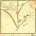
Plan du Cap Verd par 14 d. 40 m. N. et 0 d. 0 m. long. LOC 90683999.jpg 4,008 × 3,928; 2.08 MB
-
Plan du Cap Verd par 14 d. 40 m. N. et 0 d. 0 m. long. LOC 90683999.tif 4,008 × 3,928; 45.04 MB
-
PointeAlmadies.jpg 2,048 × 1,536; 127 KB
-
Pêcheur près du port de Ferreiros au Cap-Vert.jpg 4,896 × 3,672; 5.75 MB
-
Village de Tantum - Cap-Vert 1.jpg 4,896 × 3,672; 7.53 MB
-
Village de Tantum - Cap-Vert 2.jpg 4,896 × 3,672; 7.78 MB
-
Village de Tantum - Cap-Vert 3.jpg 4,720 × 3,540; 6.02 MB
-
Vue depuis Tantum - Cap-Vert 1.jpg 4,896 × 3,672; 7.55 MB
-
Vue depuis Tantum - Cap-Vert 2.jpg 4,896 × 3,672; 8.64 MB


