Category:Calthwaite
Jump to navigation
Jump to search
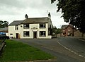
English: Calthwaite is a small village in rural Cumbria, situated between the small market town of Penrith and the larger City of Carlisle. It has a population of around 100 people. The village contains a primary school, a Church of England Church, a pre-school nursery and a pub called the Globe Inn. (01768 885238)

village in United Kingdom  | |||||
| Upload media | |||||
| Instance of | |||||
|---|---|---|---|---|---|
| Location | Hesket, Eden, Cumbria, North West England, England | ||||
 | |||||
Subcategories
This category has the following 2 subcategories, out of 2 total.
A
C
- Calthwaite Hall (3 F)
Media in category "Calthwaite"
The following 54 files are in this category, out of 54 total.
-
 Aikbank Cottages - geograph.org.uk - 185873.jpg 640 × 480; 226 KB
-
 Calthwaite - barn conversion in progress - geograph.org.uk - 562644.jpg 640 × 473; 139 KB
-
 Calthwaite - geograph.org.uk - 2709222.jpg 3,758 × 2,094; 1.69 MB
-
 Calthwaite - geograph.org.uk - 2709224.jpg 3,888 × 2,121; 1.44 MB
-
 Calthwaite - geograph.org.uk - 2709228.jpg 3,869 × 2,565; 1.75 MB
-
 Calthwaite Beck, Calthwaite - geograph.org.uk - 1066053.jpg 480 × 640; 90 KB
-
 Calthwaite Bridge - geograph.org.uk - 187713.jpg 640 × 480; 165 KB
-
 Calthwaite Hall Lodge - geograph.org.uk - 562630.jpg 640 × 471; 123 KB
-
 Calthwaite House Bridge - geograph.org.uk - 554132.jpg 640 × 480; 151 KB
-
 Calthwaite station site geograph-3098874-by-Ben-Brooksbank.jpg 2,350 × 1,308; 2.64 MB
-
 Calthwaite, crossroads - geograph.org.uk - 1066067.jpg 640 × 480; 74 KB
-
 Farm track, Brackenburgh - geograph.org.uk - 946228.jpg 480 × 640; 112 KB
-
 Hutton in the Forest Parkland - geograph.org.uk - 143789.jpg 640 × 480; 87 KB
-
 M6 from Robinson House Bridge - geograph.org.uk - 554135.jpg 640 × 480; 126 KB
-
 Road bridge at Plumpton Foot. - geograph.org.uk - 146588.jpg 640 × 480; 86 KB
-
 Robinson House Bridge - geograph.org.uk - 554134.jpg 640 × 459; 146 KB
-
-
 The Elephant Farmhouse, Calthwaite.jpg 3,801 × 2,463; 1.87 MB
-
 The Globe Inn, Calthwaite - geograph.org.uk - 562624.jpg 640 × 467; 126 KB
-
 Wet Muddy Track. - geograph.org.uk - 143787.jpg 640 × 480; 94 KB
-
 B5305 Penrith to Wigton route. - geograph.org.uk - 146560.jpg 640 × 480; 68 KB
-
 Brackenburgh Home Farm - geograph.org.uk - 555742.jpg 640 × 475; 122 KB
-
 Calthwaite House - geograph.org.uk - 554131.jpg 640 × 480; 165 KB
-
 Entrance to Ravensgill Plantation - geograph.org.uk - 554138.jpg 640 × 480; 194 KB
-
 Farmland, Black Sykes - geograph.org.uk - 640285.jpg 640 × 480; 119 KB
-
 Field and Wood. - geograph.org.uk - 143794.jpg 640 × 480; 75 KB
-
 Footpath to Sceugh Dyke - geograph.org.uk - 334976.jpg 640 × 480; 239 KB
-
 Hay Close - farmhouse and tearoom - geograph.org.uk - 555746.jpg 640 × 468; 130 KB
-

-

-
 Knowe Farm - geograph.org.uk - 638921.jpg 640 × 480; 120 KB
-
 Lane at Plumpton Foot - geograph.org.uk - 640291.jpg 480 × 640; 123 KB
-
 Lid or roof of curiosity. - geograph.org.uk - 143791.jpg 640 × 480; 89 KB
-
 Ling Close Barn - geograph.org.uk - 168854.jpg 640 × 480; 235 KB
-
 Low Burthwaite - geograph.org.uk - 341821.jpg 640 × 480; 46 KB
-
 Lowstreet House Farm. - geograph.org.uk - 146563.jpg 640 × 480; 45 KB
-
 Morton - geograph.org.uk - 168781.jpg 640 × 480; 227 KB
-
 Ordnance mark - geograph.org.uk - 146582.jpg 640 × 448; 44 KB
-
 Parkland with cock pheasant. - geograph.org.uk - 146561.jpg 640 × 412; 54 KB
-
 Phone mast in field of stubble - geograph.org.uk - 554133.jpg 640 × 480; 145 KB
-
 Plumpton Back Street Methodist Church - geograph.org.uk - 555741.jpg 640 × 480; 132 KB
-
 Pyeing Farm. - geograph.org.uk - 146632.jpg 640 × 380; 61 KB
-
 Ravensgill Beck - geograph.org.uk - 554137.jpg 480 × 640; 153 KB
-

-
 Roadside curiosity - geograph.org.uk - 61057.jpg 640 × 424; 93 KB
-
 Robinson House Farm - geograph.org.uk - 554136.jpg 640 × 480; 132 KB
-
 Straw bales and motorway traffic - geograph.org.uk - 554130.jpg 640 × 464; 146 KB
-
 Tarmac track. - geograph.org.uk - 146559.jpg 640 × 480; 95 KB
-
 The Road to Sceugh Mire Farm - geograph.org.uk - 334998.jpg 640 × 480; 224 KB
-
 The Solway Plain - geograph.org.uk - 341827.jpg 640 × 480; 29 KB
-
 Thornbarrow. - geograph.org.uk - 146557.jpg 640 × 480; 81 KB
-
 Three Gables - geograph.org.uk - 168851.jpg 640 × 480; 227 KB
-
 Trig Stone with Pennines. - geograph.org.uk - 143792.jpg 640 × 480; 65 KB
-
 Wet eden valley farmland. - geograph.org.uk - 146590.jpg 640 × 398; 51 KB


_-_geograph.org.uk_-_334974.jpg)


