Category:California State Route 39
Jump to navigation
Jump to search
highway in California | |||||
| Upload media | |||||
| Instance of | |||||
|---|---|---|---|---|---|
| Location |
| ||||
| Transport network |
| ||||
| Connects with | |||||
| Owned by | |||||
| Maintained by | |||||
| Has part(s) |
| ||||
| Inception |
| ||||
| Length |
| ||||
 | |||||
Subcategories
This category has the following 5 subcategories, out of 5 total.
Media in category "California State Route 39"
The following 11 files are in this category, out of 11 total.
-
CA-Interstate 5 North and South Arrow Sign-Buena Park.jpg 2,048 × 1,536; 359 KB
-
California 39 1948.svg 1,485 × 1,440; 103 KB
-
California 39.svg 385 × 401; 14 KB
-
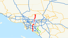
California State Route 39.svg 1,152 × 640; 271 KB
-
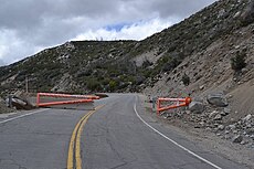
California-Highway-39-Closure.jpg 4,000 × 3,000; 1.75 MB
-
California-highway-39-south-closure.jpg 1,024 × 683; 191 KB
-
Islip-39.jpg 4,000 × 3,000; 2.09 MB
-
La Habra Circle Shopping Center, La Habra, California (2021-06-25).jpeg 3,264 × 2,448; 1.84 MB
-
San Gabriel Mountains 3, CA.JPG 1,024 × 768; 303 KB
-
SR 39.jpg 567 × 2,091; 432 KB
-
SR 39.svg 567 × 2,091; 2.02 MB
Categories:
- State highways in California by number
- Roads in Los Angeles County, California
- Roads in Orange County, California
- Azusa, California
- West Covina, California
- La Habra, California
- Buena Park, California
- Streets in Anaheim, California
- Stanton, California
- Westminster, California
- Huntington Beach, California
- Roads numbered 39
- Streets in the San Gabriel Valley


