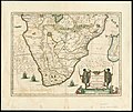
Category:Cafreria
Jump to navigation
Jump to search
A vaguely defined region of southern Africa during the Age of Exploration, principally the Namibian coast and surrounding areas | |||||
| Upload media | |||||
| Instance of |
| ||||
|---|---|---|---|---|---|
| Named after |
| ||||
| Location |
| ||||
| Different from | |||||
| |||||
A former vague area of southwest and southern Africa during the Age of Exploration. Also known as Kaffiria, Kaffirland, etc. Not to be confused with the later Kaffraria and British Kaffraria, largely restricted to the Xhosa and surrounding areas.
Subcategories
This category has the following 4 subcategories, out of 4 total.
B
- Burgerzaal map (24 F)
K
Media in category "Cafreria"
The following 16 files are in this category, out of 16 total.
-
1665 Kircher Map.jpg 7,248 × 6,079; 6.82 MB
-
1730 Southern Africa Map.jpg 4,841 × 4,209; 2.98 MB
-
Afrique - DPLA - 30f87a4501730f95862768d989104577.jpg 1,000 × 820; 266 KB
-
Abissinie. - DPLA - e80611f4f6375d79554d014338ce5c67.jpg 596 × 1,000; 166 KB
-
Africa - DPLA - e3e70b9d1bcdf52ea5722c1448b74f5e.jpg 1,000 × 849; 274 KB
-
Burgerzaal - Oostelijk Halfrond.JPG 3,264 × 2,448; 1.57 MB
-
Cafrerie Pure et Cafrerie Melangee.jpeg 786 × 760; 96 KB
-
Eastern hemisphere - Google Art Project.jpg 4,837 × 4,837; 3.63 MB
-
Hottentots de la Caffrerie, XIX secolo – BEIC IE8957292.jpg 1,086 × 1,626; 629 KB
-
Southern Africa 1640, Jan Jansson (4265384-recto).jpg 7,103 × 5,982; 7.52 MB
-
Southern Africa 1640, Jan Jansson (4265384-verso).jpg 7,112 × 6,022; 7.24 MB
-
Southern Part of Africa - DPLA - a4511796b1c5174516b12ba622587a03.jpg 1,000 × 859; 282 KB
-
Uomo della Caffraria, 1765 – BEIC IE8952819.jpg 1,619 × 2,539; 1.48 MB
-
Nouvel atlas portatif 1806 (138991336).jpg 6,021 × 5,166; 27.01 MB


