Category:Cadastral maps of Western Australia
Jump to navigation
Jump to search
Media in category "Cadastral maps of Western Australia"
The following 15 files are in this category, out of 15 total.
-
 Avon land district WA.png 400 × 575; 39 KB
-
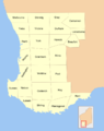
 Nelson land district WA.png 400 × 575; 38 KB
-
 Perth County 1886.jpg 1,041 × 1,266; 329 KB
-
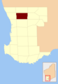
 Perth County location.PNG 200 × 290; 10 KB
-
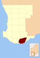 Plantagenet County location.PNG 200 × 290; 10 KB
-
 Sussex land district WA.png 400 × 575; 38 KB
-
 Swan land district WA.png 400 × 575; 39 KB
-
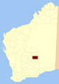
 Victoria plains County location.PNG 200 × 290; 10 KB
-
 Weld land district WA.png 400 × 575; 38 KB
-
 Wellington land district WA.png 400 × 575; 38 KB
-
 Western Australia cadastral divisions.png 800 × 1,012; 116 KB
-
 Western Australia land districts blank.png 400 × 575; 39 KB
-
 Western Australia land districts.png 1,200 × 1,725; 289 KB
-
 Western Australia land districts.svg 3,123 × 4,490; 286 KB
-
 Western Australia land divisions.png 500 × 719; 48 KB


