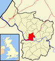
Category:Cabot (ward)
Jump to navigation
Jump to search
ward of City of Bristol, United Kingdom | |||||
| Upload media | |||||
| Instance of | |||||
|---|---|---|---|---|---|
| Location | City of Bristol, South West England, England | ||||
 | |||||
Cabot was an electoral ward in Bristol until 2016. It was largely replaced by Category:Central (Bristol ward) and Category:Hotwells and Harbourside. Images in this category should be sub-categorised to ensure they are in categories with enduring relevance.
Subcategories
This category has the following 39 subcategories, out of 39 total.
B
- Brandon Steep, Bristol (7 F)
- Bristol Royal Infirmary (18 F)
C
- Castle Park View (43 F)
- Central Health Clinic (6 F)
- Cotham Parish Church (5 F)
- Cube Microplex (4 F)
D
G
N
- Nova Scotia, Bristol (10 F)
P
- St Philip and Jacob, Bristol (13 F)
Q
- Queen's Parade, Bristol (6 F)
R
- Red Lodge Museum (47 F)
- Robinson's Warehouse (15 F)
S
- St George's Road, Bristol (23 F)
T
- Temple Way, Bristol (28 F)
W
- Wills Memorial Building (121 F)
Media in category "Cabot (ward)"
The following 23 files are in this category, out of 23 total.
-
An old sign for the crescent - geograph.org.uk - 7126276.jpg 4,000 × 3,000; 4.59 MB
-
Benchmark facing Brandon Hill - geograph.org.uk - 7128736.jpg 4,000 × 3,000; 4.27 MB
-
Berkleycrescent.JPG 2,576 × 1,952; 1.14 MB
-
Bristol cabot.png 702 × 780; 149 KB
-
Bristol MMB 67 Harbour Festival 2008.jpg 2,000 × 3,008; 1.4 MB
-
Bristol MMB 68 Harbour Festival 2008.jpg 2,000 × 3,008; 1.48 MB
-
Cabot Bristol UK ward map.svg 1,138 × 1,266; 709 KB
-
Christmas Cottage - geograph.org.uk - 7126252.jpg 4,000 × 3,000; 4.43 MB
-
Clifton Heights - geograph.org.uk - 5761793.jpg 2,848 × 4,288; 1,014 KB
-
Contemplating the drop^ - geograph.org.uk - 7126259.jpg 3,000 × 4,000; 4.56 MB
-
Don't drop^ - geograph.org.uk - 7126263.jpg 3,000 × 4,000; 4.62 MB
-
Drying out - geograph.org.uk - 7058984.jpg 532 × 478; 73 KB
-
Inside the walls - geograph.org.uk - 6755765.jpg 4,266 × 3,072; 3.02 MB
-
More Mud - geograph.org.uk - 6453661.jpg 3,456 × 2,364; 3.7 MB
-
Old style in Clifton - geograph.org.uk - 7199264.jpg 3,000 × 4,000; 4.48 MB
-
Right outside the shops - geograph.org.uk - 7021879.jpg 3,000 × 4,000; 4.5 MB
-
Sleeping - geograph.org.uk - 7198541.jpg 1,922 × 1,506; 1.2 MB
-
The Eyes have it^ - geograph.org.uk - 6453453.jpg 1,253 × 1,467; 586 KB
-
The footpath is definitely closed - geograph.org.uk - 6902019.jpg 4,000 × 3,000; 4.52 MB
-
The shadow of a table - geograph.org.uk - 6133163.jpg 3,296 × 2,472; 3.48 MB
-
The struggle to account for all aspects - geograph.org.uk - 7021788.jpg 4,000 × 3,000; 4.54 MB
-
Theatrical graphics - geograph.org.uk - 6276519.jpg 3,296 × 2,472; 3.37 MB
-
Tower Crane - geograph.org.uk - 6947091.jpg 2,644 × 3,282; 1.39 MB


