Category:Bynack More
Jump to navigation
Jump to search
1090m high mountain in Highland, Scotland, UK | |||||
| Upload media | |||||
| Instance of | |||||
|---|---|---|---|---|---|
| Location | Highland, Scottish Highlands, Scotland | ||||
| Mountain range | |||||
| Topographic prominence |
| ||||
| Elevation above sea level |
| ||||
| Parent peak | |||||
 | |||||
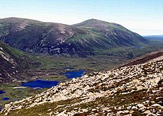
Bynack More (Gaelic: A' Bheithneag Mhòr or Beinn Bheithneag) is a mountain in the Cairngorms of Scotland, 16 kilometres east-south-east of the town of Aviemore in the Highland council area. It is 1090 m high, and listed as a Munro and a Marilyn
Media in category "Bynack More"
The following 42 files are in this category, out of 42 total.
-
Barns of Bynack - geograph.org.uk - 10131.jpg 577 × 385; 53 KB
-
Barns of Bynack from the north - geograph.org.uk - 364011.jpg 640 × 427; 100 KB
-
Barns of Bynack.jpg 1,593 × 1,133; 113 KB
-
Bynach More from Cairn Gorm - geograph.org.uk - 657987.jpg 640 × 382; 85 KB
-
Bynack Beg from Bynack More - geograph.org.uk - 642116.jpg 640 × 480; 65 KB
-
Bynack More (left) and Bynack Beg. - geograph.org.uk - 420643.jpg 640 × 427; 74 KB
-
Bynack More - geograph.org.uk - 259432.jpg 640 × 480; 50 KB
-
Bynack More from Beinn a' Chaorainn.jpg 1,473 × 1,048; 133 KB
-
Bynack More. - geograph.org.uk - 420674.jpg 640 × 427; 111 KB
-
Bynack More. - geograph.org.uk - 420682.jpg 640 × 427; 95 KB
-
Bynack More. - geograph.org.uk - 420755.jpg 640 × 427; 108 KB
-
Descent from Creagan Gorm - geograph.org.uk - 273891.jpg 640 × 480; 104 KB
-
Footpath Erosion Cairngorms - geograph.org.uk - 11450 (cropped).jpg 640 × 385; 71 KB
-
Footpath Erosion Cairngorms - geograph.org.uk - 11450.jpg 640 × 427; 86 KB
-
Little Barns of Bynack - geograph.org.uk - 364006.jpg 640 × 427; 117 KB
-
Lochan Stac na -h Iolaire - geograph.org.uk - 118048.jpg 640 × 363; 73 KB
-
Looking across Strath Nethy - geograph.org.uk - 118045.jpg 640 × 251; 34 KB
-
Northern approach to Bynack More - geograph.org.uk - 662657.jpg 640 × 421; 71 KB
-
On route to Bynack - geograph.org.uk - 268106.jpg 640 × 480; 92 KB
-
Strath Nethy from path to Bynack More - geograph.org.uk - 121638.jpg 640 × 427; 66 KB
-
Summit cairn on Meall a Bhuachaille - geograph.org.uk - 273906.jpg 640 × 480; 102 KB
-
Summit of A' Choinneach - geograph.org.uk - 1157131.jpg 640 × 427; 71 KB
-
The eastern side of Derry Cairngorm - geograph.org.uk - 777220.jpg 1,024 × 682; 956 KB
-
The Little Barns of Bynack - geograph.org.uk - 662646.jpg 640 × 412; 79 KB
-
The summit ridge of Bynack More - geograph.org.uk - 662654.jpg 640 × 384; 73 KB
-
View from the Roches Moutonnées - geograph.org.uk - 1301438.jpg 640 × 427; 260 KB
-
View north northwest from Beinn Bhreac - geograph.org.uk - 644290.jpg 640 × 427; 108 KB
-
View southwest from Bynack More - geograph.org.uk - 662652.jpg 640 × 424; 58 KB
-
View towards Bynack More - geograph.org.uk - 902502.jpg 800 × 600; 201 KB
-
View up Glen Derry - geograph.org.uk - 1057256.jpg 800 × 600; 219 KB
-
Wild blueberries in Scotland.jpg 800 × 533; 63 KB
-
Barns of Bynack seen from west - geograph.org.uk - 364009.jpg 640 × 427; 118 KB
-
Bynack More - geograph.org.uk - 259438.jpg 640 × 480; 50 KB
-
Bynack More. - geograph.org.uk - 420653.jpg 640 × 427; 78 KB
-
Bynack More. - geograph.org.uk - 420668.jpg 640 × 427; 107 KB
-
Tors Bynack Mor - geograph.org.uk - 111908.jpg 640 × 362; 49 KB


