Category:Buttermere, Cumbria (village)
Jump to navigation
Jump to search
village and civil parish in Cumbria, UK  | |||||
| Upload media | |||||
| Instance of | |||||
|---|---|---|---|---|---|
| Location | Allerdale, Cumbria, North West England, England | ||||
| Population |
| ||||
| Said to be the same as | Buttermere (Wikimedia duplicated page, civil parish) | ||||
 | |||||
Subcategories
This category has the following 17 subcategories, out of 17 total.
B
- Brackenthwaite, Buttermere (2 F)
- Bridge Hotel, Buttermere (14 F)
- Buttermere Youth Hostel (5 F)
C
D
- Dodd, Buttermere (3 F)
F
- Fish Hotel, Buttermere (12 F)
G
- Gatesgarth (18 F)
H
- High Crag (31 F)
J
S
- Scale Force (9 F)
- Scarth Gap Pass, Cumbria (14 F)
- Scope Beck Reservoir (9 F)
- Seat, Lake District (7 F)
- Sour Milk Gill (48 F)
W
Media in category "Buttermere, Cumbria (village)"
The following 200 files are in this category, out of 1,526 total.
(previous page) (next page)-
 "I am not blocking the path" - geograph.org.uk - 5901331.jpg 4,000 × 3,000; 4.75 MB
-
 "Loss" at the Honister Slate Mine - geograph.org.uk - 5906939.jpg 640 × 427; 284 KB
-
 "Wild Ennerdale" - geograph.org.uk - 428339.jpg 640 × 427; 166 KB
-
 A Cairn on the summit of Brandreth - geograph.org.uk - 2926706.jpg 800 × 600; 321 KB
-
 A Herdwick sheep above Scar Crag - geograph.org.uk - 3800887.jpg 1,024 × 768; 294 KB
-
 A small tarn on Grey Knotts - geograph.org.uk - 2693444.jpg 723 × 800; 197 KB
-
 Above Burtness Comb - geograph.org.uk - 882853.jpg 480 × 640; 94 KB
-
 Above Burtness Wood - geograph.org.uk - 6131726.jpg 1,600 × 1,067; 231 KB
-
 Above Buttermere - geograph.org.uk - 5983114.jpg 1,024 × 678; 856 KB
-
 Above Buttermere village - geograph.org.uk - 5941012.jpg 1,280 × 850; 1.07 MB
-
 Above Clews Gill - geograph.org.uk - 1427376.jpg 640 × 480; 68 KB
-
 Above Coledale Hause - geograph.org.uk - 654704.jpg 640 × 480; 62 KB
-
 Above Dubs Bottom - geograph.org.uk - 1706166.jpg 640 × 480; 73 KB
-
 Above Far Tongue Gill - geograph.org.uk - 1409798.jpg 640 × 480; 70 KB
-
 Above Gasgale - geograph.org.uk - 1382700.jpg 640 × 480; 37 KB
-
 Above Hackney Holes - geograph.org.uk - 4766084.jpg 4,608 × 3,072; 3.24 MB
-
 Above Honister Hause - geograph.org.uk - 2942188.jpg 2,560 × 1,920; 917 KB
-
 Above Hope Gill - geograph.org.uk - 3767421.jpg 2,560 × 1,920; 2.05 MB
-
 Above Old Burtness - geograph.org.uk - 3154925.jpg 2,560 × 1,920; 942 KB
-
 Above Seavy Knott - geograph.org.uk - 2949232.jpg 2,560 × 1,920; 2.07 MB
-
 Above Seavy Knott - geograph.org.uk - 2949234.jpg 2,560 × 1,920; 1.1 MB
-
-
 Above Third Gill - geograph.org.uk - 3182156.jpg 1,920 × 2,560; 2.01 MB
-
 Adit on Yewcrag Incline - geograph.org.uk - 4667430.jpg 640 × 384; 105 KB
-
 Along Gasgale Crags - geograph.org.uk - 967302.jpg 640 × 424; 77 KB
-
 An old friend - geograph.org.uk - 1744974.jpg 480 × 640; 93 KB
-
 An outcrop on Dodd (Whiteside) - geograph.org.uk - 3003430.jpg 2,592 × 1,944; 2.32 MB
-
 And down came the rain - geograph.org.uk - 5906990.jpg 460 × 640; 236 KB
-
 And not a tourist in sight - geograph.org.uk - 5622916.jpg 1,200 × 800; 768 KB
-
 And then the sun came out^ - geograph.org.uk - 5907867.jpg 640 × 433; 257 KB
-
 Approaching Black Sail - geograph.org.uk - 270097.jpg 640 × 480; 125 KB
-
 Approaching Loaf Tarn - geograph.org.uk - 3832587.jpg 2,560 × 1,920; 2.08 MB
-
 Approaching Sail Summit - geograph.org.uk - 5278677.jpg 1,920 × 1,280; 518 KB
-
 Approaching Sourmilk Gill - geograph.org.uk - 3154936.jpg 2,560 × 1,920; 1.95 MB
-
 Approaching The Scar - geograph.org.uk - 5278680.jpg 1,874 × 1,088; 207 KB
-
 Approaching the summit of Grasmoor - geograph.org.uk - 6337414.jpg 1,999 × 1,084; 1.85 MB
-
 Approaching the summit of High Crag - geograph.org.uk - 6130972.jpg 1,600 × 1,067; 379 KB
-

-
 Approaching Whiteless Pike - Flickr - Robert J Heath.jpg 3,432 × 1,824; 7.37 MB
-
 Ard Crags Path - geograph.org.uk - 3146447.jpg 800 × 600; 156 KB
-
 Ard crags. - geograph.org.uk - 2481023.jpg 640 × 620; 74 KB
-
 Ascending Dale Head - geograph.org.uk - 4766047.jpg 4,094 × 2,782; 1.65 MB
-
 Ascending Grasmoor - geograph.org.uk - 1181463.jpg 640 × 480; 59 KB
-
 Ascending Grasmoor - geograph.org.uk - 3767413.jpg 2,560 × 1,920; 662 KB
-
 Ascending Grey Knotts - geograph.org.uk - 2942199.jpg 2,560 × 1,920; 1.21 MB
-
 Ascending Grey Knotts - geograph.org.uk - 3831053.jpg 2,560 × 1,920; 2.12 MB
-
 Ascending Grey Knotts - geograph.org.uk - 3832166.jpg 2,560 × 1,920; 698 KB
-
 Ascending Grey Knotts - geograph.org.uk - 5060457.jpg 1,920 × 1,280; 561 KB
-
 Ascending Lingmell - geograph.org.uk - 1492832.jpg 480 × 640; 107 KB
-
 Ascending Lingmell - geograph.org.uk - 1492852.jpg 640 × 480; 111 KB
-
 Ascending Robinson - geograph.org.uk - 1109121.jpg 640 × 480; 81 KB
-
 Ascending Robinson - geograph.org.uk - 1409792.jpg 640 × 480; 90 KB
-
 Ascending Robinson - geograph.org.uk - 4766085.jpg 4,608 × 3,072; 3.23 MB
-
 At Blackbeck Tarn - geograph.org.uk - 1258770.jpg 640 × 426; 105 KB
-
 At Gatesgarth - geograph.org.uk - 881776.jpg 480 × 640; 88 KB
-
 At Lanthwaite Green - geograph.org.uk - 3452391.jpg 2,560 × 1,920; 2.08 MB
-
 At the Honister Slate Mine - geograph.org.uk - 5906878.jpg 640 × 427; 196 KB
-

-
 At the summit of the Honister Pass - geograph.org.uk - 5906908.jpg 640 × 427; 378 KB
-
 At the western end of The Honister Pass - geograph.org.uk - 6184928.jpg 4,032 × 3,024; 6.33 MB
-
 Autumnal colours at Newlands pass - geograph.org.uk - 1207140.jpg 640 × 392; 73 KB
-
 B5289 - geograph.org.uk - 5991704.jpg 1,024 × 678; 818 KB
-
 B5289 - geograph.org.uk - 5991760.jpg 1,024 × 678; 843 KB
-
 B5289 - geograph.org.uk - 5991798.jpg 1,024 × 678; 779 KB
-
 B5289 by Buttermere - geograph.org.uk - 6476232.jpg 1,600 × 1,433; 588 KB
-
 B5289 north west of Buttermere village - geograph.org.uk - 4963799.jpg 1,024 × 768; 239 KB
-
 Bales of hay at Gatesgarth Farm - geograph.org.uk - 4910807.jpg 3,264 × 2,448; 1.62 MB
-
 Bay in Burtness Wood - geograph.org.uk - 4963726.jpg 1,024 × 768; 171 KB
-
 Beck House - geograph.org.uk - 5492377.jpg 4,608 × 3,456; 4.1 MB
-
 Beck in Rannerdale - geograph.org.uk - 3476271.jpg 640 × 427; 417 KB
-
 Bell Crag Honister Pass - geograph.org.uk - 2778601.jpg 427 × 640; 321 KB
-
 Below Littledale Edge - geograph.org.uk - 1029780.jpg 640 × 427; 217 KB
-
 Below Robinson Crag - geograph.org.uk - 1029823.jpg 640 × 427; 224 KB
-
 Berries, berries everywhere - geograph.org.uk - 239612.jpg 640 × 480; 164 KB
-
 Big slate - geograph.org.uk - 6139208.jpg 3,264 × 2,448; 1.56 MB
-
 Bird in the Bathroom - geograph.org.uk - 3475705.jpg 640 × 427; 319 KB
-
 Black Beck - geograph.org.uk - 1027938.jpg 640 × 425; 80 KB
-
 Black Beck - geograph.org.uk - 882206.jpg 640 × 480; 95 KB
-
 Black beck. - geograph.org.uk - 2481005.jpg 480 × 640; 87 KB
-
 Black Sail Hut, Ennerdale - geograph.org.uk - 308504.jpg 640 × 480; 107 KB
-
 Blackbeck cascades into the valley below - geograph.org.uk - 3212144.jpg 3,456 × 4,608; 3.04 MB
-
 Blackbeck Tarn - geograph.org.uk - 4809586.jpg 640 × 480; 108 KB
-
 Blackthorn Flowers - geograph.org.uk - 3483205.jpg 640 × 640; 556 KB
-
 Bleaberry Comb - geograph.org.uk - 1745066.jpg 640 × 480; 100 KB
-
 Bleaberry Tarn - geograph.org.uk - 2667418.jpg 1,920 × 2,560; 1,004 KB
-
 Bleaberry Tarn - geograph.org.uk - 3074615.jpg 3,358 × 1,024; 888 KB
-
 Bleaberry Tarn - geograph.org.uk - 3154945.jpg 2,560 × 1,920; 825 KB
-
 Bleaberry Tarn - geograph.org.uk - 4971863.jpg 640 × 480; 63 KB
-
 Bleaberry Tarn - geograph.org.uk - 5489209.jpg 1,600 × 1,200; 432 KB
-
 Bleaberry Tarn - geograph.org.uk - 6131097.jpg 1,600 × 1,067; 496 KB
-
 Bleaberry Tarn from High Stile, 1971 - geograph.org.uk - 3853392.jpg 683 × 1,024; 230 KB
-
 Bleaberry Tarn From Path To Red Pike - geograph.org.uk - 2951590.jpg 2,560 × 1,920; 2.93 MB
-
 Bleaberry Tarn from Red Pike - geograph.org.uk - 3630715.jpg 4,608 × 3,456; 5.53 MB
-
 Bleabery Tarn below Red Pike - geograph.org.uk - 6501811.jpg 1,799 × 1,199; 343 KB
-
 Bluebell Fields - geograph.org.uk - 3476275.jpg 640 × 427; 531 KB
-
 Bluebells Rannerdale - geograph.org.uk - 1549511.jpg 640 × 480; 138 KB
-
 Boggy pool on Grey Knotts - geograph.org.uk - 2693800.jpg 800 × 600; 125 KB
-
 Boots left at Whiteless Pike summit - geograph.org.uk - 3779862.jpg 1,024 × 768; 834 KB
-
 Borrowdale viewed from Hindscarth Edge - geograph.org.uk - 779345.jpg 640 × 427; 211 KB
-
 Boulder Outside Black Sail YH - geograph.org.uk - 100163.jpg 480 × 640; 132 KB
-
 Boulder-filled gully on Whiteside - geograph.org.uk - 4097488.jpg 1,500 × 1,125; 1.63 MB
-
 Boundary fence above Honister - geograph.org.uk - 2695318.jpg 800 × 600; 100 KB
-
 Bowderbeck - geograph.org.uk - 1176444.jpg 640 × 425; 74 KB
-
 Bracken Covered Fellside above Buttermere - geograph.org.uk - 3210895.jpg 4,354 × 2,699; 2.15 MB
-
 Bracken covered slope descending towards Buttermere - geograph.org.uk - 3562170.jpg 1,000 × 1,500; 1.26 MB
-
 Brackenthwaite - geograph.org.uk - 5543420.jpg 640 × 480; 78 KB
-
 Brackenthwaite Hows - geograph.org.uk - 4510312.jpg 640 × 480; 101 KB
-
 Brew Time - geograph.org.uk - 2483430.jpg 2,560 × 1,920; 1.4 MB
-
 Bridge abutments, Honister Pass - geograph.org.uk - 5489041.jpg 1,600 × 1,200; 429 KB
-
 Bridge over Comb Beck - geograph.org.uk - 4963646.jpg 1,024 × 768; 292 KB
-
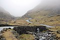 Bridge over Gatesgarthdale Beck - geograph.org.uk - 1177294.jpg 640 × 425; 74 KB
-
 Bridge over Gatesgarthdale Beck - geograph.org.uk - 5721479.jpg 1,600 × 1,066; 458 KB
-
 Bridge over Low Beck - geograph.org.uk - 98807.jpg 640 × 427; 126 KB
-
 Bridleway along the shore of Buttermere - geograph.org.uk - 4961821.jpg 1,024 × 768; 165 KB
-
 Bridleway from High Crag - geograph.org.uk - 5490486.jpg 1,600 × 1,200; 384 KB
-
 Bridleway leading to Scales Fell Buttermere - geograph.org.uk - 4080971.jpg 683 × 1,024; 371 KB
-
 Bridleway south east of Buttermere village (1) - geograph.org.uk - 4964847.jpg 1,024 × 768; 238 KB
-
 Bridleway south east of Buttermere village (2) - geograph.org.uk - 4964852.jpg 1,024 × 768; 284 KB
-
 Bridleway to High Stile - geograph.org.uk - 5490496.jpg 1,600 × 1,200; 352 KB
-
 Bridleway to Red Pike - geograph.org.uk - 5489185.jpg 1,600 × 1,200; 379 KB
-
 Bridleway up Buttermere Fell - geograph.org.uk - 4961810.jpg 1,024 × 768; 236 KB
-
 Broad col between Red Pike and High Stile - geograph.org.uk - 3389363.jpg 1,500 × 1,125; 1.63 MB
-
 Bull Gill Gully, Honister Crag - geograph.org.uk - 1491072.jpg 480 × 640; 134 KB
-
 Burtness Comb - geograph.org.uk - 782596.jpg 640 × 480; 150 KB
-
 Burtness Comb - geograph.org.uk - 783154.jpg 640 × 480; 145 KB
-

-
 Burtness Wood - geograph.org.uk - 2603879.jpg 4,032 × 3,024; 6.35 MB
-
 Burtness Wood - geograph.org.uk - 2993305.jpg 2,592 × 1,944; 2.32 MB
-
 Burtness Wood - geograph.org.uk - 4910255.jpg 3,264 × 2,448; 3.54 MB
-
 Burtness Wood - geograph.org.uk - 947792.jpg 640 × 426; 105 KB
-
 Buttercups at Buttermere - geograph.org.uk - 3531180.jpg 2,560 × 1,920; 1.42 MB
-
 Buttermere - 1983 - geograph.org.uk - 2241894.jpg 2,272 × 1,521; 367 KB
-
 Buttermere - 1983 - geograph.org.uk - 2241898.jpg 2,270 × 1,514; 648 KB
-
 Buttermere - geograph.org.uk - 137840.jpg 640 × 431; 54 KB
-
 Buttermere - geograph.org.uk - 1880593.jpg 1,000 × 679; 296 KB
-
 Buttermere - geograph.org.uk - 1880623.jpg 1,000 × 669; 208 KB
-
 Buttermere - geograph.org.uk - 5071182.jpg 1,600 × 1,201; 500 KB
-
 Buttermere - geograph.org.uk - 6240570.jpg 2,000 × 943; 1.96 MB
-
 Buttermere - geograph.org.uk - 881722.jpg 480 × 640; 78 KB
-
 Buttermere and Burtness Comb - geograph.org.uk - 1659707.jpg 640 × 425; 151 KB
-
 Buttermere and Burtness Comb - geograph.org.uk - 5550532.jpg 1,280 × 850; 544 KB
-
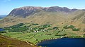
 Buttermere and Dale Head - geograph.org.uk - 5652408.jpg 1,280 × 720; 422 KB
-
 Buttermere and Fleetwith Pike - geograph.org.uk - 5550541.jpg 1,280 × 850; 255 KB
-
 Buttermere and Fleetwith pike. - geograph.org.uk - 2480975.jpg 640 × 361; 47 KB
-
 Buttermere and Haystacks - geograph.org.uk - 779702.jpg 640 × 480; 115 KB
-
 Buttermere and High Stile - geograph.org.uk - 6217463.jpg 480 × 640; 67 KB
-
 Buttermere And Whiteless Pike - geograph.org.uk - 5516108.jpg 2,272 × 1,704; 1.92 MB
-
 Buttermere at Lower Gatesgarth - geograph.org.uk - 6217445.jpg 480 × 640; 129 KB
-
 Buttermere Farm Machinery Yard - geograph.org.uk - 4080973.jpg 1,024 × 683; 419 KB
-
 Buttermere Fell, from Buttermere - geograph.org.uk - 6199948.jpg 2,592 × 1,944; 1.17 MB
-
 Buttermere from Red Pike - geograph.org.uk - 5232718.jpg 1,024 × 683; 156 KB
-
 Buttermere from Scarth Gap. - geograph.org.uk - 272978.jpg 640 × 480; 49 KB
-
 Buttermere from the air - geograph.org.uk - 5312904.jpg 640 × 480; 135 KB
-
 Buttermere Lake Path near Pike Rigg - geograph.org.uk - 4081089.jpg 683 × 1,024; 568 KB
-
 Buttermere Moss from the air - geograph.org.uk - 5312910.jpg 640 × 486; 132 KB
-
 Buttermere off Fleetwith Pike - geograph.org.uk - 275305.jpg 640 × 480; 117 KB
-
 Buttermere Path near Crag Woods - geograph.org.uk - 4081081.jpg 683 × 1,024; 404 KB
-
 Buttermere seen from near the YHA - geograph.org.uk - 2992806.jpg 1,024 × 703; 106 KB
-
 Buttermere sign post - geograph.org.uk - 3390348.jpg 1,328 × 2,034; 1,011 KB
-
 Buttermere Valley in the First Snows of Winter - geograph.org.uk - 3212554.jpg 4,457 × 3,422; 2.84 MB
-
 Buttermere Village - geograph.org.uk - 3212584.jpg 3,163 × 2,296; 1.81 MB
-
 Buttermere village - geograph.org.uk - 5639270.jpg 1,054 × 1,600; 317 KB
-
 Buttermere Village Hall - geograph.org.uk - 3146572.jpg 800 × 600; 160 KB
-

-
 Buttermere with grass, two trees and a bench - geograph.org.uk - 4086936.jpg 1,500 × 1,125; 2.29 MB
-
 Buttermere with Haystacks beyond - geograph.org.uk - 4080964.jpg 1,024 × 683; 420 KB
-
 Buttermere, Buttermere and Grasmoor (7281736000).jpg 3,264 × 1,835; 1.96 MB
-
 Buttermere, Lake District (14007333598).jpg 3,240 × 4,320; 4.76 MB
-
 Buttermere, Lake District (14170845526).jpg 4,320 × 3,240; 4.81 MB
-
 Buttermere, UK - panoramio (17).jpg 3,648 × 2,736; 6.14 MB
-
 Buttermere, UK - panoramio (18).jpg 2,048 × 1,536; 665 KB
-
 Buttermere, UK - panoramio (19).jpg 1,536 × 2,048; 712 KB
-
 By Bleaberry Tarn - geograph.org.uk - 3154953.jpg 2,560 × 1,920; 1 MB
-
 By Chapel Crags - geograph.org.uk - 3154966.jpg 2,560 × 1,920; 785 KB
-
 By Sourmilk Gill - geograph.org.uk - 3154940.jpg 2,560 × 1,920; 1,011 KB
-
 Cairn and fence, Looking Stead - geograph.org.uk - 1438865.jpg 640 × 480; 66 KB
-
 Cairn marking a view point from Eel Crag - geograph.org.uk - 3800905.jpg 1,024 × 768; 600 KB
-
 Cairn near Little Round How - geograph.org.uk - 1007633.jpg 640 × 422; 76 KB
-
 Cairn on approach to Scarth Gap - geograph.org.uk - 1334219.jpg 640 × 479; 85 KB
-
 Cairn on Dale Head - geograph.org.uk - 4766074.jpg 4,608 × 3,072; 3.1 MB
-
 Cairn on Fleetwith Pike - geograph.org.uk - 6295992.jpg 1,280 × 850; 506 KB
-
 Cairn on ridge - geograph.org.uk - 4838419.jpg 1,600 × 1,064; 324 KB
-
 Cairn on Thirdgill Head Man - geograph.org.uk - 1244391.jpg 640 × 426; 97 KB
-
 Cairn on Thirdgill Head Man - geograph.org.uk - 1531946.jpg 640 × 480; 91 KB
-
 Cairn on Whiteless Pike - geograph.org.uk - 1531966.jpg 640 × 480; 96 KB
-
 Cairn on Whiteside, looking North West - geograph.org.uk - 6531087.jpg 640 × 480; 105 KB
-

-
 Campsite in Buttermere - geograph.org.uk - 35139.jpg 640 × 480; 171 KB
-
 Car park attendant at Gatesgarth - geograph.org.uk - 4910276.jpg 2,448 × 3,264; 2.52 MB
-
 Car park entrance, Lanthwaite - geograph.org.uk - 4127214.jpg 640 × 480; 64 KB
-
 Cars parked on Newlands Pass near Buttermere - geograph.org.uk - 6239918.jpg 2,000 × 1,331; 2.73 MB
-
 Cattle Grid at Lanthwaite Gate - geograph.org.uk - 5492569.jpg 4,608 × 1,848; 2.36 MB
-
 Cattle grid, Lanthwaite Gate - geograph.org.uk - 5482469.jpg 640 × 427; 92 KB
-
 Caw Fell - geograph.org.uk - 1495200.jpg 640 × 480; 69 KB
-
 Caw Fell - geograph.org.uk - 705954.jpg 640 × 471; 96 KB
-
 Chapel Crags - geograph.org.uk - 4688547.jpg 640 × 480; 119 KB
-
 Chapel Crags - geograph.org.uk - 6130975.jpg 1,600 × 1,067; 525 KB
-
 Church Hall, Buttermere - geograph.org.uk - 6240573.jpg 2,000 × 1,125; 2.46 MB
-
 Cinderdale - 1983 - geograph.org.uk - 2241826.jpg 2,272 × 1,514; 777 KB
-
 Cinderdale - 1983 - geograph.org.uk - 2241837.jpg 2,272 × 1,514; 645 KB


_-_geograph.org.uk_-_3003430.jpg)


_-_geograph.org.uk_-_4964847.jpg)
_-_geograph.org.uk_-_4964852.jpg)


.jpg)
.jpg)
.jpg)
.jpg)
.jpg)
.jpg)


&filefrom=Cinderdale+Beck+-+geograph.org.uk+-+1804150.jpg#mw-category-media)