Category:Burton in Lonsdale
Jump to navigation
Jump to search
village and civil parish in the Craven district of North Yorkshire, England  | |||||
| Upload media | |||||
| Instance of | |||||
|---|---|---|---|---|---|
| Location | Craven, North Yorkshire, Yorkshire and the Humber, England | ||||
| Population |
| ||||
 | |||||
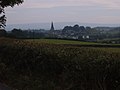
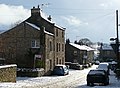
English: Burton in Lonsdale is a village and civil parish in the Craven district of North Yorkshire, England, close to the border with Lancashire. It is in Lonsdale (the River Lune valley and its tributaries). According to the 2001 census it had a population of 621. The parish is approximately 1500 acres (6 km²) in area and has many farms – dairy, beef and sheep. Little is grown, except grass to feed the animals.
Subcategories
This category has the following 3 subcategories, out of 3 total.
A
B
P
Media in category "Burton in Lonsdale"
The following 124 files are in this category, out of 124 total.
-
 A barn in a field - geograph.org.uk - 2047159.jpg 3,676 × 2,494; 4.24 MB
-
 A field of cut grass - geograph.org.uk - 2049345.jpg 3,872 × 2,485; 3.26 MB
-
 A rectangular thing by the path - geograph.org.uk - 2344191.jpg 640 × 480; 101 KB
-
 A Yorkshire barn - geograph.org.uk - 2047147.jpg 3,872 × 2,592; 2.02 MB
-
 A687 - geograph.org.uk - 4526138.jpg 640 × 426; 46 KB
-
 A687 - geograph.org.uk - 48709.jpg 640 × 480; 111 KB
-

-

-
 A687 near Lowfields - geograph.org.uk - 3338976.jpg 640 × 480; 36 KB
-
 A687 west of Burton in Lonsdale - geograph.org.uk - 3338981.jpg 640 × 480; 58 KB
-
 A687, Bogg Bridge - geograph.org.uk - 4527146.jpg 640 × 411; 74 KB
-
 A687, Burton in Lonsdale - geograph.org.uk - 4527140.jpg 640 × 377; 44 KB
-
 Approaching Burton in Lonsdale - geograph.org.uk - 1724740.jpg 2,816 × 2,112; 1.89 MB
-
 Approaching Stainderber - geograph.org.uk - 1726362.jpg 2,816 × 2,112; 1.82 MB
-
 Approaching the border - geograph.org.uk - 4804620.jpg 640 × 480; 55 KB
-
 Bench mark on Burton House, High Street - geograph.org.uk - 2556424.jpg 480 × 640; 159 KB
-
 Bench mark on Mount View, Low Street - geograph.org.uk - 2556491.jpg 481 × 640; 192 KB
-
 Bideber Mill - geograph.org.uk - 2093081.jpg 640 × 480; 107 KB
-
 Border country - geograph.org.uk - 1910343.jpg 640 × 480; 121 KB
-
 Boundary markers old and new - geograph.org.uk - 4390301.jpg 1,024 × 553; 569 KB
-
 Breastfield (field or barn^) - geograph.org.uk - 1910308.jpg 640 × 480; 69 KB
-
 Bridge over the Greta - geograph.org.uk - 4190011.jpg 1,280 × 960; 1.36 MB
-
 Bridge over the River Greta - geograph.org.uk - 48712.jpg 640 × 480; 179 KB
-
 Burton in Lonsdale - geograph.org.uk - 127350.jpg 640 × 480; 69 KB
-
 Burton In Lonsdale - geograph.org.uk - 4526123.jpg 640 × 426; 52 KB
-
 Burton in Lonsdale - geograph.org.uk - 5413321.jpg 5,184 × 2,775; 1.77 MB
-
 Burton in Lonsdale - geograph.org.uk - 5413322.jpg 5,174 × 2,605; 1.64 MB
-
 Burton in Lonsdale Methodist Church - geograph.org.uk - 5773484.jpg 1,600 × 1,200; 310 KB
-
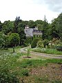
 Burton in Lonsdale Vicarage - geograph.org.uk - 2344868.jpg 800 × 513; 73 KB
-
 Burton in Lonsdale Village Hall - geograph.org.uk - 5774731.jpg 1,600 × 1,200; 285 KB
-
 Burton in Lonsdale.jpg 640 × 480; 103 KB
-
 Burton Village Shop ^ Post Office - geograph.org.uk - 5773510.jpg 1,600 × 1,200; 364 KB
-
 Chapel Lane, Burton in Lonsdale - geograph.org.uk - 5774745.jpg 1,600 × 1,200; 390 KB
-
 Church in Burton in Lonsdale (5784).jpg 4,288 × 2,848; 5.59 MB
-
 Countryside Burton in Lonsdale and Ingleton - geograph.org.uk - 4284332.jpg 5,179 × 3,451; 5.12 MB
-
 Countryside North West of Burton-in-Lonsdale - geograph.org.uk - 5153647.jpg 1,600 × 1,067; 567 KB
-
 Countryside Seen from Ireby Road - geograph.org.uk - 4284346.jpg 5,184 × 3,456; 5.3 MB
-

-
 Derelict Barn near Burton in Lonsdale - geograph.org.uk - 1726326.jpg 2,816 × 2,112; 2.02 MB
-
 Direction Sign – Signpost - geograph.org.uk - 6565883.jpg 512 × 1,024; 96 KB
-
 Duke Street, Burton in Lonsdale - geograph.org.uk - 1635244.jpg 640 × 469; 108 KB
-
 Duke Street, Burton in Lonsdale - geograph.org.uk - 2047181.jpg 3,872 × 2,503; 3.57 MB
-
 Field north of Longber - geograph.org.uk - 1910329.jpg 640 × 480; 140 KB
-
 Finger-post, Burton in Lonsdale - geograph.org.uk - 4469843.jpg 624 × 640; 241 KB
-

-
 Footpath heading for Burton - geograph.org.uk - 2093087.jpg 640 × 480; 57 KB
-
 Gallaber Hill - geograph.org.uk - 2092838.jpg 640 × 480; 84 KB
-
 Grazing land near Kepp House - geograph.org.uk - 2049327.jpg 3,872 × 2,480; 3.23 MB
-
 Greeta House, Burton in Lonsdale - geograph.org.uk - 1910508.jpg 480 × 640; 111 KB
-
 Heading north out of Burton-in-Lonsdale - geograph.org.uk - 1910274.jpg 640 × 480; 113 KB
-
 High Street with Ingleborough - geograph.org.uk - 1584782.jpg 640 × 472; 209 KB
-
 High Street, Burton in Lonsdale - geograph.org.uk - 2486294.jpg 1,024 × 768; 155 KB
-

-
 House in Burton in Lonsdale (5787).jpg 4,288 × 2,848; 5.04 MB
-
 Houses in Burton in Lonsdale (5781).jpg 4,288 × 2,848; 5.14 MB
-
 Ingleborough from Over Raygill - geograph.org.uk - 138552.jpg 640 × 480; 59 KB
-
 Ingleborough from the A687 - geograph.org.uk - 5149588.jpg 1,280 × 960; 1.08 MB
-
 Ingleborough in the winter - geograph.org.uk - 3836792.jpg 800 × 531; 109 KB
-
 Ireby Road - geograph.org.uk - 4284357.jpg 5,184 × 3,456; 7.75 MB
-
 Kepp House near Burton-in-Lonsdale - geograph.org.uk - 2343561.jpg 640 × 480; 69 KB
-
 Ladder Stile East of Burton in Lonsdale - geograph.org.uk - 1724727.jpg 2,816 × 2,112; 2.77 MB
-
 Leeming Lane, Burton in Lonsdale - geograph.org.uk - 2578761.jpg 3,872 × 2,592; 1.96 MB
-
 Left to Ingleton - geograph.org.uk - 1584770.jpg 640 × 479; 208 KB
-
 Looking towards Ingleborough - geograph.org.uk - 2343858.jpg 640 × 480; 60 KB
-
 Lowfields (or Lowfields Park) - geograph.org.uk - 2344167.jpg 640 × 480; 82 KB
-
 Lowfields farms - geograph.org.uk - 2343812.jpg 640 × 480; 74 KB
-
 Lund Farm - geograph.org.uk - 2049366.jpg 3,872 × 2,480; 4.3 MB
-
 Lund Farm - geograph.org.uk - 2343502.jpg 824 × 683; 121 KB
-
 Lund Farm - geograph.org.uk - 2346547.jpg 960 × 720; 109 KB
-
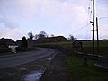
 Motte and Bailey, Burton in Lonsdale (geograph 4190007).jpg 2,913 × 2,155; 3.6 MB
-
 Motte at Burton in Lonsdale - geograph.org.uk - 4937279.jpg 1,280 × 548; 568 KB
-

-

-

-

-

-
 Old road sign, Burton in Lonsdale - geograph.org.uk - 1635100.jpg 499 × 640; 111 KB
-
 Old Sunday School - geograph.org.uk - 1584779.jpg 640 × 479; 150 KB
-
 Ordnance Survey Flush Bracket S0737 - geograph.org.uk - 4090715.jpg 4,000 × 3,000; 4.46 MB
-

-
 Pasture east of Burton-in-Lonsdale - geograph.org.uk - 2343814.jpg 826 × 583; 108 KB
-
 Path across a field near Barnoldswick Lane - geograph.org.uk - 2049314.jpg 3,872 × 2,489; 3.41 MB
-
 Refurbished fingerpost - geograph.org.uk - 5593386.jpg 2,448 × 3,264; 2.03 MB
-
 Rich grazing land near Whaitber - geograph.org.uk - 2047114.jpg 3,657 × 2,475; 4.31 MB
-

-
 Richard Thornton, I presume^ - geograph.org.uk - 2343848.jpg 480 × 640; 135 KB
-
 River Greta at Burton in Lonsdale - geograph.org.uk - 2047465.jpg 640 × 413; 102 KB
-
 River Greta, near Kepp House - geograph.org.uk - 717833.jpg 640 × 427; 105 KB
-
 Road junction at Burton-in-Lonsdale - geograph.org.uk - 1584769.jpg 640 × 479; 260 KB
-
 Ruined barn near Burton in Lonsdale - geograph.org.uk - 2048568.jpg 640 × 411; 56 KB
-
 Sheep near Lund Farm - geograph.org.uk - 2049362.jpg 3,872 × 2,480; 4.01 MB
-
 Signpost in Burton in Lonsdale (5788).jpg 2,848 × 4,288; 6.02 MB
-
 Stile by Gallaber - geograph.org.uk - 1726351.jpg 2,816 × 2,112; 1.62 MB
-
 Sun on the road to Bentham - geograph.org.uk - 2342907.jpg 480 × 640; 119 KB
-
 Sunday School in Burton in Lonsdale (5783).jpg 4,288 × 2,848; 5.55 MB
-
 Sunny High Street - geograph.org.uk - 1584773.jpg 640 × 479; 197 KB
-
 The A687 - geograph.org.uk - 5149590.jpg 1,280 × 958; 778 KB
-
 The end of the path - geograph.org.uk - 2344180.jpg 640 × 480; 153 KB
-

-
 The Methodist Church, Burton in Lonsdale - geograph.org.uk - 2048556.jpg 3,872 × 2,485; 3.49 MB
-
 The Old Police House, Main Street, Burton in Lonsdale - geograph.org.uk - 5773499.jpg 1,600 × 1,200; 363 KB
-
 The River Greta - geograph.org.uk - 4190015.jpg 4,000 × 3,000; 6.28 MB
-

-
 The valley of the Greta - geograph.org.uk - 2049377.jpg 3,872 × 2,592; 5.81 MB
-

-
 Traditional signpost - geograph.org.uk - 1584775.jpg 479 × 640; 220 KB
-
 Vicarage, Burton-in-Lonsdale - geograph.org.uk - 2343827.jpg 640 × 480; 203 KB
-

-

-
 Bridge over the River Greta - geograph.org.uk - 1420803.jpg 640 × 480; 73 KB
-
 Burton in Lonsdale - geograph.org.uk - 48711.jpg 640 × 480; 146 KB
-
 Country Road - geograph.org.uk - 183411.jpg 640 × 480; 148 KB
-
 Four Lane Ends - geograph.org.uk - 48715.jpg 640 × 480; 127 KB
-
 Fourlands Hill - geograph.org.uk - 48713.jpg 640 × 480; 140 KB
-
 Gooda - geograph.org.uk - 48716.jpg 640 × 480; 138 KB
-
 Ingleborough from High Bentham - geograph.org.uk - 103463.jpg 640 × 433; 125 KB
-
 Lower Westhouse - geograph.org.uk - 42648.jpg 640 × 480; 50 KB
-
 Near Wrayton - geograph.org.uk - 127345.jpg 480 × 640; 149 KB
-
 Plantation Gill Farm - geograph.org.uk - 127346.jpg 640 × 480; 112 KB
-
 Small Lake - geograph.org.uk - 127344.jpg 640 × 480; 115 KB
-
 Stainderber - geograph.org.uk - 378615.jpg 636 × 477; 92 KB
-
 Valley of the River Greta - geograph.org.uk - 127352.jpg 640 × 480; 123 KB
-
 View from Anems House - geograph.org.uk - 48718.jpg 640 × 480; 191 KB
-
 Wave - geograph.org.uk - 372796.jpg 640 × 478; 60 KB


_-_geograph.org.uk_-_1910308.jpg)


.jpg)


.jpg)
.jpg)


_-_geograph.org.uk_-_2344167.jpg)


.jpg)


.jpg)


.jpg)


