Category:Burgebrach
Jump to navigation
Jump to search
market municipality of Germany | |||||
| Upload media | |||||
| Instance of |
| ||||
|---|---|---|---|---|---|
| Part of |
| ||||
| Location | Bamberg, Upper Franconia, Bavaria, Germany | ||||
| Population |
| ||||
| Area |
| ||||
| Elevation above sea level |
| ||||
| official website | |||||
 | |||||
Subcategories
This category has the following 13 subcategories, out of 13 total.
Media in category "Burgebrach"
The following 32 files are in this category, out of 32 total.
-
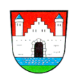
Wappen Burgebrach.png 150 × 160; 71 KB
-
Wappen von Burgebrach.svg 718 × 790; 96 KB
-
Burgebrach - panoramio (1).jpg 1,403 × 1,504; 519 KB
-
Burgebrach - panoramio.jpg 1,225 × 1,252; 332 KB
-
Burgebrach im Landkreis Bamberg.png 961 × 690; 16 KB
-
Burgebrach Luftbild -20230604-RM-144434.jpg 4,573 × 3,425; 7.78 MB
-
Burgebrach Luftbild -20230604-RM-144448.jpg 4,643 × 2,490; 6.19 MB
-
Burgebrach Luftbild -20230604-RM-144642.jpg 4,671 × 3,498; 8.42 MB
-
Burgebrach Luftbild -20230604-RM-150457.jpg 4,285 × 3,209; 7.17 MB
-
Burgebrach Luftbild Panorama-20230604-RM-150520.jpg 8,801 × 3,488; 13.64 MB
-
Burgebrach Luftbild Panorama-20230604-RM-150533.jpg 9,222 × 3,486; 15.08 MB
-
BURGEBRACH OBERHARNSBACH nieder.png 480 × 360; 5 KB
-
BURGEBRACH OBERHARNSBACH nieder.svg 512 × 427; 21 KB
-
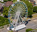
Burgebrach Riesenrad Luftbild -20230604-RM-150156.jpg 3,948 × 2,112; 4.59 MB
-
Burgebrach Riesenrad Luftbild -20230604-RM-150225.jpg 4,798 × 3,593; 10.44 MB
-
Burgebrach Riesenrad Luftbild -20230604-RM-150357.jpg 3,144 × 2,722; 5.78 MB
-
Burgebrach, Ampferbach, Max-Keller, 001.jpg 4,928 × 3,264; 9.83 MB
-
Burgebrach, Germany - panoramio.jpg 600 × 450; 267 KB
-
Burgebrach.png 338 × 246; 15 KB
-
Friedhof Burgebrach.JPG 1,536 × 2,048; 1.5 MB
-
Garage in Burgebrach.JPG 1,536 × 2,048; 1.58 MB
-
Haus mit Giebel - panoramio.jpg 1,536 × 1,721; 279 KB
-
Kreuzigungsszene an der Pfarrkirche - panoramio.jpg 1,555 × 1,517; 425 KB
-
Pfarrkirche - panoramio (43).jpg 1,464 × 1,536; 254 KB
-
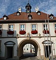
Rathaus Burgebrach - panoramio.jpg 1,436 × 1,536; 344 KB
-
Rathaus-Burgebrach.jpg 5,184 × 3,888; 9.24 MB
-
Seltsamer Baum - panoramio.jpg 1,456 × 1,535; 344 KB
-
Steigerwald-Wegkapelle-7039091.jpg 3,456 × 4,608; 5.28 MB
-
Trinkwasser-Spender - panoramio.jpg 1,366 × 1,999; 886 KB
-
Verknoteter Baum - panoramio.jpg 1,511 × 1,536; 434 KB
-
Ölberg - panoramio (6).jpg 1,566 × 1,536; 364 KB
-
Ölberggruppe in einem sechseckigen Sandsteingehäuse - panoramio.jpg 1,381 × 1,488; 460 KB


