Category:Buildings in London photographed in 2010
Jump to navigation
Jump to search
Ceremonial counties of England: Bedfordshire · Berkshire · Buckinghamshire · Cambridgeshire · Cheshire · Cornwall · Cumbria · Derbyshire · Devon · Dorset · East Sussex · Gloucestershire · Greater London · Greater Manchester · Hampshire · Hertfordshire · Isle of Wight · Kent · Lancashire · Leicestershire · Lincolnshire · Norfolk · North Yorkshire · Northamptonshire · Northumberland · Oxfordshire · Shropshire · Somerset · Suffolk · Surrey · Warwickshire · West Midlands · West Sussex · Wiltshire · Worcestershire
City-counties:
Former historic counties:
Other former counties:
City-counties:
Former historic counties:
Other former counties:
Subcategories
This category has the following 23 subcategories, out of 23 total.
B
- Buckingham Palace in 2010 (55 F)
C
E
- 2010 at Euston station (58 F)
H
L
- London Eye in 2010 (37 F)
M
- 2010 at Marylebone station (29 F)
P
- 2010 at Paddington station (56 F)
- Palace of Westminster in 2010 (105 F)
S
- Shard London Bridge in 2010 (51 F)
- 2010 at Stratford station (45 F)
V
W
Media in category "Buildings in London photographed in 2010"
The following 200 files are in this category, out of 211 total.
(previous page) (next page)-
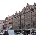
109-111 Farringdon Road - geograph.org.uk - 2508314.jpg 451 × 640; 222 KB
-
113 Cadogan Gardens SW1 - geograph.org.uk - 2105416.jpg 480 × 640; 68 KB
-
19 Fleet Street - geograph.org.uk - 1802394.jpg 640 × 480; 100 KB
-
40 Melton Street Euston - geograph.org.uk - 2027599.jpg 2,472 × 3,296; 1.91 MB
-
43 Old Bond Street (5168976605).jpg 2,816 × 4,704; 5.8 MB
-
6-9 Smith Square - geograph.org.uk - 2301853.jpg 640 × 482; 241 KB
-
61-62 Piccadilly, London W1 (1).jpg 3,096 × 4,616; 8.01 MB
-
61-62 Piccadilly, London W1 (2).jpg 4,120 × 5,039; 9.8 MB
-
71-72 Princes Gate, Kensington, September 2010.jpg 3,264 × 2,448; 3.22 MB
-
78 and 77 Pall Mall (5126948000).jpg 5,094 × 4,514; 8.32 MB
-
Administrative building like in Prague, nonsense - panoramio.jpg 4,592 × 3,056; 3.91 MB
-
Alliance, West Hampstead, NW6 (5033709253).jpg 3,459 × 2,306; 3.12 MB
-
Balcony on Madam Sophie's, viewed from Portobello Road - geograph.org.uk - 2170985.jpg 3,456 × 2,592; 3.06 MB
-
Bentley and Skinner (5126977966).jpg 4,358 × 4,248; 9.56 MB
-
Bibendum Building, Fulham Road SW3 - geograph.org.uk - 2105354.jpg 640 × 479; 62 KB
-
Black Friars, Blackfriars, EC4 (5235755889).jpg 3,532 × 2,355; 3.44 MB
-
Builders Arms, Britten Street SW3 - geograph.org.uk - 2105181.jpg 464 × 640; 78 KB
-
Cadogan Gardens SW3 - geograph.org.uk - 2105445.jpg 480 × 640; 83 KB
-
Casaslondres.jpg 1,255 × 1,200; 177 KB
-
Cattle trough, Farringdon Lane - geograph.org.uk - 2508544.jpg 640 × 474; 216 KB
-
Central Wash - geograph.org.uk - 1879641.jpg 640 × 480; 94 KB
-
Chelsea Cinema, Kings Road SW3 - geograph.org.uk - 2105496.jpg 480 × 640; 72 KB
-
Chelsea Fire Station, Kings Road SW3 - geograph.org.uk - 2105521.jpg 640 × 480; 116 KB
-
Chelsea Potter, Radnor Walk SW3 - geograph.org.uk - 2105467.jpg 480 × 640; 60 KB
-
Chelsea Toys, Cale Street SW3 - geograph.org.uk - 2105159.jpg 640 × 478; 58 KB
-
Chopin's house in St James's Place - geograph.org.uk - 2211481.jpg 480 × 640; 101 KB
-
Crown, Bermondsey, SE16 (5669595364).jpg 2,700 × 1,800; 2.5 MB
-
Custom House City of London.jpg 3,347 × 2,027; 1.96 MB
-
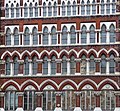
Detail of 109-111 Farringdon Road - geograph.org.uk - 2508329.jpg 640 × 592; 282 KB
-
Duke of York, Victoria - geograph.org.uk - 2023835.jpg 3,488 × 2,616; 2.18 MB
-
Eagle, Clerkenwell, EC1 (2587948043).jpg 3,776 × 2,520; 3.81 MB
-
Edificacaolondon.jpg 1,600 × 1,200; 339 KB
-
Edificaçãolondon.jpg 1,600 × 1,200; 328 KB
-
Edificaçãolondresinglaterra.jpg 1,200 × 1,600; 275 KB
-
Elms Lesters - geograph.org.uk - 1957976.jpg 1,106 × 1,600; 508 KB
-
Elystan Street SW3 - geograph.org.uk - 2105128.jpg 480 × 640; 79 KB
-
Eni House, Ebury Bridge Road SW1 - geograph.org.uk - 2104766.jpg 640 × 480; 64 KB
-
Entrance to Chester Square Mews - geograph.org.uk - 2183238.jpg 640 × 480; 58 KB
-
External view of 198 Contemporary Arts and Learning, 2010.jpg 720 × 480; 90 KB
-
Fanlight for Gordon Mansions.jpg 1,390 × 740; 206 KB
-
Finsbury Town Hall - geograph.org.uk - 1737648.jpg 1,143 × 1,203; 200 KB
-
Fleet Street 3 (4866729326).jpg 2,800 × 4,000; 4.86 MB
-
Former pub, Merton High Street (geograph 1939645).jpg 480 × 640; 88 KB
-
Foundation stone of the old fire station - geograph.org.uk - 2110417.jpg 640 × 480; 133 KB
-
Geales Restaurant, Cale Street SW3 - geograph.org.uk - 2105148.jpg 480 × 640; 52 KB
-
George Wombwell tomb.jpg 600 × 800; 331 KB
-
Gordon Mansions - geograph.org.uk - 2167795.jpg 480 × 640; 70 KB
-
Gothic grave, St John-at-Hampstead Churchyard, London NW3 - geograph.org.uk - 1938626.jpg 3,008 × 2,000; 2.68 MB
-
Guardian (5168046042).jpg 2,448 × 3,264; 2.28 MB
-
Harrodslondon.jpg 1,200 × 1,600; 261 KB
-
Horse Guards Parade, London.jpg 1,280 × 852; 989 KB
-
Houses in Regent's Park Terrace - geograph.org.uk - 1974254.jpg 640 × 480; 118 KB
-
IYLO TQ3266 039.JPG 3,648 × 2,736; 2.47 MB
-
Jackson, Cadogan Street SW3 - geograph.org.uk - 2105406.jpg 480 × 640; 78 KB
-
John Lewis, Sloane Square SW1 - geograph.org.uk - 2105054.jpg 640 × 479; 76 KB
-
Joseph, Sloane Avenue SW3 - geograph.org.uk - 2105345.jpg 640 × 469; 66 KB
-
Killir ^ Co, Cadogan Street SW3 - geograph.org.uk - 2105391.jpg 480 × 640; 76 KB
-
King Haakon VII house.jpg 3,264 × 2,448; 2.91 MB
-
King Haakon VII plaque.jpg 2,098 × 1,579; 638 KB
-
King William IV public house, Hampstead - geograph.org.uk - 2178458.jpg 4,320 × 3,240; 4.24 MB
-
Kings Road SW10 - geograph.org.uk - 2105585.jpg 640 × 473; 60 KB
-
Le Poule au Pot, Ebury Street SW1 - geograph.org.uk - 2104844.jpg 480 × 640; 130 KB
-
Le Suquet, Draycott Place SW3 - geograph.org.uk - 2105375.jpg 475 × 640; 41 KB
-
London - Brompton Road - Harrods - Charcuterie, Fromagerie & Traiteur Department II.jpg 3,024 × 2,016; 2.62 MB
-
London - Brompton Road - Harrods - Charcuterie, Fromagerie & Traiteur Department III.jpg 3,024 × 2,016; 2.35 MB
-
London - Brompton Road - Harrods - Charcuterie, Fromagerie & Traiteur Department.jpg 3,024 × 2,016; 2.67 MB
-
London - Brompton Road - Harrods - Confectionery & Patisserie Department.jpg 3,024 × 2,016; 2.38 MB
-
London - Brompton Road - Harrods - Cosmetics Department.jpg 3,024 × 2,016; 2.28 MB
-
London - Brompton Road - Harrods - Egyptian Style Escalator I.jpg 3,024 × 2,016; 2.75 MB
-
London - Brompton Road - Harrods - Egyptian Style Escalator II.jpg 3,024 × 2,016; 2.81 MB
-
London - Brompton Road - Harrods - Egyptian Style Escalator III.jpg 3,024 × 2,016; 2.52 MB
-
London - Brompton Road - Harrods - Fruit & Vegetables Department II.jpg 3,024 × 2,016; 2.82 MB
-
London - Brompton Road - Harrods - Fruit & Vegetables Department.jpg 2,016 × 3,024; 2.91 MB
-
London - Brompton Road - Harrods - Meat, Fish & Poultry Department I.jpg 3,024 × 2,016; 2.78 MB
-
London - Brompton Road - Harrods - Meat, Fish & Poultry Department II.jpg 3,024 × 2,016; 2.94 MB
-
London - Brompton Road - Harrods - Meat, Fish & Poultry Department III.jpg 3,024 × 2,016; 2.74 MB
-
London - Brompton Road - Harrods - Meat, Fish & Poultry Department IV.jpg 3,024 × 2,016; 3.09 MB
-
London - Brompton Road - Harrods - Tea & Coffee Department.jpg 3,024 × 2,016; 2.64 MB
-
London - Hans Crescent - Landon Place - View NW towards Harrods.jpg 3,024 × 2,016; 3.03 MB
-
London 2012 olympics basketball sept 2010.jpg 1,200 × 900; 356 KB
-
London MMB 89 Adelaide Road.jpg 2,432 × 3,868; 2.39 MB
-
London Sri Murugan Temple, Manor Park, E12 2.jpg 1,600 × 2,133; 380 KB
-
London Sri Murugan Temple, Manor Park, E12 3.jpg 1,600 × 2,133; 427 KB
-
London Sri Murugan Temple, Manor Park, E12.jpg 1,600 × 2,133; 399 KB
-
London Sri Murugan Temple, Manor Park, London E12.jpg 2,133 × 1,600; 526 KB
-
London St James (4316333213).jpg 3,888 × 2,592; 2.08 MB
-
Londonedificacao.jpg 1,600 × 1,200; 294 KB
-
Londonedificação.jpg 1,600 × 1,200; 297 KB
-
Londonharrods.jpg 1,600 × 1,200; 245 KB
-
Londrescasas.jpg 1,600 × 1,200; 366 KB
-
Londresinglaterraedificação.jpg 1,600 × 1,200; 324 KB
-
Mamelon Tower, Gospel Oak, NW5 (4760061604).jpg 3,776 × 2,520; 3.3 MB
-
Marble Arch Tower, Marylebone, March 2010.jpg 1,920 × 1,080; 1.01 MB
-
Mersey House Fleet Street (4866086097).jpg 3,168 × 4,752; 6.75 MB
-
Millennium mills northwest.jpg 4,752 × 3,168; 8.43 MB
-
Mitre, Gospel Oak, NW5 (4760058810).jpg 3,144 × 2,096; 2.82 MB
-
Modern housing on Falmouth Road - geograph.org.uk - 1766016.jpg 640 × 480; 161 KB
-
New End Theatre, Hampstead - geograph.org.uk - 2178289.jpg 640 × 480; 89 KB
-
New London Photographs by Jared Tarbell.jpg 1,800 × 2,400; 2.09 MB
-
No. 5, Marylebone, W1 (4829825919).jpg 1,777 × 2,664; 2.1 MB
-
Orange Tree, Richmond, TW9 (4611230138).jpg 2,736 × 3,648; 2.52 MB
-
OS benchmark, Mansfield Mews - geograph.org.uk - 3293546.jpg 480 × 640; 98 KB
-
Pall Mall (5133777908).jpg 3,016 × 4,560; 4.85 MB
-
Park Walk SW10 - geograph.org.uk - 2105563.jpg 640 × 470; 61 KB
-
Parliament Street (5140756142).jpg 3,168 × 3,712; 5.06 MB
-
Phelps Cottage, Islington - geograph.org.uk - 1708520.jpg 1,280 × 960; 163 KB
-
Pimlico Road SW1 - geograph.org.uk - 2104875.jpg 480 × 640; 83 KB
-
Police call box, Guildhall, City of London (geograph 1946351).jpg 1,193 × 2,991; 542 KB
-
Portobello Bridge, Golborne Road W10 - geograph.org.uk - 1822154.jpg 479 × 640; 53 KB
-
Primark, 1 King's Mall, King Street, W6 - geograph.org.uk - 2161150.jpg 1,024 × 613; 159 KB
-
Queen's Head, Tryon Street SW3 - geograph.org.uk - 2105108.jpg 640 × 480; 74 KB
-
Rear of Bibendum, Ixworth Place SW3 - geograph.org.uk - 2105305.jpg 640 × 480; 77 KB
-
Red House home of William Morris (1).jpg 4,752 × 3,168; 7.86 MB
-
Red House home of William Morris (2).jpg 4,674 × 3,168; 10.11 MB
-
Red House home of William Morris.jpg 4,470 × 3,168; 7.96 MB
-
Restaurant, Kings Road SW3 - geograph.org.uk - 2105458.jpg 640 × 473; 78 KB
-
Rose and Crown, Highgate, N6 (4803817143).jpg 2,051 × 2,734; 2.37 MB
-
Royal Brompton Hospital-geograph-2105200.jpg 640 × 471; 64 KB
-
Ruislip High School 1871077 e8956104.jpg 640 × 480; 57 KB
-
SE10 Restaurant and Bar, Greenwich, SE10 (5273658528).jpg 3,203 × 2,135; 2.61 MB
-
Sedding Street, SW1 - geograph.org.uk - 1805159.jpg 640 × 480; 92 KB
-
Shamrock, Kilburn, NW6 (5033746293).jpg 3,228 × 2,152; 2.82 MB
-
Slaidburn Street SW10 - geograph.org.uk - 2105601.jpg 480 × 640; 61 KB
-
Sloane Terrace SW1 - geograph.org.uk - 2105420.jpg 640 × 480; 70 KB
-
Slug and Lettuce, Muswell Hill, N10 (5186946995).jpg 3,219 × 2,146; 3.04 MB
-
Spotted Dog, Barking, IG11 (5127757697).jpg 2,820 × 1,880; 2.23 MB
-
St Giles Tower - geograph.org.uk - 1751579.jpg 640 × 480; 72 KB
-
St Jamess Street (5128084307).jpg 3,168 × 4,248; 6.35 MB
-
St Joseph plaque, Cadogan Street SW3 - geograph.org.uk - 2105396.jpg 640 × 480; 76 KB
-
Strand Palace Hotel (4343129401).jpg 3,072 × 2,304; 1.76 MB
-
Street sign, Elystan Place SW3 - geograph.org.uk - 2105114.jpg 640 × 480; 62 KB
-
Street sign, Ixworth Place SW3 - geograph.org.uk - 2105294.jpg 640 × 480; 68 KB
-
Street sign, Paulton's Square SW3 - geograph.org.uk - 2105543.jpg 640 × 480; 62 KB
-
Street sign, Sloane Square SW1 - geograph.org.uk - 2105434.jpg 640 × 480; 63 KB
-
Sutton Dwellings, Ixworth Place SW3 - geograph.org.uk - 2105276.jpg 470 × 640; 90 KB
-
Sydney Street SW3 - geograph.org.uk - 2105208.jpg 480 × 640; 108 KB
-
Sydney Street SW3 - geograph.org.uk - 2105254.jpg 640 × 479; 73 KB
-
Ten past two in Fleet Street - geograph.org.uk - 1802765.jpg 480 × 640; 99 KB
-
Thames, Greenwich, SE10 (2587498017).jpg 3,776 × 2,520; 3.89 MB
-
The Blue Bird Garage, Kings Road SW3 - geograph.org.uk - 2105556.jpg 640 × 480; 70 KB
-
The Cadogan Arms, Kings Road SW3 - geograph.org.uk - 2105536.jpg 640 × 465; 64 KB
-
The Camden Eye, Camden - geograph.org.uk - 1893532.jpg 3,488 × 2,616; 2.25 MB
-
The Chelsea Theatre, Kings Road SW10 - geograph.org.uk - 2105595.jpg 640 × 480; 100 KB
-
The Clachan (5143052909).jpg 2,880 × 4,696; 6.63 MB
-
The Dial House.jpg 2,896 × 1,944; 817 KB
-
The Dulwich Estate - DSC05986.JPG 2,532 × 3,498; 5.02 MB
-
The Ebury, Pimlico Road SW1 - geograph.org.uk - 2104786.jpg 480 × 640; 59 KB
-
The Fire Station, Waterloo Road.jpg 2,362 × 1,732; 1.65 MB
-
The gateway to the Chelsea Physic Garden - geograph.org.uk - 2124604.jpg 480 × 640; 120 KB
-
The Old Mill House - geograph.org.uk - 1754078.jpg 640 × 445; 98 KB
-
The pavilion at Syon House - geograph.org.uk - 2037453.jpg 640 × 480; 76 KB
-
The Pavilion, Syon Park - geograph.org.uk - 2119475.jpg 640 × 430; 167 KB
-
The Pavilion, Syon Park - geograph.org.uk - 2119482.jpg 640 × 351; 79 KB
-
The Plough Inn at Norwood Green - panoramio.jpg 3,632 × 2,716; 1.99 MB
-
The Prince of Wales, Covent Garden - geograph.org.uk - 1893596.jpg 3,488 × 2,616; 2.09 MB
-
The Royal Standard, Harper Road - geograph.org.uk - 1766155.jpg 640 × 480; 160 KB
-
The Sloane Club, Lower Sloane Street - geograph.org.uk - 2105034.jpg 465 × 640; 56 KB
-
The White Hart Pub, 89 Whitechapel High Street East London 2010-07-05.jpg 3,000 × 3,565; 1.78 MB
-
The Worlds End, Kings Road SW10 - geograph.org.uk - 2105607.jpg 480 × 640; 79 KB
-
Time, Maida Hill, W9 (4241780368).jpg 3,776 × 2,520; 3.58 MB
-
Tollington Park bay window, N4.jpg 1,600 × 2,133; 503 KB
-
Toucan, Soho, W1 (2377487697).jpg 2,173 × 3,258; 2.67 MB
-
Tower Casino (4875582825).jpg 2,710 × 4,472; 4.87 MB
-
Trafalgar, Kings Road SW3 - geograph.org.uk - 2105488.jpg 640 × 455; 87 KB


