Category:Buildings in Horning
Jump to navigation
Jump to search
Subcategories
This category has the following 7 subcategories, out of 7 total.
B
H
- Houses in Horning (22 F)
M
P
- Horning Post Office (4 F)
R
- RAF Air Defence Radar Museum (17 F)
S
- St Benet's Abbey (88 F)
Media in category "Buildings in Horning"
The following 14 files are in this category, out of 14 total.
-
 Derelict cottage by Browns Hill - geograph.org.uk - 2863841.jpg 640 × 480; 231 KB
-
 Farm buildings near St Benet's Abbey Drainage Mill, Horning - geograph.org.uk - 4857376.jpg 3,648 × 2,432; 2.09 MB
-
 A church with a very steep gable - geograph.org.uk - 904194.jpg 480 × 640; 154 KB
-
 A church without a name^ - geograph.org.uk - 904199.jpg 640 × 480; 165 KB
-
 Interesting brick work - geograph.org.uk - 904069.jpg 640 × 480; 150 KB
-
 Lower Street by the New Inn - geograph.org.uk - 904093.jpg 640 × 480; 138 KB
-
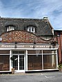 Restaurant front - geograph.org.uk - 904121.jpg 480 × 640; 179 KB
-
 Riverside building - geograph.org.uk - 5669770.jpg 1,000 × 665; 732 KB
-
 Riverside houses, Horning - geograph.org.uk - 2681908.jpg 800 × 600; 228 KB
-
 Riverside houses, Horning - geograph.org.uk - 2681927.jpg 800 × 600; 225 KB
-
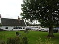 Riverside in Horning - geograph.org.uk - 561969.jpg 640 × 478; 161 KB
-
 Shops on Lower Street - geograph.org.uk - 904065.jpg 640 × 480; 127 KB
-
 Souvenir and gift shop - geograph.org.uk - 904106.jpg 640 × 468; 130 KB
-
 The village hall - geograph.org.uk - 904168.jpg 640 × 457; 141 KB


