
Category:Buildings in Greetland
Subcategories
This category has the following 9 subcategories, out of 9 total.
C
- Clay House, Greetland (10 F)
G
- Gate Head Mill (5 F)
- Greetland library (3 F)
H
- Houses in Greetland (3 F)
I
P
S
- Schools in Greetland (5 F)
- Shops in Greetland (1 F)
Media in category "Buildings in Greetland"
The following 53 files are in this category, out of 53 total.
-
 Back John Street and a former shop, Clay House Lane - geograph.org.uk - 4412301.jpg 2,000 × 1,460; 1.15 MB
-
 Brian Royd Mill, Greetland - geograph.org.uk - 3372047.jpg 2,000 × 1,464; 862 KB
-
 Brian Royd.jpg 3,744 × 2,246; 8.02 MB
-

-
 Brook Row, Greetland - geograph.org.uk - 3811005.jpg 1,986 × 1,455; 1.02 MB
-
 Brow Bridge, Greetland - geograph.org.uk - 1572614.jpg 640 × 468; 101 KB
-
 Building work on Far Syke House - geograph.org.uk - 4305515.jpg 2,000 × 1,500; 974 KB
-
 Communication mast on Greetland Moor - geograph.org.uk - 1480807.jpg 480 × 640; 92 KB
-
 Crawstone Hall, Dog Lane, Greetland - geograph.org.uk - 3373293.jpg 2,000 × 1,500; 918 KB
-
 Crawstone Rock Farm - geograph.org.uk - 3804492.jpg 2,048 × 1,536; 889 KB
-
-
 Derelict mill at Gate Head - geograph.org.uk - 3973564.jpg 1,600 × 1,200; 934 KB
-

-
 Elland FP42 at Lower Turbury Farm - geograph.org.uk - 3804445.jpg 1,710 × 1,218; 420 KB
-
 Engineering Works, Stainland Road, Greetland - geograph.org.uk - 2593407.jpg 2,000 × 1,427; 719 KB
-
 Former coach house of Brian Royde - geograph.org.uk - 3811094.jpg 2,007 × 1,413; 832 KB
-
-
 Garage on Saddleworth Road - geograph.org.uk - 1097138.jpg 640 × 480; 57 KB
-
 Goofy Gargoyle, Greetland (3206888837).jpg 1,314 × 1,314; 1.42 MB
-

-

-

-

-
-
 Greetland Social Club - Rochdale Road - geograph.org.uk - 811485.jpg 640 × 480; 57 KB
-
 Greetland Social Club, Rochdale Road - geograph.org.uk - 1116184.jpg 640 × 480; 80 KB
-
 Higher Turbury, Turbury Lane, Greetland - geograph.org.uk - 3804395.jpg 2,048 × 1,536; 735 KB
-
 Highlands View - Ashfield Road - geograph.org.uk - 3751590.jpg 640 × 480; 78 KB
-

-

-
 House, Green Lane, Greetland - geograph.org.uk - 2593311.jpg 1,791 × 1,356; 579 KB
-

-
 Houses at Gate Farm, off Scar Bottom Lane - geograph.org.uk - 3372019.jpg 2,000 × 1,395; 756 KB
-
 Houses at Scar Bottom, Greetland - geograph.org.uk - 3810813.jpg 1,974 × 1,449; 980 KB
-
 Houses on Rochdale Road near Brow Bridge - geograph.org.uk - 3816276.jpg 2,000 × 1,478; 1.23 MB
-
 Lower Ellistones - Saddleworth Road - geograph.org.uk - 3751676.jpg 640 × 480; 97 KB
-
 Old Bank End Farmhouse.jpg 2,000 × 1,483; 841 KB
-
 Old Property above the Skircoat cutting - geograph.org.uk - 1455281.jpg 480 × 640; 100 KB
-

-
-
 Prospect House and Farm, Turbury Lane, Greetland - geograph.org.uk - 3810819.jpg 2,048 × 1,536; 997 KB
-
 Road junction - geograph.org.uk - 1116541.jpg 640 × 480; 66 KB
-

-
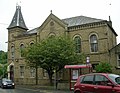
 Sunday School (St Thomas's) - geograph.org.uk - 1116244.jpg 640 × 480; 103 KB
-

-
 Sunny Bank, Greetland.jpg 2,000 × 1,505; 1,023 KB
-

-
 The Old Vicarage, Greetland - geograph.org.uk - 661529.jpg 640 × 480; 131 KB
-
 Turbury Lane, Greetland - geograph.org.uk - 986710.jpg 640 × 445; 49 KB
-
 Upper Greetland Post Office - geograph.org.uk - 1116295.jpg 480 × 640; 80 KB
-

-
 Victoria Mill, West Vale, Greetland - geograph.org.uk - 75878.jpg 640 × 480; 147 KB
-


.jpg)


_-_geograph.org.uk_-_1116244.jpg)


