Category:Buildings in County Durham
Jump to navigation
Jump to search
Ceremonial counties of England: Bedfordshire · Berkshire · Buckinghamshire · Cambridgeshire · Cheshire · Cornwall · Cumbria · Derbyshire · Devon · Dorset · Durham · East Riding of Yorkshire · East Sussex · Essex · Gloucestershire · Greater London · Greater Manchester · Hampshire · Herefordshire · Hertfordshire · Isle of Wight · Kent · Lancashire · Leicestershire · Lincolnshire · Merseyside · Norfolk · North Yorkshire · Northamptonshire · Northumberland · Nottinghamshire · Oxfordshire · Rutland · Shropshire · Somerset · South Yorkshire · Staffordshire · Suffolk · Surrey · Tyne and Wear · Warwickshire · West Midlands · West Sussex · West Yorkshire · Wiltshire · Worcestershire
City-counties: Bristol · City of London
Former historic counties: Huntingdonshire · Middlesex · Sussex · Yorkshire
Other former counties:
City-counties: Bristol · City of London
Former historic counties: Huntingdonshire · Middlesex · Sussex · Yorkshire
Other former counties:
Wikimedia category | |||||
| Upload media | |||||
| Instance of | |||||
|---|---|---|---|---|---|
| Category combines topics | |||||
| Category contains | |||||
| |||||
Subcategories
This category has the following 62 subcategories, out of 62 total.
A
B
- Bandstands in County Durham (13 F)
- Biomass Energy Centre (1 F)
C
D
F
G
- Garages in County Durham (5 F)
H
- Holmside Hall (1 F)
- Huts in County Durham (1 F)
I
L
M
P
R
S
- Seaham Hall (1 F)
T
- Tees Cottage Pumping Station (15 F)
V
Media in category "Buildings in County Durham"
The following 81 files are in this category, out of 81 total.
-
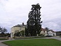
 "The Big House", Eden Lane, Peterlee - geograph.org.uk - 649431.jpg 640 × 414; 94 KB
-
 31 and 33 Thorngate - geograph.org.uk - 1191150.jpg 640 × 640; 126 KB
-
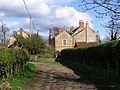
 Back lane Middleton - geograph.org.uk - 499754.jpg 640 × 427; 386 KB
-
 Bolton Hall in Autumn colours - geograph.org.uk - 542084.jpg 640 × 480; 114 KB
-
 Building at Leading Stead Bottom - geograph.org.uk - 152970.jpg 640 × 479; 109 KB
-
 Burdon Hall. - geograph.org.uk - 150915.jpg 640 × 479; 94 KB
-
 Cheveley Park Medical Centre - geograph.org.uk - 781014.jpg 640 × 487; 110 KB
-
 Cottage, Stanhope 11.jpg 3,888 × 2,592; 5.06 MB
-
 Cottage, Unthank Park, Stanhope 01.jpg 3,888 × 2,592; 4.34 MB
-
 Durham Radisson SAS,redboxdesign,Critical Tortoise.jpg 1,024 × 629; 603 KB
-
 Durham Town Hall The Great Hall (49862871036).jpg 8,682 × 5,788; 29.39 MB
-
 Durham Town Hall The Great Hall Window (49863217792).jpg 5,791 × 8,686; 33.76 MB
-
 Eastgate Gauging Station - geograph.org.uk - 728895.jpg 480 × 640; 107 KB
-

-
 Elstob Hall. - geograph.org.uk - 189667.jpg 640 × 404; 85 KB
-
 Ferryhill old fire station - geograph.org.uk - 1393265.jpg 640 × 427; 204 KB
-
 Gainford Post Office, County Durham.jpg 2,560 × 1,920; 4.11 MB
-
 Greatham Hall - geograph.org.uk - 279231.jpg 640 × 480; 86 KB
-
 Hearse store, Stanhope 10.jpg 3,888 × 2,592; 6.04 MB
-
 Hilton Hall. - geograph.org.uk - 165520.jpg 640 × 479; 128 KB
-
 Ivy House - geograph.org.uk - 495408.jpg 640 × 480; 110 KB
-
 Killerby Hall. - geograph.org.uk - 148095.jpg 640 × 479; 76 KB
-
 Langley Hall North-East Gable.jpg 3,753 × 2,108; 2.36 MB
-
 Langley Hall.jpg 3,992 × 2,242; 2.79 MB
-
 Low Walworth Hall. - geograph.org.uk - 162022.jpg 640 × 479; 115 KB
-
 Manor Cottage and Manor House, Boldron - geograph.org.uk - 1639977.jpg 640 × 400; 125 KB
-
 Mount Community Centre, Eighton Banks. - geograph.org.uk - 513190.jpg 640 × 480; 108 KB
-
 Norton Hall from across Norton Green - geograph.org.uk - 414977.jpg 640 × 480; 82 KB
-
 Old church hall, Frosterley - geograph.org.uk - 2181622.jpg 2,000 × 1,500; 2.5 MB
-
 Oxen Law - geograph.org.uk - 550117.jpg 640 × 480; 82 KB
-
 Raby Castle Carriage House - geograph.org.uk - 576783.jpg 640 × 480; 91 KB
-

-
 Stanhope 06.jpg 2,592 × 3,888; 5.06 MB
-
 Stanhope 07.jpg 2,592 × 3,888; 6.22 MB
-
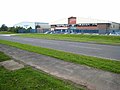
 Tees Whitewater Centre-1024.jpg 1,024 × 768; 705 KB
-
 The old ink works - geograph.org.uk - 1369100.jpg 640 × 427; 72 KB
-

-
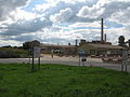 Thrislington Works - geograph.org.uk - 489130.jpg 640 × 480; 86 KB
-
 Toft House - geograph.org.uk - 589936.jpg 640 × 427; 118 KB
-
 Tower in wall, Stanhope 08.jpg 2,592 × 3,888; 5.05 MB
-
 Tower in Wall, Stanhope 09.jpg 3,888 × 2,592; 4.92 MB
-
 UK - Peterlee, Durham, New Castle (29162216964).jpg 2,500 × 1,667; 1.66 MB
-
 UK - Peterlee, Durham, New Castle (29162219504).jpg 2,500 × 1,667; 1.9 MB
-
 UK - Peterlee, Durham, New Castle (29164202113).jpg 2,500 × 1,667; 1.51 MB
-
 UK - Peterlee, Durham, New Castle (29707300891).jpg 2,500 × 1,667; 1.74 MB
-
 UK - Peterlee, Durham, New Castle (29707304891).jpg 2,500 × 1,667; 2.39 MB
-
 UK - Peterlee, Durham, New Castle (29753791896).jpg 2,500 × 1,667; 1.71 MB
-
 UK - Peterlee, Durham, New Castle (29789886475).jpg 1,667 × 2,500; 1.49 MB
-
 Ulnaby Hall - geograph.org.uk - 137045.jpg 640 × 479; 68 KB
-
 Unthank Hall, Cottage, Unthank Park, Stanhope 03.jpg 2,592 × 3,888; 4.65 MB
-
 Water Works Building - geograph.org.uk - 542516.jpg 640 × 480; 82 KB
-
 Waterworks near Bayford - geograph.org.uk - 520930.jpg 640 × 480; 101 KB
-
 Wear Valley Business Centre - geograph.org.uk - 486520.jpg 640 × 480; 60 KB
-
 Witton Hall , Witton-le-Wear - geograph.org.uk - 306753.jpg 640 × 489; 127 KB
-
 Workshop at Burtree Pasture - geograph.org.uk - 634598.jpg 640 × 453; 128 KB
-
 WW2 army hut at Stainton Grove - geograph.org.uk - 531708.jpg 597 × 400; 106 KB
-
 Bescol premises, Delves Lane - geograph.org.uk - 1418503.jpg 640 × 480; 80 KB
-
 Bradley Hall - geograph.org.uk - 452416.jpg 640 × 480; 76 KB
-
 Businesses on Front Street - geograph.org.uk - 1419412.jpg 640 × 480; 109 KB
-
 Dent's House - geograph.org.uk - 309620.jpg 640 × 480; 106 KB
-
 Flass Hall, Esh Winning - geograph.org.uk - 346074.jpg 640 × 480; 79 KB
-

-
 Greystone Hall. - geograph.org.uk - 148066.jpg 640 × 479; 84 KB
-
 Horden Hall - geograph.org.uk - 488193.jpg 640 × 480; 86 KB
-
 Kelloe Hall - geograph.org.uk - 474103.jpg 640 × 480; 127 KB
-
 Ketton Hall - geograph.org.uk - 161095.jpg 640 × 479; 120 KB
-
 Lodge to Broomshiels Hall - geograph.org.uk - 358661.jpg 640 × 480; 88 KB
-
 Newfound England Farm - geograph.org.uk - 476859.jpg 640 × 480; 99 KB
-
 North Lodge, Whitworth Park - geograph.org.uk - 404632.jpg 640 × 480; 82 KB
-
 Old buildings at High Hesleden - geograph.org.uk - 419931.jpg 640 × 480; 84 KB
-
 Parkhead - geograph.org.uk - 550282.jpg 640 × 480; 91 KB
-
 Rippling Grass on driveway to Bolton Hall - geograph.org.uk - 541000.jpg 640 × 480; 148 KB
-
 Rogerley Lodge - geograph.org.uk - 471678.jpg 640 × 480; 122 KB
-
 Rowley Lodge , Woodland Fell - geograph.org.uk - 331630.jpg 640 × 275; 45 KB
-
 Sadberge Hall. - geograph.org.uk - 168196.jpg 640 × 275; 63 KB
-
 Sharnberry Gill - geograph.org.uk - 590414.jpg 640 × 371; 80 KB
-
 Sharnberry Gill - geograph.org.uk - 590426.jpg 640 × 427; 105 KB
-
 South Lodge , Streatlam Park - geograph.org.uk - 201479.jpg 640 × 479; 104 KB
-
 South Lodge , Witton Castle - geograph.org.uk - 284886.jpg 640 × 479; 108 KB
-
 Tudhoe Lodge, Scripton Lane - geograph.org.uk - 404387.jpg 640 × 480; 95 KB
-
 Willington Old Hall - geograph.org.uk - 453766.jpg 640 × 480; 165 KB


.jpg)
.jpg)


_-_geograph.org.uk_-_720045.jpg)


.jpg)
.jpg)
.jpg)
.jpg)
.jpg)
.jpg)
.jpg)


