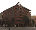
Category:Building C (Warsaw School of Economics)
Jump to navigation
Jump to search
| Object location | | View all coordinates using: OpenStreetMap |
|---|
| Upload media | |||||
| Instance of | |||||
|---|---|---|---|---|---|
| Location | Mokotów, Warsaw, Masovian Voivodeship, Poland | ||||
| Street address |
| ||||
| Located on street | |||||
| Owned by | |||||
| Inception |
| ||||
 | |||||
Media in category "Building C (Warsaw School of Economics)"
The following 18 files are in this category, out of 18 total.
-
128, Aleja Niepodległości in Warsaw - 01.jpg 4,896 × 3,672; 2.49 MB
-
Biurowiec przy Króżańskiej. W tle mokotowskie kamienice. - panoramio.jpg 1,200 × 1,803; 1.24 MB
-
Budynek C SGH al. Niepodległości 128.jpg 2,911 × 2,332; 1.26 MB
-
Budynek C Szkoła Główna Handlowa al. Niepodległości 128.jpg 6,408 × 4,736; 18.39 MB
-
Building C (Warsaw School of Economics) - 01.jpg 4,896 × 3,672; 2.97 MB
-
Building C (Warsaw School of Economics) - 02.jpg 4,896 × 3,672; 6.01 MB
-
Building C (Warsaw School of Economics) - 03.jpg 3,672 × 4,896; 3.68 MB
-
Building C (Warsaw School of Economics) - 04.jpg 4,896 × 3,672; 6.76 MB
-
Building C (Warsaw School of Economics) - 05.jpg 4,896 × 3,672; 4.51 MB
-
Building C (Warsaw School of Economics) - 06.jpg 4,896 × 3,672; 6.34 MB
-
Building C (Warsaw School of Economics) - 07.jpg 4,896 × 3,672; 6.37 MB
-
Building C (Warsaw School of Economics) - 08.jpg 4,000 × 3,000; 1.94 MB
-
Byk GPW Budynek C SGH.JPG 4,443 × 3,032; 2.27 MB
-
Na ulicy Madalińskiego - panoramio.jpg 1,536 × 2,048; 650 KB
-
Sgh 2 beax.jpg 1,104 × 921; 613 KB
-
Sgh c logo.jpg 1,825 × 1,463; 1.59 MB
-
Sgh c madalinskiego.jpg 3,209 × 2,964; 4.48 MB
-
Sgh c zegar.jpg 2,013 × 3,050; 3.37 MB


