Category:Brown Edge, Staffordshire
Jump to navigation
Jump to search
English: Brown Edge is a village and civil parish in the Staffordshire Moorlands district of Staffordshire, England. According to the 2001 census it had a population of 2,406. The village is on the fringe of The Potteries Urban Area, and is about 5 miles north-east of Hanley in Stoke-on-Trent.
village in Staffordshire, England, UK | |||||
| Upload media | |||||
| Instance of | |||||
|---|---|---|---|---|---|
| Location | Staffordshire Moorlands, Staffordshire, West Midlands, England | ||||
| Population |
| ||||
 | |||||
Subcategories
This category has the following 2 subcategories, out of 2 total.
A
B
Media in category "Brown Edge, Staffordshire"
The following 133 files are in this category, out of 133 total.
-
A living fossil - geograph.org.uk - 2372170.jpg 603 × 800; 193 KB
-
Across the dam - geograph.org.uk - 2452671.jpg 800 × 600; 128 KB
-
All creatures great and small - geograph.org.uk - 503919.jpg 640 × 480; 144 KB
-
Alongside the Head of Trent - geograph.org.uk - 5751559.jpg 3,776 × 2,520; 3.73 MB
-
Annatt's Farm, Norton Green - geograph.org.uk - 4048205.jpg 1,600 × 1,200; 508 KB
-
Apple blossom - geograph.org.uk - 2369782.jpg 800 × 600; 183 KB
-
Arched window - geograph.org.uk - 2607993.jpg 800 × 600; 280 KB
-
Autumn colours - geograph.org.uk - 2607763.jpg 800 × 657; 261 KB
-
Autumn is here - geograph.org.uk - 2607777.jpg 800 × 689; 249 KB
-
Back along the path - geograph.org.uk - 2371238.jpg 800 × 563; 241 KB
-
Back to the start - geograph.org.uk - 1988640.jpg 2,048 × 1,536; 965 KB
-
Basking in the sun - geograph.org.uk - 2376955.jpg 800 × 573; 127 KB
-
Blackthorn blossom - geograph.org.uk - 2371369.jpg 800 × 549; 228 KB
-
Boggy land - geograph.org.uk - 2371260.jpg 800 × 600; 205 KB
-
Brown Edge - geograph.org.uk - 10513.jpg 640 × 433; 51 KB
-
Brown Edge - geograph.org.uk - 193909.jpg 640 × 480; 84 KB
-
Brown Edge - geograph.org.uk - 2022930.jpg 640 × 480; 150 KB
-
Canada goose - geograph.org.uk - 2372325.jpg 800 × 571; 117 KB
-
Cherry blossom - geograph.org.uk - 2369788.jpg 800 × 600; 235 KB
-
Chionodoxa flower - geograph.org.uk - 2342251.jpg 968 × 1,000; 142 KB
-
Church Lane, Brown Edge - geograph.org.uk - 1028164.jpg 640 × 480; 78 KB
-
Clump of Chionodoxa - geograph.org.uk - 2342236.jpg 1,486 × 1,180; 637 KB
-
Crossing the River Trent - geograph.org.uk - 1499876.jpg 640 × 480; 356 KB
-
Dandelions and seat - geograph.org.uk - 2607803.jpg 800 × 746; 352 KB
-
Down the hill - geograph.org.uk - 2298267.jpg 1,903 × 1,380; 774 KB
-
Down the path - geograph.org.uk - 2298230.jpg 1,903 × 1,380; 722 KB
-
Down the Serpentine - geograph.org.uk - 2373970.jpg 800 × 600; 126 KB
-
Feeding frenzy - geograph.org.uk - 2607830.jpg 800 × 723; 134 KB
-
Flower of the Germander Speedwell - geograph.org.uk - 2456181.jpg 800 × 696; 95 KB
-
Flower of the Wood Sorrel - geograph.org.uk - 2370071.jpg 800 × 738; 92 KB
-
Footpath off Greenway Bank opposite Knypersley Reservoir - geograph.org.uk - 4776101.jpg 4,896 × 3,672; 4.54 MB
-
Footpath towards Brown Edge - geograph.org.uk - 2022980.jpg 640 × 480; 177 KB
-
Footpath towards Norton Green - geograph.org.uk - 2022806.jpg 640 × 480; 169 KB
-
Footpath towards Stockton Brook - geograph.org.uk - 2022975.jpg 640 × 480; 166 KB
-
Foxgloves by the path - geograph.org.uk - 2448503.jpg 800 × 600; 229 KB
-
Germander Speedwell - geograph.org.uk - 2456145.jpg 686 × 800; 222 KB
-
Grating on the dam - geograph.org.uk - 2452690.jpg 800 × 638; 192 KB
-
Greening up - geograph.org.uk - 2371355.jpg 800 × 600; 221 KB
-
Greenway Bank - geograph.org.uk - 942926.jpg 640 × 427; 130 KB
-
Grey Squirrel - geograph.org.uk - 2298017.jpg 1,903 × 1,380; 401 KB
-
Guelder Rose - geograph.org.uk - 2406268.jpg 800 × 710; 286 KB
-
Guelder Rose flower-head - geograph.org.uk - 2406298.jpg 800 × 786; 121 KB
-
High Lane, Brown Edge (1) - geograph.org.uk - 3672211.jpg 1,024 × 768; 131 KB
-
High Lane, Brown Edge (2) - geograph.org.uk - 3672222.jpg 1,024 × 768; 120 KB
-
High Lane, Brown Edge – 1970 - geograph.org.uk - 7053619.jpg 1,280 × 859; 371 KB
-
Horse Chestnut - geograph.org.uk - 2376910.jpg 600 × 800; 265 KB
-
Hoverfly on a Dandelion - geograph.org.uk - 2607891.jpg 800 × 753; 139 KB
-
In Greenway Wood - geograph.org.uk - 889404.jpg 640 × 427; 138 KB
-
Ivy Cottages - geograph.org.uk - 942919.jpg 640 × 423; 101 KB
-
Ivy-clad wall - geograph.org.uk - 2298155.jpg 2,048 × 1,536; 1.04 MB
-
Knypersley Dam Wall - geograph.org.uk - 5071614.jpg 1,500 × 1,000; 957 KB
-
Knypersley Mill - geograph.org.uk - 1499813.jpg 640 × 480; 344 KB
-
Knypersley Mill Pool - geograph.org.uk - 1499772.jpg 640 × 480; 312 KB
-
Knypersley Reservoir - geograph.org.uk - 2022808.jpg 640 × 480; 123 KB
-
Knypersley Reservoir - geograph.org.uk - 4776076.jpg 4,896 × 3,672; 3.6 MB
-
Knypersley Reservoir - geograph.org.uk - 5346665.jpg 4,032 × 3,024; 2.9 MB
-
Knypersley Reservoir car park - geograph.org.uk - 4776056.jpg 4,896 × 3,672; 3.44 MB
-
Knypersley Reservoir near Biddulph - geograph.org.uk - 5243492.jpg 5,184 × 2,920; 6.68 MB
-
Knypersley Reservoir, box valves - geograph.org.uk - 4776242.jpg 4,896 × 3,672; 4.71 MB
-
Knypersley Reservoir, dam - geograph.org.uk - 4776064.jpg 4,896 × 3,672; 3.65 MB
-
Knypersley Reservoir, dam wall - geograph.org.uk - 4776237.jpg 4,896 × 3,672; 2.6 MB
-
Knypersley Reservoir, information board (1) - geograph.org.uk - 4776239.jpg 4,896 × 3,672; 3.24 MB
-
Knypersley Reservoir, information board (2) - geograph.org.uk - 4776240.jpg 4,896 × 3,672; 3.96 MB
-
Knypersley Reservoir, Lesser Black-backed Gull - geograph.org.uk - 4776238.jpg 4,896 × 3,672; 2.35 MB
-
Knypersley Reservoir, overflow - geograph.org.uk - 4776094.jpg 4,896 × 3,672; 4.64 MB
-
Lanes Old and New, Brown Edge - geograph.org.uk - 3670655.jpg 1,024 × 768; 143 KB
-
Local watering hole - geograph.org.uk - 273908.jpg 640 × 427; 59 KB
-
Looking through the trees - geograph.org.uk - 2298221.jpg 2,048 × 1,536; 939 KB
-
Lower Stonehouse Farm, Brown Edge - geograph.org.uk - 4151847.jpg 1,600 × 1,053; 324 KB
-
Marsh Marigold flowers - geograph.org.uk - 2371297.jpg 800 × 488; 102 KB
-
Marsh Marigolds - geograph.org.uk - 2371287.jpg 800 × 565; 277 KB
-
Marshes Hill Common - geograph.org.uk - 2022933.jpg 640 × 480; 150 KB
-
Meadow above Knypersley Reservoir - geograph.org.uk - 940485.jpg 640 × 427; 75 KB
-
Memorial bench by Knypersley reservoir - geograph.org.uk - 890505.jpg 640 × 427; 115 KB
-
Muddy waters - geograph.org.uk - 2371275.jpg 800 × 632; 220 KB
-
New extension - geograph.org.uk - 2607904.jpg 800 × 596; 157 KB
-
New Lane, Brown Edge - geograph.org.uk - 5342510.jpg 1,600 × 1,200; 587 KB
-
Nothing flowing - geograph.org.uk - 2452712.jpg 800 × 600; 134 KB
-
Old outbuilding - geograph.org.uk - 2607978.jpg 800 × 568; 157 KB
-
On a Staffordshire Moorlands walk north of Stoke-on-Trent - geograph.org.uk - 5749759.jpg 3,776 × 2,520; 3.78 MB
-
Open countryside north of Stoke-on-Trent - geograph.org.uk - 5749746.jpg 3,776 × 2,520; 3.5 MB
-
Over the bridge - geograph.org.uk - 2452695.jpg 800 × 600; 140 KB
-
Path junction above the Serpentine Pool - geograph.org.uk - 4776301.jpg 4,896 × 3,672; 6.01 MB
-
Pheasant Berry - geograph.org.uk - 2608062.jpg 625 × 800; 282 KB
-
Pheasant Berry berries - geograph.org.uk - 2608105.jpg 515 × 800; 157 KB
-
Public Footpath to Norton Green - geograph.org.uk - 942749.jpg 640 × 427; 119 KB
-
Rest a while - geograph.org.uk - 2298344.jpg 1,903 × 1,380; 864 KB
-
Rhododendron bush - geograph.org.uk - 2369888.jpg 800 × 600; 276 KB
-
Rhododendron bush near the car park - geograph.org.uk - 2406088.jpg 800 × 688; 266 KB
-
Rhododendron flower cluster - geograph.org.uk - 2406127.jpg 800 × 752; 158 KB
-
Rhododendron flowers - geograph.org.uk - 2369900.jpg 800 × 660; 95 KB
-
Rose in the corner - geograph.org.uk - 2608015.jpg 800 × 688; 122 KB
-
Sandy Lane, Brown Edge - geograph.org.uk - 5342536.jpg 1,600 × 1,200; 641 KB
-
Seat by the path - geograph.org.uk - 2371229.jpg 800 × 563; 250 KB
-
Small pond looking towards Ladymoor Farm - geograph.org.uk - 2022936.jpg 640 × 480; 150 KB
-
Snake's Head Fritillary - geograph.org.uk - 2342267.jpg 1,802 × 1,484; 795 KB
-
South end of Sytch Road, Brown Edge - geograph.org.uk - 3672226.jpg 1,024 × 768; 169 KB
-
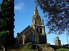
St Anne's Church, Brown Edge - geograph.org.uk - 5342559.jpg 1,600 × 1,200; 614 KB
-
St Anne's Vale, Brown Edge - geograph.org.uk - 3670666.jpg 1,024 × 768; 255 KB
-
St Anne's Vale, Brown Edge - geograph.org.uk - 5342139.jpg 1,600 × 1,200; 565 KB
-
St. Anne Church, Brown Edge - geograph.org.uk - 5057680.jpg 1,500 × 1,000; 1.2 MB
-
Standing deadwood - geograph.org.uk - 2376933.jpg 800 × 569; 232 KB
-
Standing on tiptoe - geograph.org.uk - 2448633.jpg 800 × 774; 227 KB
-
Sun on the leaves - geograph.org.uk - 2376918.jpg 800 × 624; 257 KB
-
Through the arch - geograph.org.uk - 2298367.jpg 2,045 × 1,421; 831 KB
-
Through the door - geograph.org.uk - 2298523.jpg 1,979 × 1,484; 940 KB
-
To the tip - geograph.org.uk - 2296932.jpg 2,024 × 1,350; 549 KB
-
Top of the steps - geograph.org.uk - 2371248.jpg 800 × 563; 242 KB
-
Towards the dam - geograph.org.uk - 2452660.jpg 800 × 600; 153 KB
-
Trig point at Brown Edge, Staffs - geograph.org.uk - 5243490.jpg 5,184 × 2,920; 7.08 MB
-
Up the path - geograph.org.uk - 2298280.jpg 1,903 × 1,380; 666 KB
-
Up the steps - geograph.org.uk - 2376943.jpg 800 × 600; 235 KB
-
Valley of the 'Head of Trent' - geograph.org.uk - 5749769.jpg 3,776 × 2,520; 3.73 MB
-
Valve house - geograph.org.uk - 2452705.jpg 800 × 600; 133 KB
-
View over the fields - geograph.org.uk - 2298005.jpg 1,903 × 1,380; 548 KB
-
Wildlife Well dressing 2007 - geograph.org.uk - 503929.jpg 531 × 640; 213 KB
-
Wood Anemone flower - geograph.org.uk - 2371395.jpg 800 × 709; 107 KB
-
Wood Anemones - geograph.org.uk - 2371384.jpg 800 × 549; 228 KB
-
Wood Sorrel - geograph.org.uk - 2370062.jpg 800 × 660; 207 KB
-
Wood Sorrel growing on a tree - geograph.org.uk - 2375816.jpg 512 × 800; 228 KB
-
Woodside Avenue, Brown Edge - geograph.org.uk - 3672216.jpg 1,024 × 768; 118 KB
-
Yellow Rhododendron - geograph.org.uk - 2406196.jpg 800 × 752; 281 KB


