Category:Brotton
Jump to navigation
Jump to search
village in the United Kingdom  | |||||
| Upload media | |||||
| Instance of | |||||
|---|---|---|---|---|---|
| Location | Skelton and Brotton, Redcar and Cleveland, North Yorkshire, North East England, England | ||||
 | |||||

Subcategories
This category has the following 4 subcategories, out of 4 total.
Media in category "Brotton"
The following 54 files are in this category, out of 54 total.
-
 A174 Skelton Bypass towards Brotton. - geograph.org.uk - 225052.jpg 640 × 422; 32 KB
-
 Bird Flight Goit, Hunt Cliff - geograph.org.uk - 1625533.jpg 640 × 480; 102 KB
-
 Brotton Hospital - geograph.org.uk - 42805.jpg 640 × 480; 101 KB
-
 Brotton Hospital - geograph.org.uk - 670466.jpg 640 × 427; 67 KB
-
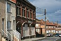
 Brotton Post Office - geograph.org.uk - 3885953.jpg 640 × 627; 90 KB
-
 Brotton.jpg 640 × 482; 65 KB
-
 Canterbury Road, Brotton - geograph.org.uk - 2831704.jpg 640 × 480; 51 KB
-
 Canterbury Road, Brotton - geograph.org.uk - 2831711.jpg 640 × 480; 58 KB
-

-
 Communication Tower and Reservoir - geograph.org.uk - 670499.jpg 640 × 427; 63 KB
-
 Double Bridge, North Skelton - geograph.org.uk - 334965.jpg 640 × 480; 65 KB
-
-
 From Cattersty Cliff - geograph.org.uk - 1600.jpg 640 × 427; 32 KB
-
 Gripps Farm near Brotton - geograph.org.uk - 1710501.jpg 2,048 × 1,536; 481 KB
-
 Houses on High Street, Brotton - geograph.org.uk - 3885974.jpg 640 × 480; 57 KB
-
 Hunley Hall Golf Course - geograph.org.uk - 1720094.jpg 2,048 × 1,536; 1.68 MB
-
 Hunt Cliff at Warsett Hill - geograph.org.uk - 1625580.jpg 640 × 480; 103 KB
-
 Ings Lane, Brotton - geograph.org.uk - 3885978.jpg 640 × 480; 53 KB
-
 Ings Lane, Brotton - geograph.org.uk - 3885982.jpg 640 × 480; 46 KB
-
 New Hill Gill Brotton - geograph.org.uk - 1714809.jpg 2,048 × 1,365; 561 KB
-

-
 Shops on High Street, Brotton - geograph.org.uk - 3885945.jpg 640 × 480; 62 KB
-
 St Margaret's Way, Brotton - geograph.org.uk - 3885984.jpg 640 × 480; 54 KB
-
 The Green Tree pub, Brotton - geograph.org.uk - 3885971.jpg 640 × 480; 65 KB
-
 The Railway Arms pub, Brotton - geograph.org.uk - 3885950.jpg 640 × 480; 51 KB
-
 Trig point on Warsett Hill - geograph.org.uk - 1720107.jpg 2,048 × 1,536; 1.65 MB
-
 Above Cattersty Cliffs - geograph.org.uk - 337726.jpg 640 × 426; 64 KB
-
 Below Hunt Cliff - geograph.org.uk - 468683.jpg 640 × 427; 204 KB
-
 Below Hunt Cliff - geograph.org.uk - 468708.jpg 640 × 427; 211 KB
-
 Brotton - geograph.org.uk - 42588.jpg 640 × 480; 126 KB
-
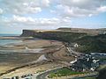
 Cattersty Sands - geograph.org.uk - 1073.jpg 640 × 427; 46 KB
-

-
 Farm Track to Gripps Farm - geograph.org.uk - 337753.jpg 640 × 426; 81 KB
-
 Farmland, Howe Hill - geograph.org.uk - 42595.jpg 640 × 480; 134 KB
-
 Former Co-op Building - geograph.org.uk - 342729.jpg 640 × 426; 77 KB
-
 Former School Buildings - geograph.org.uk - 343127.jpg 640 × 384; 65 KB
-
 Ginnel off Saltburn Road, Brotton - geograph.org.uk - 163355.jpg 482 × 640; 128 KB
-
 Gripps Farm - geograph.org.uk - 343124.jpg 640 × 384; 72 KB
-
 House Near Kilton Castle - geograph.org.uk - 216690.jpg 640 × 480; 98 KB
-
 Hummersea Cliff - geograph.org.uk - 342733.jpg 640 × 426; 75 KB
-
 Hunt Cliff with Warset Hill above - geograph.org.uk - 442616.jpg 640 × 480; 110 KB
-
 Huntcliff Foot - geograph.org.uk - 414292.jpg 640 × 426; 77 KB
-
 Huntcliff Foot - geograph.org.uk - 414297.jpg 640 × 426; 56 KB
-
-
 Huntley Hall Golf Course - geograph.org.uk - 163361.jpg 640 × 480; 47 KB
-
 Iron Fence and Arable Field - geograph.org.uk - 670355.jpg 640 × 427; 85 KB
-
 Ironstone Nodules, Bird Flight Goit - geograph.org.uk - 468707.jpg 640 × 427; 232 KB
-
 Kilton Lane Roundabout, A174 - geograph.org.uk - 42599.jpg 640 × 480; 130 KB
-
 Kilton Lane, Brotton - geograph.org.uk - 163613.jpg 640 × 482; 47 KB
-
 Maynard Arms - geograph.org.uk - 343123.jpg 640 × 426; 71 KB
-
 North Skelton Club - geograph.org.uk - 42582.jpg 640 × 480; 80 KB
-
 Outskirts of Brotton - geograph.org.uk - 670464.jpg 640 × 427; 61 KB
-
 Path and poles - geograph.org.uk - 611025.jpg 480 × 640; 88 KB
-
 Sea Sculptured Rocks, Below Huntcliff - geograph.org.uk - 468702.jpg 640 × 427; 257 KB


