Category:Brompton, Kent
Jump to navigation
Jump to search
village in Kent, UK  Melville Court à Brompton | |||||
| Upload media | |||||
| Instance of | |||||
|---|---|---|---|---|---|
| Location | Medway, Kent, South East England, England | ||||
 | |||||
Subcategories
This category has the following 4 subcategories, out of 4 total.
Media in category "Brompton, Kent"
The following 200 files are in this category, out of 659 total.
(previous page) (next page)-
 3.7 Inch Heavy Anti-aircraft Gun, Fort Amherst - geograph.org.uk - 2592672.jpg 4,288 × 3,216; 4.73 MB
-
 58 Mill Rd - geograph.org.uk - 2922041.jpg 640 × 430; 63 KB
-

-
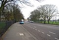
 A231 - geograph.org.uk - 3889641.jpg 640 × 430; 99 KB
-
 A231, Brompton - geograph.org.uk - 2730108.jpg 640 × 430; 53 KB
-
 A231, Brompton Rd, Gillingham - geograph.org.uk - 1148718.jpg 640 × 430; 79 KB
-

-
 Admiral's Cottage, Chatham Dockyard - geograph.org.uk - 4215463.jpg 640 × 427; 122 KB
-
 Aggregates Terminal, Medway City Estate (at night) - geograph.org.uk - 3201873.jpg 4,288 × 3,216; 3.5 MB
-

-
 All ending in Smoke, Great Lines Heritage Park - geograph.org.uk - 2679687.jpg 4,288 × 3,216; 6.55 MB
-
 Allotment gardens, Mill Road, Gillingham - geograph.org.uk - 3812586.jpg 3,488 × 2,616; 2.18 MB
-
 Allotment, Mill Rd - geograph.org.uk - 2195732.jpg 640 × 430; 147 KB
-
 Allotments, Mill Lane - geograph.org.uk - 2950791.jpg 640 × 430; 69 KB
-
 Amherst Redoubt, Brompton - geograph.org.uk - 3772126.jpg 3,488 × 2,616; 2.19 MB
-
 Amherst's Coffee House, Chatham - geograph.org.uk - 900569.jpg 640 × 480; 98 KB
-
 Anti-Tank Blocks, Fort Amherst - geograph.org.uk - 2592660.jpg 4,288 × 3,216; 6.37 MB
-
 Apartments, High St - geograph.org.uk - 2130329.jpg 640 × 430; 128 KB
-
 Arden St - geograph.org.uk - 3403997.jpg 640 × 396; 46 KB
-
 Arden St off Saunders St - geograph.org.uk - 2195703.jpg 640 × 430; 119 KB
-
 Arden Street, Gillingham - geograph.org.uk - 4221866.jpg 3,264 × 2,448; 1.39 MB
-
 Arden Street, Gillingham - geograph.org.uk - 4872914.jpg 3,264 × 2,448; 1.59 MB
-
 Arden Street, Gillingham - geograph.org.uk - 4872938.jpg 3,264 × 2,448; 1.59 MB
-

-

-
 Army, Navy ^ Air Force Veterans Club - geograph.org.uk - 3393647.jpg 640 × 430; 46 KB
-
 Athletics track, Brompton Rd - geograph.org.uk - 2950837.jpg 640 × 430; 106 KB
-
 Athletics Track, Medway Park - geograph.org.uk - 2195947.jpg 640 × 430; 135 KB
-
 Barclays, High St - geograph.org.uk - 2992802.jpg 640 × 400; 69 KB
-
 Barfleur Manor, Brompton - geograph.org.uk - 2108413.jpg 3,143 × 2,070; 2.68 MB
-
 Barrier Road, Chatham - geograph.org.uk - 3782680.jpg 3,488 × 2,616; 2.55 MB
-
 Beaufort House, Medway City Estate - geograph.org.uk - 3201898.jpg 4,288 × 3,216; 4.01 MB
-
 Before the event, Great Lines Heritage Park - geograph.org.uk - 3536091.jpg 4,288 × 3,216; 3.92 MB
-
 Before the Event, Great Lines Heritage Park - geograph.org.uk - 3536101.jpg 4,288 × 3,216; 4.95 MB
-
 Beheaded, Fort Amherst - geograph.org.uk - 2912179.jpg 4,288 × 3,216; 6.28 MB
-
 Beheaded, Fort Amherst - geograph.org.uk - 2912185.jpg 4,288 × 3,216; 6.98 MB
-
 Belevedere Battery - geograph.org.uk - 2415250.jpg 3,072 × 2,304; 2.1 MB
-
 Black Lion Leisure Centre - geograph.org.uk - 1144996.jpg 640 × 430; 79 KB
-
 Blesma Bike, Armed Forces Day - geograph.org.uk - 3537743.jpg 4,288 × 3,216; 5.94 MB
-
 Blue Christmas Lights - geograph.org.uk - 3801135.jpg 4,288 × 3,216; 2.67 MB
-
 Boat on River Medway - Chatham - geograph.org.uk - 2516103.jpg 1,600 × 1,176; 275 KB
-
 Bomb Disposal Man, Armed Forces Day - geograph.org.uk - 3537752.jpg 4,288 × 3,216; 4.85 MB
-
 Bridge builder, Royal Engineers Museum - geograph.org.uk - 2950818.jpg 640 × 430; 112 KB
-
 Bridge in Fort Amhurst - geograph.org.uk - 2415135.jpg 3,072 × 2,304; 2.56 MB
-

-

-
 Britton Farm Street, Gillingham - geograph.org.uk - 4872944.jpg 3,264 × 2,448; 1.98 MB
-
 Britton Street, Gillingham - geograph.org.uk - 2015233.jpg 3,488 × 2,616; 2.46 MB
-
 Britton Street, Gillingham - geograph.org.uk - 3639702.jpg 3,488 × 2,616; 2.13 MB
-
 Brompton Academy undergoing renovation (2) - geograph.org.uk - 2878724.jpg 4,288 × 3,216; 7.08 MB
-
 Brompton Academy undergoing renovation (3) - geograph.org.uk - 2878727.jpg 4,288 × 3,216; 4.86 MB
-
 Brompton Academy undergoing renovation (3) - geograph.org.uk - 2925157.jpg 4,288 × 3,216; 5.03 MB
-
 Brompton Academy, New Building (3) - geograph.org.uk - 3179444.jpg 4,288 × 3,216; 5.1 MB
-
 Brompton Barracks Gymnasium - geograph.org.uk - 2730105.jpg 640 × 372; 63 KB
-
 Brompton barracks gymnasium, Brompton (2) - geograph.org.uk - 3175880.jpg 4,288 × 3,216; 5.02 MB
-
 Brompton barracks gymnasium, Brompton - geograph.org.uk - 3175874.jpg 4,288 × 3,216; 6.62 MB
-
 Brompton Boundary Stone and Rivet - geograph.org.uk - 3277780.jpg 3,648 × 2,736; 2.45 MB
-

-
 Brompton Hill, Brompton - geograph.org.uk - 1365269.jpg 640 × 480; 66 KB
-
 Brompton Rd - geograph.org.uk - 2950840.jpg 640 × 430; 94 KB
-
-
 Brompton Sports Ground - geograph.org.uk - 3393641.jpg 640 × 371; 32 KB
-
 Brompton Sports Ground - geograph.org.uk - 3403794.jpg 640 × 430; 36 KB
-
 Brompton Sports Ground - geograph.org.uk - 3403799.jpg 640 × 430; 45 KB
-
 Brompton Sports Ground - geograph.org.uk - 3882540.jpg 640 × 395; 65 KB
-
 Building in Chatham Dockyard - geograph.org.uk - 6301834.jpg 1,886 × 1,226; 1.47 MB
-
 Building Site on Wood Street - geograph.org.uk - 1729125.jpg 2,580 × 1,932; 773 KB
-
 Building Site, Brompton - geograph.org.uk - 1133906.jpg 640 × 480; 81 KB
-
 Building works, Brompton Academy - geograph.org.uk - 3393696.jpg 640 × 430; 47 KB
-
 Cannons, Fort Amherst - geograph.org.uk - 3882447.jpg 640 × 430; 75 KB
-

-
 Caveyard Cavern, Fort Amherst - geograph.org.uk - 2912204.jpg 4,288 × 3,216; 5.2 MB
-
 CBM Brompton Barracks Gym - geograph.org.uk - 2746188.jpg 2,304 × 1,728; 867 KB
-
 Charred circle, Great Lines Heritage Park - geograph.org.uk - 3224094.jpg 4,288 × 3,216; 6.96 MB
-
 Chatham bonfire pile - geograph.org.uk - 3730639.jpg 4,288 × 3,216; 3.76 MB
-
 Chatham Dockyard - geograph.org.uk - 6300137.jpg 1,920 × 1,280; 1.01 MB
-
 Chatham Dockyard - geograph.org.uk - 6300144.jpg 1,876 × 1,212; 1.2 MB
-
 Chatham Dockyard - geograph.org.uk - 6301810.jpg 1,860 × 1,184; 1.19 MB
-
 Chatham Dockyard - geograph.org.uk - 6301851.jpg 1,920 × 1,280; 1.06 MB
-
 Chatham Dockyard - The Ropery - geograph.org.uk - 2481254.jpg 1,600 × 1,200; 579 KB
-
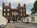
 Chatham Dockyard Main Gate - geograph.org.uk - 2793438.jpg 1,155 × 1,600; 701 KB
-
 Chatham Dockyard Map 1774.jpg 5,376 × 3,024; 4.51 MB
-
 Chatham from Fort Amherst - geograph.org.uk - 3882459.jpg 640 × 430; 84 KB
-

-

-
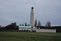
 Chatham Naval Memorial - geograph.org.uk - 2066649.jpg 2,616 × 3,488; 1.76 MB
-
 Chatham Naval Memorial - geograph.org.uk - 3393806.jpg 640 × 430; 36 KB
-
 Chatham Naval Memorial - geograph.org.uk - 3403558.jpg 640 × 430; 35 KB
-
 Chatham Naval Memorial - geograph.org.uk - 3403568.jpg 413 × 640; 27 KB
-
 Chatham Naval Memorial - geograph.org.uk - 3403584.jpg 442 × 640; 35 KB
-
 Chatham Naval Memorial - geograph.org.uk - 3403590.jpg 640 × 430; 35 KB
-
 Chatham Naval Memorial - geograph.org.uk - 3403595.jpg 640 × 430; 51 KB
-
 Chatham Naval Memorial - geograph.org.uk - 3403620.jpg 640 × 430; 35 KB
-
 Chatham Naval Memorial - geograph.org.uk - 3403644.jpg 640 × 355; 23 KB
-
 Chatham Naval Memorial - geograph.org.uk - 3889409.jpg 640 × 430; 45 KB
-
 Chatham Naval Memorial silhouetted - geograph.org.uk - 3403563.jpg 640 × 430; 30 KB
-
 Chatham Reach, Brompton - geograph.org.uk - 5408698.jpg 2,366 × 2,399; 954 KB
-
 Chatham Royal Dockyard, Main Gate - geograph.org.uk - 3473298.jpg 640 × 481; 448 KB
-
 Chatham's Bonfire 2013 - geograph.org.uk - 3730922.jpg 3,216 × 4,288; 3.04 MB
-
 Chatham, Pentagon Centre and Brook Theatre - geograph.org.uk - 2538464.jpg 3,072 × 2,304; 2.22 MB
-
 Childrens Play Area, Brompton - geograph.org.uk - 517095.jpg 640 × 480; 119 KB
-
 Church House, Maxwell Rd - geograph.org.uk - 3882512.jpg 640 × 430; 74 KB
-
 Circus attractions, Great Lines Heritage Park - geograph.org.uk - 3537767.jpg 4,288 × 3,216; 4.51 MB
-
 Closed Down Post Office, Brompton - geograph.org.uk - 681345.jpg 640 × 480; 83 KB
-
 Community Police Lodge - geograph.org.uk - 3882510.jpg 640 × 430; 103 KB
-
-
 Construction of paths on Great Lines - geograph.org.uk - 1729345.jpg 2,580 × 1,932; 1.64 MB
-
 Construction site - geograph.org.uk - 3010947.jpg 640 × 428; 96 KB
-
 Conway Hall, Conway Mews, Brompton - geograph.org.uk - 517091.jpg 640 × 480; 108 KB
-
 Conway Mews - geograph.org.uk - 3882516.jpg 640 × 430; 66 KB
-
 Conway Mews, Brompton - geograph.org.uk - 517088.jpg 640 × 480; 120 KB
-

-
 Corner of Mansion Row and Garden St - geograph.org.uk - 3882518.jpg 640 × 430; 83 KB
-
 Cornwall Road, Gillingham - geograph.org.uk - 1391034.jpg 640 × 480; 90 KB
-
 Creation of Medway Park - geograph.org.uk - 1359973.jpg 640 × 480; 80 KB
-
 Defensive Ditch towards Brompton - geograph.org.uk - 3175510.jpg 4,100 × 2,533; 7.22 MB
-
 Defensive Ditch towards Fort Amherst (2) - geograph.org.uk - 3175583.jpg 4,288 × 3,216; 6.98 MB
-
 Defensive Ditch towards Fort Amherst - geograph.org.uk - 3175505.jpg 4,288 × 3,216; 4.99 MB
-
 Defensive Ditch towards Prince Williams Reservoir - geograph.org.uk - 3175650.jpg 4,288 × 3,216; 7.46 MB
-
 Defensive ditch, Fort Amhurst - geograph.org.uk - 2912171.jpg 4,288 × 3,216; 7.32 MB
-
 Derelict buildings, Mill Rd - geograph.org.uk - 3169851.jpg 640 × 430; 78 KB
-

-
 Development Land, Amherst Hill (2) - geograph.org.uk - 3352429.jpg 4,288 × 3,216; 3.96 MB
-
 Development Land, Amherst Hill (3) - geograph.org.uk - 3352436.jpg 4,288 × 3,216; 4.93 MB
-
 Development Land, Amherst Hill (4) - geograph.org.uk - 3352440.jpg 4,288 × 3,216; 4.28 MB
-
 Development Land, Amherst Hill - geograph.org.uk - 3352426.jpg 4,288 × 3,216; 5.01 MB
-
 Diana House, Mill Rd - geograph.org.uk - 2922039.jpg 640 × 430; 55 KB
-
 Digging a path on the Great Lines - geograph.org.uk - 1729363.jpg 2,580 × 1,932; 692 KB
-
 Disused moat, Fort Amherst - geograph.org.uk - 3882460.jpg 640 × 430; 67 KB
-
 Disused moat, Fort Amherst - geograph.org.uk - 3882493.jpg 640 × 430; 129 KB
-
 Dock Rd (A231) - geograph.org.uk - 3897530.jpg 640 × 430; 54 KB
-
 Dock Road, Chatham - geograph.org.uk - 3812345.jpg 3,488 × 2,616; 2.15 MB
-
 Dog Agility Course, Great Lines Heritage Park - geograph.org.uk - 2945159.jpg 4,288 × 3,216; 6.56 MB
-
 East Road, Chatham Dockyard - geograph.org.uk - 6301831.jpg 1,920 × 1,280; 1.43 MB
-
 Edge, High St - geograph.org.uk - 3169818.jpg 640 × 430; 81 KB
-
 Electric Car at Medway Council - geograph.org.uk - 3065288.jpg 3,072 × 2,304; 1.93 MB
-
 Entrance hall to Mid Kent College - geograph.org.uk - 3816683.jpg 4,288 × 3,216; 4.61 MB
-
 Entrance to Chatham Dockyard - geograph.org.uk - 3812347.jpg 3,488 × 2,616; 2.21 MB
-
 Entrance to Fort Amherst - geograph.org.uk - 3882496.jpg 640 × 430; 63 KB
-
 Entrance to Fort Amhurst - geograph.org.uk - 2415122.jpg 3,072 × 2,304; 2.13 MB
-
 Entrance to Great Lines Heritage Park - geograph.org.uk - 2588593.jpg 4,288 × 3,216; 5.1 MB
-
 Entrance to Medway Park Leisure Centre - geograph.org.uk - 2195712.jpg 640 × 430; 191 KB
-
-
 Explore Medway, Royal Engineers Museum - geograph.org.uk - 3552953.jpg 4,288 × 3,216; 4.95 MB
-
 Express Food Centre - geograph.org.uk - 2992792.jpg 640 × 439; 60 KB
-
 Express Food Centre - geograph.org.uk - 3169843.jpg 640 × 430; 75 KB
-
 Express Food Centre - geograph.org.uk - 3393629.jpg 640 × 430; 55 KB
-
 Express Food Centre, Gillingham - geograph.org.uk - 2679676.jpg 4,288 × 2,936; 4.9 MB
-
 Express Food Store - geograph.org.uk - 2730111.jpg 640 × 430; 57 KB
-
 Feeding the crowds, Great Lines Heritage Park - geograph.org.uk - 3536109.jpg 4,288 × 3,216; 3.38 MB
-
 Feeding the crowds, Great Lines Heritage Park - geograph.org.uk - 3536192.jpg 4,288 × 3,216; 5.27 MB
-

-
 Field of fire, Brompton Road - geograph.org.uk - 2679707.jpg 4,288 × 3,216; 6.38 MB
-
 Field of Fire, Wood Street - geograph.org.uk - 2679717.jpg 4,288 × 3,216; 6.09 MB
-
 Figurehead of HMS Wellesley - Chatham Dockyard - geograph.org.uk - 2516115.jpg 1,600 × 1,450; 575 KB
-

-
 Flats on Middle Street, Brompton - geograph.org.uk - 636919.jpg 640 × 480; 81 KB
-
 Foot and Cycle Path to Great Lines - geograph.org.uk - 929070.jpg 640 × 480; 108 KB
-
 Football pitch near St Barbara's Garrison Church - geograph.org.uk - 3175704.jpg 4,288 × 3,216; 6.76 MB
-
 Football Play Area off Maxwell Road - geograph.org.uk - 914405.jpg 640 × 480; 108 KB
-
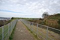
 Footbridge and Stairs, Melville Court - geograph.org.uk - 2945189.jpg 4,288 × 3,216; 5.76 MB
-
 Former Kitchener Barracks, Dock Road - geograph.org.uk - 6407209.jpg 3,264 × 2,448; 3.7 MB
-
 Former Ordnance Store, Gun Wharf - geograph.org.uk - 3889606.jpg 640 × 430; 89 KB
-
 Fort Amherst - geograph.org.uk - 3882489.jpg 640 × 430; 44 KB
-
 Fort Amherst - geograph.org.uk - 3882492.jpg 640 × 430; 112 KB
-
 Fort Amherst - geograph.org.uk - 3889406.jpg 640 × 430; 69 KB
-
 Fort Amherst - geograph.org.uk - 3889444.jpg 640 × 430; 85 KB
-
 Fort Amherst - geograph.org.uk - 3889593.jpg 640 × 430; 101 KB
-
 Fort Amherst Guardhouse and Chatham Lines - geograph.org.uk - 3175483.jpg 4,288 × 3,216; 7.06 MB
-
 Fort Amherst, Chatham - geograph.org.uk - 3772109.jpg 3,488 × 2,616; 2.28 MB
-
 Fort Amherst, Chatham - geograph.org.uk - 3772111.jpg 3,488 × 2,616; 2.19 MB
-
 Fort Amherst, Chatham - geograph.org.uk - 3772113.jpg 3,488 × 2,616; 2.24 MB
-
 Fort Amherst, Chatham - geograph.org.uk - 3772120.jpg 3,488 × 2,616; 2.25 MB
-
 Fox Street, Gillingham - geograph.org.uk - 2066465.jpg 3,488 × 2,616; 2.23 MB
-
 Fox Street, Gillingham - geograph.org.uk - 4221847.jpg 3,264 × 2,448; 1.48 MB
-
 Fox Street, Gillingham - geograph.org.uk - 4872932.jpg 3,264 × 2,448; 1.6 MB
-
 Function Room, King Charles Hotel - geograph.org.uk - 2195928.jpg 640 × 430; 149 KB
-
 Funhouse and train ride, Great Lines Heritage Park - geograph.org.uk - 3537772.jpg 4,288 × 3,216; 5.4 MB
-
 Garden Street, Brompton (1) - geograph.org.uk - 517117.jpg 640 × 480; 116 KB
-
 Garden Street, Brompton (2) - geograph.org.uk - 517121.jpg 640 × 480; 127 KB
-
 Garden Street, Brompton (3) - geograph.org.uk - 525262.jpg 640 × 480; 87 KB
-
 Garden Street, Brompton - geograph.org.uk - 1369779.jpg 640 × 480; 85 KB
-
 Garden Street, Brompton - geograph.org.uk - 1369783.jpg 640 × 480; 74 KB
-
 Garden Street, Brompton - geograph.org.uk - 3772153.jpg 3,488 × 2,616; 2.17 MB
-
 Garden Street, Brompton - geograph.org.uk - 4927797.jpg 3,264 × 2,448; 2.03 MB
-
 Garrison Church Hall, Maxwell Road - geograph.org.uk - 914402.jpg 640 × 480; 106 KB
-
 Garrison Church of St. Barbara, Brompton - geograph.org.uk - 1974901.jpg 3,488 × 2,616; 2.13 MB
-
 Garrison Sports Ground - geograph.org.uk - 2118434.jpg 640 × 430; 134 KB
-
 Garrison Sports Ground - geograph.org.uk - 2118437.jpg 640 × 430; 120 KB
-
 Garrison Sports Ground, Gillingham - geograph.org.uk - 2129836.jpg 640 × 430; 71 KB
-
 Garrison Sports Ground, Marlborough Rd - geograph.org.uk - 1243322.jpg 640 × 430; 106 KB
-
 Gatehouse - Chatham Dockyards - geograph.org.uk - 2516107.jpg 1,600 × 1,200; 379 KB
-
-

-
 Gillingham Library - geograph.org.uk - 2015245.jpg 3,488 × 2,616; 2.2 MB
-
 Gillingham Library - geograph.org.uk - 2130335.jpg 640 × 430; 134 KB
-
 Gillingham Library - geograph.org.uk - 2992794.jpg 640 × 430; 81 KB
-
 Gillingham War Memorial - geograph.org.uk - 3303361.jpg 430 × 640; 44 KB
-
 Gillingham War Memorial - geograph.org.uk - 3350840.jpg 640 × 430; 61 KB
-
 Gillingham War Memorial - geograph.org.uk - 3812640.jpg 3,488 × 2,616; 2.13 MB


_RMG_PY9721.jpg)


_-_geograph.org.uk_-_3201873.jpg)


_-_geograph.org.uk_-_3175576.jpg)


_-_geograph.org.uk_-_2878724.jpg)
_-_geograph.org.uk_-_2878727.jpg)
_-_geograph.org.uk_-_2925157.jpg)
_-_geograph.org.uk_-_3179444.jpg)

_-_geograph.org.uk_-_3175880.jpg)


_-_geograph.org.uk_-_3882508.jpg)


_-_geograph.org.uk_-_3175583.jpg)


_-_geograph.org.uk_-_3352429.jpg)
_-_geograph.org.uk_-_3352436.jpg)
_-_geograph.org.uk_-_3352440.jpg)


_-_geograph.org.uk_-_3897530.jpg)


_-_geograph.org.uk_-_517117.jpg)
_-_geograph.org.uk_-_517121.jpg)
_-_geograph.org.uk_-_525262.jpg)


