Category:Brisbane Valley Highway
Jump to navigation
Jump to search
Deutsch: Der Brisbane Valley Highway ist eine Fernstraße im Südosten des australischen Bundesstaates Queensland. Er zweigt vom Warrego Highway (A2) westlich von Ipswich in nordwestlicher Richtung ab und folgt dem Brisbane River flussaufwärts. Bei Harlin trifft er auf den D'Aguilar Highway (R17 / S85).
English: The Brisbane Valley Highway is a state highway in Queensland. It leaves the Warrego Highway near Ipswich and travels in a northwesterly direction, following the Brisbane River until it reaches the D'Aguilar Highway about south-east of Moore, where it ends. It is part of National Route 17, which continues, duplexing with the D'Aguilar Highway to Nanango and then becomes the Burnett Highway. State Route 85 is duplexed with the Brisbane Valley Highway from Esk to the D'Aguilar Highway.
highway in Queensland  | |||||
| Upload media | |||||
| Instance of | |||||
|---|---|---|---|---|---|
| Location | Queensland, AUS | ||||
| Length |
| ||||
| |||||
Media in category "Brisbane Valley Highway"
The following 8 files are in this category, out of 8 total.
-
 Brisbane Valley Highway crossing Fernvale.jpg 2,048 × 1,536; 2.02 MB
-
 Brisbane Valley Highway during 2011 floods.jpg 4,320 × 3,240; 5.81 MB
-
 Brisbane Valley Highway Wanora.jpg 2,048 × 1,536; 2.08 MB
-
 Brisbane Valley Highway, Fernvale, Queensland.jpg 600 × 450; 187 KB
-
 Fernvale Main Street.JPG 3,872 × 2,592; 2.35 MB
-
 Fireweed warning - panoramio.jpg 3,072 × 2,304; 1.96 MB
-
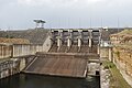 Wivenhoe dam wall.jpg 3,510 × 2,350; 1.58 MB
-
 Wivenhoe lakeside - panoramio.jpg 3,986 × 1,056; 638 KB


