Category:Bridges in Sowerby Bridge
Jump to navigation
Jump to search
Subcategories
This category has the following 7 subcategories, out of 7 total.
G
S
- Sowerby Long Bridge (8 F)
- Sowerby Viaduct (5 F)
Media in category "Bridges in Sowerby Bridge"
The following 58 files are in this category, out of 58 total.
-
 A footbridge over the Rochdale Canal - geograph.org.uk - 2970563.jpg 800 × 600; 117 KB
-
 A-frame on the canal towpath - geograph.org.uk - 3128836.jpg 2,000 × 1,473; 1.03 MB
-
 Benchmark on High Royd Bridge - geograph.org.uk - 6024825.jpg 683 × 1,024; 292 KB
-

-
-

-

-
 Bridge No 3, Rochdale Canal - geograph.org.uk - 3653864.jpg 1,600 × 1,200; 945 KB
-
 Bridge No.3 on the Rochdale Canal - geograph.org.uk - 5393052.jpg 3,586 × 2,620; 3.36 MB
-
 Bridge No.3, Rochdale Canal - geograph.org.uk - 3735044.jpg 2,000 × 1,500; 1.69 MB
-
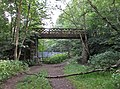
 Bridge on Sowerby Bridge Footpath 136 - geograph.org.uk - 2930385.jpg 2,000 × 1,472; 1.32 MB
-
 Bridge over the disused Rishworth branch line - geograph.org.uk - 3966635.jpg 2,000 × 1,442; 1.32 MB
-
 Bridge over the old railway near Dodge Royd Wood - geograph.org.uk - 3104590.jpg 2,048 × 1,536; 534 KB
-
-
 Canal Bridge - geograph.org.uk - 2532460.jpg 800 × 520; 192 KB
-
 Canal Footbridge near Sowerby Bridge - geograph.org.uk - 2532457.jpg 640 × 425; 125 KB
-
 Chain Bridge 1 - geograph.org.uk - 2533100.jpg 800 × 380; 111 KB
-
 Chapel Lane Bridge over the Calder and Hebble Navigation - geograph.org.uk - 6453990.jpg 2,000 × 1,569; 2.04 MB
-
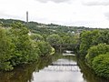
 Confluence of Rivers Calder and Ryburn, Sowerby Bridge - geograph.org.uk - 2953259.jpg 2,105 × 1,404; 1.23 MB
-

-
 Cycle route to Sowerby - geograph.org.uk - 6065670.jpg 1,024 × 768; 253 KB
-
 Fall Lane on the railway bridge, Sowerby Bridge - geograph.org.uk - 4490388.jpg 2,010 × 1,500; 915 KB
-
 Fall Lane over Mearclough Bridge - geograph.org.uk - 1602937.jpg 640 × 425; 102 KB
-
 Footbridge over the River Calder, Sowerby Bridge - geograph.org.uk - 2130642.jpg 1,485 × 2,000; 855 KB
-
 Footbridge over the River Calder, Sowerby Bridge - geograph.org.uk - 4624840.jpg 1,024 × 768; 187 KB
-

-

-
 Footpath crossing a factory yard, Norland - geograph.org.uk - 4884485.jpg 1,995 × 1,437; 743 KB
-
 Gas pipes over the canal - geograph.org.uk - 2054763.jpg 480 × 640; 100 KB
-
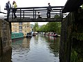 Gongoozlers on Lock 1 footbridge, Rochdale Canal - geograph.org.uk - 3977291.jpg 1,024 × 768; 190 KB
-
 High Royd Bridge 3 - geograph.org.uk - 2532452.jpg 800 × 535; 192 KB
-

-
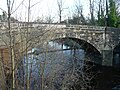
 High Royd Bridge, Sowerby Bridge - geograph.org.uk - 1866955.jpg 2,000 × 1,500; 1,012 KB
-

-
 Mearclough Bridge 2 - geograph.org.uk - 2533102.jpg 800 × 600; 161 KB
-
 Mearclough Bridge, Sowerby Bridge - geograph.org.uk - 4794058.jpg 2,048 × 1,536; 750 KB
-
 National Cycle Route bridge, simplified - geograph.org.uk - 4797157.jpg 2,048 × 1,536; 809 KB
-
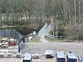
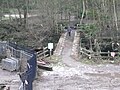
 New river bridge under construction at Milner Royd - geograph.org.uk - 2884605.jpg 2,000 × 1,350; 610 KB
-
 On the footbridge over the disused railway, Norland - geograph.org.uk - 4884452.jpg 1,536 × 2,048; 750 KB
-
 Pipe bridge over the canal - geograph.org.uk - 2054761.jpg 640 × 480; 209 KB
-
 Pipe bridge over the River Ryburn - geograph.org.uk - 3464284.jpg 1,500 × 2,000; 1.06 MB
-
 Railway bridge at west end of Holmes Road - geograph.org.uk - 5801379.jpg 1,024 × 683; 202 KB
-
 Railway Bridge over Holmes Road.jpg 1,024 × 683; 195 KB
-
 Railway bridge, Hollas Lane - geograph.org.uk - 4327824.jpg 2,000 × 1,500; 1.44 MB
-
 Repairs to Mearclough Bridge, Sowerby Bridge - geograph.org.uk - 4794053.jpg 2,048 × 1,536; 741 KB
-
 River Calder from Gas Works Bridge - geograph.org.uk - 1652244.jpg 640 × 480; 73 KB
-
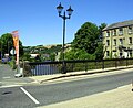
 River Ryburn from Victoria Bridge - geograph.org.uk - 1814416.jpg 640 × 480; 159 KB
-
 Road closed for bridge repairs - geograph.org.uk - 3097376.jpg 2,000 × 1,500; 883 KB
-

-
 Rochdale Canal, Sowerby Bridge - geograph.org.uk - 702700.jpg 640 × 427; 90 KB
-
 Sitting area off West Street, Sowerby Bridge - geograph.org.uk - 2884529.jpg 2,000 × 1,500; 1.39 MB
-
-
 The new Hollas Lane Bridge - geograph.org.uk - 3264313.jpg 2,000 × 1,500; 1.13 MB
-
 The new Sterne Bridge - geograph.org.uk - 4625115.jpg 1,024 × 768; 226 KB
-
 The Rochdale Canal at Hollins Mill Lane - geograph.org.uk - 5388691.jpg 4,550 × 2,468; 2.63 MB
-
 Towpath approaching the Canal Road bridge - geograph.org.uk - 3128849.jpg 2,000 × 1,471; 1.15 MB
-

-


