Category:Bridges in County Cork
Jump to navigation
Jump to search
Counties of the Republic of Ireland: Carlow · Cavan · Clare · Cork(1) · Donegal · Fingal(2) · Galway(3) · Kerry · Kildare · Kilkenny · Laois · Leitrim · Limerick · Longford · Louth · Mayo · Meath · Monaghan · Offaly · Roscommon · Sligo · South Dublin(2) · Tipperary(4) · Waterford · Westmeath · Wexford · Wicklow – Separate cities: Cork(1) · Dublin(2) · – Former counties: Dublin(2) · Former counties of Northern Ireland: Antrim · Armagh · Down · Fermanagh · Londonderry · Tyrone
Wikimedia category | |||||
| Upload media | |||||
| Instance of | |||||
|---|---|---|---|---|---|
| Category combines topics | |||||
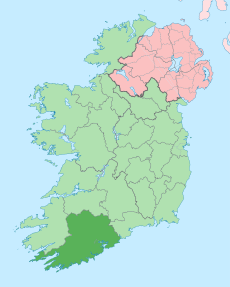
| County Cork | |||||
county in Ireland | |||||
| Instance of | |||||
| Location | Munster, Ireland | ||||
| Capital | |||||
| Legislative body |
| ||||
| Executive body |
| ||||
| Official language | |||||
| Population |
| ||||
| Area |
| ||||
| official website | |||||
 | |||||
Subcategories
This category has the following 13 subcategories, out of 13 total.
C
- Carrignavar Bridge (2 F)
- Cork bridge, Midleton (3 F)
- Cuskinny Bridge (3 F)
F
G
- Glanworth Bridge (10 F)
M
- Mallow Bridge (3 F)
R
- Rincrew Bridge (2 F)
S
- Slatty Viaduct (2 F)
T
- The Dandy Bridge (5 F)
Media in category "Bridges in County Cork"
The following 72 files are in this category, out of 72 total.
-
Aghalode Bridge - geograph.org.uk - 5814458.jpg 1,024 × 748; 142 KB
-
Aheen Bridge - geograph.org.uk - 3553731.jpg 640 × 427; 230 KB
-
Bandon Bridge.JPG 2,048 × 3,072; 2.08 MB
-
Belgooly Bridge in Belgooly (geograph 2116946).jpg 640 × 480; 164 KB
-
Belvelly Castle, Fota, Co. Cork (20291587808).jpg 2,000 × 1,514; 1.65 MB
-
Brandy Hall Bridge near Castletown-Berehaven, Co Cork.jpg 2,000 × 1,397; 1.63 MB
-
Bridge at Carrigbui - geograph.org.uk - 3561167.jpg 640 × 427; 209 KB
-
Bridge near Travaud Strand - geograph.org.uk - 2066516.jpg 640 × 426; 136 KB
-
Bridge on the Tim Healy Pass - geograph.org.uk - 1380762.jpg 640 × 480; 88 KB
-
Bridge on the Tim Healy Pass - geograph.org.uk - 1380791.jpg 640 × 480; 96 KB
-
Bridge over Sullane River - geograph.org.uk - 820084.jpg 640 × 480; 172 KB
-
Bridge over the Gearagh - geograph.org.uk - 483706.jpg 640 × 426; 111 KB
-
Bridge over the River Bandon - geograph.org.uk - 596671.jpg 640 × 480; 85 KB
-
Bridge over the River Ilen - geograph.org.uk - 3551525.jpg 800 × 600; 256 KB
-
Bridge over the Youghal Bypass - geograph.org.uk - 6054106.jpg 800 × 533; 655 KB
-
Bridge pilaster on disused road bridge - geograph.org.uk - 1396051.jpg 480 × 640; 311 KB
-
Bridge to Inishbeg - geograph.org.uk - 4958621.jpg 4,320 × 3,240; 2.93 MB
-
Clonakilty2.jpg 840 × 1,120; 427 KB
-
Cork, 2001 - panoramio (1).jpg 1,600 × 889; 432 KB
-
County Cork - Ballyhooly Bridge - .jpeg 2,048 × 1,536; 1.39 MB
-
County Cork - Bealahacreagh Bridge - 20180914135604.jpg 6,000 × 4,000; 4.14 MB
-
County Cork - Bealahacreagh Bridge - 20180914140450.jpg 6,000 × 4,000; 5.58 MB
-
Disused railway bridge at Waterfall - geograph.org.uk - 5436916.jpg 1,024 × 768; 177 KB
-
Disused road bridge - geograph.org.uk - 1370864.jpg 480 × 640; 119 KB
-
Disused road bridge - geograph.org.uk - 1396066.jpg 640 × 480; 298 KB
-
Dripsey Bridge (geograph 5815220).jpg 1,024 × 768; 221 KB
-
Dromcarra Bridge - geograph.org.uk - 5814099.jpg 1,024 × 768; 213 KB
-
Fly the flag - geograph.org.uk - 2116667.jpg 640 × 480; 146 KB
-
Footbridge and Viaduct - geograph.org.uk - 3944401.jpg 640 × 480; 79 KB
-
Goleen Bridge - geograph.org.uk - 2917624.jpg 1,024 × 768; 202 KB
-
Haulbowline Island - geograph.org.uk - 3666550.jpg 1,024 × 768; 185 KB
-
Lag Bridge, 1 - geograph.org.uk - 5225733.jpg 1,600 × 901; 568 KB
-
Lag Bridge, 2 - geograph.org.uk - 5225737.jpg 1,600 × 1,200; 801 KB
-
Lag Bridge, 3 - geograph.org.uk - 5225744.jpg 1,600 × 1,200; 898 KB
-
Lake near Rostellan Wood - geograph.org.uk - 2944022.jpg 4,784 × 1,264; 2.09 MB
-
Morris's Bridge, Dromduff nr. Macroom - geograph.org.uk - 734777.jpg 640 × 480; 142 KB
-
N71 Road Bridge - geograph.org.uk - 1382887.jpg 640 × 480; 87 KB
-
Old disused railway bridge over a country road - geograph.org.uk - 4898576.jpg 1,600 × 1,200; 525 KB
-
Old railway bridge over road - geograph.org.uk - 3117863.jpg 1,024 × 768; 238 KB
-
On the N22 Bridge - geograph.org.uk - 989541.jpg 640 × 480; 46 KB
-
Over Inniscarra Bridge - geograph.org.uk - 994241.jpg 640 × 480; 75 KB
-
Queen's Square, Fermoy, Co. Cork (8642608252).jpg 2,000 × 1,517; 1.4 MB
-
Railway bridge - geograph.org.uk - 1382858.jpg 640 × 480; 96 KB
-
Railway line - geograph.org.uk - 552744.jpg 640 × 480; 44 KB
-
Reen Bridge - geograph.org.uk - 264398.jpg 640 × 480; 93 KB
-
Road bridge on Cork to Kinsale road - geograph.org.uk - 1396077.jpg 640 × 475; 179 KB
-
Rocky Island (geograph 3666538).jpg 1,024 × 768; 148 KB
-
Shournagh River at Foxs Bridge near Courtbrack, Cork (geograph 3090119).jpg 3,648 × 2,736; 3.92 MB
-
The Boys of Ballydehob (8746216317).jpg 2,000 × 1,515; 1.32 MB
-
The Bridge over Bandon River - geograph.org.uk - 596673.jpg 640 × 480; 95 KB
-
The Bridge to Haulbowline Island - geograph.org.uk - 5039743.jpg 1,024 × 768; 215 KB
-
The bridge to Haulbowline Island - geograph.org.uk - 5041037.jpg 1,024 × 768; 142 KB
-
The Line, Rochestown, Cork, Ireland.jpg 720 × 960; 42 KB
-
The Promenade at Cobh - geograph.org.uk - 596574.jpg 519 × 640; 123 KB
-
The Watergrasshill Bypass.JPG 4,000 × 3,000; 2.85 MB
-
Bridge at Mill Little - geograph.org.uk - 756421.jpg 640 × 480; 150 KB
-
Funcheon River - geograph.org.uk - 308779.jpg 640 × 480; 116 KB
-
Ring Bridge - geograph.org.uk - 406558.jpg 640 × 480; 83 KB


