Category:Bricked-up doors in the United Kingdom
Jump to navigation
Jump to search
Subcategories
This category has only the following subcategory.
E
Media in category "Bricked-up doors in the United Kingdom"
The following 48 files are in this category, out of 48 total.
-
 Allington - St John The Baptist Church - geograph.org.uk - 1279789.jpg 640 × 480; 127 KB
-
 Avonmouth old fire station - geograph.org.uk - 784948.jpg 640 × 427; 220 KB
-
 Back Wharf Street, Sowerby Bridge - geograph.org.uk - 703132.jpg 640 × 427; 81 KB
-
 Beaumaris Castle 2015 132.jpg 3,456 × 5,184; 6.21 MB
-
 Bricked up - geograph.org.uk - 708896.jpg 640 × 427; 95 KB
-
 Bricked up door - geograph.org.uk - 1058352.jpg 426 × 640; 94 KB
-
 Bricked up door - geograph.org.uk - 1711748.jpg 1,024 × 683; 160 KB
-
 Bricked up doors - geograph.org.uk - 1595569.jpg 640 × 480; 70 KB
-
 Bricked up gate - geograph.org.uk - 938815.jpg 426 × 640; 97 KB
-
 Bricked up window - geograph.org.uk - 1304395.jpg 400 × 600; 80 KB
-
 Byfleet Manor House (geograph 3492825) (cropped and squared up).jpg 2,020 × 1,495; 390 KB
-
 Byfleet Manor House (geograph 3492825).jpg 2,048 × 1,536; 538 KB
-
 Chapel Lane railway bridge - geograph.org.uk - 957235.jpg 640 × 480; 54 KB
-
 Clanville - Brick And Flint Cottage - geograph.org.uk - 789957.jpg 640 × 480; 133 KB
-
 Closed door, Manor Farm - geograph.org.uk - 1197560.jpg 426 × 640; 135 KB
-
 Demolition of a Controversial Factory - geograph.org.uk - 1125754.jpg 427 × 640; 124 KB
-
 Dolyhir Station - geograph.org.uk - 1552787.jpg 640 × 427; 71 KB
-
 Doors to the cave - geograph.org.uk - 1294027.jpg 640 × 426; 110 KB
-
 Gainsborough fire station - geograph.org.uk - 1631924.jpg 640 × 427; 171 KB
-
 In need of some work - geograph.org.uk - 999164.jpg 640 × 427; 211 KB
-

-
 John Whites House, Dorchester - geograph.org.uk - 1252479.jpg 640 × 428; 81 KB
-
 Kesgrave Hall - old kitchen steps - geograph.org.uk - 1031298.jpg 640 × 480; 100 KB
-

-
-
 North Door, St. Wilfrid's. - geograph.org.uk - 1106977.jpg 480 × 640; 137 KB
-
 Number 9 Store - Portsmouth Historic Dockyard.jpg 4,167 × 2,402; 1.16 MB
-
 Old Church of St Andrew bricked up door.jpg 712 × 1,072; 450 KB
-
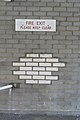 Old-fashioned Fire Exit sign - geograph.org.uk - 959836.jpg 427 × 640; 58 KB
-

-
 Pillbox at Cairnbulg Harbour - geograph.org.uk - 1610206.jpg 640 × 480; 56 KB
-
 Priest's door - geograph.org.uk - 593707.jpg 427 × 640; 87 KB
-

-

-

-
 South side of the church - geograph.org.uk - 1561421.jpg 426 × 640; 70 KB
-
 Station from the line - geograph.org.uk - 1552844.jpg 640 × 427; 91 KB
-
 Thatched Cottage - geograph.org.uk - 1620705.jpg 479 × 640; 84 KB
-
 The Clockhouse, Blackhorse Way - geograph.org.uk - 454972.jpg 640 × 480; 74 KB
-

-
 Turville Heath Telephone Exchange (1) - geograph.org.uk - 1658435.jpg 640 × 480; 128 KB
-

-
 Bricked up door - geograph.org.uk - 1650083.jpg 480 × 640; 93 KB
-
 Damson Cottage, The Smithies, Shropshire - geograph.org.uk - 456667.jpg 640 × 498; 169 KB
-
 Holly Cottage, High Street - geograph.org.uk - 759202.jpg 479 × 640; 84 KB
-
 Old Shropshire Cottage, The Smithies - geograph.org.uk - 456664.jpg 640 × 437; 142 KB
-
 Steele Street, Chester - geograph.org.uk - 289584.jpg 640 × 480; 53 KB
-
 Wainscott Primary School - geograph.org.uk - 333252.jpg 640 × 480; 108 KB


_(cropped_and_squared_up).jpg)
.jpg)


_-_geograph.org.uk_-_1658435.jpg)


