Category:Brentford, London Borough of Hounslow
Jump to navigation
Jump to search
town in west London, England  | |||||
| Upload media | |||||
| Instance of |
| ||||
|---|---|---|---|---|---|
| Location | London Borough of Hounslow, Greater London, London, England | ||||
| Located in or next to body of water | |||||
| Area |
| ||||
| Different from | |||||
 | |||||
Subcategories
This category has the following 37 subcategories, out of 37 total.
B
- Brentford railway station (58 F)
- Brentford War Memorial (9 F)
C
- Clitheroe's Lock No 99 (7 F)
F
G
H
- Hilton London Syon Park (3 F)
K
L
- Liquidity (8 F)
M
- Musical Museum, Brentford (36 F)
P
- Pyrene Building (6 F)
S
T
- Thames Lock, Brentford (5 F)
W
- Watermans, Brentford (12 F)
Media in category "Brentford, London Borough of Hounslow"
The following 184 files are in this category, out of 184 total.
-

-
 45 Brook Road South - geograph.org.uk - 2167654.jpg 640 × 427; 65 KB
-
 A Reindeer in Brentford - London. 2023-12-17.jpg 2,341 × 1,865; 1.27 MB
-
 A4 and M4, Brentford - geograph.org.uk - 58189.jpg 640 × 480; 60 KB
-
 Abellio 8450 on Route 235, Brentford Great West Quarter (11313629416).jpg 3,072 × 2,304; 2.96 MB
-
 Abellio 8575 on Route 235, Brentford Great West Quarter (11313489195).jpg 2,952 × 1,566; 4.82 MB
-
 Abellio 8575 on Route 235, Brentford Great West Quarter (11313570094).jpg 2,721 × 1,632; 3.22 MB
-
 Abellio 8575 on Route 235, Brentford Great West Quarter (11313644126).jpg 3,072 × 2,304; 2.65 MB
-
 Abellio 8809 on Route 235, Brentford Great West Quarter (11313449745).jpg 3,072 × 2,304; 2.37 MB
-
 Abellio 8809 on Route 235, Brentford Great West Quarter (11313512924).jpg 3,072 × 2,304; 2.86 MB
-
 Aerial view of Brentford High Street.jpg 1,600 × 1,200; 712 KB
-
 Aerial view of Brentford with Griffin Park football stadium.jpg 1,600 × 1,200; 800 KB
-
 Aerial view of Brentford, Boston Manor, M4 and A4.jpg 1,600 × 1,200; 785 KB
-
 An appeal to the public Fleuron N014716-1.png 626 × 380; 21 KB
-
 Au Morandarte Flickr DSC05572 (15315357797).jpg 3,264 × 2,448; 2.8 MB
-
 Augustus Close Footbridge in Brentford - geograph.org.uk - 4631963.jpg 800 × 613; 164 KB
-
-
Bettany Hughes on the The Roman River Crossing at Brentford.ogg 6 min 44 s; 3.49 MB
-
 Boat - panoramio (6).jpg 4,672 × 3,104; 1.7 MB
-
 Brentford Ait - geograph.org.uk - 921341.jpg 640 × 473; 56 KB
-
 Brentford Basin - geograph.org.uk - 3520298.jpg 640 × 430; 64 KB
-
 Brentford Basin - geograph.org.uk - 3520306.jpg 640 × 430; 60 KB
-
 Brentford Baths (North Face - 01).jpg 4,592 × 3,448; 10.86 MB
-
 Brentford Free Church - geograph.org.uk - 5706048.jpg 851 × 1,280; 393 KB
-
 Brentford Free Church - geograph.org.uk - 5762409.jpg 1,067 × 1,600; 426 KB
-
 Brentford Free Church.jpg 4,032 × 3,024; 4.23 MB
-
 Brentford from Kew Bridge - geograph.org.uk - 3432375.jpg 640 × 425; 309 KB
-
 Brentford from Kew Bridge - geograph.org.uk - 3433024.jpg 640 × 402; 357 KB
-
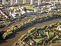
 Brentford from the air - geograph.org.uk - 5074314.jpg 640 × 445; 196 KB
-
 Brentford from the air - geograph.org.uk - 5074322.jpg 640 × 480; 202 KB
-
 Brentford magistrate's court.jpg 1,360 × 2,048; 280 KB
-
 Brentford Magistrates Court - geograph.org.uk - 2612772.jpg 640 × 466; 57 KB
-
 Brentford Police Station - geograph.org.uk - 2612836.jpg 447 × 640; 49 KB
-
 Brentford Police Station - geograph.org.uk - 2612857.jpg 640 × 430; 53 KB
-
 Brentford public baths (22305551250).jpg 1,024 × 768; 169 KB
-
 Brentford skyline 4670.JPG 3,648 × 2,736; 3.61 MB
-
 Brentford skyline.JPG 3,264 × 2,176; 4.24 MB
-
 Brentford Towers - geograph.org.uk - 2515188.jpg 4,000 × 3,000; 3.97 MB
-
 Brentford Towers - geograph.org.uk - 2515276.jpg 4,000 × 3,000; 4.01 MB
-
 Brentford Towers from the river - geograph.org.uk - 3242889.jpg 1,024 × 768; 159 KB
-
 Brentford, 1856 map.jpg 350 × 235; 86 KB
-
 Brentford, John's Boat Works at Lots Ait Boatyard.jpg 4,000 × 2,668; 2.7 MB
-
 Brentford, Lots Ait Boatyard from Ferry Wharf.jpg 3,500 × 2,333; 1.47 MB
-
 Brentford, Lots Ait Boatyard from the Thames Path.jpg 4,500 × 1,974; 1.95 MB
-
 Brentford, MSO Marine boatyard, Dock Road.jpg 6,000 × 2,054; 2.39 MB
-
 Brentford, The boatyard, Dock Road.jpg 3,500 × 2,625; 1.79 MB
-
 Brentford, UK - panoramio - IIya Kuzhekin (1).jpg 4,000 × 3,000; 3.13 MB
-
 Brentford, UK - panoramio - IIya Kuzhekin.jpg 4,000 × 3,000; 3.13 MB
-
 Brentford, view towards Kew Bridge and Brentford Ait.jpg 3,000 × 1,995; 2.29 MB
-
 Brentford-houseboats-5840.jpg 2,101 × 1,576; 1.84 MB
-
 Brentfordbath.jpg 1,053 × 619; 435 KB
-
 Bridge House South - geograph.org.uk - 4031751.jpg 640 × 430; 68 KB
-
 Bridge House South - geograph.org.uk - 6607825.jpg 1,024 × 684; 106 KB
-
 Bronze at Brentford - geograph.org.uk - 4912138.jpg 4,000 × 2,666; 6.42 MB
-
 Bâtiments à Brentford.jpg 4,032 × 3,024; 3.89 MB
-
-
 Cottages in Upper Butts, Brentford - geograph.org.uk - 5549890.jpg 1,886 × 1,316; 1.09 MB
-
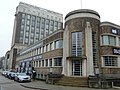
 Courthouse, Brentford - geograph.org.uk - 6187974.jpg 1,024 × 1,024; 369 KB
-
 Courts, Brentford - geograph.org.uk - 3528342.jpg 640 × 558; 73 KB
-
 Denis Brandt 1963 Scammell Highwayman Gardner tractor (694 GXO), November 1980.jpg 3,191 × 2,203; 1.31 MB
-
 Distillery Walk, Brentford - geograph.org.uk - 5192028.jpg 1,600 × 1,200; 509 KB
-
 Dock Road, Brentford. - geograph.org.uk - 257280.jpg 640 × 480; 141 KB
-
 Elevated M4 at Boston manor from the air - geograph.org.uk - 2357220.jpg 640 × 480; 228 KB
-
 Elevated M4 at Boston manor from the air - geograph.org.uk - 2357230.jpg 640 × 480; 230 KB
-
 England (9553519116).jpg 3,850 × 2,559; 10.74 MB
-
 English canal scene, early 1900s (2464880005).jpg 2,274 × 2,265; 879 KB
-
-
 Evening, Brentford's Modern Mile (13020811684).jpg 3,264 × 2,448; 2.23 MB
-
 Flats and boats above Brentford Locks - geograph.org.uk - 6188128.jpg 1,024 × 768; 382 KB
-
 Flats and boats, Brentford - geograph.org.uk - 6188141.jpg 1,024 × 768; 345 KB
-
 Flats at Town Meadow, Brenford - geograph.org.uk - 5549881.jpg 2,048 × 1,372; 1.09 MB
-
 Flats near Brentford Station - geograph.org.uk - 3528572.jpg 640 × 430; 71 KB
-
 Flats near Kew Bridge - geograph.org.uk - 5558964.jpg 640 × 480; 101 KB
-
 Flats on the corner of Clayponds Avenue and Occupation Lane - geograph.org.uk - 3653027.jpg 2,048 × 1,536; 1.56 MB
-

-
 Former Brentford Courts - geograph.org.uk - 5433803.jpg 640 × 426; 62 KB
-
 Former Brentford Police Station (01).jpg 4,372 × 3,267; 7.77 MB
-
 Former Brentford Police Station (02).jpg 3,124 × 4,282; 7.01 MB
-
 Former Currys HQ and factory.jpg 1,538 × 1,076; 214 KB
-
 Former Nat West Bank, Great West Road, Brentford.jpg 6,016 × 4,016; 11.01 MB
-
 Front-garden wall, The Butts, Brentford - geograph.org.uk - 4029473.jpg 752 × 1,024; 284 KB
-
 George Bulteel Fisher - The Thames at Brentford - 9600.jpg 2,048 × 1,395; 444 KB
-

-

-
 Gillette Building, Brentford - geograph.org.uk - 6021688.jpg 1,024 × 681; 215 KB
-
 Goat Wharf - geograph.org.uk - 4384576.jpg 800 × 530; 491 KB
-
 Goat Wharf - geograph.org.uk - 4384877.jpg 530 × 800; 521 KB
-
 Goat Wharf, Brentford - geograph.org.uk - 3087974.jpg 4,288 × 3,216; 3.62 MB
-
 GOC Kew to Osterley 064- Naked Grain (11150963136).jpg 3,771 × 2,832; 3.02 MB
-

-
 Great West Road (51306255322).jpg 3,648 × 2,736; 2.73 MB
-
 Grey Heron by the Thames, Brentford - geograph.org.uk - 596697.jpg 450 × 600; 140 KB
-
 Griffin Park from the air - geograph.org.uk - 4104454.jpg 640 × 480; 242 KB
-
 GSK Brentford from the air - geograph.org.uk - 5074331.jpg 640 × 480; 177 KB
-
 GSK House, Brentford from the air - geograph.org.uk - 4641877.jpg 640 × 480; 203 KB
-
 GSK House, Brentford from the air - geograph.org.uk - 6366509.jpg 1,024 × 768; 345 KB
-
 Gulls above The Thames Path at Brentford - geograph.org.uk - 6069749.jpg 3,286 × 2,437; 1.32 MB
-
 H91 to Lampton Corner (15315203020).jpg 3,264 × 2,448; 1.85 MB
-
 High-rise flats, Brentford - geograph.org.uk - 1972792.jpg 480 × 640; 71 KB
-
 House by the Market Place, Brentford - geograph.org.uk - 4030365.jpg 762 × 1,024; 171 KB
-
 House entrance, The Butts Estate, Brentford - geograph.org.uk - 4030145.jpg 741 × 1,024; 192 KB
-
 Houses on Boston Manor Road, Brentford - geograph.org.uk - 3410006.jpg 1,600 × 1,200; 603 KB
-
 Housing development off Brentford High Street - geograph.org.uk - 5735594.jpg 4,032 × 3,024; 3.23 MB
-
 Housing on Green Dragon Lane - geograph.org.uk - 1972771.jpg 640 × 478; 101 KB
-
 Housing on Hope Close, Brentford - geograph.org.uk - 5613975.jpg 1,024 × 768; 164 KB
-

-
 Industrial unit, The Ham - geograph.org.uk - 3528074.jpg 640 × 430; 51 KB
-
 Iron Bridge on the Grand Union, Brentford - geograph.org.uk - 2143074.jpg 1,280 × 960; 479 KB
-
 Junction on Windmill Road - geograph.org.uk - 1973183.jpg 640 × 449; 91 KB
-
 Kew and Brentford from the air - geograph.org.uk - 4355420.jpg 640 × 410; 141 KB
-
 Kew Bridge from the air - geograph.org.uk - 5074300.jpg 640 × 480; 196 KB
-
 Kew from the air - geograph.org.uk - 6080450.jpg 768 × 1,024; 816 KB
-
 Kew Gardens from the air - geograph.org.uk - 6080451.jpg 1,024 × 768; 768 KB
-
 Kew Palace from the air - geograph.org.uk - 5074307.jpg 640 × 480; 217 KB
-
 Kew Turnham Green 1785 map.jpg 584 × 468; 237 KB
-
 Lion Way - geograph.org.uk - 2612832.jpg 640 × 430; 67 KB
-
 Lionel Road, Brentford - geograph.org.uk - 4272593.jpg 2,560 × 1,920; 1.35 MB
-
 Lock, Dock & Reflection - Brentford - June 2016.jpg 4,000 × 3,000; 3.9 MB
-
 London bus route 235.jpg 1,280 × 960; 326 KB
-
 London Buses route 237 Brentford.jpg 1,600 × 1,200; 660 KB
-
 London Buses route 267 Brentford.jpg 1,600 × 1,200; 558 KB
-
 London england, high street canal near brentford - panoramio.jpg 2,816 × 2,112; 1.22 MB
-
 London Metropolitan Police Offices and St Paul's Church in Brentford - panoramio.jpg 2,484 × 1,863; 605 KB
-
 London Road, Brentford - geograph.org.uk - 3034536.jpg 1,600 × 1,067; 660 KB
-
 London United DE1 on Route H91, Brentford-Windmill Road (15031570230).jpg 3,264 × 2,448; 2.57 MB
-
 London United VH29 on Route H91, Brentford (18264823450).jpg 2,560 × 1,920; 993 KB
-
 Market Place, Brentford - geograph.org.uk - 3825687.jpg 2,304 × 1,728; 742 KB
-
 Market Place, Brentford - geograph.org.uk - 3825689.jpg 2,304 × 1,728; 738 KB
-
 Metroline route E2.jpg 3,072 × 2,304; 2.65 MB
-
 Metroline route E8.jpg 3,072 × 2,304; 2.44 MB
-
 Modern Flats at Brentford - geograph.org.uk - 3432343.jpg 574 × 640; 420 KB
-
 Mouth of the River Brent - geograph.org.uk - 4385866.jpg 800 × 530; 676 KB
-

-
 New Apartments - geograph.org.uk - 3433041.jpg 640 × 421; 371 KB
-

-

-

-
 Parking à Brentford 2.jpg 4,032 × 3,024; 4.37 MB
-
 Parking à Brentford.jpg 4,032 × 3,024; 3.43 MB
-

-
-

-
 Pump-house tower above apartments, Kew Bridge - geograph.org.uk - 6131743.jpg 768 × 1,024; 254 KB
-

-

-
 River Brent - geograph.org.uk - 6021687.jpg 1,024 × 681; 189 KB
-
 River Thames, Brentford, 2018-06 I.jpg 4,380 × 2,845; 10.1 MB
-
 River Thames, Brentford, 2018-06 II.jpg 4,592 × 3,448; 12.84 MB
-
 Road junction, Brentford - geograph.org.uk - 1972960.jpg 640 × 480; 89 KB
-

-
 Sculpture by Ferry Lane, Brentford - geograph.org.uk - 1086294.jpg 640 × 480; 68 KB
-
 St George's Church, Brentford (14933581467).jpg 3,578 × 5,367; 14.27 MB
-
 Syon Park and Brentford from the air - geograph.org.uk - 2577972.jpg 640 × 480; 161 KB
-
 Syon Park and Brentford from the air - geograph.org.uk - 2646453.jpg 640 × 480; 158 KB
-
 Thames Path in Brentford - geograph.org.uk - 2325118.jpg 1,280 × 960; 626 KB
-
 The Brentford Towers - geograph.org.uk - 3810649.jpg 758 × 1,024; 149 KB
-
 The Consultation of Surgeons (BM 1855,0609.1947).jpg 1,600 × 1,084; 625 KB
-
 The Grand Union Canal, Brentford - geograph.org.uk - 596694.jpg 640 × 480; 120 KB
-
 The Pocahontas Plaque in Brentford, London.jpg 2,964 × 3,973; 3.8 MB
-
 The present State of Surgery, or Modern Practice (BM 1868,0808.9821).jpg 1,600 × 1,023; 585 KB
-
 The Timothy David Hair Studio, Brentford - London 2024-03-25.jpg 4,000 × 2,315; 1.97 MB
-
 Tower two and three on Green Dragon Lane - geograph.org.uk - 3653072.jpg 2,048 × 1,536; 1.47 MB
-
 Tower two on Green Dragon Lane - geograph.org.uk - 3653082.jpg 2,048 × 1,536; 1.41 MB
-
 Towerblocks at Green Dragon Lane - geograph.org.uk - 4408367.jpg 640 × 480; 119 KB
-
 Towerblocks, Brentford - geograph.org.uk - 6021685.jpg 1,024 × 681; 221 KB
-
 Trico Factory - geograph.org.uk - 310499.jpg 640 × 435; 46 KB
-
 Trico Factory at Brentford - geograph.org.uk - 105270.jpg 434 × 640; 73 KB
-
 TVU Paragon Campus Brentford.jpg 3,456 × 2,592; 1.9 MB
-
 Wallis House - geograph.org.uk - 4406809.jpg 640 × 480; 144 KB
-
 Wallis House - geograph.org.uk - 4406811.jpg 480 × 640; 133 KB
-
 Wallis House - geograph.org.uk - 4406814.jpg 640 × 480; 116 KB
-
 Wallis House - geograph.org.uk - 4406822.jpg 480 × 640; 151 KB
-
 Wallis House - geograph.org.uk - 4406825.jpg 640 × 480; 138 KB
-
 Wallis House - geograph.org.uk - 4406827.jpg 480 × 640; 143 KB
-
 Wallis House - geograph.org.uk - 4408080.jpg 480 × 640; 156 KB
-
 Wallis House - geograph.org.uk - 4408083.jpg 480 × 640; 137 KB
-
 Wallis House Brentford.JPG 1,978 × 2,226; 1.48 MB
-
 West Cross Industrial Park from the air - geograph.org.uk - 5074351.jpg 640 × 480; 216 KB
-
 West Link House - geograph.org.uk - 6604093.jpg 1,024 × 684; 84 KB
-

-
 Windmill Road - geograph.org.uk - 1814954.jpg 640 × 480; 87 KB
-
 Windmill Road, Brentford - geograph.org.uk - 1814966.jpg 640 × 480; 86 KB
-
 Wrought-iron gateway arch, the Butts - geograph.org.uk - 4033197.jpg 690 × 1,024; 233 KB
-
 York Road, Brentford - geograph.org.uk - 2653305.jpg 640 × 480; 61 KB


.jpg)
.jpg)
.jpg)
.jpg)
.jpg)
.jpg)


.jpg)


.jpg)


.jpg)


.jpg)


.jpg)


,_November_1980.jpg)


.jpg)
.jpg)

.jpg)


.jpg)
.jpg)


.jpg)

.jpg)


.jpg)


.jpg)
.jpg)


_1_Heathrow_Airport_-_Victoria_Station_London00628_(48359826971).jpg)
_1_Heathrow_Airport_-_Victoria_Station_London00629_(48359810372).jpg)
.jpg)


.jpg)


.jpg)


.jpg)


,_RP-F-F25469-BT.jpg)