Category:Brechin, Angus
Jump to navigation
Jump to search
city and former royal burgh in Angus, Scotland, UK  | |||||
| Upload media | |||||
| Instance of |
| ||||
|---|---|---|---|---|---|
| Location |
| ||||
| Population |
| ||||
| Area |
| ||||
| official website | |||||
 | |||||
English: Brechin is a former royal burgh in Angus, Scotland. Traditionally Brechin is often described as a city because of its cathedral and its status as the seat of a pre-Reformation Roman Catholic diocese (which continues today as an episcopal seat of the Scottish Episcopal Church), however this status was never officially recognised. Nevertheless the designation is widely used, with examples being the City of Brechin and District Community Council, City of Brechin and Area Partnership, City of Brechin Civic Trust and Brechin City Football Club.
Français : Le Burgh Royal de Brechin est un burgh du comté d'Angus en Écosse. La ville est célèbre pour sa tour ronde de style irlandais du s, dont notamment une très belle tour et une porte de procession. Traditionnellement Brechin était considérée comme une Cité en raison de son statut de siège d'un diocèse catholique avant la Réforme (et qui est aujourd'hui encore un siège épiscopal de l'Église épiscopale écossaise), bien que le burgh n'ait pas de charte de cité. Le club de football de la ville se nomme cependant Brechin City FC. Au recensement de 2001 la population de Brechin était de 7 199 habitants.
Gàidhlig: 'S e baile ann an Aonghas ann an Alba an ear a tha ann am Breichin neo Brichin. 'S e seo na co-chomharran aige: 56° 43′ 47.78″ Tuath agus 2° 39′ 19.19″ Iar.
Norsk bokmål: Brechin er en by i Angus, Skottland. Den er kjent for Brechinkatedralen fra det 10. århundre, og er også bispesete for Brechin bispedømme i Skottlands episkopale kirke. På grunn av dette ble den lenge regnet som en city, men den har aldri fått kongelig charter som det. Den er derimot en kongelig burgh.
Subcategories
This category has the following 8 subcategories, out of 8 total.
Media in category "Brechin, Angus"
The following 92 files are in this category, out of 92 total.
-
 A small Fishing pond and Bothy - geograph.org.uk - 78750.jpg 640 × 475; 110 KB
-

-
 A90 underpass - geograph.org.uk - 511476.jpg 640 × 480; 115 KB
-
 A935 and Disused Petrol Station - geograph.org.uk - 112092.jpg 640 × 475; 86 KB
-

-

-
 Brechin Railway Station - geograph.org.uk - 672502.jpg 640 × 427; 59 KB
-
 Brechin United Co-operative Society Ltd, Angus. Co-op Plaque 2004.jpg 1,170 × 1,744; 254 KB
-
 Brechin-Scotland (Location).png 553 × 933; 177 KB
-
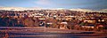
 Brechin.jpg 640 × 348; 40 KB
-
 Brechin2.jpg 640 × 231; 81 KB
-
 Church Lane, Brechin - geograph.org.uk - 828194.jpg 480 × 640; 84 KB
-
 Field and Hill of Wirren - geograph.org.uk - 112058.jpg 640 × 427; 43 KB
-
 Former Drill Hall, Brechin - geograph.org.uk - 4267864.jpg 640 × 427; 328 KB
-
 Glebe Park, Brechin 180321.jpg 4,000 × 2,248; 3.23 MB
-
 Glebe Park. - geograph.org.uk - 43596.jpg 640 × 425; 62 KB
-
 History of Brechin Bridge - geograph.org.uk - 647619.jpg 640 × 480; 129 KB
-
 Junction on Noranside to Brechin Road - geograph.org.uk - 126035.jpg 640 × 475; 96 KB
-

-
 Little brechin.jpg 640 × 480; 102 KB
-
 Maisondieu - geograph.org.uk - 374836.jpg 640 × 480; 64 KB
-
 Maisondieu Farm - geograph.org.uk - 115800.jpg 640 × 475; 73 KB
-
 Market Cross - geograph.org.uk - 905130.jpg 480 × 640; 68 KB
-

-
-
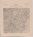
 Ordnance Survey One-Inch Sheet 43 Stonehaven, Published 1958.jpg 8,309 × 9,959; 8.47 MB
-
 Ordnance Survey One-Inch Sheet 43 Stonehaven, Published 1969.jpg 8,297 × 9,860; 30.59 MB
-
 Ordnance Survey One-Inch Sheet 50 Forfar, Published 1959.jpg 8,319 × 9,969; 9.71 MB
-
 Ordnance Survey One-Inch Sheet 50 Forfar, Published 1969.jpg 8,341 × 9,888; 32.39 MB
-
 Ordnance Survey One-Inch Sheet 51 Stonehaven and Brechin, Published 1946.jpg 12,210 × 9,350; 12.91 MB
-
 Panmure Street, Brechin - geograph.org.uk - 1065530.jpg 640 × 425; 47 KB
-
 Pieter van der Aa Brechin 1727.jpg 400 × 319; 31 KB
-

-

-
 Platforms in Brechin Station - geograph.org.uk - 511919.jpg 640 × 480; 112 KB
-
 Ridges and Furrows near Brechin - geograph.org.uk - 8395.jpg 640 × 480; 83 KB
-
 Road junction in Trinity - geograph.org.uk - 511480.jpg 640 × 480; 120 KB
-

-

-

-
 St Ninian's Square, Brechin - geograph.org.uk - 511911.jpg 640 × 480; 117 KB
-
-

-
-
-
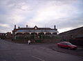
 The Caledonian Hotel - geograph.org.uk - 511912.jpg 640 × 480; 118 KB
-

-
 Townhead c.2018.png 662 × 329; 369 KB
-

-
 Trinity toll.jpg 640 × 427; 75 KB
-
 Trinityvillage.jpg 640 × 427; 71 KB
-
 Turin Home Farm - geograph.org.uk - 572501.jpg 640 × 427; 114 KB
-
 Unthank.jpg 640 × 426; 61 KB
-

-

-
 Watson Watt Memorial.jpg 3,456 × 4,608; 4.07 MB
-
 A field of bales - geograph.org.uk - 565729.jpg 640 × 409; 63 KB
-
 Brechin Railway Station - geograph.org.uk - 511917.jpg 640 × 480; 116 KB
-
 Brechin Sewerage Treatment Works - geograph.org.uk - 112095.jpg 640 × 475; 87 KB
-
 Burghill farm - geograph.org.uk - 116519.jpg 640 × 427; 69 KB
-
 Caledonian Railway Station - geograph.org.uk - 111241.jpg 640 × 475; 60 KB
-

-
 Entry into Brechin - geograph.org.uk - 511486.jpg 640 × 480; 118 KB
-
 Field and Copse - geograph.org.uk - 112046.jpg 640 × 475; 56 KB
-
 Field Boundary at Middle Drums - geograph.org.uk - 575988.jpg 427 × 640; 275 KB
-
 Field, Trees and Caldcots Farm - geograph.org.uk - 112067.jpg 640 × 475; 128 KB
-
 Fields and Leuchland Plantation - geograph.org.uk - 112064.jpg 640 × 475; 84 KB
-

-
 Gateway to Roughmoss, Brechin - geograph.org.uk - 647426.jpg 640 × 480; 116 KB
-
 Hay Bales in Storage on Kincraig Farm - geograph.org.uk - 122400.jpg 640 × 475; 143 KB
-
 Little Brechin - geograph.org.uk - 111291.jpg 640 × 475; 69 KB
-
-
 Mavisbank from Middle Drums - geograph.org.uk - 575990.jpg 640 × 427; 256 KB
-
 Middle Drums - geograph.org.uk - 575976.jpg 640 × 337; 195 KB
-
 Middle Drums - geograph.org.uk - 575979.jpg 640 × 376; 213 KB
-
 Middle Drums - geograph.org.uk - 576011.jpg 640 × 416; 211 KB
-
 Middle Drums - geograph.org.uk - 576017.jpg 515 × 640; 247 KB
-
 Montreathmont Moor - geograph.org.uk - 575956.jpg 427 × 640; 336 KB
-
 Muirton of Ardovie - geograph.org.uk - 572528.jpg 640 × 427; 119 KB
-
 Muirton of Ardovie - geograph.org.uk - 575962.jpg 640 × 427; 231 KB
-
 Newish House in Little Brechin - geograph.org.uk - 112671.jpg 640 × 475; 82 KB
-
 Park Bar, Brechin - geograph.org.uk - 511920.jpg 640 × 480; 116 KB
-
 Piperton Farm and Fields - geograph.org.uk - 111321.jpg 640 × 475; 66 KB
-
 Pittendreich Farm - geograph.org.uk - 115801.jpg 640 × 475; 65 KB
-

-
 Ploughed Fields and Pylons - geograph.org.uk - 115821.jpg 640 × 475; 57 KB
-
 South Esk River - geograph.org.uk - 115824.jpg 640 × 475; 103 KB
-
 Tattie Field at Middle Drums - geograph.org.uk - 575995.jpg 640 × 427; 286 KB
-
 Tattie Field at Middle Drums - geograph.org.uk - 575998.jpg 640 × 427; 307 KB
-
 Track to Leuchland - geograph.org.uk - 112061.jpg 640 × 475; 81 KB
-
 Track to Tillygloom Farmshop - geograph.org.uk - 65624.jpg 640 × 475; 90 KB
-
 Trig Point - geograph.org.uk - 115822.jpg 640 × 475; 63 KB


.png)


.jpg)
.jpg)
.jpg)


