Category:Breakwaters in England
Jump to navigation
Jump to search
Subcategories
This category has the following 7 subcategories, out of 7 total.
Media in category "Breakwaters in England"
The following 116 files are in this category, out of 116 total.
-
 A section of Portland Harbour breakwater - geograph.org.uk - 1858828.jpg 4,288 × 2,848; 2.93 MB
-

-
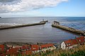
 A windy day at Staithes - geograph.org.uk - 947357.jpg 640 × 480; 68 KB
-
 Along the Breakwater - geograph.org.uk - 1484858.jpg 640 × 480; 57 KB
-
 Balaclava Bay - geograph.org.uk - 432979.jpg 640 × 480; 72 KB
-
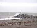
 Big wave^ - geograph.org.uk - 571373.jpg 640 × 480; 48 KB
-
 Boscastle DSC 7401.jpg 4,288 × 2,848; 8.72 MB
-
 Boscastle DSC 7402.jpg 4,288 × 2,848; 8.8 MB
-
 Boscastle DSC 8080.jpg 4,288 × 2,848; 8.7 MB
-

-
 Breakwater at Bembridge Point - geograph.org.uk - 96585.jpg 640 × 470; 266 KB
-
 Breakwater at North Wirral Coastal Park-by-Sue-Adair.jpg 640 × 480; 61 KB
-
 Breakwater at Port Mulgrave - geograph.org.uk - 948283.jpg 640 × 480; 203 KB
-
 Breakwater end at South entrance, Portland Harbour - geograph.org.uk - 1858916.jpg 4,288 × 2,848; 3.17 MB
-
 Breakwater light (3701753).jpg 1,024 × 768; 80 KB
-
 Breakwater N of Rossall School - geograph.org.uk - 52594.jpg 640 × 427; 96 KB
-

-
 Breakwater, Harwich - geograph.org.uk - 540665.jpg 640 × 480; 105 KB
-
 Breakwater, Langstone Rock - geograph.org.uk - 3452570.jpg 640 × 430; 73 KB
-
 Breakwater, Langstone Rocks - geograph.org.uk - 1116616.jpg 640 × 430; 60 KB
-
 Breakwater, New Brighton beach.JPG 2,048 × 1,536; 876 KB
-
 Breakwater, Shell Cove - geograph.org.uk - 3345569.jpg 640 × 430; 47 KB
-
 Breakwaters at Shoreham Harbour - geograph.org.uk - 1013366.jpg 640 × 480; 113 KB
-
-
 Angling Pitches, Eastern Breakwater - geograph.org.uk - 1064678.jpg 479 × 640; 48 KB
-
 Bude entrance to harbor and breakwater Cornwall England.jpg 1,075 × 843; 158 KB
-
 Caissons.jpg 1,024 × 768; 578 KB
-
 Checkered Fort Harbour - geograph.org.uk - 480370.jpg 640 × 362; 64 KB
-
 Checkered Fort Harbour 2 - geograph.org.uk - 480371.jpg 640 × 323; 56 KB
-
 Checkered Fort Harbour 3 - geograph.org.uk - 480373.jpg 640 × 338; 58 KB
-

-
 Disused building on breakwater - geograph.org.uk - 1858759.jpg 4,288 × 2,848; 3.47 MB
-
 Disused building on breakwater - geograph.org.uk - 1858814.jpg 4,288 × 2,848; 3.01 MB
-
 Disused building on the breakwater - geograph.org.uk - 1858797.jpg 4,288 × 2,848; 3 MB
-
 Disused buildings at the end of the breakwater - geograph.org.uk - 1859016.jpg 4,288 × 2,848; 2.98 MB
-
 Disused buildings on breakwater - geograph.org.uk - 1858981.jpg 4,288 × 2,848; 3.06 MB
-
 Disused buildings on the breakwater - geograph.org.uk - 1858805.jpg 4,288 × 2,848; 3.33 MB
-
 Disused buildings on the breakwater - geograph.org.uk - 1858974.jpg 4,288 × 2,848; 3.45 MB
-
 Disused torpedo gantry - geograph.org.uk - 1858772.jpg 4,288 × 2,848; 3.16 MB
-
 East and Inner Breakwaters - geograph.org.uk - 488827.jpg 640 × 468; 143 KB
-
 East Entrance - Northern Lighthouse - geograph.org.uk - 480375.jpg 640 × 258; 32 KB
-
 Eastbourne RNLI Museum.jpg 1,984 × 1,488; 1.31 MB
-
 Eastern Breakwater - geograph.org.uk - 488804.jpg 640 × 473; 104 KB
-
 Easternmost point of England - geograph.org.uk - 229059.jpg 640 × 480; 28 KB
-
 Breakwater at Egremont Ferry.jpg 4,995 × 3,390; 21.38 MB
-
 End of breakwater, Portland harbour - geograph.org.uk - 1858748.jpg 4,288 × 2,848; 3.38 MB
-
 Fishing on the breakwater - geograph.org.uk - 5424735.jpg 4,320 × 3,240; 2.33 MB
-
 Harwich Breakwater - geograph.org.uk - 61216.jpg 640 × 424; 66 KB
-
 Heugh Breakwater - geograph.org.uk - 615010.jpg 427 × 640; 58 KB
-

-
 Holy Well, Eastbourne 01.jpg 1,488 × 1,984; 938 KB
-
 Holy Well, Eastbourne 02.jpg 1,984 × 1,488; 1.26 MB
-

-
 Incoming Tide, South Gare breakwater - geograph.org.uk - 1718857.jpg 1,280 × 853; 375 KB
-
 King's Pier, East Weares, Portland - geograph.org.uk - 449466.jpg 480 × 640; 44 KB
-
 Lyme Regis Cobb Breakwater.jpg 3,820 × 2,536; 1.06 MB
-
 Ness Point breakwater - geograph.org.uk - 1821226.jpg 640 × 480; 114 KB
-
 North Entrance - geograph.org.uk - 480393.jpg 640 × 342; 41 KB
-
 North Entrance - North side - geograph.org.uk - 480395.jpg 640 × 420; 35 KB
-
 North Entrance - South Side - geograph.org.uk - 480396.jpg 640 × 428; 47 KB
-
 North Gare breakwater - geograph.org.uk - 164276.jpg 640 × 427; 53 KB
-
 North Gare Breakwater - geograph.org.uk - 568530.jpg 640 × 427; 60 KB
-
-
 Outer Checkered Fort - geograph.org.uk - 480381.jpg 640 × 258; 44 KB
-

-
 Polkerris breakwater (2024).JPG 2,730 × 1,820; 2.21 MB
-

-
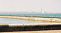
 Portland Harbour - geograph.org.uk - 666718.jpg 640 × 196; 35 KB
-
 Portland Harbour breakwater and disused buildings - geograph.org.uk - 1859011.jpg 4,288 × 2,848; 3.42 MB
-
 Portland, ships berthed in harbour - geograph.org.uk - 1098755.jpg 640 × 480; 56 KB
-
 Seaward end of Shell Bay - geograph.org.uk - 118062.jpg 640 × 480; 66 KB
-

-
 Section of Portland Harbour breakwater - geograph.org.uk - 1858908.jpg 4,288 × 2,848; 3.06 MB
-
 Section of the breakwater at Portland Harbour - geograph.org.uk - 1859032.jpg 4,288 × 2,848; 3.53 MB
-
 South Gare Breakwater - geograph.org.uk - 412353.jpg 640 × 480; 73 KB
-
 South Gare-1280.jpg 1,280 × 960; 187 KB
-
 South Pier - geograph.org.uk - 567370.jpg 640 × 456; 80 KB
-
 Sports Area, East Weare - geograph.org.uk - 1030073.jpg 480 × 640; 106 KB
-
 Staithes MMB 36.jpg 4,077 × 2,685; 4.36 MB
-
 Staithes MMB 38.jpg 4,147 × 2,637; 4.09 MB
-
 Staithes MMB 39.jpg 4,113 × 2,706; 4.63 MB
-
 Staithes MMB 40.jpg 3,858 × 2,507; 4.21 MB
-
 Staithes MMB 41.jpg 3,996 × 2,641; 4.36 MB
-
 Staithes MMB 42.jpg 4,095 × 2,595; 4.49 MB
-
 Staithes MMB 43.jpg 4,149 × 2,751; 3.8 MB
-
 Staithes MMB 44.jpg 4,149 × 2,547; 3.92 MB
-
 The "jaws" of Whitby Harbour - geograph.org.uk - 25606.jpg 640 × 260; 33 KB
-
 The end of the breakwater, Portland Harbour - geograph.org.uk - 1859023.jpg 4,288 × 2,848; 3.21 MB
-
 The Pier Gorleston-on-Sea - geograph.org.uk - 96264.jpg 640 × 427; 74 KB
-
 Torpedo Gantry - geograph.org.uk - 480380.jpg 640 × 355; 45 KB
-
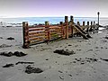
 Walcott revement.JPG 2,304 × 1,728; 1.68 MB
-

-
 West Breakwater - geograph.org.uk - 705566.jpg 640 × 479; 59 KB
-
 West Breakwater, Shoreham Harbour - geograph.org.uk - 179750.jpg 640 × 479; 84 KB
-
 Western Breakwater - geograph.org.uk - 1233608.jpg 480 × 640; 50 KB
-
 Western Breakwater, Brighton Marina - geograph.org.uk - 370206.jpg 640 × 476; 156 KB
-
 Western Breakwater, Brighton Marina - geograph.org.uk - 52008.jpg 640 × 479; 53 KB
-
 Whitby Harbour Entrance - geograph.org.uk - 312891.jpg 640 × 426; 63 KB
-
 Whitby piers.jpg 3,888 × 2,592; 6.11 MB
-
 Workington Harbour Breakwater - geograph.org.uk - 104559.jpg 640 × 480; 65 KB
-
 Yaverland beach breakwater.JPG 4,592 × 3,056; 3.64 MB
-
 Black-headed gulls feed by breakwater - geograph.org.uk - 807712.jpg 480 × 640; 183 KB
-
 Breakwater at New Brighton-by-Tom-Pennington.jpg 640 × 480; 41 KB
-
 Breakwater from the Cliffs, Walton - geograph.org.uk - 520114.jpg 640 × 468; 89 KB
-
 Breakwaters in Newbiggin Bay - geograph.org.uk - 598567.jpg 640 × 425; 56 KB
-
-
 Mockbeggar Wharf Breakwater, Leasowe-by-E-Pollock.jpg 640 × 480; 46 KB
-
 Newbiggin Point - geograph.org.uk - 272697.jpg 480 × 640; 90 KB
-
 Old Breakwater - geograph.org.uk - 59938.jpg 640 × 480; 77 KB
-
 Perch and Groyne at Morecambe - geograph.org.uk - 32842.jpg 640 × 480; 68 KB
-
 Sea Front - geograph.org.uk - 676178.jpg 640 × 480; 100 KB
-

-
 South Pier - geograph.org.uk - 567360.jpg 639 × 425; 81 KB
-
 Southern breakwater Harrington Harbour - geograph.org.uk - 425991.jpg 640 × 480; 104 KB
-

-
 The beach and breakwater at New Brighton-by-Roger-Davies.jpg 640 × 426; 50 KB


.jpg)


.JPG)


