Category:Bramhope
Jump to navigation
Jump to search
village in the United Kingdom  | |||||
| Upload media | |||||
| Instance of | |||||
|---|---|---|---|---|---|
| Location | Leeds, West Yorkshire, Yorkshire and the Humber, England | ||||
| Population |
| ||||
| Said to be the same as | Bramhope (Wikimedia duplicated page, civil parish) | ||||
 | |||||
Subcategories
This category has the following 6 subcategories, out of 6 total.
Media in category "Bramhope"
The following 200 files are in this category, out of 390 total.
(previous page) (next page)-
 20200808 First Leeds 35291.jpg 6,016 × 4,012; 12.27 MB
-
 A footpath off Black Hill Road - geograph.org.uk - 2094292.jpg 800 × 600; 350 KB
-
 A old farm building on Black Hill Road - geograph.org.uk - 2094303.jpg 800 × 600; 318 KB
-
 A tower off Moor Road - geograph.org.uk - 2550797.jpg 600 × 800; 210 KB
-
 A658 at Old Bramhope - geograph.org.uk - 5365155.jpg 640 × 481; 48 KB
-
 A660 approaching Dyneley Arms - geograph.org.uk - 5359082.jpg 2,711 × 1,626; 799 KB
-
 A660 near Dyneley Arms - geograph.org.uk - 5359068.jpg 640 × 427; 80 KB
-
 A660 Otley Road, Bramhope - geograph.org.uk - 3579119.jpg 1,024 × 682; 248 KB
-
 Another spoil tip above Bramhope tunnel - geograph.org.uk - 6107067.jpg 1,024 × 768; 240 KB
-
 Approaching West Breary - geograph.org.uk - 3403475.jpg 2,048 × 1,536; 575 KB
-
 Arthington Quarry (1) - geograph.org.uk - 5789255.jpg 1,024 × 768; 267 KB
-
 Arthington Quarry (2) - geograph.org.uk - 5789256.jpg 1,024 × 768; 298 KB
-
 Arthington Road heading north - geograph.org.uk - 2765761.jpg 640 × 480; 76 KB
-
 Arthington Road near East Breary Farm - geograph.org.uk - 4380651.jpg 1,024 × 682; 218 KB
-
 Ashcroft House, Bramhope - geograph.org.uk - 6713694.jpg 1,024 × 768; 203 KB
-
 Bank Top Farm, Blackhill Lane - geograph.org.uk - 174780.jpg 640 × 480; 101 KB
-
 Barn, Pool Bank - geograph.org.uk - 5240428.jpg 1,942 × 2,110; 959 KB
-
 Barns by Old Pool Bank - geograph.org.uk - 6645871.jpg 1,024 × 684; 229 KB
-
 Bird's eye view - geograph.org.uk - 6107072.jpg 1,024 × 768; 90 KB
-
 Black Hill Lane - geograph.org.uk - 2094308.jpg 800 × 600; 356 KB
-
 Black Hill Quarry (geograph 2768229).jpg 2,592 × 3,872; 3.56 MB
-
 Bramhope (37275626824).jpg 6,000 × 3,491; 11.32 MB
-
 Bramhope 018.jpg 2,572 × 3,440; 1.92 MB
-
 Bramhope 021.jpg 2,956 × 2,608; 1.76 MB
-
 Bramhope 025.jpg 3,152 × 2,096; 1.36 MB
-
 Bramhope 029.jpg 2,360 × 2,492; 1.31 MB
-
 Bramhope 034.jpg 3,384 × 1,920; 1.38 MB
-
 Bramhope 036.jpg 2,808 × 2,172; 1.37 MB
-
 Bramhope 041.jpg 3,524 × 2,212; 1.6 MB
-
 Bramhope Bowling Club - geograph.org.uk - 6718553.jpg 1,024 × 768; 172 KB
-
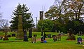
 Bramhope Cemetery - general view - geograph.org.uk - 6107078.jpg 1,024 × 768; 192 KB
-
 Bramhope Cemetery - geograph.org.uk - 691336.jpg 640 × 480; 108 KB
-
 Bramhope Cemetery - grave of Eddie Waring MBE - geograph.org.uk - 6107082.jpg 1,024 × 768; 284 KB
-
 Bramhope Cemetery - shelter - geograph.org.uk - 6107081.jpg 1,024 × 768; 226 KB
-
 Bramhope Cemetery with Fawcett memorial - geograph.org.uk - 6107079.jpg 1,024 × 768; 193 KB
-
 Bramhope Cross - geograph.org.uk - 6713661.jpg 1,024 × 768; 202 KB
-
 Bramhope Grove Farm - geograph.org.uk - 5347027.jpg 1,600 × 1,200; 362 KB
-
 Bramhope Jubilee planter - geograph.org.uk - 6713689.jpg 1,024 × 768; 304 KB
-
 Bramhope memorial garden - geograph.org.uk - 6713656.jpg 1,024 × 768; 221 KB
-
 Bramhope memorial recreation ground - geograph.org.uk - 6718559.jpg 1,024 × 768; 165 KB
-
 Bramhope Methodist Church - Christmas crib - geograph.org.uk - 6713641.jpg 1,024 × 767; 250 KB
-
 Bramhope Methodist Church - entrance - geograph.org.uk - 6713639.jpg 1,024 × 768; 212 KB
-
 Bramhope Methodist Church - geograph.org.uk - 6713638.jpg 768 × 1,022; 184 KB
-
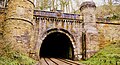
 Bramhope North Portal, Leeds - geograph.org.uk - 4861271.jpg 1,280 × 693; 846 KB
-
 Bramhope North Portal, Leeds - geograph.org.uk - 4861273.jpg 1,280 × 694; 763 KB
-
 Bramhope North Portal, Leeds - geograph.org.uk - 4861275.jpg 1,280 × 694; 606 KB
-
 Bramhope North Portal, Leeds - geograph.org.uk - 4861278.jpg 1,280 × 693; 593 KB
-
 Bramhope North Portal, Leeds - geograph.org.uk - 4861279.jpg 1,280 × 694; 493 KB
-
 Bramhope North Portal, Leeds - geograph.org.uk - 4861286.jpg 1,280 × 694; 429 KB
-
 Bramhope North Portal, Leeds - geograph.org.uk - 4861287.jpg 1,280 × 851; 1.03 MB
-
 Bramhope North Portal, Leeds - geograph.org.uk - 4861288.jpg 1,280 × 695; 902 KB
-
 Bramhope North Portal, Leeds - geograph.org.uk - 4861292.jpg 1,280 × 695; 870 KB
-
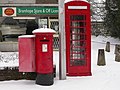 Bramhope Post Office - geograph.org.uk - 137015.jpg 640 × 480; 119 KB
-
 Bramhope Primary School, Tredgold Crescent - geograph.org.uk - 6456060.jpg 1,024 × 768; 210 KB
-
 Bramhope sighting tower - geograph.org.uk - 6107071.jpg 1,024 × 768; 158 KB
-
 Bramhope tennis courts - geograph.org.uk - 6718550.jpg 1,024 × 625; 150 KB
-
 Breary Court - Breary Lane - geograph.org.uk - 3244124.jpg 640 × 466; 55 KB
-
 Breary Court, Breary Lane - geograph.org.uk - 6713711.jpg 1,024 × 768; 154 KB
-
 Breary Grange Farm - geograph.org.uk - 5347031.jpg 1,600 × 1,200; 348 KB
-
 Breary Grange Farm, with wind turbine - geograph.org.uk - 6106006.jpg 1,024 × 768; 105 KB
-
 Breary Lane East - Bramhope - geograph.org.uk - 798386.jpg 640 × 440; 49 KB
-
 Breary Lane, Bramhope - geograph.org.uk - 5861825.jpg 4,000 × 3,000; 2.51 MB
-
 Breary Rise - Breary Lane - geograph.org.uk - 3244112.jpg 640 × 480; 63 KB
-
 Bridleway - Hall Rise - geograph.org.uk - 3244430.jpg 480 × 640; 139 KB
-
 Bridleway - Hall Rise - geograph.org.uk - 3244434.jpg 480 × 640; 91 KB
-
 Bridleway alongside Arthington Quarry - geograph.org.uk - 5789251.jpg 1,024 × 768; 406 KB
-
 Bridleway off Hall Rise, Bramhope - geograph.org.uk - 5789279.jpg 768 × 1,024; 267 KB
-

-
 Bridleway west from Hillcrest - geograph.org.uk - 3403498.jpg 2,048 × 1,536; 630 KB
-
 Bungalow on St Giles Garth, Bramhope - geograph.org.uk - 5988062.jpg 640 × 480; 66 KB
-
 Bus shelter, Leeds Road, Bramhope - geograph.org.uk - 6456063.jpg 1,024 × 768; 303 KB
-

-

-
 Camp House Farm (1) - geograph.org.uk - 6107065.jpg 1,024 × 768; 159 KB
-
 Camp House Farm (2) - geograph.org.uk - 6107088.jpg 1,024 × 768; 198 KB
-
 Christmas day in St Giles churchyard - geograph.org.uk - 6713688.jpg 1,024 × 768; 301 KB
-
 Church Hill - Bramhope - geograph.org.uk - 798362.jpg 640 × 432; 41 KB
-
 Church Hill joining the A660 at Bramhope - geograph.org.uk - 5400938.jpg 4,000 × 3,000; 3.49 MB
-
 Construction detail, Otley Road - geograph.org.uk - 2720084.jpg 3,872 × 2,592; 4.22 MB
-

-
 Copse adjacent to Arthington Road - geograph.org.uk - 5448303.jpg 1,024 × 768; 1.14 MB
-
 Cormorant, Golden Acre Park - geograph.org.uk - 259547.jpg 640 × 480; 58 KB
-
 Corner of a field, Golden Acre Park - geograph.org.uk - 5498463.jpg 1,024 × 768; 1.23 MB
-
 Crag Cottage - Eastgate, Bramhope - geograph.org.uk - 798342.jpg 640 × 544; 88 KB
-
 Crag Cottage, Breary Lane - geograph.org.uk - 6713712.jpg 1,024 × 768; 186 KB
-
 Creskeld Crescent - Creskeld Drive - geograph.org.uk - 3244473.jpg 640 × 480; 88 KB
-
 Creskeld Gardens - Creskeld Drive - geograph.org.uk - 3244469.jpg 640 × 480; 80 KB
-
 Creskeld Lane - Bramhope - geograph.org.uk - 798389.jpg 640 × 438; 53 KB
-
 Creskeld Lane - Leeds Road - geograph.org.uk - 3243652.jpg 640 × 480; 93 KB
-
 Creskeld Lane, Bramhope - geograph.org.uk - 3115117.jpg 4,320 × 3,240; 3.36 MB
-
 Cyclists passing through Bramhope - geograph.org.uk - 5789284.jpg 1,024 × 768; 132 KB
-
 Daffodils in Golden Acre Park - geograph.org.uk - 6106021.jpg 1,024 × 768; 345 KB
-
 Dancing to the music, Golden Acre Park - geograph.org.uk - 5498456.jpg 1,024 × 768; 963 KB
-
 Derelict Barn, East Breary Farm - geograph.org.uk - 4380637.jpg 1,024 × 682; 194 KB
-
 Detail of the spoil tip - geograph.org.uk - 6107057.jpg 1,024 × 768; 459 KB
-
 Disused quarry, Old Pool Bank - geograph.org.uk - 6718589.jpg 1,024 × 768; 312 KB
-
 Dyneley Arms - geograph.org.uk - 5240329.jpg 1,962 × 1,805; 744 KB
-
 Dyneley Arms - geograph.org.uk - 5359193.jpg 2,878 × 1,922; 1.01 MB
-
 Dyneley Arms - Leeds Road - geograph.org.uk - 1407697.jpg 640 × 445; 178 KB
-
 Dyneley Arms public house - geograph.org.uk - 5744669.jpg 1,024 × 683; 209 KB
-
 Dyneley Arms public house, Leeds Road - geograph.org.uk - 5744667.jpg 1,024 × 683; 241 KB
-
 East Breary Farm, Black Hill Road - geograph.org.uk - 2094301.jpg 800 × 600; 250 KB
-
 Eastgate - Bramhope - geograph.org.uk - 798355.jpg 640 × 445; 47 KB
-
 Eastgate, Bramhope - geograph.org.uk - 6713659.jpg 1,024 × 768; 156 KB
-
 Ebor Way approaching Fells Plantation - geograph.org.uk - 5370170.jpg 3,072 × 2,048; 1.45 MB
-
 Ebor Way approaching Fells Plantation - geograph.org.uk - 5370933.jpg 2,048 × 3,072; 1.16 MB
-
 Ebor Way entering Fells Plantation - geograph.org.uk - 5370944.jpg 3,072 × 2,048; 1.42 MB
-
 Elizabeth II postbox on Moor Road, Bramhope - geograph.org.uk - 5988231.jpg 2,848 × 3,824; 2.39 MB
-
 Elizabeth II postbox on Old Lane, Bramhope - geograph.org.uk - 5988226.jpg 2,799 × 4,930; 2.51 MB
-

-
 Entering Bramhope on Moor Road - geograph.org.uk - 6107074.jpg 1,024 × 768; 271 KB
-
 Entrance to Bramhope Cemetery - geograph.org.uk - 6107076.jpg 1,024 × 768; 314 KB
-
 Farmland near Bramhope - geograph.org.uk - 2765735.jpg 640 × 480; 71 KB
-
 Farmland, Hunger Hill - geograph.org.uk - 4199393.jpg 640 × 308; 72 KB
-
 Field above Bramhope Wood - geograph.org.uk - 3343485.jpg 4,608 × 3,456; 1.49 MB
-
 Field rising towards trees and bushes - geograph.org.uk - 5864137.jpg 1,499 × 1,079; 1.11 MB
-
 Footbridge over Bramhope Beck northeast of Green Gates - geograph.org.uk - 5347023.jpg 1,600 × 1,200; 320 KB
-
 Footpath - Breary Lane - geograph.org.uk - 3244120.jpg 480 × 640; 118 KB
-
 Footpath - Leeds Road - geograph.org.uk - 3243522.jpg 480 × 640; 68 KB
-
 Footpath - Leeds Road - geograph.org.uk - 3244127.jpg 480 × 640; 108 KB
-
 Footpath - Parklands Gate - geograph.org.uk - 3244115.jpg 480 × 640; 60 KB
-
 Footpath - Parklands Gate - geograph.org.uk - 3244117.jpg 480 × 640; 113 KB
-
 Footpath - The Birches - geograph.org.uk - 3243631.jpg 480 × 640; 61 KB
-
 Footpath - The Poplars - geograph.org.uk - 3243640.jpg 480 × 640; 131 KB
-
 Footpath - The Sycamores - geograph.org.uk - 3243534.jpg 480 × 640; 104 KB
-
 Footpath - Wynmore Avenue - geograph.org.uk - 3243673.jpg 480 × 640; 89 KB
-
 Footpath from Bramhope towards Yeadon - geograph.org.uk - 6718554.jpg 1,024 × 768; 291 KB
-
 Footpath from Breary Lane to Leeds Road - geograph.org.uk - 6713699.jpg 768 × 1,024; 232 KB
-
 Footpath from Otley Old Road to Moorland Road - geograph.org.uk - 5293245.jpg 1,024 × 1,024; 428 KB
-
 Footpath through a spoil tip - geograph.org.uk - 6107056.jpg 1,024 × 768; 382 KB
-
 Footpath towards Bramhope - geograph.org.uk - 2765747.jpg 640 × 480; 119 KB
-
 Fox and Hounds public house, Bramhope - geograph.org.uk - 3403490.jpg 2,048 × 1,536; 621 KB
-
 From Crag Wood - geograph.org.uk - 701572.jpg 640 × 480; 58 KB
-
 Frosty field at Pool Bank - geograph.org.uk - 5359419.jpg 2,718 × 1,668; 860 KB
-
 Frosty field by Old Pool Bank - geograph.org.uk - 5359500.jpg 3,037 × 1,926; 1.46 MB
-
 Frosty field near the Dyneley Arms - geograph.org.uk - 5240365.jpg 2,880 × 1,864; 1.48 MB
-
 Frosty field near the Dyneley Arms - geograph.org.uk - 5359048.jpg 3,040 × 1,706; 1.31 MB
-
 Frosty footpath above Pool Bank - geograph.org.uk - 5369980.jpg 3,072 × 2,048; 1.34 MB
-
 Frosty hillside near the Dyneley Arms - geograph.org.uk - 5359075.jpg 2,039 × 1,167; 655 KB
-

-
 Gated track off Otley Old Road - geograph.org.uk - 5988079.jpg 640 × 480; 114 KB
-
 Golden Acre Park - arboretum (1) - geograph.org.uk - 6106000.jpg 1,024 × 768; 375 KB
-
 Gorse bush in Golden Acre Park - geograph.org.uk - 6106009.jpg 1,024 × 768; 305 KB
-
 Gorse-covered spoil tip - geograph.org.uk - 6107058.jpg 1,024 × 768; 238 KB
-
 Gradient sign, Old Pool Bank - geograph.org.uk - 6718584.jpg 1,024 × 768; 251 KB
-
 Grassland to the north of Golden Acre Park - geograph.org.uk - 6105993.jpg 1,024 × 768; 171 KB
-
 Grazing beside woodland - geograph.org.uk - 5988078.jpg 640 × 480; 57 KB
-
 Grazing land off Arthington Road - geograph.org.uk - 2765757.jpg 640 × 480; 53 KB
-
 Grazing, Bramhope - geograph.org.uk - 5985595.jpg 640 × 480; 45 KB
-
 Hall Close - Hall Rise - geograph.org.uk - 3244436.jpg 640 × 480; 71 KB
-
 Hall Drive - viewed from Hall Rise - geograph.org.uk - 3244453.jpg 640 × 480; 113 KB
-
 Hall Rise - Creskeld Drive - geograph.org.uk - 3244445.jpg 640 × 480; 66 KB
-
 Hall Rise - Leeds Road - geograph.org.uk - 3244125.jpg 640 × 480; 58 KB
-
 Hall Rise Close - Hall Rise - geograph.org.uk - 3244419.jpg 640 × 480; 83 KB
-
 Hall Rise Croft - Hall Rise - geograph.org.uk - 3244427.jpg 640 × 480; 71 KB
-
 Hall Rise, Bramhope (1) - geograph.org.uk - 5789277.jpg 1,024 × 768; 187 KB
-
 Hall Rise, Bramhope (2) - geograph.org.uk - 5789278.jpg 1,024 × 768; 204 KB
-
 Heading South along Black Hill Road - geograph.org.uk - 2094296.jpg 800 × 600; 357 KB
-
 High Ridge Way - Leeds Road - geograph.org.uk - 3243650.jpg 640 × 416; 47 KB
-

-
 Holland Mount, Church Hill, Bramhope - geograph.org.uk - 6713668.jpg 1,024 × 769; 212 KB
-
 House on Church Hill, Bramhope - geograph.org.uk - 6713676.jpg 1,024 × 768; 185 KB
-
 Houses on Hilton Grange - geograph.org.uk - 6718578.jpg 1,024 × 768; 110 KB
-
 Houses on Moor Road, Bramhope - geograph.org.uk - 5988068.jpg 640 × 478; 56 KB
-
 Houses on Moorland Road - geograph.org.uk - 6107066.jpg 1,024 × 768; 147 KB
-
 Houses, Kings Road - geograph.org.uk - 4452982.jpg 1,024 × 682; 204 KB
-
 Junction on A658 - geograph.org.uk - 5359765.jpg 3,072 × 2,048; 1.5 MB
-
 Just north of the Bramhope Tunnel - geograph.org.uk - 4199395.jpg 640 × 430; 98 KB
-
 Kings Drive, Bramhope, LS16 - geograph.org.uk - 166240.jpg 640 × 480; 131 KB
-
 Kings Road - Leeds Road - geograph.org.uk - 3243519.jpg 640 × 477; 54 KB
-
 Kings Road entering Bramhope - geograph.org.uk - 6456071.jpg 1,024 × 768; 160 KB
-
 Kings Road heading east - geograph.org.uk - 2765741.jpg 640 × 480; 108 KB
-
 Kings Road near Blackhill - geograph.org.uk - 5400933.jpg 4,000 × 3,000; 3.78 MB
-
 Kissing gate off Arthington Road - geograph.org.uk - 5787837.jpg 1,024 × 768; 194 KB
-
 Kissing gate on The Sycamores - geograph.org.uk - 689182.jpg 640 × 480; 97 KB
-
 Lay-by on the A658 - geograph.org.uk - 3071789.jpg 1,024 × 682; 147 KB
-
 Leeds Road (A660) - geograph.org.uk - 2764194.jpg 640 × 480; 93 KB
-
 Leeds Road (A660) - geograph.org.uk - 5988060.jpg 640 × 480; 79 KB
-
 Leeds Road (A660) at Bramhope - geograph.org.uk - 5400940.jpg 4,000 × 3,000; 3.93 MB
-
 Leeds Road (A660), Bramhope - geograph.org.uk - 5988063.jpg 640 × 480; 58 KB
-
 Leeds Road, Bramhope - geograph.org.uk - 2764195.jpg 640 × 480; 96 KB
-
 Leeds Road, Bramhope - geograph.org.uk - 6713695.jpg 1,024 × 768; 169 KB
-

-
-
 Looking down Kings Road - geograph.org.uk - 2094314.jpg 800 × 600; 328 KB
-
 Looking up Old Pool Bank - geograph.org.uk - 6718590.jpg 1,024 × 768; 176 KB
-
 Low Croft Court - Breary Lane - geograph.org.uk - 3244121.jpg 640 × 512; 56 KB
-
 Mast beside Moorland Road, Bramhope - geograph.org.uk - 5347024.jpg 1,600 × 1,200; 350 KB
-
 Meadow End - Long Meadows - geograph.org.uk - 3243701.jpg 640 × 480; 50 KB
-
 Meadow Garth - Long Meadows - geograph.org.uk - 3243707.jpg 640 × 480; 45 KB
-
 Mile Post Bramhope (geograph 2720091).jpg 3,872 × 2,592; 3.13 MB
-
 Mile post on Leeds Road - geograph.org.uk - 5744646.jpg 1,024 × 683; 333 KB
-
 Milestone - Leeds Road (geograph 3243516).jpg 489 × 640; 109 KB
-
 Milestone at Bramhope near Leeds (geograph 2569298).jpg 2,608 × 1,952; 1.4 MB
-
 Milestone Bramhope - geograph.org.uk - 2720088.jpg 3,872 × 2,592; 3.75 MB
-
 Milestone, Breary Lane East.jpg 1,894 × 2,683; 582 KB
-
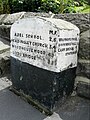
 Milestone, Church Hill.jpg 1,392 × 1,789; 296 KB
-
 Milestone, Leeds Road, Bramhope.jpg 1,183 × 2,172; 301 KB
-
 Milestone, Otley Old Road.jpg 860 × 557; 93 KB
-
 Milestone, Pool Bank New Road (North).jpg 453 × 665; 53 KB


_-_geograph.org.uk_-_5789255.jpg)
_-_geograph.org.uk_-_5789256.jpg)


.jpg)
.jpg)


_-_geograph.org.uk_-_5985601.jpg)

_-_geograph.org.uk_-_6107065.jpg)
_-_geograph.org.uk_-_6107088.jpg)


_-_geograph.org.uk_-_5985599.jpg)

_-_geograph.org.uk_-_6106000.jpg)


_-_geograph.org.uk_-_5789277.jpg)
_-_geograph.org.uk_-_5789278.jpg)


_-_geograph.org.uk_-_2764194.jpg)
_-_geograph.org.uk_-_5988060.jpg)
_at_Bramhope_-_geograph.org.uk_-_5400940.jpg)
,_Bramhope_-_geograph.org.uk_-_5988063.jpg)


.jpg)

.jpg)
.jpg)


.jpg)