Category:Bramham cum Oglethorpe
Jump to navigation
Jump to search
English: Bramham cum Oglethorpe is a civil parish in the City of Leeds metropolitan borough, West Yorkshire, England.

civil parish in West Yorkshire, England | |||||
| Upload media | |||||
| Instance of | |||||
|---|---|---|---|---|---|
| Location | Leeds, West Yorkshire, Yorkshire and the Humber, England | ||||
| Population |
| ||||
 | |||||
Subcategories
This category has the following 10 subcategories, out of 10 total.
Media in category "Bramham cum Oglethorpe"
The following 200 files are in this category, out of 348 total.
(previous page) (next page)-
 A farm track near Headley Hall - geograph.org.uk - 3070527.jpg 800 × 600; 151 KB
-
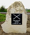
 A plaque to Bramham Moor battle in 1408 - geograph.org.uk - 3070514.jpg 600 × 800; 141 KB
-
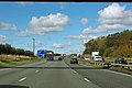
 A1(M) - bridge, Brabham - geograph.org.uk - 2646896.jpg 640 × 428; 88 KB
-
 A1(M) - Clifford Moor - geograph.org.uk - 2646924.jpg 640 × 428; 76 KB
-
 A1(M) - geograph.org.uk - 3038449.jpg 640 × 430; 39 KB
-
 A1(M) - junction 45 in 1 mile - geograph.org.uk - 2646913.jpg 640 × 428; 67 KB
-
 A1(M) - maintenance sign - geograph.org.uk - 2646876.jpg 640 × 428; 68 KB
-
 A1(M) Bramham - geograph.org.uk - 3038445.jpg 640 × 430; 39 KB
-
 A1(M) near Bramham - geograph.org.uk - 2040857.jpg 640 × 480; 63 KB
-
 A1(M) northbound - geograph.org.uk - 2646888.jpg 640 × 428; 73 KB
-
 A1(M) northbound - geograph.org.uk - 2646902.jpg 640 × 428; 77 KB
-
 A1(M) northbound - geograph.org.uk - 2782744.jpg 640 × 480; 55 KB
-
 A1(M) northbound - geograph.org.uk - 3038439.jpg 640 × 462; 42 KB
-

-
 A1(M) southbound near Bramham - geograph.org.uk - 2784265.jpg 640 × 480; 49 KB
-
 A1(M) southbound near Paradise Farm - geograph.org.uk - 5396321.jpg 640 × 481; 39 KB
-
 A1(M), Bramham - geograph.org.uk - 1852757.jpg 1,024 × 683; 144 KB
-
 A1(M), Bramham - geograph.org.uk - 4806026.jpg 640 × 353; 24 KB
-
 A1(M), Bramham bypass - geograph.org.uk - 4793158.jpg 640 × 426; 35 KB
-
 A1(M), Clifford Moor - geograph.org.uk - 1845166.jpg 1,024 × 683; 101 KB
-
 A1(M), Junction 44 - geograph.org.uk - 4806041.jpg 640 × 334; 23 KB
-
 A1(M), southbound - geograph.org.uk - 4806031.jpg 640 × 395; 32 KB
-
 A1(M), southbound - geograph.org.uk - 4806036.jpg 640 × 426; 30 KB
-
 A1(M), southbound - geograph.org.uk - 4806038.jpg 640 × 376; 22 KB
-
 A1M near to Bramham - geograph.org.uk - 6399043.jpg 800 × 533; 201 KB
-
 A1M north of Bramham - geograph.org.uk - 6399047.jpg 800 × 600; 232 KB
-
 A1M north of Bramham Crossroads - geograph.org.uk - 6399037.jpg 800 × 600; 231 KB
-
 A659 heading east - geograph.org.uk - 3798908.jpg 640 × 480; 56 KB
-
 Aberford , A1(M) - geograph.org.uk - 6635013.jpg 6,000 × 4,000; 5.67 MB
-

-

-

-
 Across Bramham Park - geograph.org.uk - 4692454.jpg 640 × 427; 60 KB
-
 All Saints Church, Bramham - geograph.org.uk - 3435408.jpg 1,536 × 2,048; 468 KB
-
 All Saints Church, Bramham - geograph.org.uk - 5184487.jpg 1,600 × 1,067; 324 KB
-

-
 Along Paradise Way - geograph.org.uk - 5373708.jpg 640 × 427; 208 KB
-
 Approaching Dawsonfield Plantation - geograph.org.uk - 5295465.jpg 5,184 × 3,456; 5.75 MB
-
 Arena at Bramham - geograph.org.uk - 5807389.jpg 1,024 × 683; 538 KB
-
 Ascending Town Hill in Bramham - geograph.org.uk - 5185419.jpg 1,600 × 1,067; 376 KB
-
 Autumnal track in Black Fen Wood - geograph.org.uk - 4692465.jpg 427 × 640; 136 KB
-
 Back Lane - viewed from New Road - geograph.org.uk - 5171641.jpg 640 × 480; 70 KB
-
 Bar Lane - geograph.org.uk - 5614784.jpg 640 × 427; 218 KB
-
 Bar Lane junction with the A659 - geograph.org.uk - 6608895.jpg 1,024 × 683; 329 KB
-
 Battle of Bramham memorial - geograph.org.uk - 5373693.jpg 640 × 427; 210 KB
-
 Battle of Bramham Moor Memorial - geograph.org.uk - 2782747.jpg 640 × 480; 73 KB
-
 Beck - New Road - geograph.org.uk - 5171587.jpg 640 × 480; 140 KB
-
 Beck - New Road - geograph.org.uk - 5171627.jpg 640 × 480; 142 KB
-
 Bench Mark, Clifford Moor Milestone - geograph.org.uk - 1845134.jpg 683 × 1,024; 208 KB
-
 Benchmark at the entrance to Bramham Park - geograph.org.uk - 3428710.jpg 2,048 × 1,536; 511 KB
-
 Benchmark on the house Rose Mount - geograph.org.uk - 3435393.jpg 2,048 × 1,536; 516 KB
-
 Beside North Terrace - geograph.org.uk - 5807632.jpg 1,024 × 683; 440 KB
-
 Between Bar Lane and Oglethorpe Hall Farm - geograph.org.uk - 3323858.jpg 768 × 1,024; 548 KB
-
 Between the arenas - geograph.org.uk - 4034185.jpg 640 × 427; 82 KB
-
 Biggin Park - geograph.org.uk - 5183583.jpg 1,600 × 1,067; 721 KB
-
 Biggin Park farmland - geograph.org.uk - 2891547.jpg 1,024 × 768; 128 KB
-
 Birds Nest Fungus - geograph.org.uk - 510097.jpg 640 × 419; 71 KB
-
 Black Fen Field - geograph.org.uk - 2584021.jpg 640 × 430; 63 KB
-
 Bowcliffe Hall - geograph.org.uk - 5295291.jpg 5,184 × 3,456; 5.79 MB
-
 Bowcliffe Road - geograph.org.uk - 5374192.jpg 640 × 427; 215 KB
-

-
 Bramham , A1(M) - geograph.org.uk - 6635065.jpg 6,000 × 4,000; 7.28 MB
-
 Bramham , A1(M) - geograph.org.uk - 6635069.jpg 6,000 × 4,000; 7.26 MB
-
 Bramham Cum Oglethorpe , A1(M) - geograph.org.uk - 6635074.jpg 6,000 × 4,000; 6.83 MB
-
 Bramham Horse Trials - geograph.org.uk - 558930.jpg 640 × 427; 141 KB
-
 Bramham House - geograph.org.uk - 4033994.jpg 640 × 427; 81 KB
-
 Bramham Moor 1408.jpg 420 × 478; 85 KB
-
 Bramham Moor Battle information board - geograph.org.uk - 3070521.jpg 800 × 600; 158 KB
-
 Bramham Park 10k - geograph.org.uk - 4685043.jpg 640 × 427; 108 KB
-
 Bramham Pavilion - geograph.org.uk - 5789819.jpg 1,024 × 768; 221 KB
-
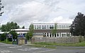 Bramham Primary School - geograph.org.uk - 949864.jpg 640 × 401; 174 KB
-
 Bramham Road - Clifford - geograph.org.uk - 949867.jpg 640 × 474; 258 KB
-
 Bramham short course - geograph.org.uk - 4034186.jpg 640 × 427; 92 KB
-
 Bramham tower mill, West Yorkshire - geograph.org.uk - 473880.jpg 640 × 480; 88 KB
-
 Bramham windmill seen from Heygate Lane (geograph 5789774).jpg 1,024 × 768; 268 KB
-
 Bridge over the A1(M), Clifford Moor - geograph.org.uk - 2515495.jpg 640 × 430; 41 KB
-
 Bridleway to Wetherby - geograph.org.uk - 5374470.jpg 640 × 427; 195 KB
-
 Brmaham park during the horse trials - geograph.org.uk - 5807381.jpg 1,024 × 683; 419 KB
-
 Building site at Headley - geograph.org.uk - 3322208.jpg 1,022 × 614; 167 KB
-
 Buildings at Highmoor Quarry - geograph.org.uk - 3322244.jpg 1,024 × 768; 154 KB
-
 Caterpillar infestation - geograph.org.uk - 5805091.jpg 1,024 × 768; 282 KB
-
 Church Hill - Vicarage Lane - geograph.org.uk - 5171638.jpg 640 × 480; 89 KB
-
 Clifford , A1(M) - geograph.org.uk - 6635075.jpg 6,000 × 4,000; 7.53 MB
-
 Communications masts off West Woods Road - geograph.org.uk - 2784272.jpg 2,848 × 2,136; 1.46 MB
-
 Concessionary Path in Bramham Park - geograph.org.uk - 5183597.jpg 1,600 × 1,067; 614 KB
-
 Countryside between Bramham and Tadcaster - geograph.org.uk - 5370719.jpg 5,184 × 3,456; 6.13 MB
-
 Croft Drive - Lyndon Road - geograph.org.uk - 5171573.jpg 640 × 480; 59 KB
-
 Croft Drive - viewed from Croft Road - geograph.org.uk - 5171575.jpg 640 × 480; 55 KB
-
 Croft Road - Clifford Road - geograph.org.uk - 5171580.jpg 640 × 480; 68 KB
-
 Croft Road - Croft Drive - geograph.org.uk - 5171576.jpg 640 × 480; 67 KB
-
 Crop field off Spen Common Lane - geograph.org.uk - 2782753.jpg 640 × 480; 123 KB
-
 Cropstones - Folly Lane - geograph.org.uk - 5171716.jpg 640 × 480; 83 KB
-
 Cross Country course - geograph.org.uk - 5807379.jpg 1,024 × 683; 421 KB
-
 Cycle path beside Paradise Way - geograph.org.uk - 5373696.jpg 640 × 427; 189 KB
-
 Cycle path leading to Junction 44 - geograph.org.uk - 5373704.jpg 640 × 427; 214 KB
-
 Cycle Path, Paradise Way - geograph.org.uk - 1877611.jpg 1,024 × 683; 114 KB
-
 Cycle Route No. 67 on Clifford Moor - geograph.org.uk - 5185714.jpg 1,600 × 1,067; 692 KB
-
 Dalton Lane at West Woods - geograph.org.uk - 3290733.jpg 2,048 × 1,536; 623 KB
-
 Dawsonfield Plantation - geograph.org.uk - 4692443.jpg 640 × 427; 83 KB
-
 Descending Town Hill in Bramham - geograph.org.uk - 5185426.jpg 1,600 × 1,067; 386 KB
-
 Disconnected Lane - geograph.org.uk - 1850975.jpg 1,024 × 683; 151 KB
-
 Disused Lay-by, A1(M) - geograph.org.uk - 1845158.jpg 1,024 × 683; 136 KB
-
 Drive through Biggin Wood - geograph.org.uk - 2584170.jpg 640 × 480; 135 KB
-
 Drive to the house - geograph.org.uk - 4034047.jpg 640 × 427; 85 KB
-
 Edge of Black Fen Wood - geograph.org.uk - 4692451.jpg 640 × 427; 92 KB
-
 Edge of Rakes Wood - geograph.org.uk - 4692449.jpg 640 × 427; 64 KB
-

-
 Entrance to Headley Hall - geograph.org.uk - 3322192.jpg 1,024 × 768; 197 KB
-
 Equitrek Arena - geograph.org.uk - 4034139.jpg 640 × 427; 85 KB
-
 Farm building at Bramham - geograph.org.uk - 4692546.jpg 640 × 427; 141 KB
-
 Farm Track heading West from Meadow Lane - geograph.org.uk - 5184471.jpg 1,600 × 1,067; 756 KB
-
 Farm track near the A1(M) - geograph.org.uk - 2782746.jpg 640 × 480; 57 KB
-
 Farmland east of Bramham - geograph.org.uk - 2784219.jpg 640 × 480; 76 KB
-
 Farmland east of Warren Lane - geograph.org.uk - 3322226.jpg 1,024 × 768; 155 KB
-
 Farmland east of Windmill Road - geograph.org.uk - 3323957.jpg 1,024 × 768; 140 KB
-
 Farmland north of Bramham - geograph.org.uk - 5374464.jpg 640 × 427; 212 KB
-
 Farmland north of Thorner Lane - geograph.org.uk - 2891538.jpg 1,024 × 768; 148 KB
-
 Farmland off the A659 - geograph.org.uk - 3798895.jpg 640 × 480; 56 KB
-
 Farmland towards Rakes Wood - geograph.org.uk - 2782745.jpg 640 × 480; 72 KB
-
 Farmland west of Bramham - geograph.org.uk - 2784308.jpg 640 × 480; 82 KB
-
 Farmland, Bramham Moor - geograph.org.uk - 2784189.jpg 640 × 480; 45 KB
-
 Farmland, Camp Hill - geograph.org.uk - 2782741.jpg 640 × 480; 56 KB
-
 Farmland, NewYork Farm - geograph.org.uk - 2784201.jpg 640 × 480; 49 KB
-
 Farmland, West Woods - geograph.org.uk - 2784292.jpg 640 × 480; 70 KB
-
 Farmland, West Woods Farm - geograph.org.uk - 2784280.jpg 640 × 480; 70 KB
-
 Field beside Spen Common Lane - geograph.org.uk - 5295706.jpg 5,184 × 3,456; 5.63 MB
-
 Field entrance near Headley Hall - geograph.org.uk - 3322196.jpg 1,024 × 768; 163 KB
-
 Fields near Quarry Farm - geograph.org.uk - 5789923.jpg 1,024 × 768; 183 KB
-
 Fine Garth Close - Back Lane - geograph.org.uk - 5171650.jpg 640 × 478; 69 KB
-
 Firbeck Road - Clifford Road - geograph.org.uk - 5171583.jpg 640 × 480; 62 KB
-
 Firbeck Road - New Road - geograph.org.uk - 5171585.jpg 640 × 480; 63 KB
-
 Flock of sheep, south of Bar Lane - geograph.org.uk - 3323928.jpg 1,024 × 768; 119 KB
-
 Folly Lane - Aberford Road - geograph.org.uk - 5171713.jpg 640 × 480; 73 KB
-
 Food stalls - geograph.org.uk - 4034184.jpg 640 × 427; 91 KB
-
 Footbridge at Bramham over the A1(M) - geograph.org.uk - 2515480.jpg 640 × 430; 37 KB
-
 Footbridge at Camp Hill, A1(M) - geograph.org.uk - 2515475.jpg 640 × 430; 34 KB
-
 Footbridge over the A1(M) - geograph.org.uk - 3038429.jpg 640 × 430; 41 KB
-
 Footbridge over the A1(M) - geograph.org.uk - 3038443.jpg 640 × 430; 56 KB
-
 Footbridge over the A1(M) - geograph.org.uk - 3038457.jpg 640 × 430; 40 KB
-
 Footbridge over the A1(M) - geograph.org.uk - 4793148.jpg 640 × 426; 32 KB
-
 Footbridge over the A1(M) - geograph.org.uk - 4793152.jpg 640 × 426; 44 KB
-
 Footbridge over the A1M near Bramham - geograph.org.uk - 6399039.jpg 800 × 600; 243 KB
-

-
 Footbridge, A1(M) - geograph.org.uk - 4793160.jpg 640 × 426; 28 KB
-
 Footpath - Croft Road - geograph.org.uk - 5171577.jpg 480 × 640; 110 KB
-
 Footpath - Wetherby Road - geograph.org.uk - 5171478.jpg 640 × 480; 113 KB
-
 Footpath descending Oglethorpe Hills - geograph.org.uk - 5370734.jpg 5,184 × 3,456; 5.82 MB
-
 Footpath descending towards Meadow Lane - geograph.org.uk - 5184463.jpg 1,600 × 1,067; 637 KB
-
 Footpath heading North to Bar Lane - geograph.org.uk - 5370342.jpg 5,184 × 3,456; 5.65 MB
-
 Footpath in Bramham - geograph.org.uk - 5789769.jpg 1,024 × 768; 221 KB
-
 Footpath in Bramham Park - geograph.org.uk - 5295471.jpg 5,184 × 3,456; 7.5 MB
-
 Footpath near Wellhill farm - geograph.org.uk - 4687693.jpg 427 × 640; 94 KB
-
 Footpath on Well Hill - geograph.org.uk - 5295293.jpg 5,184 × 3,456; 5.73 MB
-
 Footpath stile on north side of Thorner Road - geograph.org.uk - 2891530.jpg 1,024 × 768; 157 KB
-
 Footpath to Biggin Wood - geograph.org.uk - 4687320.jpg 640 × 427; 116 KB
-
 Footpath to Clifford from Heygate Lane - geograph.org.uk - 5789783.jpg 1,024 × 768; 148 KB
-
 Footpath to Toulston Lane - geograph.org.uk - 5805040.jpg 1,024 × 768; 175 KB
-
 Footpath to Warren Lane - geograph.org.uk - 5789787.jpg 1,024 × 768; 191 KB
-
 Footpath to Warren Lane - geograph.org.uk - 5789803.jpg 1,024 × 768; 278 KB
-
 Footpath to Warren Lane - geograph.org.uk - 5799258.jpg 1,024 × 768; 374 KB
-
 Footpath to Windmill Lane - geograph.org.uk - 5799264.jpg 1,024 × 768; 209 KB
-
 Forestry operations at Wellhill Farm - geograph.org.uk - 3428704.jpg 2,048 × 1,536; 527 KB
-
 Freely Lane, Bramham - geograph.org.uk - 5804144.jpg 1,024 × 768; 251 KB
-

-

-
 Garages and glasshouses at Headley - geograph.org.uk - 5789807.jpg 1,024 × 768; 199 KB
-
 Gas Installation - Lyndon Avenue - geograph.org.uk - 5171482.jpg 640 × 480; 76 KB
-
 Gateway to stubble field, north of Paradise Farm - geograph.org.uk - 3324684.jpg 1,024 × 768; 130 KB
-
 Headley Cottages - geograph.org.uk - 306084.jpg 640 × 480; 50 KB
-
 Headley Hall, near Bramham.jpg 5,184 × 3,456; 3.78 MB
-
 Headley Lane - geograph.org.uk - 5789812.jpg 1,024 × 768; 162 KB
-
 Headley Lane - geograph.org.uk - 5789817.jpg 1,024 × 768; 226 KB
-
 Headley Lane - geograph.org.uk - 5805044.jpg 1,024 × 768; 186 KB
-
 Headley Lane looking North West - geograph.org.uk - 5295673.jpg 5,184 × 3,456; 5.85 MB
-
 Headley Lane looking South East - geograph.org.uk - 5295681.jpg 5,184 × 3,456; 6.51 MB
-
 Hedged field boundary, east of Warren Lane - geograph.org.uk - 3322231.jpg 1,024 × 768; 151 KB
-
 Heygate Lane - geograph.org.uk - 5789780.jpg 1,024 × 768; 208 KB
-
 Heygates Lane - geograph.org.uk - 5185689.jpg 1,600 × 1,067; 666 KB
-
 High Street - Aberford Road - geograph.org.uk - 5171709.jpg 640 × 480; 81 KB
-

-
 Horses in the ring - geograph.org.uk - 5807621.jpg 1,024 × 683; 541 KB
-
 Horsewatch warning, Bar Lane - geograph.org.uk - 3323918.jpg 1,024 × 768; 131 KB
-
 House standing between Low Way and Town Hill - geograph.org.uk - 5805023.jpg 1,024 × 768; 123 KB
-
 Jump 1 - geograph.org.uk - 4034196.jpg 640 × 427; 59 KB
-
 Jump 1 2014 - geograph.org.uk - 4034198.jpg 640 × 428; 85 KB
-
 Jump 12 - geograph.org.uk - 4034155.jpg 640 × 427; 79 KB
-
 Jump 15 - geograph.org.uk - 4034007.jpg 640 × 427; 78 KB
-
 Jump 17 - geograph.org.uk - 4034026.jpg 640 × 427; 58 KB
-
 Jump 2 - geograph.org.uk - 4034195.jpg 640 × 427; 68 KB
-
 Jump 20 (Water Jump) - geograph.org.uk - 4034137.jpg 640 × 427; 116 KB
-
 Jump 6 - geograph.org.uk - 4034188.jpg 640 × 427; 137 KB
-
 Looking south along the A1M at Bramham - geograph.org.uk - 2411395.jpg 800 × 600; 213 KB
-
 Low Way - viewed from Town Hill - geograph.org.uk - 5171745.jpg 640 × 480; 66 KB
-
 Low Way, Bramham - geograph.org.uk - 5805026.jpg 1,024 × 768; 214 KB
-
 Lyndon Avenue - Lyndon Road - geograph.org.uk - 5171499.jpg 640 × 480; 60 KB
-
 Lyndon Close - Lyndon Road - geograph.org.uk - 5171506.jpg 640 × 480; 95 KB
-
 Lyndon Crescent - Wetherby Road - geograph.org.uk - 5171481.jpg 640 × 480; 83 KB
-
 Lyndon Square - Lyndon Avenue - geograph.org.uk - 5171498.jpg 640 × 480; 69 KB
-
 Lyndon Way - Lyndon Road - geograph.org.uk - 5171503.jpg 640 × 480; 80 KB
-
 Main show jumping arena - geograph.org.uk - 5807630.jpg 1,024 × 683; 565 KB


_-_bridge,_Brabham_-_geograph.org.uk_-_2646896.jpg)
_-_Clifford_Moor_-_geograph.org.uk_-_2646924.jpg)
_-_geograph.org.uk_-_3038449.jpg)
_-_junction_45_in_1_mile_-_geograph.org.uk_-_2646913.jpg)
_-_maintenance_sign_-_geograph.org.uk_-_2646876.jpg)
_Bramham_-_geograph.org.uk_-_3038445.jpg)
_near_Bramham_-_geograph.org.uk_-_2040857.jpg)
_northbound_-_geograph.org.uk_-_2646888.jpg)
_northbound_-_geograph.org.uk_-_2646902.jpg)
_northbound_-_geograph.org.uk_-_2782744.jpg)
_northbound_-_geograph.org.uk_-_3038439.jpg)
_passes_under_Thorner_Road_overbridge_-_geograph.org.uk_-_5396309.jpg)
_southbound_near_Bramham_-_geograph.org.uk_-_2784265.jpg)
_southbound_near_Paradise_Farm_-_geograph.org.uk_-_5396321.jpg)
,_Bramham_-_geograph.org.uk_-_1852757.jpg)
,_Bramham_-_geograph.org.uk_-_4806026.jpg)
,_Bramham_bypass_-_geograph.org.uk_-_4793158.jpg)
,_Clifford_Moor_-_geograph.org.uk_-_1845166.jpg)
,_Junction_44_-_geograph.org.uk_-_4806041.jpg)
,_southbound_-_geograph.org.uk_-_4806031.jpg)
,_southbound_-_geograph.org.uk_-_4806036.jpg)
,_southbound_-_geograph.org.uk_-_4806038.jpg)


_-_geograph.org.uk_-_6635013.jpg)


_-_geograph.org.uk_-_6635065.jpg)
_-_geograph.org.uk_-_6635069.jpg)
_-_geograph.org.uk_-_6635074.jpg)


.jpg)
,_Clifford_Moor_-_geograph.org.uk_-_2515495.jpg)


_-_geograph.org.uk_-_6635075.jpg)


_-_geograph.org.uk_-_1845158.jpg)


_-_geograph.org.uk_-_2782746.jpg)


_-_geograph.org.uk_-_2515480.jpg)
_-_geograph.org.uk_-_2515475.jpg)
_-_geograph.org.uk_-_3038429.jpg)
_-_geograph.org.uk_-_3038443.jpg)
_-_geograph.org.uk_-_3038457.jpg)
_-_geograph.org.uk_-_4793148.jpg)
_-_geograph.org.uk_-_4793152.jpg)


_-_geograph.org.uk_-_4793160.jpg)


_-_geograph.org.uk_-_4034137.jpg)


