Category:Bramerton
Jump to navigation
Jump to search
English: Bramerton is a village in South Norfolk 4¾ miles (7½ km) south-east of Norwich, just north of the A146 and south of the River Yare.
village and civil parish in Norfolk, UK  | |||||
| Upload media | |||||
| Instance of | |||||
|---|---|---|---|---|---|
| Location | South Norfolk, Norfolk, East of England, England | ||||
| Population |
| ||||
| Area |
| ||||
 | |||||
Subcategories
This category has the following 6 subcategories, out of 6 total.
Media in category "Bramerton"
The following 200 files are in this category, out of 528 total.
(previous page) (next page)-
 'Alpha Lady' moored at Bramerton Common - geograph.org.uk - 6473124.jpg 800 × 582; 142 KB
-
 'Rosie' moored at Bramerton Common - geograph.org.uk - 6521161.jpg 800 × 568; 148 KB
-

-

-

-
 460H-Fleuron (Portsmouth) - geograph.org.uk - 6521142.jpg 800 × 578; 161 KB
-
 844W-Gintina moored at Bramerton Common - geograph.org.uk - 6521156.jpg 800 × 582; 155 KB
-
 94P-Todger - geograph.org.uk - 6521294.jpg 800 × 574; 189 KB
-
 96W-Damsel on the River Yare - geograph.org.uk - 6521245.jpg 800 × 582; 192 KB
-
 A 1947 Riley classic car - geograph.org.uk - 4290200.jpg 640 × 480; 164 KB
-
 A big stack of straw bales - geograph.org.uk - 4604285.jpg 640 × 360; 263 KB
-
 A crop of oilseed rape - geograph.org.uk - 1344263.jpg 640 × 480; 87 KB
-
 A double rainbow above crop fields - geograph.org.uk - 4749712.jpg 640 × 501; 390 KB
-
 A feathery weed - geograph.org.uk - 5405275.jpg 640 × 480; 473 KB
-
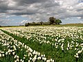
 A field of daffodils - geograph.org.uk - 4410838.jpg 640 × 480; 434 KB
-
 A field of daffodils - geograph.org.uk - 5753799.jpg 640 × 589; 428 KB
-
 A fine mansion - geograph.org.uk - 1281736.jpg 640 × 531; 107 KB
-
 A frosty morning - geograph.org.uk - 1623826.jpg 600 × 600; 100 KB
-
 A garden pansy - geograph.org.uk - 5366923.jpg 640 × 626; 287 KB
-
 A harvested field - geograph.org.uk - 1532707.jpg 640 × 480; 91 KB
-
 A load of old bricks - geograph.org.uk - 5753765.jpg 640 × 480; 370 KB
-
 A sunlit woodland edge - geograph.org.uk - 1626632.jpg 640 × 480; 176 KB
-
 A wall of bracken - geograph.org.uk - 1344236.jpg 480 × 640; 98 KB
-
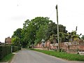
 A wintry Bramerton Road - geograph.org.uk - 1626618.jpg 640 × 480; 106 KB
-
 A146 passing The Gull - geograph.org.uk - 90309.jpg 640 × 480; 77 KB
-
 Afloat but only just - geograph.org.uk - 1759827.jpg 640 × 480; 107 KB
-

-
 All quiet on the River Yare - geograph.org.uk - 6473094.jpg 800 × 579; 132 KB
-
 All quiet on the River Yare - geograph.org.uk - 6473147.jpg 800 × 581; 127 KB
-
 An empty pasture - geograph.org.uk - 1396191.jpg 640 × 480; 112 KB
-
 An unusually quiet River Yare - geograph.org.uk - 6473107.jpg 800 × 576; 126 KB
-

-

-

-
 Approach to Kirby Road - geograph.org.uk - 1283978.jpg 640 × 480; 72 KB
-
 Approaching Bramerton Common - geograph.org.uk - 1368226.jpg 640 × 480; 139 KB
-
 Approaching the edge of a woodland - geograph.org.uk - 1344193.jpg 480 × 640; 107 KB
-
 Arab's eye (Ornithogalum arabicum) - geograph.org.uk - 5367072.jpg 640 × 597; 270 KB
-
 Baled straw - geograph.org.uk - 4604288.jpg 640 × 360; 386 KB
-
 Baled straw waiting for collection - geograph.org.uk - 4604289.jpg 640 × 360; 298 KB
-

-
 Big barn on Bramerton Road - geograph.org.uk - 1368167.jpg 640 × 480; 112 KB
-
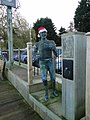 Billy Bluelight in Christmas attire - geograph.org.uk - 4290180.jpg 480 × 640; 64 KB
-
 Bird's foot trefoil (Lotus corniculatus) - geograph.org.uk - 5435493.jpg 629 × 640; 303 KB
-
 Bird's-foot trefoil (Lotus corniculatus) - geograph.org.uk - 5435496.jpg 640 × 556; 243 KB
-
 Bird's-foot trefoil (Lotus corniculatus) - geograph.org.uk - 5435497.jpg 640 × 622; 239 KB
-
 Bird's-foot trefoil (Lotus corniculatus) - geograph.org.uk - 5435500.jpg 640 × 615; 275 KB
-
 Bird's-foot trefoil (Lotus corniculatus) - geograph.org.uk - 5435502.jpg 640 × 576; 434 KB
-

-

-
-
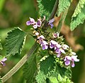
 Black Horehound (Ballota nigra) - geograph.org.uk - 5429410.jpg 613 × 640; 418 KB
-
 Black Horehound (Ballota nigra) - geograph.org.uk - 5429411.jpg 623 × 640; 438 KB
-
 Boats at Woods End - geograph.org.uk - 810935.jpg 640 × 426; 92 KB
-
 Boats moored by Bramerton Common - geograph.org.uk - 6473079.jpg 800 × 553; 160 KB
-
 Bracket fungus on beech tree - geograph.org.uk - 1532723.jpg 525 × 640; 139 KB
-

-

-

-

-

-

-

-
 Bramerton Common - geograph.org.uk - 1368253.jpg 640 × 480; 126 KB
-
 Bramerton Common - geograph.org.uk - 1553981.jpg 640 × 360; 160 KB
-
 Bramerton Hall - geograph.org.uk - 1620269.jpg 640 × 484; 186 KB
-
 Bramerton Hall - geograph.org.uk - 1620271.jpg 640 × 478; 182 KB
-
 Bramerton Hall - geograph.org.uk - 1620274.jpg 640 × 518; 213 KB
-
 Bramerton name sign - geograph.org.uk - 3622062.jpg 2,304 × 3,072; 1.68 MB
-
 Bramerton Old Post Office - geograph.org.uk - 1962369.jpg 640 × 480; 71 KB
-
 Bramerton Old School - geograph.org.uk - 1962394.jpg 640 × 480; 54 KB
-
 Bramerton Pits - information board - geograph.org.uk - 1368311.jpg 640 × 524; 118 KB
-
 Bramerton Road - geograph.org.uk - 1344113.jpg 640 × 480; 76 KB
-
 Bramerton Village Hall, Norfolk - geograph.org.uk - 1965670.jpg 640 × 480; 116 KB
-
 Bramerton village sign - geograph.org.uk - 6694161.jpg 4,504 × 3,072; 4.18 MB
-
 Bramerton village sign - the church - geograph.org.uk - 6694188.jpg 3,196 × 1,288; 862 KB
-
 Bramerton village sign - the river and yacht - geograph.org.uk - 6694190.jpg 3,472 × 1,400; 1.09 MB
-
 Bramerton village sign - village hall - geograph.org.uk - 6694186.jpg 2,704 × 1,044; 688 KB
-
 Bramerton village sign - wild garlic - geograph.org.uk - 6694189.jpg 2,860 × 1,096; 768 KB
-
 Bramerton War Memorial in the churchyard - geograph.org.uk - 6584681.jpg 4,608 × 3,072; 6.23 MB
-
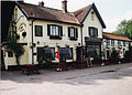 Bramerton Woods End Inn.jpg 2,084 × 1,492; 524 KB
-
 Brand new postbox - geograph.org.uk - 4132070.jpg 480 × 640; 274 KB
-
 Brand new postbox - geograph.org.uk - 4132071.jpg 480 × 640; 217 KB
-

-
 Brown long-eared bat (Plecotus auritus) - geograph.org.uk - 1415552.jpg 640 × 520; 146 KB
-
 C621-Dakota - geograph.org.uk - 6521331.jpg 800 × 579; 170 KB
-
 Calendula (Calendula officinalis) - geograph.org.uk - 5366909.jpg 640 × 605; 255 KB
-
 Calendula (Calendula officinalis) - geograph.org.uk - 5366910.jpg 640 × 622; 119 KB
-
 Calendulas (Calendula officinalis) - geograph.org.uk - 5366906.jpg 640 × 626; 436 KB
-
 Calendulas (Calendula officinalis) - geograph.org.uk - 5366908.jpg 640 × 614; 291 KB
-
 Canoeists on the River Yare - geograph.org.uk - 6521327.jpg 800 × 554; 186 KB
-
 Canoeists on the River Yare - geograph.org.uk - 6521334.jpg 800 × 553; 187 KB
-

-
 Cars parked on Mill Hill - geograph.org.uk - 6521126.jpg 800 × 562; 184 KB
-
 Catnip (Nepeta spec) - geograph.org.uk - 5367998.jpg 640 × 480; 448 KB
-
 Catnip (Nepeta spec) - geograph.org.uk - 5368001.jpg 640 × 565; 399 KB
-
 Catnip (Nepeta spec) - geograph.org.uk - 5368002.jpg 640 × 614; 277 KB
-
 Church Farm House in Framingham Lane - geograph.org.uk - 6338736.jpg 800 × 579; 167 KB
-

-

-

-
 Cleavers (Galium aparine) - geograph.org.uk - 5374246.jpg 640 × 608; 287 KB
-
 Cleavers (Galium aparine) - geograph.org.uk - 5374248.jpg 640 × 637; 292 KB
-
 Clematis flower - geograph.org.uk - 5367994.jpg 640 × 622; 280 KB
-
 Clematis in flower - geograph.org.uk - 5367992.jpg 640 × 561; 380 KB
-
 Common chickweed (Stellaria media) - geograph.org.uk - 5369330.jpg 640 × 572; 339 KB
-
 Common chickweed (Stellaria media) - geograph.org.uk - 5369334.jpg 640 × 618; 531 KB
-
 Common chickweed (Stellaria media) - geograph.org.uk - 5369339.jpg 640 × 590; 264 KB
-
 Common Groundsel (Senecio vulgaris) - geograph.org.uk - 5374228.jpg 640 × 480; 488 KB
-
 Common Groundsel (Senecio vulgaris) - geograph.org.uk - 5374230.jpg 640 × 566; 309 KB
-
 Common Groundsel (Senecio vulgaris) - geograph.org.uk - 5374232.jpg 640 × 618; 363 KB
-
 Common knapweed (Centaurea nigra) - geograph.org.uk - 5435506.jpg 640 × 593; 311 KB
-
 Common knapweed (Centaurea nigra) - geograph.org.uk - 5436113.jpg 640 × 604; 321 KB
-

-

-

-
 Common poppy (Papaver rhoeas) - geograph.org.uk - 5465866.jpg 636 × 640; 263 KB
-
 Common Sainfoin (Onobrychis viciifolia) - geograph.org.uk - 5436101.jpg 616 × 640; 231 KB
-
 Common Sainfoin (Onobrychis viciifolia) - geograph.org.uk - 5436103.jpg 586 × 640; 283 KB
-
 Common Sainfoin (Onobrychis viciifolia) - geograph.org.uk - 5436104.jpg 552 × 640; 259 KB
-
 Common teasel (Dipsacus sylvestris) - geograph.org.uk - 5487670.jpg 621 × 640; 402 KB
-
 Common teasel (Dipsacus sylvestris) - geograph.org.uk - 5487692.jpg 602 × 640; 597 KB
-
 Common teasel (Dipsacus sylvestris) - geograph.org.uk - 5487694.jpg 640 × 634; 334 KB
-
 Common teasel (Dipsacus sylvestris) - geograph.org.uk - 5487695.jpg 640 × 636; 336 KB
-
 Coronavirus notice - Stay Local - geograph.org.uk - 6473080.jpg 800 × 570; 118 KB
-

-
 Cow parsley (Anthriscus sylvestris) - geograph.org.uk - 5367805.jpg 566 × 640; 535 KB
-
 Cow parsley (Anthriscus sylvestris) - geograph.org.uk - 5367808.jpg 638 × 640; 578 KB
-
 Cow parsley and Alexanders - geograph.org.uk - 5374244.jpg 640 × 480; 427 KB
-
 Cowslips (Primula veris) - geograph.org.uk - 5367813.jpg 632 × 640; 518 KB
-
 Cowslips (Primula veris) - geograph.org.uk - 5367816.jpg 640 × 613; 411 KB
-
 Craft Shop, Bramerton Woods End - geograph.org.uk - 721692.jpg 640 × 445; 98 KB
-
 Crop fields east of Bramerton - geograph.org.uk - 5429420.jpg 640 × 480; 269 KB
-
 Crop fields north of Surlingham Lane - geograph.org.uk - 5972027.jpg 800 × 600; 125 KB
-
 Crop fields south of Bramerton - geograph.org.uk - 5503066.jpg 640 × 583; 413 KB
-
 Crops growing south of Surlingham - geograph.org.uk - 5753804.jpg 640 × 608; 434 KB
-
 Crops in flower - geograph.org.uk - 5753801.jpg 640 × 605; 464 KB
-
 Crossroads near Bramerton - geograph.org.uk - 80728.jpg 640 × 480; 109 KB
-
 Cruising the River Yare on Christmas day - geograph.org.uk - 4290194.jpg 640 × 480; 145 KB
-
 Cruising the River Yare on Christmas day - geograph.org.uk - 4290203.jpg 640 × 480; 145 KB
-
 Cyclist on Kirby Road - geograph.org.uk - 1620247.jpg 640 × 526; 179 KB
-
 Daffodil crop field by Rockland St Mary - geograph.org.uk - 4410835.jpg 640 × 480; 395 KB
-
 Daffodils and oilseed rape - geograph.org.uk - 5753807.jpg 640 × 480; 354 KB
-
 Daffodils flowering in December - geograph.org.uk - 4786760.jpg 640 × 390; 125 KB
-
 Daffodils flowering in December - geograph.org.uk - 4786762.jpg 640 × 570; 497 KB
-
 Daffodils ready for harvesting - geograph.org.uk - 5753809.jpg 640 × 480; 355 KB
-
 Dark clouds over a daffodil field - geograph.org.uk - 5753796.jpg 640 × 582; 400 KB
-

-
 Dark clouds over Cross Lane - geograph.org.uk - 5753759.jpg 640 × 480; 281 KB
-
 Day out fishing at Bramerton Common - geograph.org.uk - 6521149.jpg 800 × 581; 155 KB
-
 Disused path beside the River Yare - geograph.org.uk - 5487672.jpg 640 × 480; 416 KB
-
 Electricity pylon beside footpath - geograph.org.uk - 1422634.jpg 513 × 640; 100 KB
-
 Electricity pylon in stubble field - geograph.org.uk - 1422647.jpg 640 × 480; 103 KB
-
 Entering Bramerton on Kirby Road - geograph.org.uk - 3622027.jpg 3,072 × 2,304; 1.06 MB
-
 Entering Bramerton on Kirby Road - geograph.org.uk - 3622059.jpg 3,072 × 2,304; 1.32 MB
-
 Entering Kirby Bredon on Kirby Road - geograph.org.uk - 3622456.jpg 2,914 × 2,189; 904 KB
-
 Entrance to The Grange - geograph.org.uk - 6338731.jpg 800 × 580; 207 KB
-
 Entrance to the Mariners Store - geograph.org.uk - 4370499.jpg 635 × 640; 406 KB
-
 Field gate - geograph.org.uk - 1344163.jpg 640 × 480; 119 KB
-
 Field north of Easthill Lane - geograph.org.uk - 1532679.jpg 640 × 453; 87 KB
-
 Field north of Easthill Lane - geograph.org.uk - 1532694.jpg 640 × 454; 116 KB
-
 Field north of Surlingham Lane - geograph.org.uk - 1344262.jpg 640 × 480; 102 KB
-
 Field south of Kirby Road - geograph.org.uk - 1620255.jpg 640 × 454; 137 KB
-
 Field speedwell (Veronica persica) - geograph.org.uk - 5374236.jpg 640 × 622; 523 KB
-
 Fields between Bramerton and Surlingham - geograph.org.uk - 132832.jpg 640 × 480; 114 KB
-
 Fields between Surlingham and Bramerton - geograph.org.uk - 5753771.jpg 640 × 480; 274 KB
-
 Fields by Rockland St Mary - geograph.org.uk - 4410833.jpg 640 × 480; 421 KB
-
 Fields south of Framingham Road - geograph.org.uk - 5503072.jpg 640 × 604; 428 KB
-
 Fields west of Cross Lane - geograph.org.uk - 4410841.jpg 640 × 589; 597 KB
-
 Fields west of Cross Lane - geograph.org.uk - 5753810.jpg 640 × 480; 374 KB
-
 First snow - geograph.org.uk - 1623827.jpg 640 × 514; 193 KB
-
 Fishing in the River Yare - geograph.org.uk - 6521275.jpg 800 × 567; 135 KB
-

-
 Flies feasting on cow - geograph.org.uk - 1502016.jpg 591 × 640; 155 KB
-
 Flood indeed - geograph.org.uk - 5260725.jpg 640 × 489; 407 KB
-

-

-

-
 Flooding in The Street - geograph.org.uk - 5260723.jpg 640 × 480; 474 KB
-
 Flowering clematis - geograph.org.uk - 5367991.jpg 640 × 587; 280 KB
-
 Flowering clematis - geograph.org.uk - 5367993.jpg 640 × 540; 387 KB
-
 Flowering geraniums - geograph.org.uk - 5366914.jpg 640 × 618; 474 KB
-
 Flowering geraniums - geograph.org.uk - 5366916.jpg 640 × 634; 275 KB
-
 Flowering geraniums - geograph.org.uk - 5366918.jpg 640 × 582; 265 KB
-
 Flowering geraniums - geograph.org.uk - 5367981.jpg 640 × 480; 430 KB
-
 Flowering geraniums - geograph.org.uk - 5367985.jpg 640 × 592; 305 KB
-
 Flowering geraniums - geograph.org.uk - 5367988.jpg 640 × 630; 400 KB
-
 Flowering oilseed rape crop - geograph.org.uk - 5753768.jpg 640 × 480; 346 KB
-

-
 Flush Bracket Bench Mark at Bramerton - geograph.org.uk - 1962112.jpg 640 × 480; 109 KB
-

-
 Footpath by Hill House - geograph.org.uk - 5487679.jpg 640 × 480; 394 KB
-
 Footpath to Bramerton Common - geograph.org.uk - 5487676.jpg 640 × 480; 335 KB
-
 Former stables beside Bramerton Road - geograph.org.uk - 1605649.jpg 640 × 452; 114 KB
-
 Fossil shell.jpg 600 × 520; 142 KB
-

-
 Fritillaria acmopetala - geograph.org.uk - 5367085.jpg 640 × 622; 568 KB
-
 Fritillaria acmopetala - geograph.org.uk - 5367087.jpg 606 × 640; 237 KB
-
 Fritillaria acmopetala - geograph.org.uk - 5367088.jpg 568 × 640; 247 KB
-
 Fritillaria acmopetala - geograph.org.uk - 5367090.jpg 593 × 640; 240 KB


_moored_at_Bramerton_Common_-_geograph.org.uk_-_6521154.jpg)

_-_geograph.org.uk_-_6521142.jpg)


_beside_Cross_Lane_-_geograph.org.uk_-_5753752.jpg)


_-_geograph.org.uk_-_5369345.jpg)
_-_geograph.org.uk_-_5369347.jpg)
_-_geograph.org.uk_-_5369350.jpg)


_-_geograph.org.uk_-_5367072.jpg)


_-_geograph.org.uk_-_5435493.jpg)
_-_geograph.org.uk_-_5435496.jpg)
_-_geograph.org.uk_-_5435497.jpg)
_-_geograph.org.uk_-_5435500.jpg)
_-_geograph.org.uk_-_5435502.jpg)
_-_flowers_-_geograph.org.uk_-_5429413.jpg)
_-_flowers_-_geograph.org.uk_-_5429415.jpg)
_-_flowers_-_geograph.org.uk_-_5429419.jpg)
_-_geograph.org.uk_-_5429410.jpg)
_-_geograph.org.uk_-_5429411.jpg)


_-_geograph.org.uk_-_5899176.jpg)


_-_geograph.org.uk_-_1415542.jpg)
_-_geograph.org.uk_-_1415552.jpg)

_-_geograph.org.uk_-_5366909.jpg)
_-_geograph.org.uk_-_5366910.jpg)
_-_geograph.org.uk_-_5366906.jpg)
_-_geograph.org.uk_-_5366908.jpg)


_-_geograph.org.uk_-_5367998.jpg)
_-_geograph.org.uk_-_5368001.jpg)
_-_geograph.org.uk_-_5368002.jpg)


_-_geograph.org.uk_-_5374246.jpg)
_-_geograph.org.uk_-_5374248.jpg)


_-_geograph.org.uk_-_5369330.jpg)
_-_geograph.org.uk_-_5369334.jpg)
_-_geograph.org.uk_-_5369339.jpg)
_-_geograph.org.uk_-_5374228.jpg)
_-_geograph.org.uk_-_5374230.jpg)
_-_geograph.org.uk_-_5374232.jpg)
_-_geograph.org.uk_-_5435506.jpg)
_-_geograph.org.uk_-_5436113.jpg)
_-_flower_-_geograph.org.uk_-_5429404.jpg)
_-_flower_-_geograph.org.uk_-_5429406.jpg)
_-_flowers_-_geograph.org.uk_-_5429408.jpg)
_-_geograph.org.uk_-_5465866.jpg)
_-_geograph.org.uk_-_5436101.jpg)
_-_geograph.org.uk_-_5436103.jpg)
_-_geograph.org.uk_-_5436104.jpg)
_-_geograph.org.uk_-_5487670.jpg)
_-_geograph.org.uk_-_5487692.jpg)
_-_geograph.org.uk_-_5487694.jpg)
_-_geograph.org.uk_-_5487695.jpg)

_-_flower_-_geograph.org.uk_-_5367810.jpg)
_-_geograph.org.uk_-_5367805.jpg)
_-_geograph.org.uk_-_5367808.jpg)

_-_geograph.org.uk_-_5367813.jpg)
_-_geograph.org.uk_-_5367816.jpg)


_-_geograph.org.uk_-_5374236.jpg)


_moored_at_Bramerton_Common_-_geograph.org.uk_-_6521146.jpg)


