Category:Bradford-Calderdale boundary
Jump to navigation
Jump to search
Subcategories
This category has the following 7 subcategories, out of 7 total.
C
- Corporal Lane, Queensbury (12 F)
- Crooked Lane, HX3 (8 F)
D
- Dick Delf Hill (15 F)
H
- Halifax Footpath 313 (9 F)
R
- Royds Hall Beck (5 F)
S
- Strines Beck (6 F)
W
- Wyke Viaduct (20 F)
Media in category "Bradford-Calderdale boundary"
The following 47 files are in this category, out of 47 total.
-
A very steep section of Halifax FP313 - geograph.org.uk - 4928936.jpg 2,048 × 1,536; 1.32 MB
-
A644 at High Cross Lane - geograph.org.uk - 4347104.jpg 2,917 × 1,861; 695 KB
-
A644 at High Cross Lane - geograph.org.uk - 5414823.jpg 640 × 481; 41 KB
-
Blackshaw Beck Lane - geograph.org.uk - 4347116.jpg 1,920 × 1,377; 799 KB
-
Blackshaw Beck Lane towards Giles Hill Lane - geograph.org.uk - 5176595.jpg 1,600 × 1,065; 669 KB
-
Boundary (2581956068).jpg 1,770 × 2,157; 3.07 MB
-
Boundary stone, Halifax - Queensbury - geograph.org.uk - 591528.jpg 440 × 640; 89 KB
-
Boundary wall - geograph.org.uk - 5779914.jpg 1,024 × 768; 125 KB
-
Fishing lake seen from Queensbury FP32 - geograph.org.uk - 5625089.jpg 2,000 × 1,500; 1.13 MB
-
Footbridge over Blackshaw Beck, Clayton - geograph.org.uk - 6611485.jpg 2,000 × 1,500; 1.94 MB
-
Footbridge over disused railway, Bailiff Bridge - geograph.org.uk - 2936073.jpg 2,000 × 1,500; 1.51 MB
-
Footpath crossing Blackshaw Beck, from Clayton to Shelf - geograph.org.uk - 6634452.jpg 2,000 × 1,500; 1.65 MB
-
Halifax FP313 crossing Shibden Brook, Norrhowram - geograph.org.uk - 4928999.jpg 2,048 × 1,536; 1.34 MB
-
High Cross - geograph.org.uk - 4347110.jpg 1,920 × 1,182; 411 KB
-
High Cross Lane - geograph.org.uk - 2848663.jpg 3,072 × 2,304; 1.01 MB
-
Horse Close Bridge, near Norwood Green - geograph.org.uk - 6292669.jpg 1,200 × 1,600; 751 KB
-
Lower Lime House (49846966978).jpg 3,648 × 3,130; 8.23 MB
-
Milepost on Huddersfield Road, Lower Wyke (geograph 5635495).jpg 1,200 × 1,600; 504 KB
-
Old Milestone by the A641, Wyke, Brighouse parish (geograph 6049975).jpg 450 × 600; 109 KB
-
Pylons, Windy Bank Lane - geograph.org.uk - 3260582.jpg 640 × 480; 65 KB
-
Queensbury FP32 passing between fishing lakes - geograph.org.uk - 5625076.jpg 2,000 × 1,500; 1.09 MB
-
Queensbury FP44 at Bare Head Lane - geograph.org.uk - 5267557.jpg 2,048 × 1,536; 1,003 KB
-
Royd Halls Beck below the path, Judy Woods - geograph.org.uk - 2531962.jpg 1,024 × 768; 247 KB
-
Royd Hill - geograph.org.uk - 4345503.jpg 1,920 × 1,231; 523 KB
-
Royds Hall Beck - geograph.org.uk - 379815.jpg 640 × 480; 168 KB
-
Simm Carr Lane (1694477672).jpg 3,872 × 2,592; 4.42 MB
-
Simm Carr Lane (48224502232).jpg 4,896 × 2,754; 11.5 MB
-
Simm Carr Lane, Northowram - geograph.org.uk - 4937287.jpg 2,048 × 1,536; 1.1 MB
-
Stile on Calderdale Way - geograph.org.uk - 4346013.jpg 1,920 × 2,560; 1.4 MB
-
Swales Moor Road at Queensbury Road - geograph.org.uk - 2964316.jpg 800 × 600; 102 KB
-
Swales Moor Road meets Halifax Road - geograph.org.uk - 5459045.jpg 640 × 481; 61 KB
-
The Calderdale boundary, Halifax Road (A629) - geograph.org.uk - 2039379.jpg 2,000 × 1,493; 749 KB
-
The Halifax and Queensbury boundary stone, Halifax Road - geograph.org.uk - 5277753.jpg 1,998 × 1,404; 867 KB
-
Towards Shibden Head - geograph.org.uk - 4345565.jpg 1,920 × 1,233; 735 KB
-
UK Calderdale.jpg 1,038 × 896; 166 KB
-
Upper Shibden Dale - geograph.org.uk - 5322240.jpg 5,184 × 3,456; 6.77 MB
-
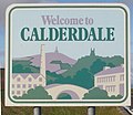
Welcome to Calderdale - geograph.org.uk - 1064112.jpg 640 × 427; 101 KB


