Category:Bothel and Threapland
Jump to navigation
Jump to search
English: Bothel and Threapland is a civil parish in the Allerdale district of Cumbria, England, just outside the Lake District National Park. According to the 2001 census it had a population of 438. The parish includes the villages of Bothel and Threapland.
civil parish in Cumbria, United Kingdom | |||||
| Upload media | |||||
| Instance of | |||||
|---|---|---|---|---|---|
| Named after | |||||
| Location | Allerdale, Cumbria, North West England, England | ||||
| Population |
| ||||
 | |||||
Subcategories
This category has the following 3 subcategories, out of 3 total.
Media in category "Bothel and Threapland"
The following 52 files are in this category, out of 52 total.
-
BATschools.png 236 × 408; 131 KB
-
Benchmark, Limekiln Bridge, Bothel - geograph.org.uk - 7137011.jpg 1,024 × 768; 402 KB
-
Bothel village - geograph.org.uk - 4911554.jpg 2,592 × 1,944; 1.29 MB
-
Bothel village - geograph.org.uk - 4911560.jpg 2,592 × 1,944; 1.41 MB
-
Census Data of BAT.png 553 × 338; 11 KB
-
Drystone wall country - geograph.org.uk - 3998647.jpg 2,472 × 3,296; 3.22 MB
-
Farmland drained by Threapland Gill - geograph.org.uk - 5732553.jpg 1,024 × 768; 259 KB
-
Farmland near Varnycrooks Beck - geograph.org.uk - 4911579.jpg 2,592 × 1,944; 1.25 MB
-
Farmland west of Bothel - geograph.org.uk - 4911571.jpg 2,592 × 1,944; 1.13 MB
-
Fields south of Bothel - geograph.org.uk - 3592094.jpg 2,592 × 1,944; 1.36 MB
-
Graph of Bothel and Threapland.jpg 482 × 292; 24 KB
-
Historicalmapbothel.png 371 × 301; 268 KB
-
Historicalmapthreapland.png 372 × 301; 263 KB
-
Lane up to the communications mast on Wharrels Hill - geograph.org.uk - 2452073.jpg 3,872 × 2,592; 5.47 MB
-
Leaving Bothel - geograph.org.uk - 4911558.jpg 2,592 × 1,944; 1.52 MB
-
Limekiln Bridge, Bothel - geograph.org.uk - 7136995.jpg 1,600 × 1,200; 851 KB
-
Line of trees on Caermote Hill - geograph.org.uk - 990451.jpg 640 × 480; 61 KB
-
Low Moor - geograph.org.uk - 1027720.jpg 640 × 425; 87 KB
-
North-west boundary of Threapland Moss - geograph.org.uk - 5732363.jpg 1,024 × 768; 229 KB
-
Occupation graph of Bothel and Threapland.png 588 × 400; 21 KB
-
Old Hedge Line - geograph.org.uk - 1607491.jpg 640 × 480; 55 KB
-
On St. John's Hill - geograph.org.uk - 1607492.jpg 640 × 480; 56 KB
-
On St. John's Hill - geograph.org.uk - 1610200.jpg 640 × 480; 36 KB
-
Over the fields - geograph.org.uk - 3998645.jpg 3,296 × 2,472; 3.53 MB
-
Paddock on Wharrels Hill - geograph.org.uk - 2452067.jpg 3,872 × 2,592; 5.07 MB
-
Road near Threapland - geograph.org.uk - 3998640.jpg 3,296 × 2,472; 3.46 MB
-
Roofless ^ in poor repair - geograph.org.uk - 3998668.jpg 3,296 × 2,472; 3.45 MB
-
Rough grasses, about 190 metres above sea level - geograph.org.uk - 5732503.jpg 1,024 × 768; 257 KB
-
Rough grassland, north of Threapland Moss - geograph.org.uk - 5732481.jpg 1,024 × 768; 249 KB
-
Sheepfold on Wharrels Hill - geograph.org.uk - 2452059.jpg 3,872 × 2,592; 4.41 MB
-
Skiddaw View Holiday Park - geograph.org.uk - 1156723.jpg 640 × 480; 63 KB
-
Small trees along a field boundary - geograph.org.uk - 5732575.jpg 1,024 × 768; 282 KB
-
The road from Sunderland to Threapland - geograph.org.uk - 5732542.jpg 1,024 × 768; 199 KB
-
The road from Threapland to Sunderland - geograph.org.uk - 5732531.jpg 1,024 × 768; 289 KB
-
The road to Gregg Hill and Sunderland - geograph.org.uk - 5732560.jpg 1,024 × 768; 193 KB
-
The road to Sunderland - geograph.org.uk - 3592076.jpg 2,592 × 1,944; 1.53 MB
-
Threapland - geograph.org.uk - 7108604.jpg 800 × 533; 118 KB
-
Threapland village - geograph.org.uk - 4911583.jpg 2,537 × 1,849; 806 KB
-
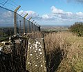
Trig pillar Wharrels Hill - geograph.org.uk - 1702995.jpg 2,470 × 2,132; 1.29 MB
-
Unclassified Country Road near Bothel - geograph.org.uk - 3998655.jpg 2,472 × 3,296; 3.34 MB
-
Very little left - geograph.org.uk - 3998666.jpg 3,296 × 2,472; 3.21 MB
-
Village green, Threapland - geograph.org.uk - 6089635.jpg 1,280 × 850; 714 KB
-
Wharrels Hill - geograph.org.uk - 1541424.jpg 640 × 247; 32 KB
-
Wharrels Hill Wind Farm - geograph.org.uk - 1937674.jpg 1,600 × 1,200; 412 KB
-
Wharrels Hill Wind Farm - geograph.org.uk - 1937677.jpg 1,200 × 1,600; 395 KB
-
Wharrels Hill Wind Farm - geograph.org.uk - 3170287.jpg 4,752 × 3,168; 2.9 MB
-
Wharrels Hill Wind Farm - geograph.org.uk - 3592066.jpg 2,592 × 1,944; 1.34 MB
-
Wind farm, Wharrels Hill - geograph.org.uk - 1702996.jpg 640 × 480; 73 KB
-
Windfarm entrance - geograph.org.uk - 6566496.jpg 1,944 × 2,592; 1.11 MB


