Category:Borthwick
Jump to navigation
Jump to search
English: Borthwick is a small hamlet in Midlothian, Scotland. To the west of the village is the fifteenth-century Borthwick Castle.
village in Midlothian, Scotland, UK  | |||||
| Upload media | |||||
| Instance of | |||||
|---|---|---|---|---|---|
| Location |
| ||||
 | |||||
Subcategories
This category has the following 5 subcategories, out of 5 total.
Media in category "Borthwick"
The following 20 files are in this category, out of 20 total.
-
 Borthwick Arms.jpg 484 × 464; 129 KB
-
 Borthwick arms.svg 512 × 563; 9 KB
-
 Borthwick Primary School - geograph.org.uk - 1466080.jpg 640 × 425; 104 KB
-
 Borthwick Rail Bridge - geograph.org.uk - 852331.jpg 640 × 480; 57 KB
-
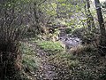 Crichton to Borthwick path - geograph.org.uk - 1556260.jpg 640 × 480; 167 KB
-
 Currie - geograph.org.uk - 681668.jpg 640 × 423; 66 KB
-
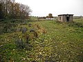
 Farmland, Halfkiln - geograph.org.uk - 175723.jpg 640 × 420; 53 KB
-
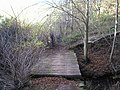 Footbridge over Middleton North Burn - geograph.org.uk - 608206.jpg 640 × 480; 139 KB
-
 Former railway sidings - geograph.org.uk - 1557829.jpg 640 × 480; 166 KB
-
 Gore Water - geograph.org.uk - 608214.jpg 640 × 480; 101 KB
-
 Lonely cottage on country road - geograph.org.uk - 995302.jpg 640 × 480; 50 KB
-
 Old Manse gateway - geograph.org.uk - 608151.jpg 640 × 480; 115 KB
-
 Ordnance Survey Sheet NT 35 Moorfoot Hils, Published 1955.jpg 7,180 × 7,661; 4.78 MB
-
 Path in Currie Woods - geograph.org.uk - 97403.jpg 640 × 480; 190 KB
-
 Path to Borthwick - geograph.org.uk - 1556257.jpg 640 × 480; 117 KB
-
 Road to Currie - geograph.org.uk - 681666.jpg 640 × 480; 104 KB
-
 The Waverly Line - geograph.org.uk - 608219.jpg 640 × 480; 65 KB
-
 Waverley Line, Borthwick - geograph.org.uk - 1556664.jpg 640 × 480; 135 KB
-
 Waverley Line, Borthwick - geograph.org.uk - 1558365.jpg 640 × 480; 130 KB
-
 Waverley Line, Borthwick - geograph.org.uk - 1558384.jpg 640 × 480; 118 KB


