Category:Bonnyrigg
Jump to navigation
Jump to search
town in Midlothian, Scotland, UK | |||||
| Upload media | |||||
| Instance of | |||||
|---|---|---|---|---|---|
| Location |
| ||||
| Population |
| ||||
 | |||||
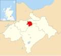
Bonnyrigg is a town in Midlothian, Scotland, eight miles (13 kilometres) southeast of Edinburgh city centre. The town had a population of 11,260 in the 1991 census which has risen to 14,457 according to the 2001 census. Along with Lasswade, Bonnyrigg is a twin town with St-Cyr-L'Ecole, France.
Subcategories
This category has the following 6 subcategories, out of 6 total.
Media in category "Bonnyrigg"
The following 39 files are in this category, out of 39 total.
-
A6094 at Bonnyrigg on a showery day - geograph.org.uk - 1026978.jpg 640 × 480; 57 KB
-
Bonnyrig.svg 1,425 × 1,313; 830 KB
-
Bonnyrigg - geograph.org.uk - 28978.jpg 640 × 420; 48 KB
-
Bonnyrigg Health Centre - geograph.org.uk - 1026974.jpg 640 × 480; 58 KB
-
Bonnyrigg Parish Church - geograph.org.uk - 1480505.jpg 480 × 640; 54 KB
-
Bonnyrigg Parish Church Pitcairn Centre - geograph.org.uk - 1480500.jpg 640 × 480; 102 KB
-
Bonnyrigg Red Rose 0 Brechin City 6.jpg 3,552 × 2,368; 3.69 MB
-
Bonnyrigg town centre (geograph 2632366).jpg 640 × 480; 76 KB
-
Bonnyrigg Town Centre - geograph.org.uk - 1210808.jpg 640 × 480; 45 KB
-
Calderwood (geograph 2617153).jpg 640 × 360; 218 KB
-
Cottages at Leyden Park, Bonnyrigg - geograph.org.uk - 1026969.jpg 640 × 480; 72 KB
-
Dalhousie - geograph.org.uk - 28991.jpg 640 × 456; 72 KB
-
Dalhousie Industrial Estate - geograph.org.uk - 1379990.jpg 640 × 480; 63 KB
-
Eldindean Road, Bonnyrigg - geograph.org.uk - 1026991.jpg 640 × 480; 63 KB
-
Eskdale Drive - geograph.org.uk - 450830.jpg 640 × 480; 61 KB
-
Field awaiting development, Eskbank - geograph.org.uk - 6080980.jpg 1,024 × 683; 207 KB
-
High Street, Bonnyrigg (geograph 4388649).jpg 800 × 533; 165 KB
-
Houses and garages, Bonnyrigg. - geograph.org.uk - 29024.jpg 640 × 480; 58 KB
-
Industrial estate, Bonnyrigg. - geograph.org.uk - 28982.jpg 640 × 433; 67 KB
-
John Clerk, of Eldin, Melville Castle from Eldin, 1776, NGA 209444.jpg 1,676 × 984; 1.71 MB
-
Lasswade and Bonnyrigg (geograph 4184190).jpg 3,264 × 2,448; 3.59 MB
-
LRFC stand.jpg 2,856 × 2,142; 1.09 MB
-
Memorial to Mick McGahey, King George V Park, Bonnyrigg.jpg 360 × 480; 41 KB
-
Midlothian Community Hospital, Bonnyrigg (geograph 4338302).jpg 1,024 × 687; 138 KB
-
New Dundas Park, Bonnyrigg.jpg 3,431 × 2,202; 3.13 MB
-
New Dundas Park.jpg 3,466 × 2,263; 3.63 MB
-
New houses, Bonnyrigg (geograph 2815845).jpg 640 × 360; 211 KB
-
Polton Colliery site (geograph 4154958).jpg 800 × 450; 329 KB
-
Polton Road - geograph.org.uk - 1312504.jpg 640 × 480; 78 KB
-
Rhododendrons, Melville - geograph.org.uk - 6080970.jpg 1,024 × 683; 410 KB
-
Sherwood Cottages - geograph.org.uk - 28984.jpg 640 × 480; 56 KB
-
Standing Stones (geograph 5593625).jpg 640 × 427; 378 KB
-
Still in Bonnyrigg. - geograph.org.uk - 992491.jpg 640 × 340; 52 KB
-
The fringes of Bonnyrigg. - geograph.org.uk - 992488.jpg 640 × 480; 57 KB
-
The Retreat Castle Hotel, Bonnyrigg - geograph.org.uk - 1742162.jpg 640 × 425; 89 KB
-
Waverley Crescent, Bonnyrigg (geograph 4338648).jpg 1,024 × 682; 135 KB
-
Welcome to Bonnyrigg - geograph.org.uk - 1745955.jpg 640 × 425; 59 KB


