Category:Bollendorf
Jump to navigation
Jump to search
municipality of Germany | |||||
| Upload media | |||||
| Pronunciation audio | |||||
|---|---|---|---|---|---|
| Instance of |
| ||||
| Location | Eifelkreis Bitburg-Prüm, Rhineland-Palatinate, Germany | ||||
| Population |
| ||||
| Area |
| ||||
| Elevation above sea level |
| ||||
| official website | |||||
 | |||||
Subcategories
This category has the following 7 subcategories, out of 7 total.
C
S
- Schlossmühle Bollendorf (5 F)
- Stolpersteine in Bollendorf (30 F)
- Synagoge (Bollendorf) (1 F)
Media in category "Bollendorf"
The following 47 files are in this category, out of 47 total.
-
DEU Bollendorf COA.svg 706 × 741; 117 KB
-
Wappen Bollendorf.png 150 × 161; 7 KB
-
Bachstrasse, Bollendorf - geo.hlipp.de - 14383.jpg 640 × 480; 65 KB
-
Bollendorf - geo.hlipp.de - 14380.jpg 640 × 480; 99 KB
-
Bollendorf 01.jpg 4,929 × 3,286; 3.39 MB
-
Bollendorf 2011-08.jpg 2,569 × 1,543; 1.38 MB
-
Bollendorf Bollendorf-Pont.jpg 3,964 × 1,636; 924 KB
-
Bollendorf Gemeinderat.png 2,287 × 1,645; 478 KB
-
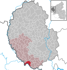
Bollendorf in BIT.svg 354 × 369; 268 KB
-
Bollendorf Ortsmitte 2021-07 --2.jpg 4,496 × 3,000; 6.04 MB
-
Bollendorf Ortsmitte 2021-07.jpg 4,496 × 3,000; 5.27 MB
-
Bollendorf Panorama 01.jpg 4,963 × 1,800; 8.28 MB
-
Bollendorf Sauer.jpg 1,060 × 795; 149 KB
-
Bollendorf, de Sauer met die katholische Pfarrkirche Sankt Michael Dm foto5 2014-06-09 10.45.jpg 4,416 × 3,312; 10.66 MB
-
Bollendorf01.jpg 1,536 × 2,048; 448 KB
-
Bollenduerfer Bréck (113).jpg 3,648 × 2,736; 2.71 MB
-
Burg Bollendorf (Bollendorf Castle) - geo.hlipp.de - 14382.jpg 640 × 480; 69 KB
-
Camping Sauer, Bollendorf - geo.hlipp.de - 41475.jpg 640 × 480; 93 KB
-
Flag of Bollendorf municipality (Germany).gif 324 × 216; 5 KB
-
Halloween in Bollendorf - geo.hlipp.de - 14390.jpg 640 × 480; 107 KB
-
House on the L1 - geo.hlipp.de - 41505.jpg 640 × 448; 65 KB
-
Infoschild Niederburg Bollendorf.jpg 3,000 × 4,496; 7.21 MB
-
Infoschild, im Hinergrund ist der Wall zu erkennen.jpg 4,496 × 3,000; 8.17 MB
-
L1 approaching Polsenhof - geo.hlipp.de - 41486.jpg 640 × 483; 98 KB
-
L1 near Dillingen - geo.hlipp.de - 41503.jpg 640 × 480; 95 KB
-
Lb-Bollenduerf.ogg 1.5 s; 14 KB
-
Madonna im Stein - geo.hlipp.de - 15178.jpg 640 × 480; 135 KB
-
MW 08 Köperich-Bollendorf 13 camino.jpg 2,285 × 1,713; 1.42 MB
-
MW 08 Köperich-Bollendorf 14 camino.jpg 2,448 × 3,264; 3.38 MB
-
MW 08 Köperich-Bollendorf 19 refugio Theresienstein.jpg 3,264 × 2,448; 3.4 MB
-
MW 08 Köperich-Bollendorf 25 camino.jpg 2,448 × 3,264; 3.64 MB
-
MW 08 Köperich-Bollendorf 34 Bollendorf.jpg 3,264 × 2,448; 1.42 MB
-
MW 09 Bollendorf-Echternacherbrück 03 Mariensäule.jpg 2,448 × 3,264; 1.33 MB
-
MW 09 Bollendorf-Echternacherbrück 15 Bollendorf.jpg 3,264 × 2,448; 3.72 MB
-
MW 09 Bollendorf-Echternacherbrück 25 banco jacobeo.jpg 2,448 × 3,264; 3.12 MB
-
Orchard near Bollendorf - geo.hlipp.de - 41482.jpg 640 × 444; 75 KB
-
Orchard, Polsenhof - geo.hlipp.de - 41494.jpg 640 × 393; 92 KB
-
Polsenhof - geo.hlipp.de - 41487.jpg 640 × 433; 77 KB
-
Rock by the L1 - geo.hlipp.de - 41495.jpg 640 × 480; 130 KB
-
Rock near Polsenhof - geo.hlipp.de - 41484.jpg 512 × 640; 158 KB
-
Sauertal (Sauer valley) - geo.hlipp.de - 41480.jpg 640 × 432; 89 KB
-
Tak7.jpg 1,176 × 1,204; 471 KB
-
Wall der Niederburg Bollendorf.jpg 4,496 × 3,000; 8.16 MB


