Category:Boats on the Aire and Calder Navigation
Jump to navigation
Jump to search
Media in category "Boats on the Aire and Calder Navigation"
The following 71 files are in this category, out of 71 total.
-

-
 A walk from Glass Houghton ^66 - geograph.org.uk - 1997051.jpg 800 × 600; 304 KB
-
 Aire and Calder Navigation - geograph.org.uk - 2734302.jpg 640 × 480; 52 KB
-
 Aire and Calder Navigation at Woodlesford - geograph.org.uk - 5653258.jpg 4,608 × 3,456; 3.99 MB
-
 Aire and Calder Navigation, Whitley - geograph.org.uk - 579853.jpg 640 × 475; 79 KB
-
 Aire ^ Calder Navigation - geograph.org.uk - 4656685.jpg 640 × 480; 65 KB
-
 And then there were three (geograph 5649817).jpg 4,608 × 3,072; 3.34 MB
-
 Boat moored on the Aire and Calder Navigation - geograph.org.uk - 4829826.jpg 2,048 × 1,536; 948 KB
-
 Boats moored along the Aire and Calder Navigation - geograph.org.uk - 6487226.jpg 3,072 × 2,304; 1.32 MB
-
 Boats moored in Lemonroyd Marina - geograph.org.uk - 4832367.jpg 2,048 × 1,536; 1.04 MB
-
 Canal and River Trust boat Shipley - geograph.org.uk - 4445961.jpg 1,600 × 1,062; 507 KB
-
 Canal boat on the Aire ^ Calder Navigation - geograph.org.uk - 3733070.jpg 1,024 × 683; 237 KB
-
 Canal Boats at Castleford - geograph.org.uk - 4445968.jpg 1,600 × 1,062; 656 KB
-
 Canal Boats at Castleford. - geograph.org.uk - 3041557.jpg 3,084 × 1,952; 1.14 MB
-
 Canal craft Moby ^1 - geograph.org.uk - 4151004.jpg 1,600 × 1,200; 421 KB
-
 Canal craft Moby ^2 - geograph.org.uk - 4151008.jpg 1,600 × 1,200; 438 KB
-
 Canal Dry-Dock. - geograph.org.uk - 3028460.jpg 3,289 × 2,022; 883 KB
-

-
 Canal side moorings at Ramsdens Bridge - geograph.org.uk - 4907906.jpg 800 × 600; 110 KB
-
 Catamaran on the Aire ^ Calder Navigation - geograph.org.uk - 5290107.jpg 1,024 × 768; 335 KB
-
 Celeste on the Knottingley ^ Goole Navigation - geograph.org.uk - 4120409.jpg 1,600 × 1,064; 816 KB
-
 Christmas tree, Stanley Ferry Marina - geograph.org.uk - 2743940.jpg 1,024 × 768; 529 KB
-
 Coal drop, Aire ^ Calder Navigation, Castleford - geograph.org.uk - 4580349.jpg 1,024 × 768; 200 KB
-
 Contrails - geograph.org.uk - 3983596.jpg 1,600 × 1,200; 335 KB
-
 Converted barge - geograph.org.uk - 5663759.jpg 4,608 × 3,456; 3.04 MB
-
 Converted barge, Papillon - geograph.org.uk - 1828821.jpg 640 × 480; 223 KB
-
 Eskdale barge moored at Ferrybridge - geograph.org.uk - 6304180.jpg 4,608 × 3,072; 1.93 MB
-
 Gibraltar Island Road, Leeds - geograph.org.uk - 4926376.jpg 1,280 × 851; 695 KB
-
 Gibraltar Island Road, Leeds - geograph.org.uk - 4926378.jpg 1,280 × 851; 730 KB
-
 Goole Canal Knottingley - geograph.org.uk - 5650355.jpg 4,118 × 2,258; 1.98 MB
-
 Jubilee Venture, Scouts Narrow Boat - geograph.org.uk - 2729747.jpg 1,024 × 768; 857 KB
-

-
 Knostrop long term moorings - geograph.org.uk - 2766030.jpg 984 × 738; 152 KB
-
 Knottingley junction Aire and Calder canal - geograph.org.uk - 2773242.jpg 4,288 × 3,216; 2 MB
-
 Large barge leaving Bullhome Locks Castleford - geograph.org.uk - 5649815.jpg 4,608 × 3,072; 3.31 MB
-
 Marina at Rawcliffe Bridge.jpg 640 × 480; 149 KB
-
 Moored boats at Ferrybridge - geograph.org.uk - 5674657.jpg 1,600 × 1,055; 425 KB
-
 Moorings on the Aire and Calder Navigation - geograph.org.uk - 6493076.jpg 1,024 × 768; 194 KB
-
 Narrow Boat entering Knottingley lock - geograph.org.uk - 4021917.jpg 4,608 × 3,456; 3.48 MB
-
 Narrow boat in Knottingley Locks - geograph.org.uk - 7020095.jpg 4,288 × 3,216; 2.11 MB
-
 Narrow boat ‘Grumpy Git’ (1) - geograph.org.uk - 1856611.jpg 640 × 480; 250 KB
-
 Narrow boat ‘Grumpy Git’ (2) - geograph.org.uk - 1856614.jpg 640 × 480; 284 KB
-
 Narrow boats moored at Woodlesford - geograph.org.uk - 4829787.jpg 2,048 × 1,536; 1.28 MB
-
 Narrowboat Fork‘andles - geograph.org.uk - 1828827.jpg 640 × 480; 318 KB
-
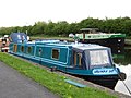
 Narrowboat on the Aire ^ Calder Navigation - geograph.org.uk - 5290105.jpg 1,024 × 768; 163 KB
-
 Narrowboats on the Aire and Calder Navigation - geograph.org.uk - 6493082.jpg 1,024 × 768; 219 KB
-
 Notice to dog walkers - geograph.org.uk - 2340061.jpg 1,024 × 765; 734 KB
-
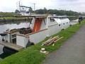
 Old Barges awaiting repair-renovation - geograph.org.uk - 6057136.jpg 4,608 × 3,072; 3.45 MB
-
 On the Aire and Calder Navigation - geograph.org.uk - 4661937.jpg 1,280 × 853; 374 KB
-
 Peace Lily on the Aire ^ Calder Navigation at Castleford - geograph.org.uk - 4445876.jpg 1,600 × 1,062; 548 KB
-
 Pollington Bridge - geograph.org.uk - 489764.jpg 640 × 398; 56 KB
-
 Racca Green Knottingley - geograph.org.uk - 5656858.jpg 3,702 × 2,599; 1.81 MB
-
 Renovated barge - geograph.org.uk - 6354082.jpg 4,288 × 3,216; 1.63 MB
-

-
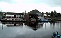
 Supreme Marine Boatyard Castleford - geograph.org.uk - 3041544.jpg 4,078 × 2,924; 1.89 MB
-
 The "Freda Carless" - geograph.org.uk - 6017653.jpg 4,608 × 3,072; 2.92 MB
-
 The 'Spirit of the Age' - geograph.org.uk - 3170454.jpg 1,024 × 661; 240 KB
-
 The Barge " Easedale" - geograph.org.uk - 6843781.jpg 1,404 × 987; 322 KB
-
 The barge "Eskdale" at twilight - geograph.org.uk - 6342683.jpg 4,288 × 3,216; 1.43 MB
-
 The Dolly Earle moored at Ferrybridge - geograph.org.uk - 5670012.jpg 3,241 × 2,018; 1.78 MB
-
 The former 'Spirit of the Age' (bow shot) - geograph.org.uk - 3034412.jpg 1,024 × 768; 667 KB
-
 The former 'Spirit of the Age' (stern shot) - geograph.org.uk - 3034414.jpg 1,024 × 768; 794 KB
-
 The Jolly Lamb Narrow boat - geograph.org.uk - 5650356.jpg 4,074 × 2,529; 2.96 MB
-
 The Stourton Boathouse, Thwaite Lane, Leeds - geograph.org.uk - 4926142.jpg 1,280 × 851; 670 KB
-
 View from Lock Lane bridge Castleford - geograph.org.uk - 5649821.jpg 4,053 × 2,503; 2.2 MB
-
 View from Ramsdens bridge Stanley Ferry - geograph.org.uk - 5701927.jpg 4,608 × 3,072; 2.58 MB
-
 ‘Horizon’ - bow view - geograph.org.uk - 2666507.jpg 1,024 × 768; 547 KB
-
 ‘Horizon’ - stern view - geograph.org.uk - 2666514.jpg 1,024 × 768; 554 KB
-
 ‘Shamrock’ - bow view - geograph.org.uk - 2666499.jpg 1,024 × 768; 623 KB
-
 ‘Shamrock’ - stern view - geograph.org.uk - 2666501.jpg 1,024 × 768; 548 KB
-
 “Oo’da thow’t it” - geograph.org.uk - 2261976.jpg 1,024 × 768; 715 KB


.jpg)


_-_geograph.org.uk_-_1856611.jpg)
_-_geograph.org.uk_-_1856614.jpg)


_-_geograph.org.uk_-_3034412.jpg)
_-_geograph.org.uk_-_3034414.jpg)


