Category:Blithfield
Jump to navigation
Jump to search
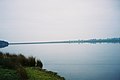
English: Blithfield is a civil parish in the East Staffordshire district of Staffordshire, England. It includes the settlements of Admaston, Newton, along with Blithfield Hall, home of the Bagot family since 1360. According to the 2001 census it had a population of 225. Blithfield Reservoir takes up much of the parish and the area is home to the Bagot goat. St Leonard's Church dates from the 13th century, and contains tombs of the Bagot family as well as an original helmet, ancient stained glass windows and a floor paved in Minton tiles. Parish registers of the church begin in 1538.
village in United Kingdom  | |||||
| Upload media | |||||
| Instance of | |||||
|---|---|---|---|---|---|
| Location | East Staffordshire, Staffordshire, West Midlands, England | ||||
| Population |
| ||||
 | |||||
Subcategories
This category has the following 4 subcategories, out of 4 total.
B
- Blithfield Reservoir (60 F)
N
- Newton, Staffordshire (9 F)
Media in category "Blithfield"
The following 113 files are in this category, out of 113 total.
-
 A Barn Conversion, Admaston - geograph.org.uk - 2498590.jpg 640 × 428; 94 KB
-
 A Blithfield field - geograph.org.uk - 2071360.jpg 1,024 × 768; 139 KB
-
 A Blithfield lane - geograph.org.uk - 2071248.jpg 1,024 × 768; 95 KB
-
 A Blithfield lane - geograph.org.uk - 2071347.jpg 1,024 × 768; 112 KB
-
 A Field of Hay Bales, from Lea Lane - geograph.org.uk - 2498585.jpg 640 × 428; 67 KB
-
 Access road, St Stephen's Hill Farm - geograph.org.uk - 6717734.jpg 1,600 × 1,200; 324 KB
-

-

-

-
 B5013 heading south - geograph.org.uk - 3421543.jpg 640 × 480; 75 KB
-
 Barn Farm - geograph.org.uk - 2459832.jpg 640 × 408; 52 KB
-
 Barn near Hillfield Plantation - geograph.org.uk - 3421510.jpg 645 × 527; 83 KB
-
 Big gates into a big field - geograph.org.uk - 2071306.jpg 1,024 × 768; 145 KB
-
 Blithfield Reservoir - geograph.org.uk - 2439136.jpg 800 × 600; 200 KB
-
 Blithfield Reservoir - geograph.org.uk - 3244715.jpg 3,072 × 2,304; 1.1 MB
-
 Blithfield Reservoir - geograph.org.uk - 6735896.jpg 3,809 × 1,535; 1.08 MB
-
 Blithfield reservoir and causeway - geograph.org.uk - 2527235.jpg 950 × 713; 268 KB
-
 Blithfield Reservoir and Causeway - geograph.org.uk - 4030119.jpg 2,798 × 2,108; 2.65 MB
-

-
 Blithfield Reservoir shoreline - geograph.org.uk - 2071341.jpg 1,024 × 768; 170 KB
-
 Blithfield Reservoir water take off point - geograph.org.uk - 3244717.jpg 3,072 × 2,304; 2.12 MB
-
 Blithfield Reservoir, causeway from Beech Tree Point - geograph.org.uk - 4357186.jpg 1,840 × 1,232; 511 KB
-
 Blithfield Reservoir, hide on Beech Tree Point - geograph.org.uk - 4357192.jpg 1,840 × 1,232; 639 KB
-
 Blithfield Reservoir, near Rugeley - geograph.org.uk - 3968077.jpg 4,000 × 3,000; 1.95 MB
-
 Blithfield Reservoir, near Rugeley - geograph.org.uk - 3968079.jpg 4,000 × 3,000; 2.14 MB
-
 Blithfield Reservoir, Staffordshire - geograph.org.uk - 6462964.jpg 5,184 × 3,888; 4.33 MB
-
 Booth Lane - geograph.org.uk - 5563755.jpg 640 × 480; 105 KB
-
 Booth Lane - geograph.org.uk - 5563766.jpg 640 × 480; 53 KB
-
 Booth Lane Leading to Upper Booth - geograph.org.uk - 2458951.jpg 640 × 428; 95 KB
-
 Capping Stone Support - geograph.org.uk - 2459359.jpg 428 × 640; 96 KB
-
 Causeway across Blithfield Reservoir - geograph.org.uk - 5734427.jpg 640 × 480; 47 KB
-
 Concrete road, St Stephen's Hill Farm - geograph.org.uk - 6717612.jpg 1,600 × 1,200; 549 KB
-

-
 Dapple Heath - geograph.org.uk - 2071293.jpg 1,024 × 768; 111 KB
-
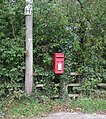 Elizabeth II postbox on Newton Hurst Lane, Dapple Heath - geograph.org.uk - 5565766.jpg 2,052 × 2,311; 1.14 MB
-
 Entrance to Blithfield Education Centre - geograph.org.uk - 1136626.jpg 640 × 479; 167 KB
-
 Farm on Booth Lane, Lower Booth - geograph.org.uk - 2458976.jpg 640 × 428; 66 KB
-
 Farmhouse and holiday cottages, St Stephen's Hill Farm - geograph.org.uk - 6717609.jpg 1,600 × 1,200; 692 KB
-
 Farmland near Hillfield Plantation - geograph.org.uk - 3421512.jpg 640 × 480; 38 KB
-
 Farmland near Newton - geograph.org.uk - 3421500.jpg 640 × 480; 84 KB
-
 Farmland, Newbuildings Farm - geograph.org.uk - 3421486.jpg 640 × 480; 83 KB
-
 Farmland, Rectory Farm - geograph.org.uk - 3421518.jpg 640 × 480; 63 KB
-
 Field and woodland, Newton Hurst - geograph.org.uk - 5563775.jpg 640 × 480; 53 KB
-
 Field boundary - geograph.org.uk - 2071273.jpg 1,024 × 768; 129 KB
-
 Field Edge view at St Stephen's Hill Triangulation Pillar - geograph.org.uk - 5053428.jpg 4,000 × 3,000; 3.71 MB
-
 Field entrance off Booth Lane - geograph.org.uk - 5563767.jpg 640 × 480; 92 KB
-
 Fields near Newton Hurst Farm - geograph.org.uk - 5563779.jpg 640 × 442; 50 KB
-
 Footpath to Admaston - geograph.org.uk - 188193.jpg 640 × 427; 135 KB
-
 Footpath, Near Newton Hurst Farm - geograph.org.uk - 2459844.jpg 640 × 428; 95 KB
-

-
 Grazing near Admaston - geograph.org.uk - 3421665.jpg 640 × 480; 63 KB
-
 Grazing near Oakfields - geograph.org.uk - 3421528.jpg 640 × 480; 59 KB
-
 Grazing near the River Blithe - geograph.org.uk - 5563758.jpg 640 × 480; 87 KB
-
 Grazing north off Booth - geograph.org.uk - 5563754.jpg 640 × 480; 63 KB
-
 Grazing sheep - geograph.org.uk - 2071325.jpg 1,024 × 768; 145 KB
-
 Grazing, Dapple Heath - geograph.org.uk - 5563770.jpg 640 × 480; 69 KB
-
 Grazing, Lea Hall Farm - geograph.org.uk - 3421538.jpg 640 × 480; 63 KB
-

-
 House Near Newtonhurst - geograph.org.uk - 2459815.jpg 640 × 428; 71 KB
-
 Houses on Steenwood Lane - geograph.org.uk - 3421551.jpg 640 × 480; 63 KB
-
 Lea Lane near Admaston - geograph.org.uk - 2439125.jpg 800 × 600; 292 KB
-
 Lea Lane, Admaston - geograph.org.uk - 2458798.jpg 640 × 428; 62 KB
-
 Lea Lane, Blithfield - geograph.org.uk - 2458857.jpg 640 × 428; 102 KB
-

-
-
 Lower Booth Farm, Booth Lane - geograph.org.uk - 2458965.jpg 640 × 428; 100 KB
-
 Manor Farm, Newton - geograph.org.uk - 2458932.jpg 640 × 428; 66 KB
-
 Marshy ground - geograph.org.uk - 1136581.jpg 640 × 479; 163 KB
-
 Minor road heading east - geograph.org.uk - 3421536.jpg 640 × 480; 47 KB
-
 Minor road heading south - geograph.org.uk - 3421495.jpg 640 × 480; 99 KB
-
 Minor road heading south - geograph.org.uk - 3421522.jpg 640 × 480; 37 KB
-
 Minor road towards Newton - geograph.org.uk - 3421492.jpg 640 × 480; 96 KB
-
 Much-extended house, Dapple Heath - geograph.org.uk - 2071298.jpg 1,024 × 768; 133 KB
-
 New Buildings Farm, New Town - geograph.org.uk - 2498383.jpg 640 × 428; 91 KB
-
 Newton Bridge - geograph.org.uk - 2459350.jpg 640 × 428; 119 KB
-
 Newton Farm, Newton - geograph.org.uk - 2458879.jpg 640 × 428; 56 KB
-
 Newton House - geograph.org.uk - 1136587.jpg 640 × 479; 201 KB
-
 Newton Hurst Lane - geograph.org.uk - 1136588.jpg 640 × 479; 189 KB
-
 Newton Hurst Lane - geograph.org.uk - 5563772.jpg 640 × 480; 75 KB
-
 Newton Hurst Lane towards Abbots Bromley - geograph.org.uk - 5563781.jpg 640 × 480; 117 KB
-
 Oakfields Farm taken from Lea Lane - geograph.org.uk - 2458814.jpg 640 × 428; 91 KB
-
 Old notice near Newton Bridge - geograph.org.uk - 2071319.jpg 1,024 × 768; 172 KB
-
 Plantation near Newton Hurst Farm - geograph.org.uk - 1136586.jpg 640 × 479; 162 KB
-
 Pond near Oakfields - geograph.org.uk - 3421526.jpg 640 × 480; 98 KB
-
 Rectory Farm - geograph.org.uk - 2458821.jpg 640 × 428; 80 KB
-
 Rectory Farm - geograph.org.uk - 3421520.jpg 1,024 × 594; 92 KB
-
 River Blythe Near Blithfield Reservoir - geograph.org.uk - 2245220.jpg 1,496 × 1,122; 709 KB
-
 Road descending to St Stephen's Hill Farm - geograph.org.uk - 6717713.jpg 1,600 × 1,200; 510 KB
-
 Roadside tree - geograph.org.uk - 2071368.jpg 1,024 × 768; 140 KB
-
 Roadside trees - geograph.org.uk - 2071254.jpg 1,024 × 768; 180 KB
-
 Sheep, Newton Bridge - geograph.org.uk - 5563774.jpg 640 × 480; 58 KB
-
 Sparkling waters - geograph.org.uk - 2071387.jpg 1,024 × 768; 152 KB
-
 St Stephens Hill Trig Point Flush Bracket S2052 - geograph.org.uk - 6801724.jpg 995 × 1,319; 1.4 MB
-
 Staffordshire Way Near Blithfield Reservoir - geograph.org.uk - 2245223.jpg 1,122 × 1,496; 1,013 KB
-
 Steenwood Lane - geograph.org.uk - 3421548.jpg 640 × 480; 104 KB
-
 Steenwood Lane, Admaston - geograph.org.uk - 3421655.jpg 640 × 480; 93 KB
-
 Telephone exchange on Booth Lane - geograph.org.uk - 5563762.jpg 640 × 480; 100 KB
-
 The B5013 at Admaston - geograph.org.uk - 2439118.jpg 800 × 600; 276 KB
-

-
 The Croft - geograph.org.uk - 1136627.jpg 640 × 479; 186 KB
-
 The River Blithe - geograph.org.uk - 5563752.jpg 640 × 480; 120 KB
-
 The road into Admaston - geograph.org.uk - 4030112.jpg 2,984 × 1,856; 2.16 MB
-
 The road to Newton Hurst - geograph.org.uk - 2071310.jpg 1,024 × 768; 105 KB
-

-
 Three trees in a row - geograph.org.uk - 2071267.jpg 1,024 × 768; 162 KB
-
 Track to Dairy House Farm - geograph.org.uk - 3421503.jpg 640 × 480; 87 KB
-
 Track to Newbuildings Farm - geograph.org.uk - 3421489.jpg 640 × 480; 68 KB
-
 Trees around a pond, St Stephen's Hill Farm - geograph.org.uk - 6717727.jpg 1,600 × 1,200; 459 KB
-
 Trees in a field, St Stephen's Hill Farm - geograph.org.uk - 6717699.jpg 1,600 × 1,200; 609 KB
-
 Two signs, one route - geograph.org.uk - 2071259.jpg 1,024 × 768; 156 KB
-

-
 Unsurfaced track, St Stephen's Hill Farm - geograph.org.uk - 6717684.jpg 1,600 × 1,200; 629 KB
-


