Category:Blantyre, South Lanarkshire
Jump to navigation
Jump to search
town in South Lanarkshire, Scotland, UK | |||||
| Upload media | |||||
| Instance of | |||||
|---|---|---|---|---|---|
| Location |
| ||||
| Population |
| ||||
 | |||||
Deutsch: Blantyre in Schottland ist eine Stadt in der Grafschaft South Lanarkshire 15 km südöstlich von Glasgow.
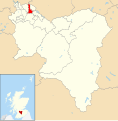
English: Blantyre is a burgh in South Lanarkshire, Scotland with a population of about 17,000. It is bounded by the River Clyde to the north, the Rotten Calder to the west, the Park Burn to the east and the Rotten Burn to the south. It is best known as the birthplace of David Livingstone, the well-known explorer and missionary who was the first European to see (and name) the Victoria Falls. His former house is now a museum which is at the end of Station Road, on the banks of the River Clyde. Also nearby is Bothwell Castle, dating from the thirteenth century.
Français : Blantyre est une ville du South Lanarkshire, au sud-ouest de la grande banlieue de Glasgow en Écosse, au Royaume-Uni.
Gàidhlig: 'S e baile ann an Alba meadhonach a tha ann am Baile an t-Saoir (Beurla: Blantyre). Tha e faisg air Glaschu.
Italiano: Blantyre ( gaelico: Baile an t-Saoir) è una cittadina scozzese situata nell'area amministrativa del Lanarkshire Meridionale, nella parte occidentale delle Lowlands Centrali.
Simple English: Blantyre is a burgh in South Lanarkshire, Scotland with a population of about 17,000.
Svenska: Blantyre är en ort och burgh i South Lanarkshire, nära Glasgow, Skottland. Orten utgör en del av grannstaden Hamiltons tätortsområde, som hade totalt 66 500 invånare år 2004, varav 18 280 invånare bodde i själva Blantyre.
Subcategories
This category has the following 15 subcategories, out of 15 total.
B
- Blantyre railway station (14 F)
C
- Craighead Viaduct (3 F)
- Crossbasket House (13 F)
D
G
H
- Haughhead Bridge, Uddingston (12 F)
J
L
M
- Milheugh Estate (11 F)
R
Media in category "Blantyre, South Lanarkshire"
The following 124 files are in this category, out of 124 total.
-
A725 at Auchinraith (geograph 3528033).jpg 640 × 480; 50 KB
-
A725 at High Blantyre (geograph 3528036).jpg 640 × 480; 35 KB
-
A725 bridge over A724, Blantyre (geograph 6966736).jpg 640 × 480; 81 KB
-
A725, East Kilbride Expressway (geograph 1667283).jpg 640 × 480; 80 KB
-
Anderson Gardens - geograph.org.uk - 894635.jpg 640 × 433; 84 KB
-
Auchentibber Reservoir - geograph.org.uk - 812342.jpg 640 × 481; 75 KB
-
B758 between High Blantyre and Blantyre (geograph 1667341).jpg 640 × 480; 77 KB
-
B758 towards Blantyre (geograph 6966709).jpg 800 × 600; 124 KB
-
Bardykes Road, Blantyre (geograph 3371873).jpg 640 × 480; 252 KB
-
Blantyre (local).ogg 1.4 s; 26 KB
-
Blantyre and the River Clyde from the air (geograph 5716649).jpg 640 × 480; 249 KB
-
Blantyre and the River Clyde from the air (geograph 5716664).jpg 640 × 480; 245 KB
-
Blantyre Farm Road (A758) (geograph 6966714).jpg 1,024 × 768; 239 KB
-
Blantyre Farm Road (A758) (geograph 6966719).jpg 800 × 600; 107 KB
-
Blantyre Leisure Centre - geograph.org.uk - 1218345.jpg 640 × 481; 136 KB
-
Blantyre Old Parish Church - geograph.org.uk - 3729483.jpg 640 × 480; 66 KB
-
Blantyre Old Parish Church - geograph.org.uk - 96281.jpg 640 × 480; 140 KB
-
Blantyre Technology Park from the air (geograph 2988862).jpg 640 × 480; 173 KB
-
Blantyre.ogg 2.0 s; 37 KB
-
Blantyre.svg 1,319 × 1,345; 2.63 MB
-
Bothwell and Blantyre from the air (geograph 7939863).jpg 1,600 × 900; 645 KB
-
Car Showrooms Adjacent to A725 - geograph.org.uk - 107086.jpg 640 × 480; 89 KB
-
Converted mill building - geograph.org.uk - 895872.jpg 640 × 480; 91 KB
-
Crossroads on the A724 in Blantyre (geograph 3230429).jpg 640 × 481; 73 KB
-
Cycle path at Ballantrae Road, Blantyre (geograph 6803197).jpg 1,024 × 683; 210 KB
-
David Livingstone memorial in Blantyre; Livingstone bidding Wellcome V0018874.jpg 3,331 × 2,260; 2.86 MB
-
David Livingstone Memorial Primary School - geograph.org.uk - 105461.jpg 640 × 480; 109 KB
-
East Kilbride Expressway - geograph.org.uk - 2762432.jpg 2,048 × 1,536; 1.36 MB
-
East Kilbride Expressway from the air (geograph 7939862).jpg 1,600 × 900; 649 KB
-
Exterieur van Auchinraith House nabij Blantyre, RP-F-2001-7-426-3.jpg 8,270 × 5,598; 5.12 MB
-
Exterieur van Craighead House te Blantyre, RP-F-2001-7-426-27.jpg 8,270 × 5,598; 5.18 MB
-
Exterieur van Milheugh House, RP-F-2001-7-426-71.jpg 5,120 × 8,270; 3.66 MB
-
Fagan Court - geograph.org.uk - 894634.jpg 640 × 480; 95 KB
-
Flats by the Clyde - geograph.org.uk - 895868.jpg 640 × 480; 91 KB
-
Flats by the Clyde - geograph.org.uk - 895888.jpg 640 × 480; 105 KB
-
Footbridge sign - geograph.org.uk - 895865.jpg 640 × 480; 130 KB
-
Footpath next to the East Kilbride Expressway (geograph 6658091).jpg 1,024 × 768; 342 KB
-
Glasgow Road (A724) towards Hamilton (geograph 6966748).jpg 800 × 600; 86 KB
-
Glasgow Road (A724), Blantyre (geograph 6966728).jpg 800 × 518; 82 KB
-
Glasgow Road, Blantyre (A724) - geograph.org.uk - 1670329.jpg 640 × 480; 70 KB
-
Glasgow Road, Blantyre (geograph 4121234).jpg 5,184 × 3,456; 7.15 MB
-
Glasgow Rutherglen ScottishParliamentConstituency.svg 162 × 143; 18 KB
-
Grey clouds reflected (geograph 7197502).jpg 6,120 × 4,608; 7.71 MB
-
Hamilton from the air (geograph 5379561).jpg 640 × 480; 142 KB
-
Hamilton International Technology Park - geograph.org.uk - 96270.jpg 640 × 480; 91 KB
-
Hotel in Blantyre - geograph.org.uk - 1253782.jpg 640 × 480; 52 KB
-
Houses on Montrose Gardens, Blantyre (geograph 6966717).jpg 800 × 509; 87 KB
-
Hunthill Road, Blantyre - geograph.org.uk - 3371782.jpg 640 × 480; 255 KB
-
Hydro electric power station - geograph.org.uk - 895851.jpg 640 × 480; 97 KB
-
Hydro-power station, Blantyre - geograph.org.uk - 3880.jpg 640 × 438; 54 KB
-
John Carrigans (geograph 3371865).jpg 640 × 480; 262 KB
-
Knightswood Terrace - geograph.org.uk - 895898.jpg 640 × 480; 97 KB
-
Lammas Growth on Quercus robur, Greenhall, Blantyre, South Lanarkshire.jpg 3,385 × 2,224; 1.76 MB
-
Lidl Supermarket, Blantyre (geograph 6966740).jpg 800 × 631; 125 KB
-
Main Street, High Blantyre (geograph 4121279).jpg 5,184 × 3,456; 7.41 MB
-
Main Street, High Blantyre (geograph 4121285).jpg 1,600 × 1,067; 526 KB
-
Map of Lanarkshire Sheet 011, Ordnance Survey, 1863-1865.jpg 10,704 × 7,164; 11.89 MB
-
Map of Lanarkshire Sheet 011, Ordnance Survey, 1863-1865.tiff 10,704 × 7,164; 219.39 MB
-
Milheugh House. Ruins of bridge over the Rotten Calder. Blantyre, South Lanarkshire.jpg 4,896 × 2,752; 2.96 MB
-
Milheugh House. Ruins of greenhouse ranges. Blantyre, South Lanarkshire.jpg 4,896 × 2,752; 3.3 MB
-
Milheugh House. Ruins of greenhouses. Blantyre, South Lanarkshire.jpg 4,896 × 2,752; 4.1 MB
-
Muiredge Primary School, Blantyre - geograph.org.uk - 4121214.jpg 5,184 × 3,456; 6.11 MB
-
National Cycle Route 75 towards Uddingston (geograph 6966707).jpg 800 × 600; 140 KB
-
NCR 75 entrance (geograph 7197213).jpg 4,896 × 3,686; 7.44 MB
-
Ness Drive - geograph.org.uk - 895897.jpg 640 × 469; 89 KB
-
New houses, Stonefield Road, Blantyre (geograph 2504687).jpg 640 × 480; 62 KB
-
Old Milheugh Estate. Wellingtonias. Blantyre, South Lanarkshire.jpg 3,752 × 2,540; 2.16 MB
-
Pathfoot, Barnhill (geograph 4877303).jpg 1,024 × 683; 120 KB
-
Playing field,Blantyre (geograph 3376834).jpg 640 × 480; 230 KB
-
Railway bridge with traffic lights (geograph 7196547).jpg 1,024 × 768; 317 KB
-
Recently cleared wooded area (geograph 7197210).jpg 4,896 × 3,686; 7.41 MB
-
Remains of old building - geograph.org.uk - 895847.jpg 640 × 480; 120 KB
-
River Clyde - geograph.org.uk - 3481212.jpg 640 × 480; 134 KB
-
River Clyde Walkway - geograph.org.uk - 895845.jpg 640 × 480; 100 KB
-
Rotten Calder at the Redlees Bridge (geograph 6689286).jpg 4,160 × 3,120; 2.64 MB
-
Roundabout on Glasgow Road (A724), Blantyre (geograph 6966734).jpg 640 × 480; 74 KB
-
School Building Blantyre - geograph.org.uk - 1253784.jpg 640 × 480; 90 KB
-
Sewage Works at Bothwell - geograph.org.uk - 760608.jpg 640 × 480; 111 KB
-
Shops and Bar, High Blantyre (geograph 3371777).jpg 640 × 444; 221 KB
-
Shops in High Blantyre (geograph 3729355).jpg 640 × 480; 91 KB
-
South Lanarkshire - Generals Bridge, Stoneymeadow Road - 20230807143322.jpg 4,000 × 3,000; 6.48 MB
-
South Lanarkshire Crematorium - geograph.org.uk - 492005.jpg 640 × 480; 64 KB
-
St Andrew's Church, Blantyre (geograph 6966731).jpg 800 × 551; 81 KB
-
St Josephs School - Blantyre - geograph.org.uk - 1218524.jpg 640 × 480; 72 KB
-
Station Road - geograph.org.uk - 894630.jpg 640 × 480; 91 KB
-
Stonefield Crescent, Blantyre - geograph.org.uk - 2042489.jpg 640 × 480; 97 KB
-
Stonefield Public Park, Blantyre (geograph 6799033).jpg 1,024 × 768; 307 KB
-
Stonefield Road, Blantyre (geograph 3371868).jpg 640 × 376; 200 KB
-
The Clyde Walkway - geograph.org.uk - 915701.jpg 480 × 640; 105 KB
-
The Cornerstone, Main Street, High Blantyre (geograph 4121306).jpg 5,184 × 3,456; 6.85 MB
-
The Hoolet's Nest in Blantyre - geograph.org.uk - 3729404.jpg 640 × 537; 77 KB
-
The Old Original Bar, Blantyre (geograph 6966730).jpg 800 × 587; 105 KB
-
The Parkville Hotel, Glasgow Road, Blantyre (geograph 4121181).jpg 5,184 × 3,456; 6.71 MB
-
The pond in Redlees Urban Park (geograph 7196549).jpg 1,024 × 768; 378 KB
-
The River Clyde - geograph.org.uk - 895863.jpg 640 × 480; 93 KB
-
The River Clyde - geograph.org.uk - 895884.jpg 640 × 480; 96 KB
-
The River Clyde - geograph.org.uk - 895889.jpg 640 × 480; 93 KB
-
The spinning mill where David Livingstone worked as a child, Wellcome V0018817.jpg 3,650 × 2,037; 3.95 MB
-
The spinning mill where David Livingstone worked, Blantyre, Wellcome V0018821.jpg 2,200 × 3,319; 2.86 MB
-
The West End Bar, Blantyre (geograph 6966724).jpg 800 × 517; 97 KB
-
Track into woodland (geograph 6966712).jpg 800 × 566; 184 KB
-
Victoria Street, Blantyre (geograph 3481290).jpg 640 × 449; 44 KB
-
View to field boundary (geograph 7197216).jpg 4,896 × 3,686; 6.14 MB
-
Watson Street (geograph 3371863).jpg 640 × 480; 260 KB
-
Weir on the Clyde at Blantyre - geograph.org.uk - 760603.jpg 640 × 480; 129 KB
-
Weir on the River Clyde - geograph.org.uk - 895849.jpg 640 × 480; 91 KB
-
Weir on the River Clyde - geograph.org.uk - 895856.jpg 640 × 402; 91 KB
-
Weir on the River Clyde - geograph.org.uk - 895878.jpg 640 × 480; 99 KB
-
Weir on the River Clyde - geograph.org.uk - 895879.jpg 640 × 480; 95 KB
-
Weir on the River Clyde - geograph.org.uk - 895891.jpg 640 × 540; 112 KB
-
West End Bar, Blantyre (geograph 2042468).jpg 640 × 480; 101 KB
-
Westerpark Avenue, Hamilton (geograph 6803171).jpg 1,024 × 683; 208 KB
-
Whistleberry Retail Park (geograph 2903450).jpg 640 × 480; 98 KB


