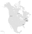
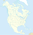
Category:Blank political maps of North America
Jump to navigation
Jump to search
Media in category "Blank political maps of North America"
The following 7 files are in this category, out of 7 total.
-
Blankmap-CentralAmerica-Caribbean.png 670 × 513; 11 KB
-
BlankMap-North America-Subdivisions.png 960 × 1,024; 118 KB
-
North America blank map with state and province boundaries.png 1,749 × 1,740; 51 KB
-
North America map with states and provinces.svg 1,300 × 1,353; 674 KB
-
North America states and provinces.svg 495 × 465; 1.18 MB
-
Northeast and Midwest America map with states and provinces.svg 638 × 638; 403 KB


