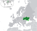
Category:Blank maps of Ukraine
Jump to navigation
Jump to search
Media in category "Blank maps of Ukraine"
The following 27 files are in this category, out of 27 total.
-
000 Ukraina harta.PNG 632 × 322; 15 KB
-
Blank map of Ukraine.svg 2,000 × 1,500; 20 KB
-
Donetsk People's Republic (2014-04-30).svg 659 × 891; 120 KB
-
Europe-Ukraine highlighted.svg 2,045 × 1,720; 2.7 MB
-
Europe-Ukraine.svg 2,045 × 1,720; 7.33 MB
-
Map of subdivisions of Ukraine.svg 14,000 × 9,500; 862 KB
-
Map of Ukraine blank.png 1,181 × 825; 54 KB
-
Map of Ukraine Oblasts 4 colors.svg 550 × 380; 728 KB
-
Map of Ukraine Oblasts simple 4 colors.svg 700 × 480; 178 KB
-
Map of Ukraine Oblasts simple 5 colors.png 700 × 480; 91 KB
-
Map of Ukraine political simple blank.png 1,280 × 878; 134 KB
-
Map of Ukraine political simple blank.svg 700 × 480; 149 KB
-
Map of Ukraine simple blank.png 1,181 × 825; 22 KB
-
Oblasti Ukrayiny.png 800 × 595; 291 KB
-
Ukraine (1991-2014) location map.svg 1,546 × 1,038; 477 KB
-
Ukraine according to Russian claims (2022) location map (1917 highlighted).svg 1,367 × 931; 1.4 MB
-
Ukraine Blank Map (de facto borders).png 7,030 × 3,796; 406 KB
-
Ukraine Grundkarte.png 1,181 × 827; 41 KB
-
Ukraine map blank.png 1,700 × 1,700; 220 KB
-
Ukraine map modern.png 1,700 × 1,700; 556 KB
-
Ukraine Political Regions.png 1,181 × 825; 62 KB
-
Ukraine Roadmap Overlay.png 2,600 × 1,877; 100 KB
-
Ukraine.png 999 × 685; 196 KB
-
Зеленський Вибори 2019 (І).png 1,576 × 1,090; 337 KB
-
Проста адміністративна мапа України.png 1,200 × 799; 77 KB
-
ウクライナの地図.png 1,500 × 1,112; 492 KB
-
ウクライナの行政区分.png 1,305 × 969; 480 KB


