Category:Blank SVG maps of Europe for historical use
Jump to navigation
Jump to search
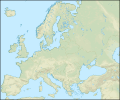
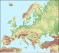
Blank maps of Europe for historical use (i.e. indicating historical borders, etc).
Media in category "Blank SVG maps of Europe for historical use"
The following 33 files are in this category, out of 33 total.
-
Blank map of Europe 814.svg 500 × 380; 771 KB
-
Blank map of Europe 843.svg 500 × 380; 935 KB
-
Blank map of Europe 1000.svg 485 × 340; 1.26 MB
-
Blank map of Europe 1004.svg 485 × 340; 1.23 MB
-
Blank map of Europe 1097.svg 550 × 350; 744 KB
-
Blank map of Europe 1190.svg 550 × 375; 994 KB
-
Blank map of Europe 1714.svg 450 × 456; 893 KB
-
Atlantic Revolutions.png 2,000 × 2,027; 472 KB
-
Europe 1789.svg 450 × 456; 929 KB
-
Europe 1797.svg 450 × 456; 859 KB
-
Europe 1799.svg 450 × 456; 819 KB
-
Blank map of Europe 1812.svg 450 × 456; 632 KB
-
Blank map of Europe 1815.svg 450 × 456; 708 KB
-
Blank map of Europe 1839.svg 450 × 456; 806 KB
-
Blank map of Europe 1860.svg 450 × 456; 816 KB
-
Blank map of Europe 1861.svg 450 × 456; 793 KB
-
Blank map of Europe 1870.svg 450 × 456; 874 KB
-
Blank map of Europe 1890.svg 450 × 456; 457 KB
-
Blank map of Europe 1914.svg 450 × 456; 467 KB
-
Blank map of Europe in 1920.svg 841 × 732; 541 KB
-
Blank map of Europe 1929-1938.svg 450 × 456; 494 KB
-
Blank map of Europe October 1938 - March 1939.svg 450 × 456; 501 KB
-
Blank map of Europe March - September 1939.svg 450 × 456; 472 KB
-
Europe 1942.svg 450 × 456; 602 KB
-
Europe 1943.svg 450 × 456; 501 KB
-
Blank map of Europe 1956-1990.svg 450 × 456; 474 KB
-
Blank political map Europe in 2006.svg 680 × 520; 518 KB
-
Europe laea topography.svg 1,302 × 1,085; 3 MB
-
Europe under the Morgenthau Plan svg map.png 2,021 × 2,048; 512 KB
-
Fond de carte Tour de France-blank.svg 2,110 × 2,525; 1.79 MB
-
Physical Map of Western Europe Without Political Markings.svg 2,286 × 2,593; 1.38 MB
-
Pysical Map of Europe (Without Markings).svg 2,070 × 1,848; 1.89 MB
-
Western Europe DEMIS topographic map.svg 1,090 × 778; 2.08 MB


