Category:Black and white aerial photographs of the United States
Jump to navigation
Jump to search
Countries of North America: United States of America‡
‡: partly located in North America
‡: partly located in North America
Subcategories
This category has the following 3 subcategories, out of 3 total.
Media in category "Black and white aerial photographs of the United States"
The following 177 files are in this category, out of 177 total.
-
 -CALIFORNIA-L-0028- Sherman Island Flood (50006741643).jpg 2,956 × 1,590; 2.08 MB
-
 071809 aboveSF 2617 (3735901157).jpg 1,280 × 853; 381 KB
-

-
 11thstreetbridges 1992.jpg 4,395 × 3,372; 1.87 MB
-
 14th street bridge aerial c04055058dfd70e4a67dfe9f17d14f60.jpg 2,944 × 2,344; 1,009 KB
-
 14th Street Bridge Under Water (7790618724).jpg 5,550 × 4,350; 1.47 MB
-
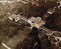
 1923CapitolComplex.jpg 520 × 320; 47 KB
-
 1947 10 11 - NARA ON003001-426 - Nr 608 per Seth Washburne and The Thirsty 13th.jpg 5,911 × 3,559; 7.87 MB
-
 1951 03 21 - NARA ON004379 - 471 rotated (from Seth Washburne for The Thirsty 13th).jpg 4,117 × 4,047; 10.2 MB
-
 1951 03 21 - NARA ON004379 -471 - Nr 172 per Seth Washburne and The Thirsty 13th.jpg 1,216 × 1,199; 1.04 MB
-
 CCAFS-LC34.jpg 2,306 × 1,799; 713 KB
-

-

-

-
-
-
-
-

-
 80-G-454982 (31734220046).jpg 2,842 × 2,276; 770 KB
-
 80-G-457011 (28571515505).jpg 2,648 × 2,132; 621 KB
-
 Aerial Fort Peck Dam before slide B.jpg 2,100 × 1,628; 2.18 MB
-
 Aerial of northwest Seattle, 1970.jpg 1,200 × 951; 379 KB
-
 Aerial of waterfront and downtown Seattle, 1968.jpg 1,200 × 887; 381 KB
-
 Aerial view capitol with snow 41953a (crop).tif 4,847 × 2,858; 26.43 MB
-

-

-

-

-

-

-

-

-

-
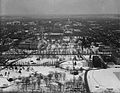 Aerial view looking toward U.S. Capitol with snow.jpg 920 × 713; 521 KB
-

-
 Aerial view of CCAFS Hangar N, 1962 (LOC-62-162).jpg 1,762 × 1,401; 695 KB
-
 Aerial view of CCAFS Hangar S, 1963 (LOC-63-4897).jpg 1,400 × 793; 535 KB
-
 Aerial view of CCAFS Industrial Area, 1966 (KSC-66C-8056).jpg 1,576 × 1,160; 758 KB
-

-

-
 Aerial view of Grafton, West Virginia LCCN2011636547.tif 9,269 × 7,248; 128.16 MB
-
 Aerial view of Hangar AE after additions, 1964 (KSC-64-10286).jpg 1,400 × 877; 538 KB
-
 Aerial view of Hangar AE before additions, 1961 (PL-61-90012).jpg 1,400 × 952; 474 KB
-
 Aerial view of marchers in the shadow of the Washington Monument, 37227u.tiff 3,240 × 4,648, 2 pages; 28.75 MB
-
 Aerial view of marchers in the shadow of the Washington Monument.jpg 3,018 × 4,527; 6.66 MB
-
 Aerial view of Nome (9511349455).jpg 2,204 × 1,653; 2.9 MB
-
 Aerial view of Nome, Alaska, between 1900 and 1908 (AL+CA 6601).jpg 768 × 536; 59 KB
-

-
 Aerial view of Richmond (7790616898).jpg 5,550 × 4,350; 1.62 MB
-
 Aerial view of San Antonio. Texas, and the surrounding plains, 12-1939 - NARA - 512843.jpg 3,000 × 2,289; 1.95 MB
-
 Aerial view of Southside (7790616584).jpg 5,550 × 4,350; 1.54 MB
-
 Aerial View Of Suspension Bridge To Yerba Buena Island And Beyond From San Francisco.jpg 5,594 × 3,903; 11.39 MB
-
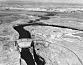 Aerial view of the Glen Canyon Dam, 1965, US Bureau of Reclamation.jpg 2,048 × 1,601; 844 KB
-

-
 Aerial view of U.S. Capitol building29453v.jpg 1,024 × 741; 286 KB
-
 Aerial view of U.S. Capitol, Washington, D.C..jpg 826 × 760; 572 KB
-
 Aerial view of Washington, D.C., looking north toward White House LCCN2016889054.jpg 10,008 × 7,752; 12.57 MB
-

-

-

-
 Aerial-view-of-Rexford-NY-showing-location-of-amusement-park.jpg 512 × 509; 33 KB
-
 Alaska - Mt. McKinley - NARA - 23940959.jpg 3,549 × 2,694; 2.84 MB
-
 Albuquerque AAB 28 April 1942.jpg 925 × 725; 179 KB
-
 Annistonafb-al-12feb1949.jpg 471 × 741; 73 KB
-
 B&P Tunnel West 1977.jpg 4,886 × 3,745; 2.73 MB
-
 Beale AFB CA - 28 Jul 1999.jpg 490 × 686; 90 KB
-
 Berry Field.jpg 972 × 792; 516 KB
-
 Bird's Eye View of East Akron (12840820484).jpg 3,186 × 2,089; 8.42 MB
-

-
 Bolling AFB DC - 5 Apr 1988.jpg 526 × 648; 132 KB
-
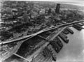
 Bush Terminal - North aerial - 1958.jpg 3,504 × 2,760; 4.23 MB
-
 Cabrini Green Housing Project.jpg 4,601 × 3,619; 2.2 MB
-
 Capitol, from air30431v.jpg 918 × 714; 517 KB
-
 CAPITOL, U.S. VIEW FROM AIR.jpg 926 × 667; 431 KB
-
 Cascade Mountain Peaks (3387044159).jpg 4,226 × 3,423; 1.62 MB
-
 Charleston Navy Hospital aerial view on 7-7-49.jpg 961 × 759; 93 KB
-
 Chicago River, 1953.jpg 2,148 × 2,117; 878 KB
-
 Cleveland Ohio 1937.jpg 1,422 × 1,080; 351 KB
-
-
 Downtown Cleveland, Ohio, in winter, from the air, 12-1937 - NARA - 512842.jpg 3,000 × 2,275; 1.73 MB
-
 Duluth-apt-17may1991.jpg 1,139 × 573; 285 KB
-

-
 Eastern View in Richmond (7790621328).jpg 5,550 × 4,350; 1.31 MB
-
 Elpasoaaf-28jan1996.jpg 538 × 478; 100 KB
-
 Flax twine plant st paul minn 6a34562u.tif 1,340 × 669; 2.57 MB
-
 Flax Twine Plant, St. Paul, Minn. 6a34562v.jpg 1,024 × 511; 152 KB
-
 Flooding in Richmond (7790620884).jpg 5,550 × 4,350; 1.65 MB
-

-
-

-

-

-
 Harrisburg, IL Areal Junior High.jpg 437 × 336; 116 KB
-
 HD.11C.076 (12460028355).jpg 3,200 × 2,480; 1.19 MB
-
 HD.11C.076 (13956785672).jpg 3,200 × 2,480; 784 KB
-
 Het Capitool, Bestanddeelnr 921-6081.jpg 2,596 × 2,056; 1.02 MB
-
 High school (2899349104).jpg 750 × 586; 123 KB
-

-

-

-

-
 Hourglass Field over Miramar College B&W.jpg 469 × 424; 72 KB
-
 I-95 Flooding in Richmond (7790618046).jpg 5,550 × 4,350; 1.6 MB
-
 I-95 Under Water (7790622800).jpg 5,550 × 4,350; 1.65 MB
-
 James River Flooding (7790613462).jpg 5,550 × 4,350; 1.1 MB
-
 Jantzen Beach Amusement Park, 1950.JPG 1,195 × 462; 312 KB
-
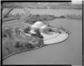
 Jefferson memorial aerial 1948fb995807bef84a37f96873d5d0ea.jpg 2,939 × 2,367; 2.84 MB
-
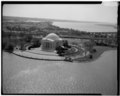
 Jefferson memorial aerial 9c841eb5c7dd0373287ecb4cb0066aa1.jpg 2,532 × 2,712; 1.91 MB
-
 Johnson High School 1921 aerial.jpg 640 × 457; 58 KB
-
 Kuaua ruins, Coronado State Monument, 1940.jpg 432 × 314; 61 KB
-

-
 Lake County Airport (Colorado) 12 Oct 1999.jpg 438 × 663; 122 KB
-
 Lockheed A-29s over Mt McKinley Feb 1942.jpg 3,414 × 2,509; 1.24 MB
-

-
 Lowry AFB CO - 9 Oct 1999.jpg 1,280 × 1,252; 427 KB
-
 Mercury Control Center 4 June 1963.jpg 3,000 × 2,400; 1.21 MB
-
 Mercury control center 4june1963.jpg 2,785 × 2,090; 810 KB
-
 Minneapolis North High School overhead 1991.jpg 252 × 263; 34 KB
-
 Minnesota - Duluth - NARA - 23941595.jpg 4,385 × 3,382; 2.22 MB
-
 Minnesota - Duluth - NARA - 23941597.jpg 4,385 × 3,382; 2.08 MB
-
 Minnesota - Duluth - NARA - 23941599.jpg 4,385 × 3,382; 1.86 MB
-
 Minnesota - Duluth - NARA - 23941601.jpg 4,385 × 3,382; 2.5 MB
-
 Minnesota - Duluth - NARA - 23941603.jpg 4,385 × 3,382; 2.67 MB
-
 Minnesota - Duluth - NARA - 23941605.jpg 4,385 × 3,382; 2.74 MB
-
 Minnesota - Minneapolis - NARA - 23941613.jpg 3,382 × 4,385; 921 KB
-
 Minnesota - St.Paul - NARA - 23941619.jpg 3,382 × 4,385; 1.07 MB
-
 Minnesota - St.Paul - NARA - 23941623.jpg 3,382 × 4,385; 1.24 MB
-
 Minnesota - St.Paul - NARA - 23941625.jpg 3,382 × 4,385; 1.13 MB
-
 Mitchel Field - New York - 1968.jpg 752 × 384; 81 KB
-
 NAS Akron OH NAN4-48.jpg 841 × 547; 171 KB
-
 NASA Crows Landing - USGS 29 July 1999.jpg 1,200 × 1,700; 256 KB
-
 New school buildings (2899338836).jpg 750 × 593; 161 KB
-
 New school buildings (4990841700).jpg 750 × 544; 124 KB
-
 NOLF Whitehouse.jpg 175 × 168; 15 KB
-
 Norfolknavalbase3.jpg 3,648 × 2,736; 3.97 MB
-
 Oakland Naval Air Reserve Grumman S2F-1 Trackers in flight on 23 December 1956.jpg 4,381 × 5,668; 8.53 MB
-
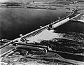
 P403A McNary Dam, Oregon and Washington 1 (22488643612).jpg 3,050 × 1,865; 2.79 MB
-
 P403A McNary Dam, Oregon and Washington 2 (22502063755).jpg 3,051 × 1,854; 2.21 MB
-
 PBY-1 Catalinas of VP-9 over the Golden Gate Bridge in May 1937.jpg 5,707 × 4,215; 8.38 MB
-
-

-
-

-
 Photograph of Aerial View of Capitol and Federal Triangle, 1936 (3873916673).jpg 3,150 × 2,522; 1.38 MB
-
 Photograph of Aerial View of Murry City, Ohio - NARA - 2128905.jpg 1,281 × 936; 870 KB
-
 Plum Brook Aerial GPN-2000-000384.jpg 3,000 × 2,400; 3.66 MB
-
 Plum Brook Station (9467810678) (cropped).jpg 2,175 × 1,223; 1.71 MB
-
 Plum Brook Station (9467810678).jpg 3,000 × 2,400; 4.18 MB
-
 Prado Dam, Santa Ana Canyon, Riverside County.jpg 5,676 × 4,392; 11.8 MB
-
 Pruitt-Igoe 1968March03.jpg 5,000 × 5,000; 8.56 MB
-
 PSA 06-00755.jpg 650 × 641; 154 KB
-
 Quaker Oats factory, Akron.jpg 4,418 × 3,494; 1.63 MB
-
 Saugatuck River Bridge, Saugatuck (Fairfield County, Connecticut).jpg 4,873 × 3,740; 6.13 MB
-
 Seymour Johnson Air Force Base NC - 9 Mar 1993.jpg 616 × 498; 113 KB
-
 SF-Oakland-Bay-Bridge-Construction.jpg 768 × 512; 74 KB
-
 South National Mall Washington DC 1863.jpg 926 × 597; 377 KB
-
 Stead Air Force Base-NV-11 September 1999-USGS.jpg 765 × 991; 257 KB
-
 The Big Depot and It's Friends (cropped).jpg 3,806 × 2,512; 4.31 MB
-
 The Big Depot and It's Friends.jpg 5,240 × 4,040; 9.1 MB
-
 The Capitol and Mall, Washington, D. C. (3678123521).jpg 1,536 × 1,182; 1.5 MB
-
 The Island and Old St. Anthony.jpg 5,248 × 4,032; 10.11 MB
-
 The Mall, Washington, D. C. (3678940338).jpg 1,536 × 1,212; 1.15 MB
-
 The Prairie School aerial-greyscale.png 320 × 340; 104 KB
-
 ThreeMileIsland LakeWinipesaukee USGS.jpg 375 × 500; 27 KB
-
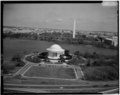
 Tidal basin aerial b260f91686a6bc5af276f0ac2705c8d8.jpg 2,939 × 2,340; 1.61 MB
-
 Twin bridges marriott aerial eea50d47356a82474625f8b10bc9346f.jpg 2,454 × 2,616; 1.74 MB
-
 U.S. Naval Hospital, Portsmouth, NH- Aerial view.jpg 2,159 × 2,293; 1.07 MB
-
 Unidentified aerial view, Richmond (2899347690).jpg 750 × 589; 158 KB
-
 USAF F-4E Phantom II 310.jpg 2,827 × 2,250; 236 KB
-
 USAF F-4E Phantom II over Mount McKinley.jpg 2,659 × 2,062; 232 KB
-
 Vassar College academic quad aerial 1995.jpeg 177 × 136; 18 KB
-
 Union Station Washington DC from the air.png 3,940 × 3,145; 10.73 MB
-
 West Mesa Field 30 Sep 1945.jpg 698 × 432; 61 KB
-
 Whittier Narrows dam project (copy), 1957 (EXM-N-12231-007~1).jpg 5,368 × 5,368; 9.16 MB
-
 Wright Field 1920.JPG 642 × 460; 75 KB
-
 Youngstown-map-20apr1994.jpg 733 × 723; 171 KB
.jpg)
.jpg)


.jpg)


.jpg)


.jpg)
.jpg)


.jpg)
.jpg)
.jpg)
.jpg)
.jpg)

.jpg)
.jpg)
.jpg)

.jpg)


.jpg)
.jpg)


.jpg)


.jpg)


.jpg)

.jpg)
.jpg)

.jpg)

.jpg)
.jpg)
.jpg)


.jpg)
_12_Oct_1999.jpg)

.jpg)


.jpg)
.jpg)


.jpg)
.jpg)

.jpg)
.jpg)


_(cropped).jpg)
.jpg)


.jpg)


.jpg)

.jpg)

.jpg)


.jpg)


,_1957_(EXM-N-12231-007~1).jpg)


_and_Snake_River,_showing_Lewiston,_Idaho_(CURTIS_492).jpeg)