Category:Biogeographical maps of Hungary
Jump to navigation
Jump to search
Subcategories
This category has only the following subcategory.
A
Media in category "Biogeographical maps of Hungary"
The following 16 files are in this category, out of 16 total.
-
 Alpicum floristic province in Hungary.png 2,000 × 1,750; 289 KB
-
 Bakonyicum floristic district in Hungary.png 2,000 × 1,750; 422 KB
-
 Carpaticum floristic province in Hungary.png 2,000 × 1,750; 351 KB
-
 Eupannonicum district in Hungary.png 2,000 × 1,750; 380 KB
-
 Hongrie Vineyards wine districts 1885.jpg 879 × 640; 218 KB
-
 Illiricum floristic province in Hungary.png 2,000 × 1,750; 300 KB
-
 Matricum floristic district in Hungary.png 2,000 × 1,750; 417 KB
-
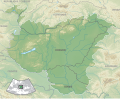 Pannonian region map.svg 937 × 769; 3.5 MB
-
 Pannonicum floristic province in Hungary.png 2,000 × 1,750; 422 KB
-
 Praeilliricum floristic district in Hungary.png 2,000 × 1,750; 419 KB
-
 Praenoricum floristic district in Hungary.png 2,000 × 1,750; 420 KB
-
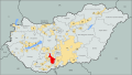
 Wine regions Hungary (Mór).svg 762 × 431; 610 KB
-
 Wine regions Hungary (Somló).svg 762 × 431; 610 KB
-
 Wine regions Hungary (Sopron).svg 762 × 431; 610 KB
-
 Wine regions Hungary Szekszard.svg 762 × 431; 610 KB
-
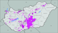 Wine regions Hungary.svg 762 × 431; 701 KB


.svg)
.svg)
.svg)

