Category:Biogeographical maps of Australia
Jump to navigation
Jump to search
Subcategories
This category has the following 3 subcategories, out of 3 total.
D
I
- IBRA maps (1 P, 139 F)
- IMCRA maps (43 F)
Media in category "Biogeographical maps of Australia"
The following 23 files are in this category, out of 23 total.
-
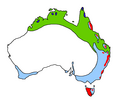
Australia Floraregion.png 2,358 × 2,016; 142 KB
-
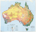
Australia Present Vegetation Map.png 2,228 × 1,988; 7.46 MB
-
Australia's rangelands (Outback).png 2,962 × 2,475; 1.62 MB
-
Australia-climate-map MJC01 french.png 1,000 × 905; 75 KB
-
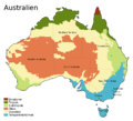
Australia-climate-map MJC01 sv.png 1,000 × 905; 31 KB
-
Australia-climate-map MJC01(hy).png 1,000 × 905; 47 KB
-
Australia-geo-stub picture 35px.png 35 × 31; 2 KB
-
Australian Vegetation.png 2,000 × 2,000; 229 KB
-
Carte des biomes en Australie n°1.png 720 × 438; 39 KB
-
Carte des biomes en Australie °2.png 698 × 555; 72 KB
-
Climas de Australia.svg 1,250 × 1,131; 119 KB
-
Cophixalus kulakula map.svg 1,560 × 1,288; 520 KB
-
Crinia flindersensis map.svg 2,006 × 1,653; 507 KB
-
Esperance Mallee ecoregion.png 1,257 × 471; 103 KB
-
Jarrah Forest En.jpeg 4,960 × 3,508; 7.78 MB
-
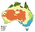
KlimaAUS.jpg 661 × 599; 27 KB
-
Klimazonen Australiens.svg 800 × 724; 107 KB
-
Mallee En.jpg 4,960 × 3,001; 6.63 MB
-
Map of Mallee Woodlands and Shrublands plant communities across southern Australia.png 2,000 × 2,000; 118 KB
-
Nord Australie région arbitraire.png 720 × 438; 29 KB
-
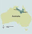
PungalinaMap.jpg 676 × 709; 106 KB
-
The Outback Locator map.png 1,024 × 920; 155 KB
-
Warren Ecoregion En.jpg 4,960 × 3,508; 10.25 MB
