Category:Bildeston
Jump to navigation
Jump to search
English: Bildeston is a village and civil parish in the Babergh district of Suffolk, England. Located around north of Hadleigh, in 2005 it had a population of 960.
village and civil parish in Babergh, Suffolk, England  | |||||
| Upload media | |||||
| Instance of | |||||
|---|---|---|---|---|---|
| Location | Babergh, Suffolk, East of England, England | ||||
| Population |
| ||||
 | |||||
Subcategories
This category has the following 8 subcategories, out of 8 total.
2
B
- Bec Cottage, Bildeston (2 F)
- Bildeston Clock Tower (8 F)
- Bildeston War Memorial (5 F)
C
- The Bildeston Crown (5 F)
K
- Kings Head, Bildeston (2 F)
M
S
- Spinners Cottage, Suffolk (2 F)
Media in category "Bildeston"
The following 74 files are in this category, out of 74 total.
-
 1 Chapel Street, Bildeston (geograph 7529983).jpg 1,600 × 900; 478 KB
-
 1 Market Place, Bildeston (geograph 7529927).jpg 1,600 × 900; 472 KB
-
 112, 114 High Street, Bildeston - geograph.org.uk - 6702269.jpg 1,024 × 768; 301 KB
-
 116, 118, 120 and 122 High Street, Bildeston (geograph 7530001).jpg 1,600 × 900; 475 KB
-
 134, 134A and 136 High Street, Bildeston (geograph 7530270).jpg 1,600 × 900; 473 KB
-
 138 and 140 High Street, Bildeston (geograph 7530283).jpg 1,600 × 900; 447 KB
-

-

-
 66 High Street, Bildeston (geograph 7542231).jpg 1,600 × 900; 530 KB
-
 76 High Street, Bildeston (geograph 7542229).jpg 1,600 × 900; 503 KB
-
 82 and 84 High Street, Bildeston (geograph 7542227).jpg 1,600 × 900; 469 KB
-
 86, 88 and 90 High Street, Bildeston (geograph 7542207).jpg 1,600 × 900; 499 KB
-
 86, 88, 90 High Street, Bildeston - geograph.org.uk - 6702260.jpg 1,024 × 768; 294 KB
-
 96, 98 and 100 High Street, Bildeston (geograph 7541778).jpg 1,600 × 900; 476 KB
-
 A long brick wall in Bildeston - geograph.org.uk - 4073910.jpg 1,600 × 1,200; 1.13 MB
-
 B1078 junction with B1115 - geograph.org.uk - 3609986.jpg 3,648 × 2,736; 1.6 MB
-
 B1078 northeast of Great Copt Hall - geograph.org.uk - 3608138.jpg 3,572 × 2,677; 914 KB
-
 B1078 northeast of High Street Farm - geograph.org.uk - 3608132.jpg 3,648 × 2,736; 1.57 MB
-
 B1115 towards Hadleigh - geograph.org.uk - 2941734.jpg 640 × 480; 79 KB
-
 B1115 turns a corner in Bildeston - geograph.org.uk - 3609981.jpg 3,648 × 2,736; 1.47 MB
-

-
 Bildeston Highstreet - geograph.org.uk - 3048236.jpg 640 × 465; 156 KB
-
 Bildeston Market Place, east side - geograph.org.uk - 6702305.jpg 1,024 × 768; 296 KB
-
 Bildeston new village sign.jpg 1,000 × 1,000; 176 KB
-
 Bildeston old village sign.jpg 1,000 × 1,000; 178 KB
-
 Bildeston Post Office 1978 - Flickr - sludgegulper.jpg 4,480 × 2,901; 635 KB
-
 Bildeston village sign - geograph.org.uk - 4291311.jpg 640 × 640; 145 KB
-
 Bildeston, Bildeston Road - geograph.org.uk - 6525885.jpg 6,323 × 4,216; 7.57 MB
-
 Bildeston, Grassland, Bildeston Road - geograph.org.uk - 6525881.jpg 7,492 × 4,994; 7.85 MB
-
 Bildeston, Manor Road - geograph.org.uk - 6526992.jpg 8,256 × 5,504; 7.75 MB
-
 Chapel Street, Bildeston - geograph.org.uk - 6702322.jpg 1,024 × 768; 318 KB
-
 Entering Bildeston - geograph.org.uk - 1480756.jpg 640 × 480; 88 KB
-
 Entering Bildeston from the north - geograph.org.uk - 1600674.jpg 640 × 437; 84 KB
-
 Entrance to Bentons - geograph.org.uk - 4509639.jpg 1,024 × 768; 558 KB
-
 Farmland near Bildeston - geograph.org.uk - 2941732.jpg 640 × 480; 51 KB
-
 High Street, Bildeston - geograph.org.uk - 2480786.jpg 1,024 × 768; 164 KB
-
 Houses along Bildeston Highstreet - geograph.org.uk - 3048239.jpg 640 × 480; 186 KB
-

-
-
 Market Place, Bildeston - geograph.org.uk - 6702287.jpg 1,024 × 768; 311 KB
-
 Old Buildings - geograph.org.uk - 1480759.jpg 640 × 480; 78 KB
-
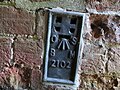 Ordnance Survey Flush Bracket 2102 - geograph.org.uk - 4562933.jpg 4,000 × 3,000; 3.74 MB
-

-
 Post Office in Bildeston Highstreet - geograph.org.uk - 3048257.jpg 640 × 480; 183 KB
-
 Post Office, Bildeston.jpg 2,726 × 1,967; 1.58 MB
-
 Power lines across green fields - geograph.org.uk - 251844.jpg 640 × 480; 74 KB
-
 Red House, Bildeston (geograph 7530002).jpg 1,600 × 900; 583 KB
-
 Road closed necessitating a five mile detour - geograph.org.uk - 4509624.jpg 1,024 × 768; 422 KB
-
 Roman Road - geograph.org.uk - 1480704.jpg 640 × 480; 113 KB
-
 Roman Road into Bildeston - geograph.org.uk - 4509643.jpg 1,024 × 768; 313 KB
-

-
 The B1115 road through Bildeston - geograph.org.uk - 3048258.jpg 640 × 480; 73 KB
-
 The B1115 road through Bildeston - geograph.org.uk - 3048266.jpg 480 × 640; 143 KB
-
 The Red House, Bildeston - geograph.org.uk - 6702297.jpg 1,024 × 768; 333 KB
-
 Timber-framed cottages, Bildeston - geograph.org.uk - 3048269.jpg 640 × 480; 147 KB
-
 Track leading to Bentons - geograph.org.uk - 1680133.jpg 640 × 427; 129 KB
-
 View of Bildeston from Church Road - geograph.org.uk - 596178.jpg 640 × 484; 74 KB
-

-
 Bentons - geograph.org.uk - 1480671.jpg 640 × 480; 103 KB
-
 Bildeston - geograph.org.uk - 322331.jpg 640 × 424; 167 KB
-
 Bildeston Baptist church - geograph.org.uk - 596172.jpg 640 × 438; 86 KB
-

-
 Chapel Street, Bildeston - geograph.org.uk - 596195.jpg 640 × 631; 124 KB
-
 Consent Lane, Bildeston - geograph.org.uk - 596187.jpg 640 × 478; 91 KB
-
 Duke Street, Bildeston - geograph.org.uk - 596171.jpg 560 × 640; 99 KB
-

-

-
 High Street, Bildeston - geograph.org.uk - 596169.jpg 640 × 480; 61 KB
-
 High Street, Bildeston - geograph.org.uk - 596200.jpg 640 × 480; 69 KB
-
 High Street, Bildeston - geograph.org.uk - 596206.jpg 640 × 499; 83 KB
-
 Needham Lane - geograph.org.uk - 279374.jpg 640 × 480; 93 KB
-
 Road to Nedging Hall Farm - geograph.org.uk - 277191.jpg 640 × 480; 129 KB
-

-
 The Sign Spells it out - geograph.org.uk - 252388.jpg 480 × 640; 140 KB
.jpg)
.jpg)

.jpg)
.jpg)
.jpg)


.jpg)
.jpg)
.jpg)
.jpg)

.jpg)


.jpg)


