Category:Biggleswade
Jump to navigation
Jump to search
town in Bedfordshire, England, UK | |||||
| Upload media | |||||
| Instance of | |||||
|---|---|---|---|---|---|
| Location | Central Bedfordshire, Bedfordshire, East of England, England | ||||
| Population |
| ||||
| Said to be the same as | Biggleswade (Wikimedia duplicated page, civil parish) | ||||
 | |||||
Subcategories
This category has the following 10 subcategories, out of 10 total.
A
B
- Biggleswade railway station (22 F)
- Biggleswade Town F.C. (2 F)
- Biggleswade War Memorial (16 F)
H
- Holme, Bedfordshire (2 F)
O
P
S
- Shortmead House (3 F)
Media in category "Biggleswade"
The following 200 files are in this category, out of 401 total.
(previous page) (next page)-
2-6 High Street, Biggleswade, August 2022.jpg 4,032 × 3,024; 4.49 MB
-
80 mph railway sign.JPG 3,472 × 2,604; 1.5 MB
-
A field of rye and Langford Wind Farm - geograph.org.uk - 5444213.jpg 4,000 × 3,000; 4.77 MB
-
A flat landscape near Biggleswade - geograph.org.uk - 2392824.jpg 640 × 352; 28 KB
-
A rough track beyond the East Coast Main Line - geograph.org.uk - 5444220.jpg 4,000 × 3,000; 4.63 MB
-
A1 northbound near Biggleswade - geograph.org.uk - 6323612.jpg 1,024 × 576; 77 KB
-
A1, Biggleswade Bypass - geograph.org.uk - 4653914.jpg 640 × 351; 34 KB
-
A1, northbound - geograph.org.uk - 4653886.jpg 640 × 353; 41 KB
-
A1, northbound - geograph.org.uk - 4653905.jpg 640 × 380; 61 KB
-
A1, northbound - geograph.org.uk - 4988033.jpg 640 × 381; 41 KB
-
A1, northbound - geograph.org.uk - 4988034.jpg 640 × 375; 46 KB
-
A1, northbound - geograph.org.uk - 4988039.jpg 640 × 378; 55 KB
-
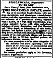
Ad for Shortmead 1830.jpg 1,200 × 1,305; 390 KB
-
Adventures with Albert at Biggleswade Station - geograph.org.uk - 5813708.jpg 4,601 × 2,766; 2.84 MB
-
Albone Way Industrial Estate, Biggleswade - geograph.org.uk - 6661751.jpg 1,024 × 768; 110 KB
-
Allotments, Biggleswade, Beds - geograph.org.uk - 190349.jpg 640 × 480; 348 KB
-
Applegreen Filling Station - geograph.org.uk - 4653889.jpg 640 × 426; 54 KB
-
Approaching Biggleswade, Beds - geograph.org.uk - 52426.jpg 640 × 480; 264 KB
-
Artistic alleyway - geograph.org.uk - 4868638.jpg 1,600 × 1,064; 465 KB
-
B659 passes under the A1 at Biggleswade - geograph.org.uk - 3804301.jpg 4,320 × 2,542; 3.46 MB
-
Baden Powell Way, Biggleswade - geograph.org.uk - 5782494.jpg 2,048 × 1,536; 1.48 MB
-
Baden Powell Way, Biggleswade - geograph.org.uk - 5783748.jpg 2,048 × 1,536; 1.5 MB
-
Beauford Farm - geograph.org.uk - 4653908.jpg 640 × 311; 33 KB
-
Biggleswade - former Court building (geograph 7144337).jpg 1,600 × 1,389; 630 KB
-
Biggleswade - former family house (geograph 7145661).jpg 1,228 × 1,600; 754 KB
-
Biggleswade - geograph.org.uk - 876343.jpg 640 × 396; 37 KB
-
Biggleswade - Stratton House (geograph 7145652).jpg 1,600 × 1,060; 564 KB
-
Biggleswade - the Market House - geograph.org.uk - 884560.jpg 640 × 480; 82 KB
-
Biggleswade - Trinity Methodist Church (geograph 7144018).jpg 1,281 × 1,600; 727 KB
-
Biggleswade Baptist Church - geograph.org.uk - 4868632.jpg 1,600 × 1,066; 393 KB
-
Biggleswade Bus Station - geograph.org.uk - 5614470.jpg 1,024 × 768; 172 KB
-
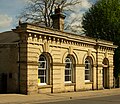
Biggleswade Cemetery Chapel Side.jpg 4,000 × 3,000; 2.34 MB
-
Biggleswade Cemetery, Beds - geograph.org.uk - 175001.jpg 640 × 480; 325 KB
-
Biggleswade Christmas Tree.JPG 3,472 × 2,604; 1.61 MB
-
Biggleswade Common - geograph.org.uk - 4187526.jpg 640 × 430; 48 KB
-
Biggleswade Common - geograph.org.uk - 4773964.jpg 640 × 480; 62 KB
-
Biggleswade Common - geograph.org.uk - 4773966.jpg 480 × 640; 89 KB
-
Biggleswade Conservative Club, St Andrew's Street, Biggleswade, August 2022.jpg 4,032 × 3,024; 4.14 MB
-
Biggleswade County Court.jpg 640 × 480; 95 KB
-
Biggleswade Entry Sign.JPG 3,472 × 2,604; 1.86 MB
-
Biggleswade fire station - geograph.org.uk - 584292.jpg 640 × 427; 200 KB
-
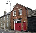
Biggleswade fire station.jpg 570 × 276; 81 KB
-
Biggleswade footpath - geograph.org.uk - 4773929.jpg 480 × 640; 107 KB
-
Biggleswade footpath - geograph.org.uk - 4773951.jpg 480 × 640; 95 KB
-
Biggleswade footpath - geograph.org.uk - 4773952.jpg 480 × 640; 82 KB
-
Biggleswade footpath - geograph.org.uk - 4773953.jpg 640 × 480; 88 KB
-
Biggleswade footpath - geograph.org.uk - 4773954.jpg 480 × 640; 77 KB
-
Biggleswade footpath - geograph.org.uk - 4773956.jpg 480 × 640; 78 KB
-
Biggleswade footpath - geograph.org.uk - 4773957.jpg 480 × 640; 75 KB
-
Biggleswade footpath - geograph.org.uk - 4773959.jpg 480 × 640; 68 KB
-
Biggleswade footpath - geograph.org.uk - 4773960.jpg 480 × 640; 78 KB
-
Biggleswade footpath - geograph.org.uk - 4773961.jpg 480 × 640; 70 KB
-
Biggleswade footpath - geograph.org.uk - 4773962.jpg 480 × 640; 87 KB
-
Biggleswade High Street - geograph.org.uk - 5813765.jpg 4,991 × 3,479; 3.01 MB
-
Biggleswade level crossing.JPG 3,472 × 2,604; 1.99 MB
-
Biggleswade library.jpg 3,264 × 2,448; 1.75 MB
-
Biggleswade old fire station - geograph.org.uk - 584288.jpg 640 × 427; 196 KB
-
Biggleswade Old Fire Station.jpg 440 × 407; 87 KB
-
Biggleswade Police Station.jpg 3,790 × 2,719; 2.23 MB
-
Biggleswade Town Council offices.jpg 4,000 × 2,790; 2.19 MB
-
Biggleswade Town FC - geograph.org.uk - 3660655.jpg 1,600 × 1,067; 556 KB
-
Biggleswade Town FC - geograph.org.uk - 3660661.jpg 1,600 × 1,067; 571 KB
-
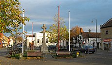
Biggleswade town.jpg 1,600 × 1,200; 411 KB
-
Biggleswade Wind Farm - geograph.org.uk - 4653872.jpg 640 × 426; 45 KB
-
Biggleswade wind farm - geograph.org.uk - 6964053.jpg 1,024 × 768; 63 KB
-
Biggleswade, Asda - geograph.org.uk - 5614352.jpg 1,024 × 768; 115 KB
-
Biggleswade, car wash - geograph.org.uk - 5614285.jpg 1,024 × 768; 180 KB
-
Biggleswade, Cemetery mortuary chapels - geograph.org.uk - 611738.jpg 640 × 474; 125 KB
-
Biggleswade, cycle-shaped cycle racks - geograph.org.uk - 884546.jpg 640 × 480; 96 KB
-
Biggleswade, Footpath near Top Field Farm - geograph.org.uk - 610976.jpg 640 × 480; 117 KB
-
Biggleswade, George's Hall - geograph.org.uk - 612474.jpg 640 × 480; 82 KB
-
Biggleswade, Ivel Mill - geograph.org.uk - 611781.jpg 640 × 480; 95 KB
-
Biggleswade, Old Fire Station - geograph.org.uk - 5614479.jpg 1,024 × 768; 131 KB
-
Biggleswade, postbox № SG18 21 - geograph.org.uk - 884587.jpg 480 × 640; 69 KB
-
Biggleswade, St. Andrew's - geograph.org.uk - 5614492.jpg 1,024 × 768; 199 KB
-
Biggleswade, The Market House - geograph.org.uk - 609922.jpg 640 × 480; 87 KB
-
Biggleswade, The Saxon Centre - geograph.org.uk - 613200.jpg 640 × 480; 67 KB
-
Biggleswade-temp-banner.jpg 4,205 × 601; 1.25 MB
-
Birthplace of the Laughing Policeman - geograph.org.uk - 4681912.jpg 1,600 × 1,071; 439 KB
-
Blunham Road, Biggleswade - geograph.org.uk - 6661775.jpg 1,024 × 768; 139 KB
-
Bridge over A1 at Topler's Hill - geograph.org.uk - 6320569.jpg 1,024 × 576; 83 KB
-
Bridleway across Biggleswade Common - geograph.org.uk - 4868597.jpg 1,600 × 1,066; 464 KB
-
Bridleway across Biggleswade Common - geograph.org.uk - 4868614.jpg 1,600 × 1,066; 801 KB
-
Bridleway towards Sandy Heath - geograph.org.uk - 4868619.jpg 1,600 × 1,066; 527 KB
-
Brigham House, Biggleswade.jpg 3,264 × 2,448; 2.28 MB
-
Brunel Drive - geograph.org.uk - 3660677.jpg 1,600 × 1,067; 644 KB
-
Bus img 8297 (16287611456).jpg 2,856 × 2,142; 1.59 MB
-
Bus img 8298 (16127379699).jpg 3,072 × 2,304; 1.81 MB
-
Bus img 8299 (15693673943).jpg 2,752 × 2,064; 1.71 MB
-
Bus img 8306 (15693677283).jpg 3,072 × 2,304; 1.81 MB
-
By the A1 - geograph.org.uk - 4653860.jpg 430 × 640; 52 KB
-
Century House, Central Bedfordshire, England - 20101219.jpg 3,472 × 2,604; 1.61 MB
-
Chapel Biggleswade Cemetery.jpg 3,206 × 2,617; 735 KB
-
Chapel Fields - geograph.org.uk - 4755365.jpg 640 × 480; 68 KB
-
Chapel Fields - geograph.org.uk - 4755367.jpg 640 × 480; 81 KB
-
Children's play area, Biggleswade - geograph.org.uk - 3084214.jpg 640 × 480; 60 KB
-
Coenwulf.png 600 × 340; 16 KB
-
Cottages on Sun Street - geograph.org.uk - 4868519.jpg 1,600 × 1,066; 298 KB
-
County Court House - geograph.org.uk - 4681984.jpg 1,600 × 1,071; 587 KB
-
Crop field east of Biggleswade - geograph.org.uk - 3084232.jpg 640 × 480; 92 KB
-
Cycleway near Holme - geograph.org.uk - 5812321.jpg 1,600 × 1,067; 493 KB
-
Cyclist on Biggleswade Common - geograph.org.uk - 4314995.jpg 3,089 × 2,048; 2.46 MB
-
Cyclist, Drove Road, Biggleswade - geograph.org.uk - 4307899.jpg 3,089 × 2,048; 3.39 MB
-
Dan Albone Grave.jpg 3,000 × 4,000; 2.22 MB
-
Devon Drive, Biggleswade - geograph.org.uk - 3097585.jpg 640 × 480; 48 KB
-
Diesel Engine at Jordans Mill - geograph.org.uk - 3460412.jpg 2,592 × 1,944; 1.24 MB
-
Diggers by Baden Powell Way, Biggleswade - geograph.org.uk - 6245677.jpg 1,900 × 1,250; 1.38 MB
-
Drove Road, Biggleswade - geograph.org.uk - 2972646.jpg 1,600 × 1,200; 585 KB
-
Drove Road, Biggleswade - geograph.org.uk - 2972647.jpg 1,600 × 1,200; 337 KB
-
Drove Road.jpg 640 × 410; 69 KB
-
Dunton Lane heading east - geograph.org.uk - 3084225.jpg 640 × 480; 43 KB
-
Dunton Lane roundabout - Biggleswade - geograph.org.uk - 6570797.jpg 768 × 1,024; 67 KB
-
East Coast Main Line, Biggleswade - geograph.org.uk - 6660714.jpg 1,024 × 768; 125 KB
-
East Coast Trains HST heads up to London on a summer's day. - panoramio.jpg 3,888 × 2,592; 2.79 MB
-
Exit with care^ - geograph.org.uk - 382666.jpg 603 × 419; 34 KB
-
Farm building on Potton Road, Biggleswade - geograph.org.uk - 2972650.jpg 1,600 × 1,200; 542 KB
-
Farm buildings on Furzenhall Road - geograph.org.uk - 4868612.jpg 1,600 × 1,066; 441 KB
-
Farm buildings on the edge of Biggleswade - geograph.org.uk - 4317382.jpg 3,089 × 2,048; 1.94 MB
-
Farmland at Furzenhall, south of Sandy - geograph.org.uk - 4575418.jpg 1,600 × 692; 130 KB
-
Farmland near Biggleswade - geograph.org.uk - 3097584.jpg 640 × 480; 81 KB
-
Farmland north of Biggleswade - geograph.org.uk - 2394284.jpg 640 × 397; 31 KB
-
Farmland off Dunton Lane - geograph.org.uk - 3084224.jpg 640 × 480; 80 KB
-
Farmland south of Biggleswade - geograph.org.uk - 3099181.jpg 640 × 450; 37 KB
-
Farmland track - geograph.org.uk - 4773969.jpg 480 × 640; 55 KB
-
Farmland track - geograph.org.uk - 4773971.jpg 640 × 480; 35 KB
-
Farmland track - geograph.org.uk - 4773973.jpg 640 × 480; 62 KB
-
Farmland track - geograph.org.uk - 4773975.jpg 480 × 640; 60 KB
-
Farmland track - geograph.org.uk - 4773977.jpg 480 × 640; 80 KB
-
Farmland track - geograph.org.uk - 4773983.jpg 480 × 640; 87 KB
-
Farmland track - geograph.org.uk - 4773997.jpg 480 × 640; 76 KB
-
Farmland track - geograph.org.uk - 4773999.jpg 480 × 640; 61 KB
-
Farmland track - geograph.org.uk - 4774000.jpg 480 × 640; 64 KB
-
Farmland, Park Corner Farm - geograph.org.uk - 3084230.jpg 640 × 480; 54 KB
-
Felled trees by Holme Green - geograph.org.uk - 4868755.jpg 1,600 × 1,066; 824 KB
-
Field of rye next to Sheep Walk - geograph.org.uk - 5441884.jpg 4,000 × 3,000; 4.89 MB
-
Fields near Holme, from the railway - geograph.org.uk - 3021130.jpg 2,256 × 1,496; 842 KB
-
Flat farmland - geograph.org.uk - 4187525.jpg 640 × 430; 38 KB
-
Flat land, Holme Green - geograph.org.uk - 4187510.jpg 640 × 430; 38 KB
-
Flat landscape north of Biggleswade - geograph.org.uk - 4187519.jpg 640 × 307; 24 KB
-
Footpath by the Ivel - geograph.org.uk - 4869030.jpg 1,600 × 1,066; 512 KB
-
Footpath crosses the mainline - geograph.org.uk - 4868621.jpg 1,600 × 1,066; 354 KB
-
Footpath east of Biggleswade, Beds - geograph.org.uk - 190348.jpg 640 × 480; 422 KB
-
Footpath near Biggleswade - geograph.org.uk - 4774004.jpg 480 × 640; 79 KB
-
Footpath near Biggleswade - geograph.org.uk - 4774006.jpg 480 × 640; 128 KB
-
Footpath near Biggleswade - geograph.org.uk - 4774007.jpg 480 × 640; 48 KB
-
Footpath near Biggleswade - geograph.org.uk - 4774008.jpg 480 × 640; 86 KB
-
Footpath off Hitchin Street, Biggleswade - geograph.org.uk - 6661771.jpg 1,024 × 768; 195 KB
-
Footpath over the stream - geograph.org.uk - 4869027.jpg 1,600 × 1,066; 469 KB
-
Footpath to Holme - geograph.org.uk - 4869333.jpg 1,600 × 1,066; 590 KB
-
Footpath to Kennel Farm - geograph.org.uk - 4868526.jpg 1,600 × 1,067; 416 KB
-
Footpath to Saxon Pool and Leisure Centre - geograph.org.uk - 4868535.jpg 1,600 × 1,066; 607 KB
-
Footpath to the playing fields - geograph.org.uk - 4868531.jpg 1,600 × 1,066; 427 KB
-
Footpath towards nature reserve - geograph.org.uk - 4869025.jpg 1,600 × 1,066; 498 KB
-
Footpath towards the retail park - geograph.org.uk - 4868702.jpg 1,600 × 1,066; 614 KB
-
Forbidden Playground - geograph.org.uk - 4868537.jpg 1,600 × 1,066; 536 KB
-
Former stables at Biggleswade Conservative Club, Biggleswade, August 2022.jpg 4,032 × 3,024; 4.99 MB
-
Former White Horse Inn, 1, 1a and 1b, High Street, Biggleswade, August 2022.jpg 4,032 × 3,024; 3.64 MB
-
Furzenhall Riding School - geograph.org.uk - 4187523.jpg 640 × 285; 18 KB
-
Furzenhall Riding School, from the railway - geograph.org.uk - 4718087.jpg 1,600 × 859; 151 KB
-
Furzenhall Road - geograph.org.uk - 4868615.jpg 1,600 × 1,066; 715 KB
-
G-Park Biggleswade - geograph.org.uk - 5794710.jpg 1,990 × 1,454; 1.24 MB
-
G-Park, Biggleswade - geograph.org.uk - 6665019.jpg 1,920 × 1,280; 974 KB
-
G-Park, Biggleswade - geograph.org.uk - 6665020.jpg 1,906 × 1,260; 1.19 MB
-
G-Park, Biggleswade - geograph.org.uk - 6665021.jpg 1,906 × 1,260; 1.04 MB
-
George's Hall and The Golden Pheasant - geograph.org.uk - 5813761.jpg 5,152 × 3,864; 3.99 MB
-
GOC Letchworth to Ickleford & Arlesey 010 View (51274660850).jpg 4,608 × 3,456; 5.31 MB
-
Headstone Biggleswade Cemetery.jpg 2,975 × 3,622; 1.95 MB
-
Headstones Biggleswade Cemetery.jpg 2,975 × 3,336; 2.07 MB
-
Hedgerow east of Biggleswade - geograph.org.uk - 3084231.jpg 600 × 800; 161 KB
-
High Street Biggleswade - geograph.org.uk - 2972645.jpg 1,600 × 1,200; 559 KB
-
High Street Biggleswade looking east - geograph.org.uk - 2504880.jpg 640 × 480; 74 KB
-
High Street, Biggleswade - geograph.org.uk - 2504887.jpg 640 × 480; 73 KB
-
High Street, Biggleswade - geograph.org.uk - 3660687.jpg 1,600 × 1,067; 559 KB
-
Hitchin Street - geograph.org.uk - 3660680.jpg 1,600 × 1,067; 676 KB
-
Hitchin Street - geograph.org.uk - 3660685.jpg 1,600 × 1,067; 616 KB
-
Hitchin Street at the junction of Teal Road - geograph.org.uk - 2971338.jpg 1,600 × 1,200; 493 KB
-
Hitchin Street, Biggleswade - geograph.org.uk - 6661764.jpg 1,024 × 768; 162 KB
-
Holme Court Avenue, Biggleswade - geograph.org.uk - 6660707.jpg 1,024 × 768; 123 KB
-
Holme Mill, Biggleswade.jpg 3,072 × 2,304; 1.38 MB
-
Holme Mill, diesel engine - geograph.org.uk - 4694110.jpg 640 × 427; 104 KB
-
Holme Mills - geograph.org.uk - 4694104.jpg 640 × 427; 76 KB
-
Holme Mills - roller plant - geograph.org.uk - 4694118.jpg 427 × 640; 89 KB
-
Holme Mills - water turbine - geograph.org.uk - 4694123.jpg 640 × 427; 90 KB


