Category:Bethaus der Bergleute (Muttental)
Jump to navigation
Jump to search
| Object location | | View all coordinates using: OpenStreetMap |
|---|
|
Bethaus der Bergleute (Muttental) has an entry on OpenStreetMap (show). |
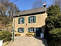
building in Witten, Germany  | |||||
| Upload media | |||||
| Instance of | |||||
|---|---|---|---|---|---|
| Location | Witten, Ennepe-Ruhr-Kreis, Arnsberg Government Region, North Rhine-Westphalia, Germany | ||||
| Street address |
| ||||
| Heritage designation | |||||
| official website | |||||
 | |||||
Media in category "Bethaus der Bergleute (Muttental)"
The following 8 files are in this category, out of 8 total.
-
 Bethaus der Bergleute, Muttental, Witten.JPG 4,032 × 3,024; 5.78 MB
-
 Bethaus, Muttental, Witten.jpg 1,824 × 1,368; 1.76 MB
-
 Bethaus.jpg 2,864 × 2,152; 1,019 KB
-
 Witten - Muttental - Bergbauwanderweg Station 05 01 ies.jpg 2,048 × 1,536; 834 KB
-
 Witten - Muttental - Bergbauwanderweg Station 05 02 ies.jpg 2,048 × 1,536; 899 KB
-
 Witten - Muttental - Bergbauwanderweg Station 05 03 ies.jpg 2,048 × 1,536; 738 KB
-
 Witten - Muttental - Bergbauwanderweg Station 05 04 ies.jpg 2,048 × 1,536; 358 KB
-
 Witten Muttental 091010 119 20.jpg 862 × 587; 191 KB


