Category:Bering Land Bridge National Preserve
Jump to navigation
Jump to search
English: The Bering Land Bridge National Preserve is one of the most remote United States national park areas, located on the Seward Peninsula
national park unit in Alaska, United States | |||||
| Upload media | |||||
| Instance of | |||||
|---|---|---|---|---|---|
| Location | Northwest Arctic Borough, Alaska | ||||
| Visitor center | |||||
| Operator | |||||
| IUCN protected areas category | |||||
| Inception |
| ||||
| Area |
| ||||
| Visitors per year |
| ||||
| official website | |||||
 | |||||
Subcategories
This category has the following 15 subcategories, out of 15 total.
Media in category "Bering Land Bridge National Preserve"
The following 56 files are in this category, out of 56 total.
-
"Caribou" Migration Parade (4778244031).jpg 3,872 × 2,592; 3.94 MB
-
Aerial view of Nome (9511349455).jpg 2,204 × 1,653; 2.9 MB
-
Arctic Hot Springs (16189187209).jpg 1,804 × 1,353; 1.44 MB
-
Artifact at an Archaelogical Dig (9514193182).jpg 3,552 × 2,368; 7.64 MB
-
Aurora lights up the Northern Night (9511577679).jpg 3,413 × 2,285; 5.36 MB
-
Beaver pond (7977121519).jpg 3,872 × 2,592; 6.27 MB
-
Bering land Bridge BioBlitz postcard (43b73eab-1dd8-b71b-0b64-66ff43ecdfdf).jpg 1,800 × 1,275; 140 KB
-
Bering Land Bridge National Preserve.png 791 × 509; 104 KB
-
Bering Land Bridge Preserve 95.jpg 2,464 × 1,950; 835 KB
-
Cache in Bering Land Bridge (3551113632).jpg 3,248 × 2,160; 1.15 MB
-
Clear Skies Over Bering Land Bridge National Preserve (NESDIS 2019-06-14).jpg 1,920 × 1,080; 422 KB
-
Hiking among the tors. (a4e32f1a-1250-4398-9bda-f62ab8c3a91a).JPG 6,000 × 4,000; 5.63 MB
-
Hiking through willows (7692330248).jpg 3,872 × 2,592; 6.03 MB
-
Is this a Frost Boil or a Man Made? (5961263159).jpg 3,072 × 2,304; 4.42 MB
-
Is this a Frost Boil or Man Made? (5961256023).jpg 3,072 × 2,304; 4.31 MB
-
It's Beginning to Look A Lot like...... (4409101753).jpg 792 × 594; 472 KB
-
Mush! (8573213368).jpg 3,622 × 2,425; 3.9 MB
-
Red Lantern winner Christine Roalof's dogs (8572050671).jpg 2,803 × 1,969; 2.9 MB
-
Rock hammer in a lava rock cavity. (64ac4b6a-b25f-4b75-9622-b4815e3a33df).jpg 3,456 × 2,304; 5.74 MB
-
Rosy morning sky (7977089246).jpg 3,872 × 2,592; 5.53 MB
-
Rosy sky (7977105176).jpg 3,872 × 2,592; 4.71 MB
-
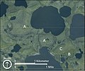
Satellite View of the Thaw-Lake Plain (3cb35dd0-5a5b-4cd1-9637-99c77958e798).jpg 1,049 × 875; 753 KB
-
Schist Fragment (9514356662).jpg 3,872 × 2,592; 4.12 MB
-
Sea Ice on the Nome Shorefront (9514361910).jpg 3,657 × 1,917; 3.21 MB
-
Sea Ice Wedges (8287944603).jpg 3,809 × 2,550; 4.33 MB
-
Snowmachine sign (9922717175).jpg 3,872 × 2,592; 4.44 MB
-
Solstise Sunrise at Nome (9511665933).jpg 4,288 × 2,848; 3.88 MB
-
Spring Sea Ice (4604729649).jpg 1,600 × 1,200; 717 KB
-
Stone Structure and Caribou Antler (7853630200).jpg 2,592 × 3,872; 5.37 MB
-
Sullivan Bluffs - DPLA - 0042791ca693dca982ebcbd5b8baba4d.jpg 6,627 × 4,158; 4.08 MB
-
Sullivan Bluffs - DPLA - e919a795e02e4557eb6143dab01255ff.jpg 6,558 × 4,140; 4.15 MB
-
Sunset (3767406512).jpg 3,456 × 2,304; 2.04 MB
-
Surface Hoarfrost (8289022130).jpg 3,872 × 2,592; 3.42 MB
-
Tent Camp (9511194249).jpg 3,456 × 2,304; 11.61 MB
-
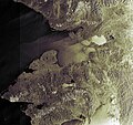
The Bering Land Bridge Preserve in Alaska ESA203691.jpg 2,362 × 2,220; 3.2 MB
-
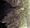
The Bering Land Bridge Preserve in Alaska ESA203691.tiff 2,362 × 2,220; 15.01 MB
-
Western Alaska map 400x800.jpg 400 × 800; 43 KB
-
Winter Solstice noon sunrise on the Bering Sea (8433692952).jpg 3,872 × 2,592; 4.1 MB
-
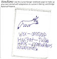
Wox from Upper Darby PA (4115144931).jpg 1,458 × 1,518; 675 KB


