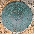
Category:Benchmarks in the United States
Jump to navigation
Jump to search
Countries of the Americas: Canada · United States of America
Subcategories
This category has the following 8 subcategories, out of 8 total.
Media in category "Benchmarks in the United States"
The following 54 files are in this category, out of 54 total.
-
0919121133b.jpg 2,448 × 3,264; 1.22 MB
-
1973IBMgeodeticTraverseStationRochesterMN.jpg 2,442 × 2,440; 4.36 MB
-
2 UHI survey marker Wailuku Maui HI.jpg 2,448 × 3,264; 1.87 MB
-
Baltimore County Survey Marker.jpg 3,280 × 2,460; 1.21 MB
-
Bench Mark in front of Zion - panoramio.jpg 3,456 × 2,304; 5.71 MB
-
Benchmark Rio Dell CA.JPG 3,072 × 2,304; 2.6 MB
-
Benchmarking.jpg 3,072 × 2,304; 1.29 MB
-
Black Hill survey marker.jpg 795 × 795; 347 KB
-
Block Island North Light - National Ocean Survey benchmark.jpg 2,652 × 2,592; 2.3 MB
-
Block Island Southeast Light - Rhode Island Geodetic Survey benchmark.jpg 1,940 × 1,920; 1.41 MB
-
Bureau of Land Management Cadastral Survey Marker Arizona.jpg 732 × 722; 118 KB
-
Cheaha Mountain benchmark.jpg 3,024 × 4,032; 6.76 MB
-
Chicago City Datum.jpg 2,304 × 1,414; 751 KB
-
City of Campbell benchmark from above.jpg 2,813 × 2,705; 1.88 MB
-
City of Campbell benchmark.jpg 4,048 × 3,036; 5.76 MB
-
City of Los Angeles survey marker.jpg 1,280 × 960; 303 KB
-
Coney Is Beach td (2018-09-03) 68 - National Ocean Survey, 1974, No. 3.jpg 5,472 × 3,648; 10.46 MB
-
Control Monument - panoramio.jpg 4,320 × 3,240; 5.79 MB
-
Crater lake bench mark.jpg 1,024 × 768; 384 KB
-
Goat Island - U.S. Coast & Geodetic Survey benchmark.jpg 2,196 × 2,187; 1.55 MB
-
Hawaii Territorial Survey LUKE survey marker Wailuku Maui HI.jpg 2,448 × 3,264; 1.58 MB
-
Height Benchmark Portland.jpg 2,448 × 3,264; 3.31 MB
-
Lake Creek Falls Watchable Wildlife & Recreation Site (25168732983).jpg 2,448 × 2,448; 9.15 MB
-
Marker 002.jpg 3,296 × 2,472; 1.16 MB
-
Multnomah County survey marker 2701.JPG 4,272 × 2,848; 6.74 MB
-
My Public Lands Magazine, Summer 2015 (19352400620) (cropped).jpg 1,211 × 853; 1.34 MB
-
My Public Lands Magazine, Summer 2015 (19352400620).jpg 5,100 × 3,300; 14.04 MB
-
North American Vertical Datum at 7th Ave S Shoreline Street End, South Park, Seattle 01.jpg 6,000 × 4,000; 14.33 MB
-
Point of Beginning at Fort Defiance.jpg 2,816 × 2,112; 3.14 MB
-
Point Reno highpoint marker.jpg 2,811 × 2,110; 1.51 MB
-
Property Boundary, Browns Canyon Nat'l Monument, Land Survey Monument sign 2023-05-06.jpg 2,915 × 3,208; 3.28 MB
-
Providence River - U.S. Army Corps of Engineers survey mark.jpg 2,367 × 2,268; 2 MB
-
Seattle - benchmark at the northwest corner of First and Wall.jpg 4,288 × 2,848; 6.28 MB
-
State of Hawaii 2 3 1969 Survey Marker Honolulu HI.jpg 3,264 × 2,448; 1.9 MB
-
State of Hawaii Survey Mark (18601420049).jpg 2,004 × 2,004; 1.77 MB
-
Survey marker on Waterrock Knob's summit, May 2017.jpg 5,184 × 3,456; 7.74 MB
-
Tripoint marker KY-TN-VA.jpg 3,024 × 4,032; 4.37 MB
-
U. S. Bureau of Reclamation benchmark (Steamboat Rock State Park, Crown Point).jpg 2,549 × 2,549; 5.18 MB
-
United States Harbor Line Reference Mark.jpg 2,448 × 3,264; 2.6 MB
-
US Dept. of Interior Benchmark - panoramio.jpg 3,888 × 2,592; 5.27 MB
-
US GENERAL LAND OFFICE Geodetic control point Douglas WY.JPG 3,264 × 2,448; 1.97 MB
-
USForestReserveBoundaryPost-211.jpg 1,280 × 960; 270 KB
-
USGSSurveyMarker2000.jpg 2,048 × 1,536; 693 KB
-
Willametestone disk.jpg 1,015 × 1,007; 179 KB
-
Willamette Stone, in western Portland, OrR.jpg 450 × 303; 76 KB
-
Woodall Mountain benchmark.jpg 3,024 × 4,032; 3.97 MB


