Category:Belmont, Lancashire
Jump to navigation
Jump to search
English: Belmont is a village in Lancashire, England. It is close to Winter Hill and the village is situated between the towns of Bolton and Darwen. It has around 500 inhabitants and lies within the civil parish of North Turton in the unitary authority area of Blackburn with Darwen.
village in Lancashire, United Kingdom  | |||||
| Upload media | |||||
| Instance of | |||||
|---|---|---|---|---|---|
| Location | North Turton, Blackburn with Darwen, Lancashire, North West England, England | ||||
 | |||||
Subcategories
This category has the following 5 subcategories, out of 5 total.
B
- Belmont Reservoir (33 F)
Media in category "Belmont, Lancashire"
The following 52 files are in this category, out of 52 total.
-

-
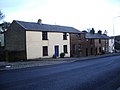 46 to 36 High Street, Belmont - geograph.org.uk - 708014.jpg 640 × 480; 236 KB
-
 Belmont Post Office - geograph.org.uk - 1908475.jpg 1,366 × 1,024; 286 KB
-
 Belmont, Lancashire (050313) (9450971611).jpg 3,088 × 2,270; 2.48 MB
-
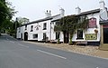
 Belmont, The Black Dog Inn - geograph.org.uk - 2020636.jpg 899 × 602; 217 KB
-
 Black Bull Hotel - geograph.org.uk - 36159.jpg 640 × 443; 64 KB
-
 Black Dog - geograph.org.uk - 1908538.jpg 1,365 × 1,024; 444 KB
-
 Black Dog - geograph.org.uk - 1908541.jpg 1,365 × 1,024; 322 KB
-
 Black Dog - geograph.org.uk - 3303174.jpg 4,608 × 3,456; 3.45 MB
-
 Black Dog at Belmont - geograph.org.uk - 5700041.jpg 800 × 477; 104 KB
-
 Black Dog Inn, 2 - 6 Church Street, Belmont - geograph.org.uk - 3264000.jpg 3,402 × 2,123; 1.28 MB
-
 Black Dog, Church Street, Belmont - geograph.org.uk - 707891.jpg 640 × 480; 167 KB
-

-
 Crookfield Road - geograph.org.uk - 879761.jpg 640 × 484; 115 KB
-
 Footbridge at Ward's Reservoir - geograph.org.uk - 131571.jpg 640 × 480; 213 KB
-
 Large marker stone - geograph.org.uk - 450084.jpg 426 × 640; 311 KB
-
 Monument, Belmont.jpg 1,224 × 1,632; 418 KB
-
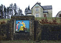
 Plaque near Springs Reservoir.jpg 640 × 480; 503 KB
-
 Redmonds Edge - geograph.org.uk - 174545.jpg 640 × 480; 138 KB
-
 St Peters Church, Belmont (250468) (9455404446).jpg 4,894 × 3,946; 5.61 MB
-
 St Peters Church, Belmont - panoramio.jpg 2,048 × 1,651; 1.09 MB
-
 Stile on Witton Weavers Way - geograph.org.uk - 217590.jpg 640 × 480; 105 KB
-
 The Belmont Bull, Belmont - geograph.org.uk - 708008.jpg 622 × 466; 176 KB
-
 Walking the Witton Weavers Way - geograph.org.uk - 217657.jpg 640 × 480; 111 KB
-
 Waterworks Cottage, Belmont.jpg 640 × 457; 95 KB
-
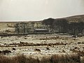
 Anglezarke Moor - geograph.org.uk - 225726.jpg 640 × 480; 60 KB
-
 Anglezarke Moor - geograph.org.uk - 225731.jpg 640 × 480; 70 KB
-

-
 Big Grey Stones - geograph.org.uk - 450096.jpg 640 × 426; 368 KB
-
 Bromiley Farm - geograph.org.uk - 131570.jpg 640 × 480; 157 KB
-
 Bromiley Heys - geograph.org.uk - 131569.jpg 640 × 480; 138 KB
-
 Crossing Limestone Brook - geograph.org.uk - 475684.jpg 426 × 640; 338 KB
-
 Footpath - geograph.org.uk - 709075.jpg 640 × 480; 197 KB
-
 Footpath on Will Narr - geograph.org.uk - 475710.jpg 640 × 394; 288 KB
-
 Greenhill Farm, Belmont - geograph.org.uk - 116161.jpg 640 × 480; 85 KB
-
 Haslams Farm and Lomax Wife's Farm - geograph.org.uk - 123061.jpg 640 × 480; 76 KB
-
 High Shores - geograph.org.uk - 475715.jpg 640 × 426; 314 KB
-
 Higher Anshaw - geograph.org.uk - 475707.jpg 640 × 426; 327 KB
-
 Higher Pasture House Farm, Belmont - geograph.org.uk - 217572.jpg 640 × 480; 110 KB
-
 Mast on Great Robert Hill - geograph.org.uk - 116164.jpg 640 × 480; 58 KB
-
 Not at all weather proof - geograph.org.uk - 709085.jpg 640 × 480; 152 KB
-
 Path by Springs Reservoir, Belmont - geograph.org.uk - 123063.jpg 640 × 480; 118 KB
-
 Path up Winter Hill from Belmont Road - geograph.org.uk - 133353.jpg 640 × 480; 129 KB
-
 Spitlers Edge in sunlight - geograph.org.uk - 133377.jpg 640 × 480; 104 KB
-
 Summit of Spittlers Edge - geograph.org.uk - 475720.jpg 640 × 331; 236 KB
-
 Track from Will Narr - geograph.org.uk - 475662.jpg 640 × 353; 219 KB
-
 Track on Longworth Moor - geograph.org.uk - 173503.jpg 640 × 480; 127 KB
-
 Ward Street, Belmont - geograph.org.uk - 708793.jpg 620 × 464; 184 KB
-
 Welcome to Belmont - geograph.org.uk - 302666.jpg 640 × 425; 71 KB
-
 Winter Hill Mast - geograph.org.uk - 36158.jpg 443 × 640; 35 KB
-
-
 Witton Weavers Way - geograph.org.uk - 450062.jpg 640 × 426; 325 KB
_2_Church_Street,_Belmont,_Bolton,_Greater_Manchester_BL7_8AB_-_geograph.org.uk_-_2083289.jpg)


_(9450971611).jpg)


_(9455404446).jpg)


