Category:Belleek, County Fermanagh
Jump to navigation
Jump to search
village in County Fermanagh, Northern Ireland, UK | |||||
| Upload media | |||||
| Instance of | |||||
|---|---|---|---|---|---|
| Location | County Fermanagh, Northern Ireland | ||||
 | |||||
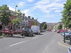
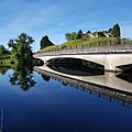
English: Belleek is a village on the boundary between County Fermanagh (in Northern Ireland) and County Donegal (in the Republic of Ireland). The majority of the village is within County Fermanagh. It had a population of 836 people in the 2001 Census. It is situated within the Fermanagh District Council area.
Subcategories
This category has the following 2 subcategories, out of 2 total.
B
- Belleek Pottery (49 F)
C
Media in category "Belleek, County Fermanagh"
The following 112 files are in this category, out of 112 total.
-
A closed shop, Beleek - geograph.org.uk - 3400314.jpg 640 × 480; 250 KB
-
A meeting of waters, Belleek, Co. Fermanagh (24239038740).jpg 2,000 × 923; 1.04 MB
-
A speedy reminder - geograph.org.uk - 1390362.jpg 640 × 480; 150 KB
-
A View of Belleek, County Fermanagh.PNG 688 × 495; 728 KB
-
Approaching the Border at Belleek - geograph.org.uk - 3226429.jpg 1,024 × 688; 105 KB
-
Battle of Belleek 1922.jpg 1,513 × 962; 434 KB
-
Beleek banner Border Bridge and Fort.jpg 6,296 × 902; 1.07 MB
-
Beleek border bridge.jpg 6,788 × 2,553; 2.98 MB
-
Beleek, Co. Fermanagh - geograph.org.uk - 3400305.jpg 640 × 480; 239 KB
-
Belleek - geograph.org.uk - 3059627.jpg 480 × 640; 292 KB
-
Belleek - geograph.org.uk - 504714.jpg 640 × 479; 78 KB
-
Belleek - geograph.org.uk - 5558048.jpg 640 × 427; 397 KB
-
Belleek Bridge - geograph.org.uk - 5652919.jpg 640 × 481; 431 KB
-
Belleek Fort from the Border - geograph.org.uk - 3085874.jpg 1,024 × 691; 95 KB
-
Belleek Newsagent - geograph.org.uk - 2549303.jpg 640 × 480; 66 KB
-
Belleek Parish Church of Ireland - geograph.org.uk - 2549199.jpg 640 × 480; 58 KB
-
Belleek Pottery - geograph.org.uk - 2395970.jpg 640 × 480; 78 KB
-
Belleek Variety Store - geograph.org.uk - 885810.jpg 640 × 480; 58 KB
-
Belleek, County Fermanagh - geograph.org.uk - 204194.jpg 640 × 479; 68 KB
-
Belleek, County Fermanagh - geograph.org.uk - 2549349.jpg 640 × 480; 66 KB
-
Belleek, County Fermanagh - geograph.org.uk - 885815.jpg 640 × 480; 49 KB
-
Belleek, Old Station Road - geograph.org.uk - 5558071.jpg 640 × 427; 455 KB
-
Belleek, River Erne - geograph.org.uk - 5558073.jpg 640 × 480; 507 KB
-
Bend into Main Street, Baleek - geograph.org.uk - 5784415.jpg 2,000 × 1,224; 626 KB
-
Black Cat Cove, Belleek - geograph.org.uk - 885806.jpg 640 × 480; 70 KB
-
Boa Island Road, Belleek - geograph.org.uk - 2549264.jpg 640 × 480; 70 KB
-
Bridge across the River Erne, Balleek - geograph.org.uk - 5784443.jpg 2,000 × 1,500; 653 KB
-
Charging point - geograph.org.uk - 3059629.jpg 480 × 640; 301 KB
-
Cottage at Carran More - geograph.org.uk - 835793.jpg 640 × 479; 50 KB
-
Cottage, Belleek - geograph.org.uk - 2549167.jpg 640 × 480; 50 KB
-
Demolition site, Beleek - geograph.org.uk - 3400337.jpg 640 × 480; 287 KB
-
Entering Belleek on the Lough Shore Road - geograph.org.uk - 3226342.jpg 1,024 × 767; 146 KB
-
Fiddler's Stone, Castlecaldwell - geograph.org.uk - 204191.jpg 359 × 480; 59 KB
-
Former Railway Station, Belleek - geograph.org.uk - 5558072.jpg 640 × 427; 340 KB
-
Fort at Belleek - geograph.org.uk - 885783.jpg 640 × 480; 49 KB
-
Frank's, Belleek - geograph.org.uk - 2549376.jpg 640 × 480; 60 KB
-
Freeburn's Mace, Belleek - geograph.org.uk - 2549394.jpg 640 × 480; 66 KB
-
Gilmartin's, Belleek - geograph.org.uk - 2549359.jpg 640 × 480; 61 KB
-
Grainne's Health ^ Beauty, Belleek - geograph.org.uk - 2549397.jpg 640 × 480; 53 KB
-
Hotel and Pharmacy, Belleek - geograph.org.uk - 5558070.jpg 640 × 427; 380 KB
-
Hotel Carlton, Belleek - geograph.org.uk - 204196.jpg 640 × 208; 28 KB
-
Hotel Carlton, Belleek - geograph.org.uk - 2549338.jpg 640 × 480; 50 KB
-
Inscribed plaque, Belleek Town Clock - geograph.org.uk - 2549173.jpg 1,920 × 2,560; 2.07 MB
-
Junction in Belleek - geograph.org.uk - 3265611.jpg 640 × 480; 238 KB
-
L3763 - Belleek , County Fermanagh.jpg 3,024 × 3,024; 3.28 MB
-
L3764 - Belleek , County Fermanagh.jpg 3,024 × 3,024; 3.1 MB
-
Lifes a Bowl of Cherries (or Grapes)! (6581076011).jpg 2,496 × 1,890; 632 KB
-
Lottery advert, Beleek - geograph.org.uk - 3400323.jpg 480 × 640; 328 KB
-
Lough Shore Road, Belleek - geograph.org.uk - 5652901.jpg 640 × 480; 544 KB
-
Main street of Belleek, Co Fermanagh - geograph.org.uk - 624302.jpg 640 × 480; 83 KB
-
Main Street, Belleek - geograph.org.uk - 5558067.jpg 640 × 427; 392 KB
-
Main Street. Belleek - geograph.org.uk - 1390364.jpg 640 × 480; 151 KB
-
McDonnell Meats, Belleek - geograph.org.uk - 2549249.jpg 640 × 480; 53 KB
-
McGrath's of Belleek - geograph.org.uk - 2549316.jpg 640 × 480; 52 KB
-
Moohan's Fiddle Stone - geograph.org.uk - 204229.jpg 640 × 479; 66 KB
-
Nina's Pizzaria - geograph.org.uk - 3400319.jpg 640 × 480; 245 KB
-
Nino's, Belleek - geograph.org.uk - 2549233.jpg 640 × 480; 54 KB
-
Plaque, Belleek National School - geograph.org.uk - 2549413.jpg 640 × 480; 51 KB
-
Plaque, William Henshall, Belleek - geograph.org.uk - 2549211.jpg 640 × 480; 89 KB
-
Postbox, Belleek - geograph.org.uk - 6887325.jpg 3,000 × 2,355; 2.21 MB
-
Rathmore Cottage - geograph.org.uk - 2804782.jpg 4,050 × 3,300; 1.43 MB
-
River Erne at Belleek - geograph.org.uk - 1390360.jpg 640 × 480; 105 KB
-
River Erne at Belleek - geograph.org.uk - 5558057.jpg 640 × 481; 478 KB
-
River Erne, Belleek Bridge - geograph.org.uk - 5558044.jpg 640 × 481; 420 KB
-
Road at Cloghore, Belleek - geograph.org.uk - 504962.jpg 640 × 479; 52 KB
-
Road near Belleek - geograph.org.uk - 504711.jpg 640 × 479; 86 KB
-
Road outside Belleek - geograph.org.uk - 504690.jpg 640 × 479; 55 KB
-
Rooney's Centra, Belleek - geograph.org.uk - 2549401.jpg 640 × 480; 50 KB
-
Salmon Leap (6606511201).jpg 2,492 × 1,890; 529 KB
-
Shine - Clothes Shop, Belleek - geograph.org.uk - 2549356.jpg 640 × 480; 63 KB
-
Shop for sale, Belleek - geograph.org.uk - 2549239.jpg 640 × 480; 53 KB
-
Slavin Parish Church Belleek, Exterior (51131586566).jpg 3,264 × 2,176; 2.49 MB
-
Speed limit signs where the A46 becomes the N3 - geograph.org.uk - 3085882.jpg 1,024 × 769; 107 KB
-
St Patrick's RC church, Belleek - geograph.org.uk - 6886130.jpg 5,049 × 3,851; 3.47 MB
-
Storage racks in the Baleek Pottery - geograph.org.uk - 5784592.jpg 2,000 × 1,500; 700 KB
-
Structure across the River Erne, Balleek - geograph.org.uk - 5784407.jpg 2,000 × 1,500; 1.13 MB
-
Telephone box, Beleek - geograph.org.uk - 3400326.jpg 640 × 480; 309 KB
-
The Boa Island Road, Belleek - geograph.org.uk - 6886139.jpg 5,137 × 3,538; 4.04 MB
-
The Donegal Corridor - geograph.org.uk - 5558065.jpg 640 × 480; 651 KB
-
The Dresser, Belleek - geograph.org.uk - 2549291.jpg 640 × 480; 61 KB
-
The Dresser, Belleek - geograph.org.uk - 885802.jpg 640 × 480; 58 KB
-
The Flower Basket, Belleek - geograph.org.uk - 2549244.jpg 640 × 480; 66 KB
-
The River Erne at Belleek - geograph.org.uk - 2395978.jpg 640 × 480; 61 KB
-
The Thatch Coffee House, Belleek - geograph.org.uk - 885796.jpg 640 × 480; 52 KB
-
The Thatch Coffee Shop, Main Street, Belleek - geograph.org.uk - 4189195.jpg 1,992 × 1,287; 588 KB
-
Thrift Shop, Belleek - geograph.org.uk - 2549384.jpg 640 × 480; 52 KB
-
Town clock, Belleek - geograph.org.uk - 2549168.jpg 640 × 480; 79 KB
-
Upper lough erne panorama1.jpg 10,890 × 2,473; 4.84 MB
-
View of the Baleek Pottery from a picnic area - geograph.org.uk - 5784597.jpg 2,000 × 1,500; 920 KB
-
Wark Hall, Belleek - geograph.org.uk - 2549164.jpg 640 × 480; 43 KB
-
Welcome to Donegal - geograph.org.uk - 3265616.jpg 640 × 480; 243 KB
-
Where the A46 becomes the N3 at Belleek - geograph.org.uk - 3226364.jpg 1,024 × 768; 112 KB
-
William Henshall memorial, Belleek - geograph.org.uk - 2549207.jpg 640 × 480; 67 KB
-
Derrykillew - geograph.org.uk - 504695.jpg 640 × 479; 78 KB
-
Derrykillew Townland - geograph.org.uk - 504694.jpg 640 × 479; 79 KB
-
Derrykillew Townland - geograph.org.uk - 504699.jpg 640 × 479; 60 KB
-
Drumlisaleen Townland - geograph.org.uk - 504965.jpg 640 × 479; 59 KB
-
Ederdamone - geograph.org.uk - 504705.jpg 640 × 479; 63 KB
-
Ederdamone Townland - geograph.org.uk - 504708.jpg 640 × 479; 87 KB
-
Keenaghan - geograph.org.uk - 504691.jpg 640 × 479; 84 KB
-
Road at Moneendogue - geograph.org.uk - 504974.jpg 640 × 479; 86 KB


