Category:Beckermet
Jump to navigation
Jump to search
English: Beckermet is a village, civil parish and post town in the English county of Cumbria, located near the coast between the towns of Egremont and Seascale. It is served by Braystones railway station and is less than a mile west of the A595 road. It is about 2 miles (3 km) from the Sellafield nuclear plant which may be seen from the higher parts of the village.
village and parish in Cumbria, England  | |||||
| Upload media | |||||
| Instance of | |||||
|---|---|---|---|---|---|
| Location | Copeland, Cumbria, North West England, England | ||||
| Population |
| ||||
 | |||||
Subcategories
This category has the following 8 subcategories, out of 8 total.
B
- Beckermet railway station (1 F)
J
M
- Morass Road, Beckermet (1 F)
N
- Nursery Road, Beckermet (3 F)
O
- Old Vicarage, Beckermet (1 F)
S
W
- White Mare, Beckermet (1 F)
Media in category "Beckermet"
The following 90 files are in this category, out of 90 total.
-
 0717 Sellafield and Seascale - geograph.org.uk - 1832470.jpg 1,024 × 768; 44 KB
-
 4472 At Sellafield - geograph.org.uk - 2001833.jpg 1,056 × 1,578; 543 KB
-
 A garage on Nursery Road, Beckermet - geograph.org.uk - 3125932.jpg 800 × 600; 233 KB
-

-
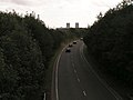
 A595 towards Egremont - geograph.org.uk - 6323470.jpg 800 × 600; 114 KB
-
 A595 towards Thornhill - geograph.org.uk - 6323472.jpg 800 × 600; 71 KB
-
 A595, Blackbeck - geograph.org.uk - 6323458.jpg 800 × 600; 97 KB
-
 A595, Yeorton Brow - geograph.org.uk - 6323466.jpg 800 × 600; 162 KB
-
-
 Blackbeck - Sellafield Road - geograph.org.uk - 55342.jpg 640 × 480; 76 KB
-
 Bridge over clearway. - geograph.org.uk - 97342.jpg 640 × 480; 73 KB
-
 Bridge over the Calder - geograph.org.uk - 4665386.jpg 1,142 × 857; 397 KB
-

-
 Castle Earthworks - geograph.org.uk - 4739018.jpg 4,896 × 3,672; 6.93 MB
-
 Clan Line Arriving At Sellafield - geograph.org.uk - 2002927.jpg 1,014 × 1,457; 549 KB
-

-
 Cycleway and footpath bridge - geograph.org.uk - 4665454.jpg 1,142 × 857; 368 KB
-
 Diamond Jubilee Tower, near Braystones - geograph.org.uk - 3558678.jpg 1,024 × 768; 158 KB
-
 Disused Water Tower - geograph.org.uk - 5900871.jpg 1,024 × 749; 225 KB
-
 Dunes near Starling Castle - geograph.org.uk - 4373829.jpg 1,600 × 1,200; 259 KB
-

-
 Field entrance off the A595, Blackbeck - geograph.org.uk - 6323348.jpg 800 × 600; 149 KB
-
 Fields near St Bridget's Church - geograph.org.uk - 4373777.jpg 1,600 × 1,200; 504 KB
-
 Footpath to Haile - geograph.org.uk - 6323464.jpg 640 × 468; 127 KB
-
 Footpath under the railway - geograph.org.uk - 4373825.jpg 1,600 × 1,144; 545 KB
-
 Freight Beside The Ehen - geograph.org.uk - 2002888.jpg 1,550 × 999; 445 KB
-
 Grass and railway line - geograph.org.uk - 4373833.jpg 1,600 × 1,200; 297 KB
-
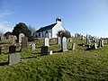
 Gravestones at St. John's Church, Beckermet - geograph.org.uk - 5526322.jpg 1,500 × 890; 1.42 MB
-
 Irresistible force meets immovable obstacle - geograph.org.uk - 5988103.jpg 4,032 × 3,024; 3.98 MB
-
 Kirk Beck Viaduct ^ modern pylons - geograph.org.uk - 5425255.jpg 3,000 × 4,000; 2.9 MB
-
 Locomotives at Sellafield railway station - geograph.org.uk - 3026342.jpg 1,024 × 683; 160 KB
-
 Looking across the fields to Morass Road - geograph.org.uk - 4739026.jpg 4,896 × 3,672; 6.96 MB
-
 Looking towards Braystones - geograph.org.uk - 4373781.jpg 1,600 × 1,200; 478 KB
-
 Looking towards St Bridget's Church - geograph.org.uk - 4373836.jpg 1,600 × 1,200; 333 KB
-
 Mill Farm near Beckermet - geograph.org.uk - 4739008.jpg 4,896 × 3,672; 6.61 MB
-
 Modern cowshed - geograph.org.uk - 4373839.jpg 1,600 × 1,200; 355 KB
-
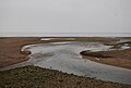
 Mouth of the River Calder - geograph.org.uk - 4879462.jpg 640 × 323; 36 KB
-
 Mouth of the River Ehen - geograph.org.uk - 6422727.jpg 1,024 × 768; 64 KB
-
 Northern Rail Services train passing Sellafield - geograph.org.uk - 4665469.jpg 1,142 × 857; 294 KB
-
 Ordnance Survey Cut Mark - geograph.org.uk - 5186314.jpg 640 × 567; 125 KB
-
 OS benchmark - Sellafield, Calder Viaduct - geograph.org.uk - 4665481.jpg 857 × 1,142; 521 KB
-
 Perimeter fence at Sellafield works - geograph.org.uk - 4665473.jpg 1,142 × 857; 418 KB
-
 Pipe Bridge at Sellafield - geograph.org.uk - 4879449.jpg 640 × 363; 64 KB
-
 Pipe bridge near Sellafield station - geograph.org.uk - 6422721.jpg 1,024 × 768; 78 KB
-

-
 Pipeline bridge at Sellafield - geograph.org.uk - 5604760.jpg 640 × 480; 306 KB
-
 Railway at Sellafield - geograph.org.uk - 6420537.jpg 1,200 × 804; 1,003 KB
-
 Redundant railway hut - geograph.org.uk - 4373835.jpg 1,600 × 1,200; 274 KB
-
 River Calder - geograph.org.uk - 1343514.jpg 640 × 430; 50 KB
-

-
 River Ehen - geograph.org.uk - 4879443.jpg 640 × 350; 51 KB
-
 River Ehen near Sellafield - geograph.org.uk - 5290296.jpg 640 × 429; 47 KB
-
 River Ehen View - geograph.org.uk - 4879452.jpg 640 × 395; 58 KB
-

-
 Rocky beach south of Braystones - geograph.org.uk - 5290293.jpg 640 × 378; 52 KB
-
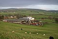
 Rothersyke Farm, nr Beckermet - geograph.org.uk - 1270301.jpg 640 × 480; 77 KB
-
 Science and Nature - geograph.org.uk - 2798974.jpg 1,024 × 683; 163 KB
-
 Second roundabout to Sellafield. - geograph.org.uk - 97357.jpg 640 × 407; 54 KB
-
 Sellafield (Calder Hall) Power Station - geograph.org.uk - 6026683.jpg 2,000 × 1,366; 1.74 MB
-
 Sellafield from above the Lake District - geograph.org.uk - 5461509.jpg 1,947 × 1,454; 1.32 MB
-
 Sellafield from the air - geograph.org.uk - 3642880.jpg 3,264 × 2,448; 3.03 MB
-
 Sellafield Nuclear Power complex - geograph.org.uk - 3435355.jpg 1,024 × 502; 55 KB
-
 Sellafield nuclear reprocessing plant - geograph.org.uk - 3320491.jpg 1,024 × 411; 136 KB
-
 Sellafield nuclear site from the air - geograph.org.uk - 2113818.jpg 2,063 × 1,291; 1.84 MB
-
 Sellafield railway station building - geograph.org.uk - 4665464.jpg 1,142 × 857; 333 KB
-
 Sellafield railway station, Cumbria - geograph.org.uk - 3558694.jpg 1,024 × 768; 160 KB
-
 Sellafield Signal Box - geograph.org.uk - 2002103.jpg 987 × 1,388; 455 KB
-
 Sellafield Visitor Centre - geograph.org.uk - 4172991.jpg 1,500 × 1,125; 1.58 MB
-
 Shingle ^ rubbish - geograph.org.uk - 4373827.jpg 1,600 × 1,200; 591 KB
-
 Silage store on the old road near Beckermet - geograph.org.uk - 4739013.jpg 1,600 × 1,200; 470 KB
-

-

-

-

-
 SRPS Cumbrian Coast Railtour 2018 , Sellafield Station - geograph.org.uk - 5777024.jpg 1,600 × 1,200; 323 KB
-
 The church has been painted - geograph.org.uk - 4373773.jpg 1,600 × 1,200; 509 KB
-
 The clearway approach to Sellafield. - geograph.org.uk - 97344.jpg 640 × 480; 81 KB
-
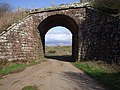
 The disused rail bridge at Beckermet - geograph.org.uk - 3125897.jpg 800 × 600; 318 KB
-
 The narrow suspension bridge over the River Ehen - geograph.org.uk - 4373786.jpg 1,600 × 1,200; 457 KB
-
 The old road is now a dumping ground - geograph.org.uk - 4739010.jpg 1,600 × 1,200; 591 KB
-
 The River Calder near Lady Wood - geograph.org.uk - 5988099.jpg 4,032 × 3,024; 2.72 MB
-
 The road to Beckermet - geograph.org.uk - 3125865.jpg 800 × 600; 225 KB
-
 The suspension bridge - geograph.org.uk - 4373789.jpg 1,600 × 1,200; 342 KB
-
 The White Mare, Beckermet - geograph.org.uk - 3125903.jpg 800 × 600; 223 KB
-
 The White Mare, Beckermet - geograph.org.uk - 3125907.jpg 600 × 800; 211 KB
-
 Track through the dunes - geograph.org.uk - 4373830.jpg 1,600 × 1,200; 311 KB
-
 View to sea from A595 - geograph.org.uk - 1958428.jpg 640 × 480; 47 KB
-
 Wet fields near the River Ehen - geograph.org.uk - 4373785.jpg 1,600 × 1,200; 512 KB
-
 Track - geograph.org.uk - 616229.jpg 640 × 480; 186 KB
-
 Yeorton Hall Farm - geograph.org.uk - 91553.jpg 640 × 427; 81 KB


_Power_Station_-_geograph.org.uk_-_6026683.jpg)


